List of FFH areas in Lower Bavaria
The list of FFH areas in Lower Bavaria includes the following lists of FFH areas in Lower Bavarian districts and cities from the article namespace:
- List of FFH areas in the Deggendorf district
- List of FFH areas in the Dingolfing-Landau district
- List of FFH areas in the Freyung-Grafenau district
- List of FFH areas in the Kelheim district
- List of FFH areas in Landshut
- List of FFH areas in the Landshut district
- List of FFH areas in Passau
- List of FFH areas in the Passau district
- List of FFH areas in the Regen district
- List of FFH areas in the Rottal-Inn district
- List of FFH areas in Straubing
- List of FFH areas in the Straubing-Bogen district
The selection corresponds to the administrative region of Lower Bavaria . There are 83 FFH areas in the administrative district (as of April 2016).
| Surname | image | Identifier
|
circle | details | position | Area hectares |
date
|
|||
|---|---|---|---|---|---|---|---|---|---|---|
| Mountain meadows and grasslands on the Dreisessel |
7248-301 WDPA: 555521873 |
Freyung-Grafenau district | ⊙ | 45.00 | ||||||
|
Bischofsreuter Waldhufen |

|
7148-301 WDPA: 555521837 |
Freyung-Grafenau district | ⊙ | 967.00 | |||||
| Borstgrasrasen and mountain meadows Obergrainet-Gschwendet |
7248-371 WDPA: 555521875 |
Freyung-Grafenau district | ⊙ | 141.49 | ||||||
|
Erlau |

|
7347-371 WDPA: 555521909 |
Freyung-Grafenau , Passau | ⊙ | 574.55 | |||||
|
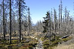
High forest and primeval forest on the Dreisessel |
|
7248-302 WDPA: 555521874 |
Freyung-Grafenau district | ⊙ | 273.00 |
|
||||
|
Moore near Finsterau and Philippsreuth |

|
7148-302 WDPA: 555521838 |
Freyung-Grafenau district | ⊙ | 88.00 | |||||
|
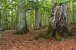
Bavarian Forest National Park |
|
6946-301 WDPA: 555579396 |
Freyung-Grafenau , district of Regen | ⊙ | 24,206.00 | |||||
| Philippsreuter Waldhufen |
7148-371 WDPA: 555521839 |
Freyung-Grafenau district | ⊙ | 69.27 |
|
|||||
|
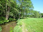
Bavarian forest streams around Schöllnach and Eging am See |
|
7245-301 WDPA: 555521869 |
District of Deggendorf , Freyung-Grafenau , Passau | ⊙ | 334.00 | |||||
|
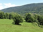
Mountain meadows and pastures in the Upper Bavarian Forest |
|
7043-301 WDPA: 555521797 |
District of Deggendorf , District of Regen | ⊙ | 19.00 | |||||
|
Deggendorfer Vorwald |

|
7043-371 WDPA: 555521798 |
District of Deggendorf , District of Regen , District of Straubing-Bogen | ⊙ | 1,497.25 | |||||
|
Extensive meadows east of Deggendorf |

|
7144-372 WDPA: 555521834 |
Deggendorf district | ⊙ | 102.78 | |||||
|
Isar mouth |

|
7243-302 WDPA: 555521867 |
Deggendorf district | ⊙ | 1,906.00 | |||||
|
Mouse-eared colonies in the Upper Palatinate-Bavarian Forest natural area |

|
6540-302 WDPA: 555521599 |
County Schwandorf , district of Regensburg , the district of Cham | also in the district of Deggendorf, district of Freyung-Grafenau | ⊙ | 0.00 | ||||
|
Coniferous forests of the Schwanenkirchner Tertiary Bay |

|
7245-302 WDPA: 555521870 |
District of Deggendorf , Passau | ⊙ | 260.00 | |||||
|
Upper Hengersberger Ohe with hillside meadows |

|
7144-373 WDPA: 555521835 |
Deggendorf district | ⊙ | 350.66 | |||||
|
Upper course of the rain and tributaries |

|
7045-371 WDPA: 555521800 |
District of Deggendorf , Freyung-Grafenau , district of Regen | ⊙ | 1,921.91 | |||||
|
Rubble bog |
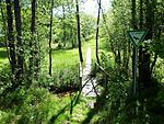
|
7244-301 WDPA: 555521868 |
Deggendorf district | ⊙ | 108.00 | |||||
|
Lower Isar between Landau and Plattling |

|
7243-301 WDPA: 555521866 |
District of Deggendorf , Dingolfing-Landau | ⊙ | 1,217.00 | |||||
|
Lower Vilstal |

|
7344-301 WDPA: 555521906 |
District of Deggendorf , Passau | ⊙ | 341.00 | |||||
|
Meadows and drifts around Rohrmünz, Grafling and Frath |

|
7144-371 WDPA: 555521833 |
District of Deggendorf , District of Regen | ⊙ | 101.78 | |||||
|
Meadow areas and Forests around the Brotjackelriegel and around Schöllnach |

|
7145-371 WDPA: 555521836 |
District of Deggendorf , Freyung-Grafenau | ⊙ | 417.55 | |||||
| Habitats of the yellow-bellied toad in the district of Dingolfing-Landau |
7340-371 WDPA: 555521903 |
Dingolfing-Landau district | ⊙ | 16.61 | ||||||
|
Mouse-eared colonies in the Lower Bavarian hill country |

|
7839-371 WDPA: 555522045 |
District of Erding , district Mühldorf am Inn , district Pfaffenhofen | also in Altötting district, Traunstein district, Dingolfing-Landau district, Rottal-Inn district | ⊙ | 0.00 | ||||
|
Mettenbacher, Grießenbacher and Königsauer Moos (Lower Isar Valley) |

|
7341-371 WDPA: 555521905 |
Dingolfing-Landau , district of Landshut | ⊙ | 220.46 | |||||
| Fens and spring swamps in the Isar-Inn hill country |
7442-301 WDPA: 555521937 |
Dingolfing-Landau , Rottal-Inn | ⊙ | 25.00 | ||||||
|
Lower Isar valley between Niederviehbach and Landau |

|
7341-301 WDPA: 555521904 |
Dingolfing-Landau district | ⊙ | 276.00 | |||||
|
Vilstal between Vilsbiburg and Marklkofen |

|
7440-371 WDPA: 555521936 |
Dingolfing-Landau , district of Landshut | ⊙ | 834.65 | |||||
| Mussel streams south of Thalmassing |
7138-371 WDPA: 555521829 |
District of Regensburg , Kelheim | ⊙ | 45.56 | ||||||
|
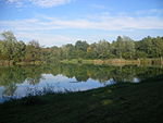
Donauauen between Ingolstadt and Weltenburg |
|
7136-304 WDPA: 555521826 |
Eichstätt district , Ingolstadt , Pfaffenhofen an der Ilm district | also in the Kelheim district | ⊙ | 2,766.00 | ||||
| Forest moss |
7236-303 WDPA: 555521863 |
District of Kelheim | ⊙ | 218.00 | ||||||
|
Frauenforst east of Ihrlerstein and west of Dürnstetten |
7037-371 WDPA: 555521793 |
District of Regensburg , Kelheim | ⊙ | 334.53 | ||||||
| Hienheimer Forst east and west Swabia |
7036-372 WDPA: 555521792 |
District of Kelheim | ⊙ | 1,188.99 | ||||||
|
Mouse-ear colonies in the southern Franconian Alb |

|
7136-303 WDPA: 555521825 |
District of Donau-Ries , Eichstätt , Kelheim | also in the district of Neuburg-Schrobenhausen | ⊙ | 0.00 | ||||
|
Naab below Schwarzenfeld and Danube from Poikam to Regensburg |

|
6937-371 WDPA: 555521761 |
Regensburg , District of Regensburg , District of Kelheim | also in the district of Schwandorf | ⊙ | 1,114.77 | ||||
| Siegenburg NATO training area |
7236-304 WDPA: 555579397 |
District of Kelheim | ⊙ | 261.00 | ||||||
|
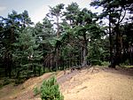
Nature reserve 'Inland dunes near Siegenburg and Offenstetten' |
|
7236-301 WDPA: 555521861 |
District of Kelheim | ⊙ | 25.00 | |||||
|
Nature reserve 'Sandharlander Heide' |

|
7136-302 WDPA: 555521824 |
District of Kelheim | ⊙ | 11.00 | |||||
| Damm natural forest reserve |
7236-302 WDPA: 555521862 |
District of Kelheim | ⊙ | 71.00 | ||||||
| Sallingbachtal |
7237-371 WDPA: 555521864 |
District of Kelheim | ⊙ | 339.39 | ||||||
|
Sippenauer Moor |

|
7137-301 WDPA: 555521828 |
District of Kelheim | ⊙ | 16.00 | |||||
| Valley of the Große Laaber between Sandsbach and Unterdeggenbach |
7138-372 WDPA: 555521830 |
District of Regensburg , Kelheim | ⊙ | 682.25 | ||||||
|
Dry slopes near Regensburg |

|
6938-301 WDPA: 555521762 |
Regensburg district , Regensburg , Kelheim district | ⊙ | 377.00 | |||||
|
Dry slopes in the lower Altmühltal with Laaberleiten and Galgental |

|
7036-371 WDPA: 555521791 |
District of Neumarkt in the Upper Palatinate , District of Kelheim | ⊙ | 2,720.05 | |||||
|
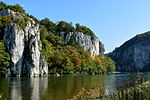
'Weltenburger Enge' and 'Hirschberg and Altmühlleiten' |
|
7136-301 WDPA: 555521823 |
District of Kelheim | ⊙ | 934.00 |
|
||||
| Klötzlmühlbach |
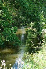
|
7438-372 WDPA: 555521934 |
Landshut , Landshut district | ⊙ | 54.06 | |||||
|
Heading the Lower Isar |
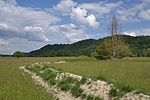
|
7439-371 WDPA: 555521935 |
Landshut , district of Dingolfing-Landau , district of Landshut | ⊙ | 642.58 | |||||
| Bucher ditch |
7438-371 WDPA: 555521933 |
Landshut district | ⊙ | 46.35 | ||||||
| Yellow-bellied toad habitats around Niedererlbach |
7538-371 WDPA: 555521967 |
Landshut district | ⊙ | 24.84 | ||||||
|
Isar floodplains from Unterföhring to Landshut |

|
7537-301 WDPA: 555521966 |
District of Erding , District of Freising , District of Munich | also in Munich, Landshut district, Landshut | ⊙ | 5,276.00 | ||||
|
Little vils |
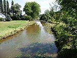
|
7539-371 WDPA: 555521968 |
Landshut district | ⊙ | 28.29 |
|
||||
| Moors in the Sonnen-Wegscheid area with sections of the Rannatals |
7348-371 WDPA: 555521911 |
District of Passau | ⊙ | 262.01 |
|
|||||
|
Salzach and Lower Inn |

|
7744-371 WDPA: 555522025 |
Berchtesgadener Land , the district of Traunstein , Altötting | also in the district of Passau, district of Rottal-Inn | ⊙ | 5,688.11 | ||||
| Loizersdorf sand and clay pit |
7246-372 WDPA: 555521872 |
District of Passau | ⊙ | 10.11 | ||||||
| Quarry area northwest of Hauzenberg |
7347-372 WDPA: 555521910 |
District of Passau | ⊙ | 13.33 | ||||||
| Lower reaches of the Rott from Bayerbach to the mouth |
7545-371 WDPA: 555521969 |
District of Passau | ⊙ | 241.00 | ||||||
| Vilshofener Danube Narrow Valley |

|
7345-301 WDPA: 555521907 |
District of Passau | ⊙ | 113.00 | |||||
|
Danube from Kachlet to Jochenstein with the Inn and Ilz estuaries |

|
7447-371 WDPA: 555521941 |
Passau , District of Passau | ⊙ | 508.02 | |||||
|
Donauleiten from Passau to Jochenstein |

|
7446-301 WDPA: 555521939 |
Passau , District of Passau | ⊙ | 517.47 | |||||
| Former gravel pit north of Hellersberg |
7346-371 WDPA: 555521908 |
Passau | ⊙ | 13.21 | ||||||
|
Ilz valley system |

|
7246-371 WDPA: 555521871 |
Passau , Freyung-Grafenau , Passau | also in the Regen district | ⊙ | 2,846.58 | ||||
| Laufenbachtal |
7445-301 WDPA: 555521938 |
Passau , District of Passau | ⊙ | 312.00 | ||||||
|
Eastern Neuburg Forest and Innleiten to Vornbach am Inn |

|
7446-371 WDPA: 555521940 |
Passau , District of Passau | see Neuburger Wald , Vornbach am Inn | ⊙ | 1,088.27 | ||||
|
Aitnach |

|
6943-371 WDPA: 555521768 |
Regen district | ⊙ | 48.94 | |||||
|
Birch break forest Oed and alder forests near Arnbruck and Hötzelsried |

|
6843-302 WDPA: 555521737 |
Regen district | ⊙ | 59.00 | |||||
|
Big and Small Arber with Arber lakes |

|
6844-373 WDPA: 555521742 |
District of Cham , District of Regen | ⊙ | 2,295.20 | |||||
|
Moore west of Zwiesel |

|
6944-302 WDPA: 555521770 |
Regen district | ⊙ | 175.00 |
|
||||
|
Upper course of the White Rain to Kötzting with Kaitersbachaue |

|
6844-371 WDPA: 555521740 |
District of Cham , District of Regen | ⊙ | 637.87 | |||||
|
Stake |
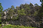
|
6842-301 WDPA: 555521734 |
Regen district | ⊙ | 104.00 | |||||
|
Silberberg |

|
6944-301 WDPA: 555521769 |
Regen district | ⊙ | 309.00 | |||||
|
Todtenau and Gföhretwiesen near Zell |

|
7144-301 WDPA: 555521832 |
Regen district | ⊙ | 150.00 | |||||
|
Wolfertsrieder Bach |

|
7043-372 WDPA: 555521799 |
Regen district | ⊙ | 62.87 | |||||
| Altbach area southwest of Triftern |
7643-371 WDPA: 555521994 |
Rottal-Inn district | ⊙ | 121.87 | ||||||
| Innleite from Buch to Simbach |
7743-301 WDPA: 555522024 |
Rottal-Inn district | ⊙ | 115.00 |
|
|||||
|
Danube and oxbow lakes between Regensburg and Straubing |

|
7040-371 WDPA: 555521795 |
Regensburg district , Straubing , Straubing-Bogen district | ⊙ | 2,193.76 | |||||
|
Donauauen between Straubing and Vilshofen |

|
7142-301 WDPA: 555521831 |
Straubing , district Deggendorf , Passau | also in the Straubing district | ⊙ | 4,787.00 | ||||
|
Stream valleys in the Falkensteiner Vorwald |

|
6939-302 WDPA: 555521763 |
District of Regensburg , the district of Cham , district of Straubing-Bogen | ⊙ | 1,387.00 | |||||
|
Brandmoos and Hauerin |

|
6941-302 WDPA: 555521767 |
District of Straubing-Bogen | ⊙ | 90.00 |
|
||||
|
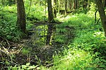
Yellow-bellied toad habitats north of Ascholtshausen |
|
7239-371 WDPA: 555521865 |
District of Straubing-Bogen | ⊙ | 15.89 | |||||
|
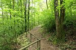
Arch training area |
|
7042-371 WDPA: 555521796 |
District of Straubing-Bogen | ⊙ | 72.47 | |||||
|
Dry slopes on the edge of the Danube |

|
6939-371 WDPA: 555521764 |
District of Regensburg , the district of Straubing-Bogen | Dry mixed oak forests on granite, silicate grasslands and silicate rock vegetation, on the steep southern slopes of the Danube valley. | ⊙ | 521.43 | ||||
|
Forests in the Danube Valley |

|
7040-302 WDPA: 555579395 |
District of Regensburg , the district of Straubing-Bogen | ⊙ | 1,289.00 | |||||
|
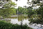
Weiher near Wiesenfelden |
|
6941-301 WDPA: 555521766 |
District of Straubing-Bogen | ⊙ | 50.00 | |||||
| Legend for fauna-flora-habitat | ||||||||||
See also
- List of nature reserves in Lower Bavaria
- List of landscape protection areas in Lower Bavaria
- List of EU bird protection areas in Lower Bavaria
- List of geotopes in Lower Bavaria
Web links
Commons : FFH areas in Lower Bavaria - collection of images, videos and audio files