| Surname
|
image
|
Identifier
|
circle
|
details
|
position
|
Area
hectares
|
date
|
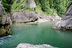
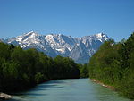
Inn and Lower Alz 
|
|
7742-371
WDPA: 555522023
|
Altötting district
|
|
⊙
|
1,564.83
|
|
|
Jachenau and extensive meadows near Fleck
|

|
8434-372
WDPA: 555522282
|
Bad Tölz-Wolfratshausen district
|
|
⊙
|
1,453.79
|
|
|
Combed newt habitat near Kochel
|
BW
|
8334-372
WDPA: 555522248
|
Bad Tölz-Wolfratshausen district
|
|
⊙
|
31.19
|
|
|
Kesselberg area
|
|
8334-373
WDPA: 555522249
|
Bad Tölz-Wolfratshausen district
|
|
⊙
|
647.95
|
|
|
Loisach
|
|
8234-372
WDPA: 555522187
|
Bad Tölz-Wolfratshausen district
|
|
⊙
|
192.74
|
|
|
Loisachleiten
|
BW
|
8134-372
WDPA: 555522142
|
Bad Tölz-Wolfratshausen district
|
|
⊙
|
306.52
|
|
|
Moors south of Königsdorf, Rothenrainer Moore and Königsdorfer Alm
|

|
8134-371
WDPA: 555522141
|
Bad Tölz-Wolfratshausen district
|
|
⊙
|
1,100.28
|
|
|
Probstalm and Probstenwand
|

|
8334-302
WDPA: 555522246
|
Bad Tölz-Wolfratshausen district
|
|
⊙
|
88.00
|
|
|
Extensive meadows in Ramsau
|
BW
|
8343-372
WDPA: 555522254
|
District of Berchtesgadener Land
|
|
⊙
|
42.69
|
|
|
Hair moss
|
|
8043-371
WDPA: 555537941
|
District of Berchtesgadener Land
|
|
⊙
|
277.18
|
|
|
Marzoller Au
|
BW
|
8243-371
WDPA: 555522201
|
District of Berchtesgadener Land
|
|
⊙
|
140.54
|
|
|
Moors in the Salzach hill country
|
|
8142-371
WDPA: 555522152
|
District of Berchtesgadener Land , District of Traunstein
|
|
⊙
|
1,308.54
|
|
|
Moors and extensive meadows near Berchtesgaden
|

|
8343-371
WDPA: 555522253
|
District of Berchtesgadener Land
|
|
⊙
|
30.71
|
|
|
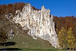
Berchtesgaden National Park
|

|
8342-301
WDPA: 555537970
|
District of Berchtesgadener Land
|
|
⊙
|
21,364.00
|
|
|
NSG 'Aschau', NSG 'Schwarzbach' and floating moss
|
|
8342-302
WDPA: 555522251
|
District of Berchtesgadener Land
|
|
⊙
|
803.00
|
|
|
Upper Surtal and Höglwörth glacial valley
|

|
8142-372
WDPA: 555522153
|
District of Berchtesgadener Land , District of Traunstein
|
|
⊙
|
878.21
|
|
|
Eastern Chiemgau Alps
|

|
8241-372
WDPA: 4415
|
District of Berchtesgadener Land , District of Traunstein
|
|
⊙
|
12,922.66
|
|
|
Salzach and Lower Inn
|

|
7744-371
WDPA: 555522025
|
Berchtesgadener Land , the district of Traunstein , Altötting
|
also in the district of Passau, district of Rottal-Inn
|
⊙
|
5,688.11
|
|
|
Kirchholz training area (Bad Reichenhall)
|
|
8243-301
WDPA: 555522200
|
District of Berchtesgadener Land
|
|
⊙
|
114.00
|
|
|
Shore areas of the Waginger See, Götzinger Achen and lower Sur
|
|
8143-371
WDPA: 555522154
|
District of Berchtesgadener Land , District of Traunstein
|
|
⊙
|
239.36
|
|
|
Untersberg
|
|
8343-303
WDPA: 19187
|
District of Berchtesgadener Land
|
|
⊙
|
3,514.00
|
|
|
Ampertal
|
|
7635-301
WDPA: 555521989
|
District of Dachau , Fürstenfeldbruck district , the district of Freising
|
|
⊙
|
2,171.00
|
|
|
Trenches and remains of fen in the Dachau Moos
|

|
7734-301
WDPA: 555522016
|
District of Dachau , Munich , District of Munich
|
|
⊙
|
306.00
|
|
|
Nature reserve 'Weichser Moos'
|

|
7634-301
WDPA: 555521988
|
District of Dachau
|
|
⊙
|
55.00
|
|
|
Attel
|

|
7938-371
WDPA: 555522075
|
District of Ebersberg , District of Rosenheim
|
|
⊙
|
294.07
|
|
|
Ebersberger and Großhaager Forest
|

|
7837-371
WDPA: 555522044
|
Ebersberg , district Mühldorf
|
Ebersberger Forest
|
⊙
|
3,840.44
|
|
|
Kastensee with adjacent Kesselmooren
|

|
8036-301
WDPA: 555522104
|
District of Ebersberg
|
|
⊙
|
28.00
|
|
|
Kupferbachtal, Glonnquellen and Gutterstätter litter meadows
|

|
8037-371
WDPA: 555522105
|
District of Ebersberg , District of Munich , District of Rosenheim
|
|
⊙
|
105.74
|
|
|
Beech forests on the Alb plateau
|

|
7132-373
WDPA: 555521821
|
District of Eichstätt
|
|
⊙
|
275.45
|
|
|
Donauauen between Ingolstadt and Weltenburg
|
|
7136-304
WDPA: 555521826
|
Eichstätt district , Ingolstadt , Pfaffenhofen an der Ilm district
|
also in the Kelheim district
|
⊙
|
2,766.00
|
|
|
Bat winter quarters in the southern Franconian Alb
|

|
6932-371
WDPA: 555521758
|
District of Weissenburg-Gunzenhausen , Eichstätt , Neuburg-Schrobenhausen
|
|
⊙
|
7.97
|
|
|
Galgenberg and Schutterquelle
|
|
7132-372
WDPA: 555521820
|
District of Eichstätt
|
|
⊙
|
11.51
|
|
|
Lean grassland on the Alb plateau in the Eichstätt district
|
BW
|
7035-371
WDPA: 555521790
|
District of Eichstätt
|
|
⊙
|
54.86
|
|
|
Mouse-ear colonies in the southern Franconian Alb
|

|
7136-303
WDPA: 555521825
|
District of Donau-Ries , Eichstätt , Kelheim
|
also in the district of Neuburg-Schrobenhausen
|
⊙
|
0.00
|
|
|
Middle Altmühltal with Wellheimer dry valley and Schambach valley
|
|
7132-371
WDPA: 555521819
|
District of Weissenburg-Gunzenhausen , Eichstätt , Neuburg-Schrobenhausen
|
|
⊙
|
4,204.50
|
|
|
Ingolstadt - Heppberg training area
|
BW
|
7134-371
WDPA: 555521822
|
District of Eichstätt
|
|
⊙
|
263.29
|
|
|
Eaves of the southern Franconian Alb
|

|
6833-371
WDPA: 555521725
|
District of Roth , District of Weißenburg-Gunzenhausen , District of Eichstätt
|
|
⊙
|
4,324.42
|
|
|
Dry grass north of Pförring
|
BW
|
7136-305
WDPA: 555521827
|
District of Eichstätt
|
|
⊙
|
4.00
|
|
|
Abandoned sand pit east of Riding
|
BW
|
7638-301
WDPA: 555521993
|
District of Erding
|
|
⊙
|
3.00
|
|
|
Trenches and remains in the Erdinger Moos
|
|
7736-371
WDPA: 555522019
|
District of Erding , District of Munich
|
|
⊙
|
110.56
|
|
|
Isar floodplains from Unterföhring to Landshut
|

|
7537-301
WDPA: 555521966
|
District of Erding , District of Freising , District of Munich
|
also in Munich, Landshut district, Landshut
|
⊙
|
5,276.00
|
|
|
Isental with tributaries
|

|
7739-371
WDPA: 555522021
|
District of Erding , District of Mühldorf am Inn
|
|
⊙
|
766.01
|
|
|
Mouse-eared colonies in the Lower Bavarian hill country
|

|
7839-371
WDPA: 555522045
|
District of Erding , district Mühldorf am Inn , district Pfaffenhofen
|
also in Altötting district, Traunstein district, Dingolfing-Landau district, Rottal-Inn district
|
⊙
|
0.00
|
|
|
Moor remains in the Freisinger and Erdinger Moos
|

|
7636-371
WDPA: 555521991
|
District of Erding , District of Freising
|
|
⊙
|
491.12
|
|
|
Strogn with Hammerbach and Köllinger Bächlein
|
BW
|
7637-371
WDPA: 555521992
|
District of Erding
|
|
⊙
|
328.04
|
|
|
Giesenbach spring moor
|

|
7635-302
WDPA: 555521990
|
District of Freising
|
|
⊙
|
8.00
|
|
|
Heathland and loamy forests north of Munich
|

|
7735-371
WDPA: 555522018
|
District of Freising , Munich , District of Munich
|
|
⊙
|
1,913.85
|
|
|
Great crested newt habitats in the Kranzberger Forest
|
BW
|
7535-371
WDPA: 555521965
|
District of Freising
|
|
⊙
|
144.54
|
|
|
Ampermoos
|
|
7832-371
WDPA: 555522041
|
Fürstenfeldbruck district , district of Landsberg am Lech , Starnberg
|
|
⊙
|
528.67
|
|
|
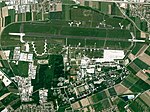
Fürstenfeldbruck Airport
|
|
7733-371
WDPA: 555522015
|
Fürstenfeldbruck district
|
|
⊙
|
226.35
|
|
|
Moors and beech forests between Etterschlag and Fürstenfeldbruck
|

|
7833-371
WDPA: 555522042
|
Fürstenfeldbruck district , Starnberg
|
|
⊙
|
775.61
|
|
|
Nature reserve 'Haspelmoor'
|

|
7732-301
WDPA: 555522014
|
Fürstenfeldbruck district
|
|
⊙
|
157.00
|
|
|
Ammer from the edge of the Alps b. to the NSG 'Bird sanctuary Ammersee-Südufer'
|
|
8331-302
WDPA: 555522238
|
Garmisch-Partenkirchen , Weilheim-Schongau
|
|
⊙
|
2,391.00
|
|
|
Ammer Mountains
|
|
8431-371
WDPA: 4419
|
Garmisch-Partenkirchen , Ostallgäu
|
|
⊙
|
27,581.80
|
|
|
Ammertaler Wiesmahd slopes
|
|
8332-304
WDPA: 555522242
|
Garmisch-Partenkirchen district
|
|
⊙
|
440.00
|
|
|
Auerberg, Mühlberg
|
BW
|
8432-302
WDPA: 555522280
|
Garmisch-Partenkirchen district
|
|
⊙
|
293.00
|
|
|
Landslide area 'Im Gsott'
|
BW
|
8332-303
WDPA: 555522241
|
Garmisch-Partenkirchen district
|
|
⊙
|
118.00
|
|
|
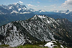
Ester Mountains
|

|
8433-371
WDPA: 555537973
|
Garmisch-Partenkirchen district
|
|
⊙
|
6,076.87
|
|
|
Extensive meadows around Glentleiten near Großweil
|
BW
|
8333-371
WDPA: 555522245
|
Garmisch-Partenkirchen , Bad Tölz-Wolfratshausen
|
|
⊙
|
132.37
|
|
|
Bat colonies in the southwest of Upper Bavaria
|

|
8134-303
WDPA: 555522140
|
Garmisch-Partenkirchen , the district of Landsberg am Lech , District of Munich
|
also in the Bad Tölz-Wolfratshausen district, Weilheim-Schongau district
|
⊙
|
0.00
|
|
|
Grasleitner moorland
|

|
8232-371
WDPA: 555522183
|
Garmisch-Partenkirchen , Weilheim-Schongau
|
|
⊙
|
2,137.87
|
|
|
Karwendel with Isar
|

|
8433-301
WDPA: 555537972
|
Garmisch-Partenkirchen , Bad Tölz-Wolfratshausen
|
|
⊙
|
19,590.00
|
|
|
Loisach-Kochelsee-Moore
|

|
8334-371
WDPA: 555537968
|
Garmisch-Partenkirchen , Weilheim-Schongau , Bad Tölz-Wolfratshausen
|
|
⊙
|
1,900.30
|
|
|
Loisach valley between Farchant and Eschenlohe
|
|
8432-301
WDPA: 555522279
|
Garmisch-Partenkirchen district
|
|
⊙
|
692.00
|
|
|
Mittenwald humpback meadows
|
|
8533-301
WDPA: 555522290
|
Garmisch-Partenkirchen district
|
|
⊙
|
1,927.00
|
|
|
Moors in the upper Ammertal
|
|
8332-371
WDPA: 555522243
|
Garmisch-Partenkirchen district
|
|
⊙
|
629.53
|
|
|
Moraine landscape between Staffelsee and Baiersoien
|

|
8332-372
WDPA: 555522244
|
Garmisch-Partenkirchen , Weilheim-Schongau
|
|
⊙
|
2,591.93
|
|
|
Murnau moss
|

|
8332-301
WDPA: 30118
|
Garmisch-Partenkirchen district
|
|
⊙
|
4,291.00
|
|
|
Upper Isar Valley
|

|
8034-371
WDPA: 555522103
|
Garmisch-Partenkirchen , Bad Tölz-Wolfratshausen , Munich County
|
also in Munich
|
⊙
|
4,669.78
|
|
|
Spatzenhausen training site north of Murnau
|
BW
|
8233-371
WDPA: 555522185
|
Garmisch-Partenkirchen , Weilheim-Schongau
|
|
⊙
|
134.69
|
|
|
Wetterstein Mountains
|

|
8532-371
WDPA: 555522289
|
Garmisch-Partenkirchen district
|
|
⊙
|
4,256.91
|
|
|
Donauauen with Gerolfinger oak forest
|

|
7233-372
WDPA: 555521858
|
Ingolstadt , district of Neuburg-Schrobenhausen
|
|
⊙
|
2,926.76
|
|
|
Donaumoosbach, Zucheringer Wörth and Brucker Forst
|

|
7233-373
WDPA: 555521859
|
Ingolstadt , district of Neuburg-Schrobenhausen , district of Aichach-Friedberg
|
also in the district of Pfaffenhofen an der Ilm
|
⊙
|
947.29
|
|
|
Ammersee south bank and Raistinger meadows
|
|
8032-371
WDPA: 555522098
|
District of Landsberg am Lech , Weilheim-Schongau
|
|
⊙
|
882.40
|
|
|
Ammerseeufer and Leitenwälder
|

|
7932-372
WDPA: 555522069
|
District of Landsberg am Lech , Starnberg
|
|
⊙
|
952.06
|
|
|
Lech between Hirschau and Landsberg with floodplains and Leiten
|

|
8131-371
WDPA: 555522135
|
District of Landsberg am Lech , Weilheim-Schongau
|
|
⊙
|
2,889.85
|
|
|
Lech between Landsberg and Königsbrunn with Auen and Leite
|
|
7631-372
WDPA: 555521987
|
District of Landsberg am Lech , district of Augsburg , Aichach-Friedberg
|
also in Augsburg
|
⊙
|
2,502.03
|
|
|
Moors and forests west of Dießen
|

|
8032-372
WDPA: 555522099
|
District of Landsberg am Lech , Weilheim-Schongau
|
|
⊙
|
2,590.62
|
|
|
Moorkette from Peiting to Wessobrunn
|
|
8131-301
WDPA: 555522134
|
District of Landsberg am Lech , Weilheim-Schongau
|
|
⊙
|
944.00
|
|
|
Nature reserve 'Seeholz und Seewiese'
|

|
8032-302
WDPA: 555522097
|
Landsberg am Lech district
|
|
⊙
|
97.00
|
|
|
Westerholz
|

|
7831-301
WDPA: 555522040
|
Landsberg am Lech district
|
|
⊙
|
40.00
|
|
|
Windach
|

|
7932-371
WDPA: 555522068
|
Landsberg am Lech district
|
|
⊙
|
309.92
|
|
|
Attenloher Filzen and Mariensteiner Moore
|

|
8235-371
WDPA: 555522189
|
Miesbach , Bad Tölz-Wolfratshausen
|
|
⊙
|
650.20
|
|
|
Ellbach and Kirchseemoor
|

|
8235-301
WDPA: 4416
|
Miesbach , Bad Tölz-Wolfratshausen
|
|
⊙
|
1,173.00
|
|
|
Flysch Mountains near Bad Wiessee
|

|
8236-371
WDPA: 555522190
|
Miesbach district
|
|
⊙
|
954.58
|
|
|
Leitzachtal
|

|
8237-371
WDPA: 555522191
|
Miesbach , Rosenheim
|
|
⊙
|
2,240.70
|
|
|
Mangfall Mountains
|

|
8336-371
WDPA: 555537969
|
Miesbach district
|
|
⊙
|
14,871.30
|
|
|
Mangfall Valley
|

|
8136-371
WDPA: 555522144
|
Miesbach , Rosenheim
|
|
⊙
|
1,347.64
|
|
|
Taubenberg
|

|
8136-302
WDPA: 555537947
|
Miesbach district
|
|
⊙
|
1,847.00
|
|
|
Wattersdorfer Moor
|
|
8137-301
WDPA: 555522145
|
Miesbach district
|
|
⊙
|
346.00
|
|
|
Grünbach and Bucher Moor
|
BW
|
7741-371
WDPA: 555522022
|
County Mühldorf , Altötting
|
|
⊙
|
150.55
|
|
|
Innauen and Leitenwälder
|

|
7939-301
WDPA: 555522076
|
District Mühldorf am Inn , Rosenheim
|
|
⊙
|
3,553.00
|
|
|
Great crested newt habitats in the districts of Mühldorf and Altötting
|
BW
|
7842-371
WDPA: 555522047
|
County Mühldorf , Altötting
|
|
⊙
|
113.57
|
|
|
Acorn garden in Forstenrieder Park
|

|
7934-302
WDPA: 555522073
|
District of Munich
|
|
⊙
|
18.00
|
|
|
Moore between Dietramszell and Deining
|
|
8135-371
WDPA: 555522143
|
District of Munich , District of Bad Tölz-Wolfratshausen
|
|
⊙
|
960.34
|
|
|
NSG south of the Ismaninger fish ponds
|
|
7736-372
WDPA: 555522020
|
District of Munich
|
|
⊙
|
22.70
|
|
|
Allacher Forst and Angerlohe
|

|
7734-302
WDPA: 555522017
|
Munich
|
|
⊙
|
219.00
|
|
|
Nymphenburger Park with avenue and Kapuzinerhölzl
|

|
7834-301
WDPA: 555522043
|
Munich
|
|
⊙
|
177.00
|
|
|
Amphibian habitats around Neuburg
|
BW
|
7233-371
WDPA: 555521857
|
District of Neuburg-Schrobenhausen
|
|
⊙
|
29.53
|
|
|
Danube with Jura slopes between Leitheim and Neuburg
|

|
7232-301
WDPA: 555521856
|
District of Donau-Ries , Neuburg-Schrobenhausen
|
|
⊙
|
3,282.00
|
|
|
Illdorfer, Kundinger, Eschlinger Leiten
|
BW
|
7332-301
WDPA: 555521901
|
District of Donau-Ries , Neuburg-Schrobenhausen
|
|
⊙
|
77.00
|
|
|
Pair
|

|
7433-371
WDPA: 555521932
|
Neuburg-Schrobenhausen , district Pfaffenhofen , Aichach-Friedberg
|
|
⊙
|
2,970.22
|
|
|
Feilenmoos with Nöttinger cattle pasture
|

|
7335-371
WDPA: 555521902
|
Pfaffenhofen an der Ilm district
|
see: Feilenmoos , Nöttinger Heide
|
⊙
|
870.41
|
|
|
Oberstimmer Schacht
|
BW
|
7234-371
WDPA: 555521860
|
Pfaffenhofen an der Ilm district
|
|
⊙
|
18.82
|
|
|
Bärnseemoor
|
BW
|
8240-302
WDPA: 555522196
|
Rosenheim district
|
|
⊙
|
93.00
|
|
|
Chiemsee
|

|
8140-372
WDPA: 67949
|
District of Rosenheim , District of Traunstein
|
|
⊙
|
8,151.56
|
|
|
Geigelstein and Achental Gorge
|
|
8239-372
WDPA: 555522195
|
District of Rosenheim , District of Traunstein
|
|
⊙
|
3,207.18
|
|
|
Hochriesgebiet and hillside forests in the Aschauer Tal
|

|
8239-371
WDPA: 555522194
|
Rosenheim district
|
|
⊙
|
1,826.39
|
|
|
Innauwald near Neubüsten and Nussdorf pioneer training area
|
BW
|
8238-371
WDPA: 555522193
|
Rosenheim district
|
|
⊙
|
191.63
|
|
|
Mouse-ear colonies in the southern district of Rosenheim
|

|
8037-372
WDPA: 555522106
|
Rosenheim district
|
|
⊙
|
2.00
|
|
|
Moore north of Bad Aibling
|
BW
|
8038-372
WDPA: 555522108
|
Rosenheim district
|
|
⊙
|
106.38
|
|
|
Moors south of the Chiemsee
|
|
8140-371
WDPA: 555522149
|
District of Rosenheim , District of Traunstein
|
|
⊙
|
3,566.41
|
|
|
Moors around Raubling
|

|
8138-372
WDPA: 555522147
|
Rosenheim district
|
|
⊙
|
1,027.92
|
|
|
Moors around Wasserburg
|
|
7939-371
WDPA: 555522077
|
Rosenheim district
|
|
⊙
|
134.29
|
|
|
Moors and lakes northeast of Rosenheim
|

|
8039-302
WDPA: 555522109
|
Rosenheim district
|
|
⊙
|
559.00
|
|
|
Moor area from Eggstädt-Hemhof to Seeon
|
|
8040-371
WDPA: 555522111
|
District of Rosenheim , District of Traunstein
|
|
⊙
|
2,115.70
|
|
|
Murn, Murner Filz and Eiselfinger See
|

|
8039-371
WDPA: 555522110
|
Rosenheim district
|
|
⊙
|
514.15
|
|
|
Rotter Forst and Rott
|

|
8038-371
WDPA: 555522107
|
Rosenheim district
|
|
⊙
|
846.29
|
|
|
Simsee area
|

|
8139-371
WDPA: 555522148
|
Rosenheim district
|
|
⊙
|
1,041.88
|
|
|
St.Margarethen / Brannenburg training area
|
BW
|
8238-301
WDPA: 555522192
|
Rosenheim district
|
|
⊙
|
64.00
|
|
|
Maternity roosts in Chiemgau
|

|
7841-371
WDPA: 555522046
|
District of Rosenheim , District of Traunstein , District of Altötting
|
|
⊙
|
3.50
|
|
|
Auer Weidmoos with Kalten and Kaltenaue
|

|
8138-371
WDPA: 555522146
|
Rosenheim , district of Rosenheim
|
|
⊙
|
465.51
|
|
|
Oak alleys and forests around Meiling and Weßling
|

|
7933-371
WDPA: 555522071
|
Starnberg district
|
|
⊙
|
329.49
|
|
|
Herrschinger Moos and Aubachtal
|

|
7933-372
WDPA: 555522072
|
Starnberg district
|
|
⊙
|
209.01
|
|
|
Moors and forests of the terminal moraine near Starnberg
|

|
7934-371
WDPA: 555522074
|
Starnberg district
|
|
⊙
|
586.62
|
|
|
Moraine landscape between Ammersee and Starnberger See
|
|
8033-371
WDPA: 555522100
|
Starnberg , Weilheim-Schongau
|
|
⊙
|
2,071.96
|
|
|
NSG Maisinger See
|
|
8033-373
WDPA: 555522102
|
Starnberg district
|
|
⊙
|
121.83
|
|
|
Schluifelder Moos and Bulachmoos
|
BW
|
7933-301
WDPA: 555522070
|
Starnberg district
|
Schluisee
|
⊙
|
74.00
|
|
|
Maising training area
|
|
8033-372
WDPA: 555522101
|
Starnberg district
|
|
⊙
|
101.52
|
|
|
starnberger Lake
|

|
8133-371
WDPA: 67948
|
Starnberg district
|
|
⊙
|
5,689.05
|
|
|
Alz from Chiemsee to Altenmarkt
|

|
8041-302
WDPA: 555522113
|
District of Traunstein
|
|
⊙
|
477.00
|
|
|
Extensive meadows around Ruhpolding
|
|
8241-371
WDPA: 555522198
|
District of Traunstein
|
|
⊙
|
103.12
|
|
|
Hill spring moor 'Ewige Sau'
|
BW
|
8141-301
WDPA: 555522151
|
District of Traunstein
|
|
⊙
|
50.00
|
|
|
Heigermoos
|

|
7942-301
WDPA: 555522078
|
District of Traunstein
|
|
⊙
|
3.00
|
|
|
Mettenhamer Filz, Süssener and Lanzinger Moos with extensive meadows
|
BW
|
8240-371
WDPA: 555522197
|
District of Traunstein
|
|
⊙
|
151.09
|
|
|
Training area in Traunstein
|

|
8041-371
WDPA: 555522114
|
District of Traunstein
|
|
⊙
|
104.45
|
|
|
Winter quarters for the pug bat in Stein Castle
|

|
8041-301
WDPA: 555522112
|
District of Traunstein
|
|
⊙
|
0.00
|
|
|
Eberfinger Drumlinfeld with Magnetsrieder Hardt u. Bernried felt
|

|
8133-302
WDPA: 555522138
|
Weilheim-Schongau district
|
|
⊙
|
1,115.00
|
|
|
Ettinger Bach
|

|
8132-302
WDPA: 555522136
|
Weilheim-Schongau district
|
|
⊙
|
59.00
|
|
|
Slope spring moor southwest of Echerschwang
|
BW
|
8230-301
WDPA: 555522180
|
Weilheim-Schongau district
|
|
⊙
|
2.00
|
|
|
Illach from Hausen to Jagdberg
|

|
8231-302
WDPA: 555522182
|
Weilheim-Schongau district
|
|
⊙
|
300.00
|
|
|
Moor and drumlin landscape between Hohenkasten and Antdorf
|
|
8233-301
WDPA: 555522184
|
Weilheim-Schongau district
|
|
⊙
|
1,412.00
|
|
|
Moors around Bernbeuren
|

|
8230-371
WDPA: 555522181
|
Weilheim-Schongau , Ostallgäu
|
|
⊙
|
325.95
|
|
|
Moors around Penzberg
|
|
8234-371
WDPA: 555522186
|
Weilheim-Schongau , Bad Tölz-Wolfratshausen
|
|
⊙
|
1,161.21
|
|
|
Nature reserve 'Moore around the Wies'
|
|
8331-301
WDPA: 555522237
|
Weilheim-Schongau district
|
|
⊙
|
378.00
|
|
|
Nature reserve 'Osterseen'
|

|
8133-301
WDPA: 555522137
|
Weilheim-Schongau district
|
|
⊙
|
1,087.00
|
|
|
Trauchberger Ach, moors and forests on the northern edge of the Ammer Mountains
|

|
8331-303
WDPA: 555522239
|
Weilheim-Schongau , Ostallgäu
|
|
⊙
|
1,129.00
|
|
|
Original felt, Premer felt and cattle pastures
|
|
8330-371
WDPA: 555522236
|
Weilheim-Schongau , Ostallgäu
|
|
⊙
|
546.57
|
|
| Legend for fauna-flora-habitat
|


.JPG)


_und_Salzach_(rechts).jpg)


.jpg)


.JPG)


.jpg)


.jpg)


_GO-1.jpg)


.JPG)


.jpg)


