List of nature reserves in Upper Bavaria
The list of nature reserves in Upper Bavaria includes the following lists of nature reserves in Upper Bavarian counties and cities from the article namespace:
- List of nature reserves in the Altötting district
- List of nature reserves in the Bad Tölz-Wolfratshausen district
- List of nature reserves in the Berchtesgadener Land district
- List of nature reserves in the Dachau district
- List of nature reserves in the Ebersberg district
- List of nature reserves in the Eichstätt district
- List of nature reserves in the district of Erding
- List of nature reserves in the Freising district
- List of nature reserves in the Fürstenfeldbruck district
- List of nature reserves in the Garmisch-Partenkirchen district
- List of nature reserves in Ingolstadt
- List of nature reserves in the Landsberg am Lech district
- List of nature reserves in the Mühldorf am Inn district
- List of nature reserves in the district and in the city of Munich
- List of nature reserves in the district of Neuburg-Schrobenhausen
- List of nature reserves in the Pfaffenhofen an der Ilm district
- List of nature reserves in the city and district of Rosenheim
- List of nature reserves in the Starnberg district
- List of nature reserves in the Traunstein district
- List of nature reserves in the Weilheim-Schongau district
The selection corresponds to the administrative region of Upper Bavaria . There are 133 nature reserves in the administrative district (as of May 2016). Together they cover an area of 90,346 hectares. The largest nature reserve in the district is the Ammer Mountains.
| Surname | image | Identifier
|
circle | details | position | Area hectares |
date
|
|||
|---|---|---|---|---|---|---|---|---|---|---|
| Bucher Moor | NSG-00287.01 WDPA: 162612 |
Altötting district | ⊙ | 13.09 | 1984 | |||||
|
Innleite at Marktl with roof wall |
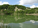
|
NSG-00272.01 WDPA: 163920 |
Altötting district | ⊙ | 204.91 | 1986 | ||||
|
Lower Alz |

|
NSG-00374.01 WDPA: 165995 |
Altötting district |
Emmerting , Mehring , Marktl , Neuötting |
⊙ | 749.88 | 1990 | |||
|
Salzach estuary bird sanctuary |

|
NSG-00419.01 WDPA: 166076 |
Altötting , Rottal-Inn | LK Altötting 288.03 ha, LK Rottal-Inn 281.51 ha | ⊙ | 569.54 | 1992
|
|||
|
Babenstuben moors |

|
NSG-00325.01 WDPA: 162311 |
Bad Tölz-Wolfratshausen district | ⊙ | 211.29 | 1994 | ||||
|
Ellbach and Kirchseemoor |

|
NSG-00030.01 WDPA: 4416 |
Bad Tölz-Wolfratshausen district |
Bad Tölz Third largest moor area in Bavaria. It is particularly characterized by its scenic diversity and beauty. |
⊙ | 797.54 | 1970 | |||
|
Habichau |

|
NSG-00056.01 WDPA: 81792 |
Bad Tölz-Wolfratshausen district | ⊙ | 25.88 | 1951 | ||||
| Hechenberger Leite | NSG-00381.01 WDPA: 163568 |
Bad Tölz-Wolfratshausen district | ⊙ | 20.12 | 1991 | |||||
|
Sassau island in Walchensee |

|
NSG-00108.01 WDPA: 81999 |
Bad Tölz-Wolfratshausen district | ⊙ | 7.73 | 1978 | ||||
|
Isar meadows between Schäftlarn and Bad Tölz (ex- Pupplinger and Ascholdinger Au ) |

|
NSG-00267.01 WDPA: 4413 |
Bad Tölz-Wolfratshausen district | Wolfratshauser Forest | ⊙ | 1,656.60 | 1986 | |||
|
Karwendel and Karwendel foothills |

|
NSG-00171.01 WDPA: 4418 |
Bad Tölz-Wolfratshausen , Garmisch-Partenkirchen |
Karwendel and Karwendel foothills are part of the FFH area "Karwendel with Isar"
Bad Tölz-Wolfratshausen district 10,648.49 ha, Garmisch-Partenkirchen district 8,699.05 ha |
⊙ | 19,347.54 | 1983 | |||
|
Monastery felt |
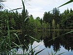
|
NSG-00280.01 WDPA: 164149 |
Bad Tölz-Wolfratshausen district | ⊙ | 25.77 | 1986 | ||||
|
Leonhard felt |

|
NSG-00060.01 WDPA: 82088 |
Bad Tölz-Wolfratshausen district | ⊙ | 15.44 | 1951 | ||||
| Schellenbergmoor | NSG-00306.01 WDPA: 82517 |
Bad Tölz-Wolfratshausen district | ⊙ | 30.22 | 1987 | |||||
|
Zellbachtal |

|
NSG-00614.01 WDPA: 319361 |
Bad Tölz-Wolfratshausen district | ⊙ | 130.27 | 2003
|
||||
|
Aschau |

|
NSG-00561.01 WDPA: 318121 |
District of Berchtesgadener Land | ⊙ | 729.13 | 1982 | ||||
|
Schwarzbach |

|
NSG-00515.01 WDPA: 165489 |
District of Berchtesgadener Land | ⊙ | 51.17 | 1996
|
||||
|
Soft moss |

|
NSG-00554.01 WDPA: 319296 |
District of Dachau | ⊙ | 55.48 | 1998
|
||||
|
Eggelburger See bird sanctuary |

|
NSG-00098.01 WDPA: 82790 |
District of Ebersberg | ⊙ | 75.60 | 1973
|
||||
| Old Danube with Brenne |
NSG-00322.01 WDPA: 162081 |
District of Eichstätt |
Großmehring Typical communities of the Danube meadows and consists of the Old Danube. |
⊙ | 225.08 | 1987 | ||||
|
Arnsberger Management |

|
NSG-00271.01 WDPA: 162239 |
District of Eichstätt |
Arnsberg Magerrasen with the range of plant and animal species typical of the Jura. |
⊙ | 20.50 | 1997 | |||
|
Arzberg near Beilngries |

|
NSG-00747.01 WDPA: 555546332 |
District of Eichstätt |
Beilngries Near-natural and extensive complex of dry sites at the confluence of the Altmühl and Sulz rivers with its semi-arid grasslands. |
⊙ | 76.14 | ||||
|
Gungoldinger juniper heather |
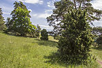
|
NSG-00076.01 WDPA: 163412 |
District of Eichstätt |
Gungolding Largest juniper heath designated as a nature reserve in Bavaria. |
⊙ | 72.38 | 1959 | |||
| Königsau near Großmehring |
NSG-00281.01 WDPA: 164198 |
Eichstätt , district Pfaffenhofen |
Großmehring wetland, consisting of an oxbow arm of the Danube and two former gravel pits. Eichstätt district 27.40 ha, Pfaffenhofen an der Ilm 2.21 ha |
⊙ | 29.61 | 1986 | ||||
| Kreutberg near Altmannstein |
NSG-00247.01 WDPA: 164251 |
District of Eichstätt |
Altmannstein Diverse complex of semi-arid lawns, fringes, dry lawns and rock corridors. |
⊙ | 23.50 | 1985 | ||||
|
Dry slopes near Dollnstein |

|
NSG-00133.01 WDPA: 82737 |
District of Eichstätt |
Dollnstein Characteristic vegetation in the existing scope, consisting of semi-arid grassland, dry grassland and rocky grasslands. |
⊙ | 61.99 | 1980
|
|||
|
Freising Buckl |

|
NSG-00176.01 WDPA: 81692 |
District of Erding |
Eitting |
⊙ | 22.01 | 1940 | |||
|
Gfallach |
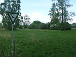
|
NSG-00379.01 WDPA: 163240 |
District of Erding |
Moosinning |
⊙ | 6.36 | 1991 | |||
| Emergency moss | NSG-00494.01 WDPA: 164849 |
District of Erding |
Oberding |
⊙ | 138.88 | 1995 | ||||
| Oberdingermoos | NSG-00492.01 WDPA: 164861 |
District of Erding |
Oberding |
⊙ | 138.26 | 1995 | ||||
|
Cattle moss |

|
NSG-00175.01 WDPA: 82780 |
District of Erding |
Eitting , mountain learning |
⊙ | 244.33 | 1983 | |||
|
Eittinger Weiher bird sanctuary |

|
NSG-00251.01 WDPA: 166069 |
District of Erding |
Eitting |
⊙ | 20.72 | 1985 | |||
|
Zengermoss |

|
NSG-00491.01 WDPA: 166402 |
District of Erding |
Moosinning , Oberding |
⊙ | 251.17 | 2002
|
|||
| Old gravel pit near Vötting | NSG-00045.01 WDPA: 81267 |
District of Freising | ⊙ | 1.47 | 1943 | |||||
|
Amperauen with oxbow lakes near Palzing |

|
NSG-00291.01 WDPA: 162201 |
District of Freising | ⊙ | 64.01 | 1986-10-14 | ||||
|
Echinger Lohe |

|
NSG-00044.01 WDPA: 81570 |
District of Freising | ⊙ | 23.69 | 1976-11-24 | ||||
|
Garching Heath |

|
NSG-00389.01 WDPA: 81713 |
District of Freising | ⊙ | 26.89 | 1991-07-09 | ||||
|
Isar floodplains between Hangenham and Moosburg |

|
NSG-00246.01 WDPA: 163928 |
District of Erding , District of Freising |
Langenbach , Moosburg an der Isar , Eitting , Langenpreising Semi-dry lawn with specialized insects and plants. LK Erding 50.53 ha, LK Freising 577.56 ha. |
⊙ | 628.09 | 1985-05-10 | |||
|
Mallertshofer wood with heathers |

|
NSG-00501.01 WDPA: 164561 |
District of Freising , District of Munich | Freising district 235.82 ha, Munich district 363.79 ha | ⊙ | 599.61 | 1994-10-18 | |||
|
Bird sanctuary Middle Isar reservoirs |

|
NSG-00170.01 WDPA: 82804 |
Freising district , district of Landshut | Freising district 191.12 ha, Landshut district 399.13 ha | ⊙ | 590.25 | 1982-09-23
|
|||
|
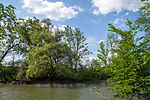
Amperauen with Leiten forests between Fürstenfeldbruck and Schöngeising |
|
NSG-00511.01 WDPA: 162202 |
Fürstenfeldbruck district | ⊙ | 184.57 | 1986 | ||||
|
Haspelmoor |

|
NSG-00250.01 WDPA: 163552 |
Fürstenfeldbruck district | ⊙ | 157.66 | 1985
|
||||
|
Altenauer Moor |

|
NSG-00097.01 WDPA: 81269 |
Garmisch-Partenkirchen district | ⊙ | 57.79 | 1973 | ||||
|
Ammer Mountains |

|
NSG-00274.01 WDPA: 4419 |
Garmisch-Partenkirchen , Ostallgäu |
Schwangau One of the most representative high-altitude moorlands in the entire Alps. LK Garmisch-Partenkirchen 18,496.84 ha, LK Ostallgäu 10,380.07 ha |
⊙ | 28,876.91 | 1993 | |||
|
Ammerschlucht at the Echelsbacher bridge |

|
NSG-00077.01 WDPA: 318113 |
Garmisch-Partenkirchen , Weilheim-Schongau | LK Garmisch-Partenkirchen 11.85 ha, LK Weilheim-Schongau 20.56 ha | ⊙ | 32.41 | 1986 | |||
|
Ammer Gorge in the Scheibum area |

|
NSG-00066.01 WDPA: 318114 |
Garmisch-Partenkirchen , Weilheim-Schongau | Garmisch-Partenkirchen County 20.32 ha, Weilheim-Schongau County 22.35 ha | ⊙ | 42.67 | 1959 | |||
|
Arnspitze |

|
NSG-00158.01 WDPA: 162241 |
Garmisch-Partenkirchen district | ⊙ | 222.54 | 1986 | ||||
|
Humpback meadows on the goat skull |

|
NSG-00324.01 WDPA: 162624 |
Garmisch-Partenkirchen district | ⊙ | 27.48 | 1994 | ||||
| Humpback meadows on the Plattele |

|
NSG-00323.01 WDPA: 162625 |
Garmisch-Partenkirchen district | ⊙ | 35.17 | 1987 | ||||
|
Ettaler Weidmoos |

|
NSG-00166.01 WDPA: 81633 |
Garmisch-Partenkirchen district | ⊙ | 155.45 | 2002 | ||||
|
Froschhauser See |

|
NSG-00254.01 WDPA: 163161 |
Garmisch-Partenkirchen district | ⊙ | 36.70 | 1983 | ||||
|
Kochelfilz near Unterammergau |

|
NSG-00312.01 WDPA: 164173 |
Garmisch-Partenkirchen district | ⊙ | 89.82 | 1987 | ||||
|
Murnau moss |

|
NSG-00129.01 WDPA: 30118 |
Garmisch-Partenkirchen district | ⊙ | 2,377.98 | 1980 | ||||
|
Powder moss |

|
NSG-00149.01 WDPA: 82347 |
Garmisch-Partenkirchen district | ⊙ | 128.66 | 1982 | ||||
| Riedboden | NSG-00157.01 WDPA: 82410 |
Garmisch-Partenkirchen district | ⊙ | 146.39 | 1982 | |||||
|
Schachen and Reintal |

|
NSG-00092.01 WDPA: 20723 |
Garmisch-Partenkirchen district | The Schachen and the Reintal in the Wetterstein Mountains. FFH area | ⊙ | 3,965.02 | 1970 | |||
|
Western Staffelsee with adjacent moors |

|
NSG-00557.01 WDPA: 319321 |
Garmisch-Partenkirchen district | ⊙ | 973.42 | 1999
|
||||
|
Donauauen on the Kälberschütt |

|
NSG-00416.01 WDPA: 162780 |
Ingolstadt , Eichstätt district |
Großmehring Near-natural floodplain biotopes, consisting of softwood and hardwood floodplain forests, distinctive single trees and groups of trees as well as backwaters. Ingolstadt 93.19 ha, Eichstätt district 22.87 ha |
⊙ | 116.06 | 1988
|
|||
|
Dettenhofer Filz and Hälsle |

|
NSG-00063.01 WDPA: 81520 |
Landsberg am Lech district | ⊙ | 119.16 | 1992 | ||||
|
Erlwiesfilz, Bremstauden, Am Eschenbächel |

|
NSG-00062.01 WDPA: 81622 |
Landsberg am Lech district | ⊙ | 127.16 | 1987 | ||||
|
Lechauwald near Unterbergen |

|
NSG-00377.01 WDPA: 164410 |
District of Landsberg am Lech , Aichach-Friedberg |
Merching "Alluvial forest area with dominating gray alder forests, pine forest relics and poor grasslands (" burning "), correspondingly rich flora and fauna. Part of the" Lechtal biotope bridge "." LK Landsberg am Lech 153.35 ha, LK Aichach-Friedberg 215.57 ha |
⊙ | 368.92 | 1990 | |||
|
Oberhauser Weiher |

|
NSG-00282.01 WDPA: 164894 |
Landsberg am Lech district | ⊙ | 30.89 | 1986 | ||||
|
Seeholz and Seewiese |

|
NSG-00245.01 WDPA: 165538 |
Landsberg am Lech district | ⊙ | 96.57 | 1985 | ||||
|
Steep slopes and floodplains of the Lech between Kinsau and Hohenfurch |

|
NSG-00643.01 WDPA: 329641 |
District of Landsberg am Lech , Weilheim-Schongau | LK Landsberg am Lech 84.96 ha, LK Weilheim-Schongau 103.34 ha | ⊙ | 188.3 | 2004 | |||
|
Bird sanctuary Ammersee south bank |

|
NSG-00120.01 WDPA: 82786 |
District of Landsberg am Lech , Weilheim-Schongau | LK Landsberg am Lech 403.98 ha, LK Weilheim-Schongau 199.67 ha | ⊙ | 603.65 | 1979
|
|||
| Bird sanctuary gray heron colony near Au a. Inn | NSG-00153.01 WDPA: 82793 |
District of Mühldorf am Inn | ⊙ | 21.01 | 1982
|
|||||
|
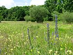
Allacher Lohe |
|
NSG-00573.01 WDPA: 318087 |
Munich | ⊙ | 156.41 | 2000 | ||||
|
Kupferbachtal near Unterlaus |

|
NSG-00177.01 WDPA: 164300 |
District of Munich , District of Ebersberg , District of Rosenheim | LK Munich 18.48 ha, LK Ebersberg 2.87 ha, LK Rosenheim 24.12 ha | ⊙ | 45.47 | 1983 | |||
|
Panzerwiese and hardwood |

|
NSG-00611.01 WDPA: 318931 |
Munich | includes the Panzerwiese and the hardwood adjoining it to the north in the Munich district of Milbertshofen-Am Hart | ⊙ | 268.77 | 2002 | |||
|
Schwarzholzl |

|
NSG-00460.01 WDPA: 165514 |
Munich , District of Munich , District of Dachau | Munich 80.49 ha, Munich district 26.70 ha, Dachau district 28.19 ha | ⊙ | 135.38 | 1994 | |||
|
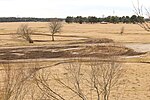
Southern Fröttmaninger Heide |
|
NSG-00750.01 WDPA: 555632900 |
Munich , District of Munich | Part of the ice age gravel landscape in the north of Munich with its limestone grasslands and sparse pine forests. | ⊙ | 347 | 2016 | |||
|
Bird sanctuary south of the fish ponds of the Middle Isar |

|
NSG-00007.01 WDPA: 82806 |
District of Munich | ⊙ | 8.20 | 1938
|
||||
|
Donaualtwasser Schnödhof |

|
NSG-00468.01 WDPA: 162778 |
District of Neuburg-Schrobenhausen , District of Donau-Ries |
Marxheim Large oxbow lake / bank complex on the Danube with wide silting zones, remains of alluvial forest and poor meadow meadows. LK Neuburg-Schrobenhausen 58.62 ha, LK Donau-Ries 23.84 ha |
⊙ | 82.46 | 1994 | |||
|
Finkenstein |

|
NSG-00201.01 WDPA: 81667 |
District of Neuburg-Schrobenhausen |
Neuburg on the Danube |
⊙ | 7.05 | 1940 | |||
|
Cross |

|
NSG-00582.01 WDPA: 318689 |
District of Neuburg-Schrobenhausen | ⊙ | 180.26 | 2000 | ||||
| Kundinger field | NSG-00190.01 WDPA: 164299 |
District of Neuburg-Schrobenhausen | ⊙ | 13.39 | 1983 | |||||
|
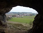
Walled caves |
|
NSG-00124.01 WDPA: 82146 |
District of Neuburg-Schrobenhausen | ⊙ | 7.03 | 1979 | ||||
| Dry slopes Leitenberg near Illdorf | NSG-00253.01 WDPA: 165955 |
District of Neuburg-Schrobenhausen | ⊙ | 11.92 | 1985
|
|||||
|
Nöttinger pasture and bathing bowls |

|
NSG-00270.01 WDPA: 82259 |
Pfaffenhofen an der Ilm district | ⊙ | 148.06 | 1986 | ||||
| Oberstimmer Schacht | NSG-00572.01 WDPA: 164902 |
Pfaffenhofen an der Ilm district | ⊙ | 18.39 | 2000 | |||||
| Windsberg | NSG-00239.01 WDPA: 166325 |
Pfaffenhofen an der Ilm district | ⊙ | 8.38 | 1985
|
|||||
|
Auer Weidmoos |

|
NSG-00117.01 WDPA: 81325 |
Rosenheim district | ⊙ | 76.95 | 1999 | ||||
|
Eggstätt-Hemhofer Lake District |

|
NSG-00154.01 WDPA: 4417 |
Rosenheim district | ⊙ | 1,023.78 | 1989 | ||||
| Frauenöder felt | NSG-00031.01 WDPA: 81690 |
Rosenheim district | ⊙ | 12.63 | 1993 | |||||
|
Geigelstein |

|
NSG-00384.01 WDPA: 64683 |
District of Rosenheim , District of Traunstein | LK Rosenheim 1,515.53 ha, LK Traunstein 1,623.57 ha | ⊙ | 3,139.1 | 1991 | |||
|
Hoes and Rottau felt |

|
NSG-00373.01 WDPA: 163467 |
District of Rosenheim , District of Traunstein | LK Rosenheim 24.91 ha, LK Traunstein 339.16 ha | ⊙ | 364.07 | 1990 | |||
|
High moor on the Kesselsee |

|
NSG-00156.01 WDPA: 81897 |
Rosenheim district | ⊙ | 82.87 | 1982 | ||||
| Irlhamer moss | NSG-00059.01 WDPA: 82004 |
Rosenheim district | ⊙ | 38.02 | 1951 | |||||
|
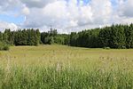
Cold |
|
NSG-00347.01 WDPA: 164009 |
Rosenheim , district of Rosenheim |
Kaltenbach , City of Rosenheim 47.90 ha, LK Rosenheim 47.77 ha |
⊙ | 95.67 | 1989 | |||
| Kühwampenmoor | NSG-00047.01 WDPA: 164292 |
Rosenheim district | ⊙ | 23.23 | 1949 | |||||
|
Murner felt |

|
NSG-00051.01 WDPA: 82197 |
Rosenheim district | ⊙ | 98.47 | 1950 | ||||
|
South bank of the Simssees |

|
NSG-00433.01 WDPA: 165791 |
Rosenheim district | ⊙ | 254.84 | 1993 | ||||
|
Innstausee bird sanctuary near Attel and Freiham |

|
NSG-00163.01 WDPA: 82797 |
Rosenheim district | ⊙ | 566.28 | 1982
|
||||
|
On the east bank of Lake Starnberg |

|
NSG-00438.01 WDPA: 162176 |
Starnberg district | ⊙ | 2.42 | 1985 | ||||
|
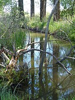
Ampermoos |
|
NSG-00168.01 WDPA: 81306 |
Fürstenfeldbruck district , district of Landsberg am Lech , Starnberg | Fürstenfeldbruck district 282.44 ha, Landsberg am Lech district 107.23 ha, Starnberg district 138.79 ha | ⊙ | 528.46 | 1996 | |||
|
Görbelmoos |

|
NSG-00034.01 WDPA: 81740 |
Starnberg district | ⊙ | 15.06 | 1941 | ||||
|
Herrschinger moss |

|
NSG-00169.01 WDPA: 163656 |
Starnberg district | ⊙ | 107.51 | 1982 | ||||
|
Carp corner with litter meadows on Lake Starnberg |

|
NSG-00238.01 WDPA: 164029 |
Starnberg , Weilheim-Schongau | Starnberg district 29.31 ha, Weilheim-Schongau district 3.98 ha | ⊙ | 33.29 | 1985 | |||
|
Leutstettener Moos |

|
NSG-00228.01 WDPA: 164444 |
Starnberg district | ⊙ | 214.96 | 1985 | ||||
|
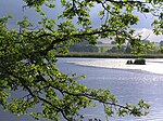
Maisinger See |
|
NSG-00313.01 WDPA: 82137 |
Starnberg district | ⊙ | 116.58 | 1987 | ||||
|
Mesnerbichl |

|
NSG-00039.01 WDPA: 82160 |
Starnberg district | ⊙ | 2.62 | 1941 | ||||
| Schluifelder moss | NSG-00286.01 WDPA: 165429 |
Starnberg district | ⊙ | 56 | 1986 | |||||
|
Wild moss |

|
NSG-00119.01 WDPA: 82918 |
Starnberg district | ⊙ | 45.15 | 1979
|
||||
|
Bergen moss |

|
NSG-00107.01 WDPA: 162379 |
District of Traunstein | ⊙ | 109.91 | 1991 | ||||
|
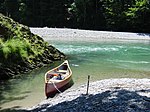
Breakthrough valley of the Tiroler Achen |
|
NSG-00150.01 WDPA: 81566 |
District of Traunstein | ⊙ | 67.8 | 1997 | ||||
| Terminal moraine pond south of Asten | NSG-00302.01 WDPA: 162949 |
District of Traunstein | ⊙ | 6.43 | 1979
|
|||||
|
Kendlmühlfilzen |

|
NSG-00397.01 WDPA: 164053 |
District of Traunstein | ⊙ | 744.49 | 1992 | ||||
| Mettenhamer felt | NSG-00046.01 WDPA: 82162 |
District of Traunstein | ⊙ | 44.96 | 1944 | |||||
|
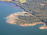
Estuary of the Tiroler Achen |
|
NSG-00304.01 WDPA: 30119 |
District of Traunstein | ⊙ | 1,264.48 | 1987 | ||||
|
Eastern Chiemgau Alps |

|
NSG-00069.01 WDPA: 4415 |
District of Berchtesgadener Land , District of Traunstein | LK Berchtesgadener Land 1,903.90 ha, LK Traunstein 7,853.76 ha | ⊙ | 9,757.66 | 1955 | |||
|
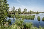
Schönramer Moor |
|
NSG-00055.01 WDPA: 82551 |
District of Traunstein | ⊙ | 51.58 | 1950 | ||||
|
Seeon lakes |

|
NSG-00229.01 WDPA: 165542 |
District of Traunstein | ⊙ | 139.95 | 1985 | ||||
| Sossauer Filz and Wildmoos | NSG-00303.01 WDPA: 82606 |
District of Traunstein | ⊙ | 245.51 | 1987 | |||||
| Süssener and Lanzinger Moos | NSG-00070.01 WDPA: 82678 |
District of Traunstein | ⊙ | 36.45 | 1955
|
|||||
|
Ammertal in the area of the Ammerleite and Talbach slopes |

|
NSG-00078.01 WDPA: 81303 |
Weilheim-Schongau district | ⊙ | 251.09 | 1953 | ||||
|
Bernried felt |

|
NSG-00073.01 WDPA: 81386 |
Weilheim-Schongau district | ⊙ | 42.88 | 1978 | ||||
|
Bichlbauernfilz with Schwaigsee |

|
NSG-00185.01 WDPA: 81397 |
Weilheim-Schongau district | ⊙ | 44.3 | 1997 | ||||
|
Eibenwald near Paterzell |

|
NSG-00200.01 WDPA: 81580 |
Weilheim-Schongau district | ⊙ | 87.05 | 1987 | ||||
|
Fichtsee in Sindelsbachfilz |

|
NSG-00026.01 WDPA: 81661 |
Weilheim-Schongau district | ⊙ | 129.74 | 1994 | ||||
|
Flachtenbergmoor |

|
NSG-00053.01 WDPA: 81674 |
Weilheim-Schongau district | ⊙ | 8.29 | 1994 | ||||
| Barley felt | NSG-00061.01 WDPA: 81725 |
Weilheim-Schongau district | ⊙ | 10.9 | 1952 | |||||
|
Lech section Hirschauer Steilhalde - Litzauer Loop |

|
NSG-00284.01 WDPA: 164408 |
Weilheim-Schongau district | ⊙ | 188.53 | 1986 | ||||
|
Magnetsrieder Hardt |

|
NSG-00147.01 WDPA: 82135 |
Weilheim-Schongau district | ⊙ | 90.26 | 1982 | ||||
|
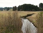
Moors around the Wies |
|
NSG-00361.01 WDPA: 164671 |
Weilheim-Schongau district | ⊙ | 375.4 | 1989 | ||||
|
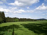
Oberoblander felt |
|
NSG-00032.01 WDPA: 82271 |
Weilheim-Schongau district | ⊙ | 50.96 | 1940 | ||||
|
Easter lakes |

|
NSG-00143.01 WDPA: 30120 |
Weilheim-Schongau district | ⊙ | 1,092.98 | 1981 | ||||
|
Pähler gorge |

|
NSG-00191.01 WDPA: 82300 |
Weilheim-Schongau district | ⊙ | 16.55 | 1983 | ||||
|
Rohrmoos |

|
NSG-00067.01 WDPA: 165211 |
Weilheim-Schongau district | ⊙ | 63.73 | 1953 | ||||
|
Plaice moss |

|
NSG-00054.01 WDPA: 165455 |
Weilheim-Schongau district | ⊙ | 18.78 | 1950 | ||||
|
Schwaigwaldmoos |

|
NSG-00068.01 WDPA: 82560 |
Weilheim-Schongau district | ⊙ | 50.25 | 1953 | ||||
|
Black spawning moor |

|
NSG-00057.01 WDPA: 82570 |
Weilheim-Schongau district | ⊙ | 127.44 | 1951
|
||||
|
Wild sea felt |

|
NSG-00029.01 WDPA: 82920 |
Weilheim-Schongau district | ⊙ | 49.25 | 1940
|
||||
| Legend for nature reserve | ||||||||||
See also
- List of landscape protection areas in Upper Bavaria
- List of FFH areas in Upper Bavaria
- List of EU bird protection areas in Upper Bavaria
- List of geotopes in Upper Bavaria
Individual evidence
- ↑ Green list of nature reserves in Upper Bavaria. (PDF; 131 kB) Bavarian State Office for the Environment, December 31, 2014, accessed on May 23, 2016 .
- ↑ 8433-301 Karwendel with Isar (FFH and EU bird sanctuary). Published by the Federal Agency for Nature Conservation . Retrieved November 28, 2017.
- ↑ 8532-371 Wetterstein Mountains. (FFH area) Profiles of the Natura 2000 areas. Published by the Federal Agency for Nature Conservation . Retrieved November 28, 2017.