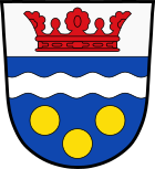
Langenbach (Upper Bavaria)
| coat of arms | Germany map | |
|---|---|---|

|
Coordinates: 48 ° 26 ' N , 11 ° 51' E |
|
| Basic data | ||
| State : | Bavaria | |
| Administrative region : | Upper Bavaria | |
| County : | Freising | |
| Height : | 429 m above sea level NHN | |
| Area : | 26.89 km 2 | |
| Residents: | 4040 (Dec. 31, 2019) | |
| Population density : | 150 inhabitants per km 2 | |
| Postal code : | 85416 | |
| Area code : | 08761 | |
| License plate : | FS | |
| Community key : | 09 1 78 138 | |
| Community structure: | 12 parts of the community | |
| Address of the municipal administration: |
Bahnhofstrasse 6 85416 Langenbach |
|
| Website : | ||
| Mayoress : | Susanne Hoyer ( FW / CSU ) | |
| Location of the municipality of Langenbach in the Freising district | ||
Langenbach is a municipality in the Upper Bavarian district of Freising .
geography
location
Langenbach is located on State Road 2350 between Freising and Moosburg .
Parish parts
The municipality has twelve officially named municipal parts (the type of settlement is given in brackets ):
|
|
history
Until the church is planted
The village of Langenbach was first mentioned in a document in 818. Langenbach belonged to the Rentamt München and the district court of Kranzberg . Until the secularization of Bavaria in 1803, the Freising Monastery and the Freising Cathedral Chapter were the most important landlords in the municipality. Langenbach became an independent political municipality in the course of the administrative reforms in Bavaria in 1818.
The place got its own train station which was opened on November 3, 1858 with the Munich - Regensburg railway line for public passenger and tourist traffic and on November 15, 1858 for goods traffic.
Incorporations
On January 1, 1972, parts of the previous municipality of Rudlfing were incorporated. On May 1, 1978 the municipality of Oberhummel was added.
Population development
Between 1988 and 2018 the community grew from 2,743 to 3,991 by 1,248 inhabitants or 45.5%.
nature and landscape
The southeast boundary of the municipality - at Oberhummel and Niederhummel - forms the Isar with the Isar floodplains.
Nature reserves
- Weissberg near Hangenham (geotope number 178A006)
- The Isarauen nature reserve between Hangenham and Moosburg is 631.9 hectares and is registered under NSG-00246.01
Attractions
- Old parish church Nikolaus von Myra in Langenbach (from 1736)
- New parish church Nikolaus von Flüe in Langenbach
- Maria Rast Church (Gothic church around the middle of the 15th century)
- Rathausplatz (also called "Red Square" by the residents)
- Filial church Pauli Conversion in Kleinviecht (late Romanesque around 1200, with a noticeably wide tower)
- Church of St. Andreas in Niederhummel (14th century)
- Church of St. Georg and St. Dionysius in Oberhummel
Economy and Infrastructure
traffic
The place is on the state road 2350 (former federal road 11 ). The A 92 Deggendorf - Munich runs south of the municipality . The closest exit in Erding is in Gaden, about seven kilometers by road from the town.
Langenbacher Bahnhof , located on the Munich – Landshut railway line , is served by the Freising – Landshut regional railways about once an hour during the day and about every two hours at the weekend and in the evening. In Freising there is a connection to the regional express and S-Bahn to Munich. Some of the regional trains are also connected to Munich Central Station.
In 2009 the station was equipped with new 210 m long and 76 cm high platforms, so that barrier-free access to the trains is now possible.
The rail traffic in Langenbach is integrated into the MVV .
The route of the Hallertau local railway to Enzelhausen branches off at Langenbach station . Until 1973 this route was served by passenger trains. Today there is only a 3 km long section from Langenbach to the Zolling power plant . This route is used to supply the power plant with coal by freight trains that run twice a day.
There is no public bus transport.
Public facilities
- Sports home
- Langenbach youth club
education
- primary school
Web links
- http://www.gemeinde-langenbach.de/
- Entry on the coat of arms of Langenbach (Upper Bavaria) in the database of the House of Bavarian History
Individual evidence
- ↑ "Data 2" sheet, Statistical Report A1200C 202041 Population of the municipalities, districts and administrative districts 1st quarter 2020 (population based on the 2011 census) ( help ).
-
↑ "She is a stroke of luck"
https://www.merkur.de/lokales/kommunalwahl/freising/kommunalwahl-2014-freising-liveticker-landrat-buergermeister-3413879.html - ^ Community Langenbach in the local database of the Bavarian State Library Online . Bavarian State Library, accessed on September 11, 2019.
- ^ Augsburger Tageblatt, October 19, 1858; Article mixed news "Munich, October 17th"
- ^ Wilhelm Volkert (ed.): Handbook of Bavarian offices, communities and courts 1799–1980 . CH Beck, Munich 1983, ISBN 3-406-09669-7 , p. 464 .
- ^ Federal Statistical Office (ed.): Historical municipality directory for the Federal Republic of Germany. Name, border and key number changes in municipalities, counties and administrative districts from May 27, 1970 to December 31, 1982 . W. Kohlhammer, Stuttgart / Mainz 1983, ISBN 3-17-003263-1 , p. 575 .


