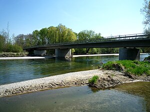
Isarauen nature reserve between Hangenham and Moosburg
|
Isarauen nature reserve between Hangenham and Moosburg
|
||
|
The Moosach flows into the Isar at Oberhummel |
||
| location | Between Hangenham and Moosburg on the Isar in the Freising district | |
| surface | 6.281 km² | |
| Identifier | NSG-00246.01 | |
| WDPA ID | 163928 | |
| Geographical location | 48 ° 26 ' N , 11 ° 54' E | |
|
|
||
| Setup date | 1985 | |
| administration | District of Freising (a very small part of the district of Erding ) | |
The Isarauen nature reserve between Hangenham and Moosburg is located almost exclusively in the Freising district (a very small part in the Erding district ), mainly in the area of the municipality of Langenbach and the town of Moosburg an der Isar . It has a size of 628.09 hectares and is registered under NSG-00246.01. The area is also a protected landscape area and part of the European Natura 2000 protected area .
geography
In the area of this nature reserve the Moosach flows into the Isar near Oberhummel , and the Goldach , the Dorfen and the Sempt flood canal also flow into the Isar here. The meadow landscape has a steep bank at Hangenham and is characterized by numerous streams.
environment
The protected area offers a habitat for a multitude of endangered plant and animal species, such as the beaver , which has become home here again.
In the first decades of the 20th century, the Isar was straightened in the "Middle Isar" area, between the Oberföhringer weir (on the Munich city limits) and beyond Moosburg, and forced into a uniform bed. Since the construction of the Middle Isar Canal in 1924/28, the amount of water in the river itself has been drastically reduced to a small amount of residual water. As a result, the river bed dug deeper and deeper; since 2001 the amount of water has increased again to 11–21 cubic meters per second.
Despite these massive interventions, a largely closed alluvial forest has been preserved between Munich and Landshut. There are measures for preventive flood protection (such as additional retention areas ) and for water development in order to preserve or restore the riparian forests and habitats. In the Rosenau (near Moosburg) the dike has already been moved back; further measures are being planned.
See also
Individual evidence
- ↑ http://www.lfu.bayern.de/natur/schutzgebiete/schutzgebietslisten/doc/nsg_oberbayern.pdf
- ↑ http://www.wwa-m.bayern.de/projekte_und_programme/laufende_projekte/mittlere_isar/index.htm ( page no longer available , search in web archives ) Info: The link was automatically marked as defective. Please check the link according to the instructions and then remove this notice.
- ↑ Archived copy ( memento of the original dated February 24, 2013 in the Internet Archive ) Info: The archive link was inserted automatically and has not yet been checked. Please check the original and archive link according to the instructions and then remove this notice. Isar floodplain forest


