
Walls
| coat of arms | Germany map | |
|---|---|---|

|
Coordinates: 48 ° 31 ' N , 11 ° 54' E |
|
| Basic data | ||
| State : | Bavaria | |
| Administrative region : | Upper Bavaria | |
| County : | Freising | |
| Management Community : | Walls | |
| Height : | 435 m above sea level NHN | |
| Area : | 24.14 km 2 | |
| Residents: | 3124 (Dec. 31, 2019) | |
| Population density : | 129 inhabitants per km 2 | |
| Postal code : | 85419 | |
| Area code : | 08764 | |
| License plate : | FS | |
| Community key : | 09 1 78 142 | |
| LOCODE : | DE MFN | |
| Community structure: | 32 parts of the community | |
| Address of the municipal administration: |
Schlossplatz 2 85419 walls |
|
| Website : | ||
| Mayor : | Georg Krojer (Free Voters) | |
| Location of the municipality of Mauern in the Freising district | ||
  |
||

Mauern is a municipality in the Upper Bavarian district of Freising . It lies between Moosburg and Nandlstadt and is the seat of the administrative association of the same name .
geography
Wauern lies in the northeast of the Freising district in Upper Bavaria and is also known as the “gateway to Hallertau”.
The municipality has 32 officially named municipal parts (the type of settlement is given in brackets ):
- Alpersdorf ( hamlet ) 48 ° 30 ′ 39 ″ N, 11 ° 54 ′ 10 ″ E
- Bergmühle ( wasteland ) 48 ° 31 ′ 12 ″ N, 11 ° 52 ′ 50 ″ E
- Beselmühle ( Wilderness ) 48 ° 30 ′ 31 ″ N, 11 ° 54 ′ 3 ″ E
- Besenried (wasteland) 48 ° 33 ′ 26 ″ N, 11 ° 54 ′ 19 ″ E
- Dürnseiboldsdorf (hamlet with church) 48 ° 31 ′ 16 ″ N, 11 ° 55 ′ 32 ″ E
- Enghausen ( Kirchdorf ) 48 ° 32 ′ 19 ″ N, 11 ° 54 ′ 22 ″ E
- Freundsbach (hamlet) 48 ° 30 ′ 36 ″ N, 11 ° 55 ′ 49 ″ E
- Gandorf (wasteland) 48 ° 30 ′ 22 ″ N, 11 ° 53 ′ 30 ″ E
- Geiting (remote area) 48 ° 32 '39 "N, 11 ° 54' 23" O
- Grub (remote area) 48 ° 33 '39 "N, 11 ° 53' 55" O
- Hanslmühle (wasteland) 48 ° 30 ′ 13 ″ N, 11 ° 55 ′ 0 ″ E
- Hartshausen ( Wilderness ) 48 ° 31 ′ 43 "N, 11 ° 54 ′ 2" E
- Hintermeier (desert) 48 ° 33 ′ 20 ″ N, 11 ° 53 ′ 6 ″ E
- Hörgersdorf (village) 48 ° 29 ′ 54 ″ N, 11 ° 54 ′ 11 ″ E
- Hufnagelreuth (desert) 48 ° 33 ′ 41 ″ N, 11 ° 54 ′ 19 ″ E
- Kleidorf (Weiler) 48 ° 31 ′ 3 ″ N, 11 ° 52 ′ 21 ″ E
- Kronwinkl (wasteland) 48 ° 30 ′ 11 ″ N, 11 ° 53 ′ 51 ″ E
- Walls ( parish village )
- Mönchsberg (wasteland) 48 ° 31 ′ 30 ″ N, 11 ° 51 ′ 29 ″ E
- Niederndorf (hamlet) 48 ° 30 ′ 26 ″ N, 11 ° 54 ′ 47 ″ E
- Nussberg (wasteland) 48 ° 33 ′ 18 ″ N, 11 ° 53 ′ 47 ″ E
- Oberndorf (desert) 48 ° 32 ′ 51 ″ N, 11 ° 53 ′ 58 ″ E
- Riedlmühle (Einöde) 48 ° 30 ′ 18 ″ N, 11 ° 54 ′ 37 ″ E
- Scheckenhofen (hamlet with church) 48 ° 30 ′ 18 ″ N, 11 ° 54 ′ 37 ″ E
- Schwarzberg (Wilderness) 48 ° 30 ′ 10 ″ N, 11 ° 53 ′ 15 ″ E
- Schwarzersdorf (Kirchdorf) 48 ° 31 ′ 45 ″ N, 11 ° 55 ′ 1 ″ E
- Thal (hamlet) 48 ° 31 ′ 1 ″ N, 11 ° 52 ′ 48 ″ E
- Vordermeier (wasteland) 48 ° 33 ′ 14 ″ N, 11 ° 53 ′ 11 ″ E
- Waldruh (settlement) 48 ° 30 ′ 38 ″ N, 11 ° 53 ′ 36 ″ E
- Wildenreuth (wasteland) 48 ° 33 ′ 59 ″ N, 11 ° 54 ′ 31 ″ E
- Wölflmühle ( Wilderness ) 48 ° 31 ′ 18 ″ N, 11 ° 52 ′ 8 ″ E
- Wollersdorf (village) 48 ° 31 ′ 16 ″ N, 11 ° 52 ′ 51 ″ E
![]() Map with all coordinates: OSM | WikiMap
Map with all coordinates: OSM | WikiMap
history
Until the church is planted
Archaeological excavations by the Archaeological Association in the Freising district revealed that walls were already settled around 7,500 years ago and have been inhabited almost continuously since then. The remains of a Roman Villa Rustica were found in Niederndorf and the grave of a Bavarian warrior from the end of the seventh century with a so-called Spatha near Alpersdorf. During construction work in the castle in 2009, post marks of a previous building were discovered, which dates from around 1000 AD.
The town of Mauern was first mentioned in a document in 899 and was the seat of a Hofmark , which over the years was owned by numerous noble families and was subordinate to the Moosburg district court and the Landshut rent office . From 1544 to 1585 the Kuttenau people exercised the court march justice. Their successors were Preysing from 1585 to 1641 . In 1692 the Hofmark was acquired by Johann Georg, Count von Seiboldsdorf , and auctioned off less than a hundred years later due to the mismanagement of his descendants. This was followed by the families of the Counts Basselet von La Rosée and von Ostini.
The office of walls was an important administrative seat of the district court Moosburg until the beginning of the 19th century . It was responsible for the chairpersons Volkmannsdorferau, Schwarzersdorf, Reichertshausen, Pörnbach, Amper, Sollern-Inkofen, Neumühl, Alpersdorf, Inzkofen, Holzdobl, Altfalterbach, Reichersdorf, Gammelsdorf, Schergenöd, Enghausen, Kleinmünchen, Martinszell, Bachhorn and Niederambach.
19th to 21st century
Wauern became a patrimonial community in the course of the administrative reforms in Bavaria in 1818. The second class patrimonial courts of Hagsdorf , Hörgertshausen , Mauern, Tegernbach and Thulbach , formed in 1818, were merged in 1841 under the von Hofstetten family to form a joint second class patrimonial court under the name of the “Mauern Patrimonial Court”. In 1848 the last remnants of the aristocracy were abolished. In 1871 the first war memorial in Bavaria was erected within walls. Today's "old" town hall was built in 1980 for the administrative community in walls. The last owner of the castle in walls, Count von Moy , sold the castle to the municipality of Mauern in 2001, which has been using the subsequently renovated building since 2009 as the town hall for the administrative community.
Incorporations
On January 1, 1971, part of the dissolved community of Reichersdorf was incorporated. On April 1, 1971, parts of the Schweinersdorf area were added. Finally, on May 1, 1978, parts of the dissolved communities Enghausen and Margarethenried were added. The administrative community of walls was also founded on May 1st, 1978.
Population development
Between 1988 and 2018 the municipality grew from 1,987 to 3,077 by 1,090 inhabitants or 54.9%.
politics
Mayor and City Council
After the local elections in Bavaria in 2020, the local council consists of 16 councilors (8 free voters , 8 CSU ) and the 1st mayor Georg Krojer (FW), who succeeded the long-term mayor Alfons Kipfelsberger (CSU) in 2014.
coat of arms
Description of the coat of arms: "In red a silver double pinnacle, above a floating, lying golden diamond."
The community coat of arms combines the family coat of arms of two families who owned the Hofmark walls for a long time , and thus represents the history of the community as Adelshofmark. The floating diamond comes from the coat of arms of the Kuttenau family , who ruled the court from 1544 to 1585. Their successors from 1585 to 1641 were the Preysing , whose heraldic mark was a silver double pinnacle in a red field.
The coat of arms has existed since 1979 on the basis of a resolution by the municipal council and the approval of the government of Upper Bavaria .
traffic
There is a public transport connection with the MVV bus lines 501, 682 and 683 to Moosburg (train connection to Freising and Munich or Landshut) and to Mainburg .
Attractions
- Catholic Parish Church of St. John the Baptist
- Hofmark castle walls , now town hall
- Enghausen church with an Enghauser crucifix , which was created between 890 and 900. It is believed that the crucifix came from the former Benedictine monastery in nearby Moosburg , which was in great bloom in the 9th century.
- Ski lift at Hanslmühle: Germany's first Doppelmayr drag lift went into operation here in 1965.
societies
With the volunteer fire brigade Mauern, the Altschützengesellschaft Mauern, the Narrhalla Mauern, the SpVgg Mauern, the KLJB Mauern, the Gartenbauverein Mauern, the TC Mauern, the Skiclub Mauern and the KSK Mauern there are nine associations that contribute to the village community.
Personalities
- Johann Kaspar Basselet von La Rosée (1710–1795), general in the Bavarian Army
- Michael Hartig (1878–1960), art historian and Catholic theologian
- Aloys Basselet von La Rosée , civil servant, judge, freemason
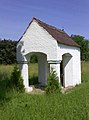
Chapel in Alpersdorf

Catholic parish church

Rectory

Marian column (1st war memorial in Bavaria)

Castle within walls


literature
- Franz Hagl: village history of walls. A home booklet. 2 volumes. Walls March 1978 / May 1980, BV013691100 .
Web links
- Entry on the coat of arms of walls in the database of the House of Bavarian History
Individual evidence
- ↑ "Data 2" sheet, Statistical Report A1200C 202041 Population of the municipalities, districts and administrative districts 1st quarter 2020 (population based on the 2011 census) ( help ).
- ^ Municipality of Mauern in the local database of the Bavarian State Library Online . Bavarian State Library, accessed on September 11, 2019.
- ^ Wörner: Heimatbuch Hörgertshausen, 1982, p. 32ff
- ↑ Historical Atlas of Bavaria - Old Bavaria Series I, Issue 1: The Moosburg district court. P. 9 ff.
- ^ Intelligence Gazette of the Royal Government of Upper Bavaria , 1841, p. 436.
- ^ Wilhelm Volkert (ed.): Handbook of Bavarian offices, communities and courts 1799–1980 . CH Beck, Munich 1983, ISBN 3-406-09669-7 , p. 464 .
- ^ Federal Statistical Office (ed.): Historical municipality directory for the Federal Republic of Germany. Name, border and key number changes in municipalities, counties and administrative districts from May 27, 1970 to December 31, 1982 . W. Kohlhammer, Stuttgart / Mainz 1983, ISBN 3-17-003263-1 , p. 575 .
- ↑ MVV timetable information , accessed on November 27, 2015
- ↑ Georg Brenninger: On the earlier Baroque interior of the parish church in walls . In: Amperland , 1986, p. 366.

Allershausen | Attenkirchen | Au in the Hallertau | Eching | Fahrenzhausen | Freising | Gammelsdorf | Hague an der Amper | Hallbergmoos | Hohenkammer | Hörgertshausen | Kirchdorf an der Amper | Kranzberg | Langenbach | Marzling | Walls | Moosburg on the Isar | Nandlstadt | Neufahrn near Freising | Paunzhausen | Rudelzhausen | Wang | Wolfersdorf | Zolling
Alpersdorf | Mountain mill | Besenried | Beselmühle | Dürnseiboldsdorf | Enghausen | Freundsbach | Gandorf | Geiting | Grub | Hanslmühle | Hartshausen | Hintermeier | Hörgersdorf | Hufnagelreuth | Kleidorf | Kronwinkl | Walls | Mönchsberg | Niederndorf | Nussberg | Oberndorf | Riedlmühle | Scheckenhofen | Schwarzberg | Schwarzersdorf | Thal | Vordermeier | Forest rest | Wildenreuth | Wölflmühle | Wollersdorf