List of nature reserves in Swabia (Bavaria)
The list of nature reserves in Swabia (Bavaria) includes the following lists of nature reserves in Swabian counties and cities from the article namespace:
- List of nature reserves in the Aichach-Friedberg district
- List of nature reserves in the Augsburg district
- List of nature reserves in the city of Augsburg
- List of nature reserves in the district of Dillingen an der Donau
- List of nature reserves in the Donau-Ries district
- List of nature reserves in the district of Günzburg
- List of nature reserves in the Lindau district (Lake Constance)
- List of nature reserves in the city of Memmingen
- List of nature reserves in the Neu-Ulm district
- List of nature reserves in the Oberallgäu district
- List of nature reserves in the Ostallgäu district
- List of nature reserves in the Unterallgäu district
The selection corresponds to the administrative region of Swabia (Bavaria) . There are 59 nature reserves in the administrative district (as of November 2015). The largest nature reserve in the district is the Ammer Mountains.
| Surname | image | Identifier
|
circle | details | position | Area hectares |
date
|
|||
|---|---|---|---|---|---|---|---|---|---|---|
|
Kissinger Heath |

|
NSG-00083.01 WDPA: 82069 |
Aichach-Friedberg district |
Kissing Heide on post-glacial alluvial gravel on the eastern side of the Lech. |
⊙ | 42.63 | 1964 | |||
|
Lechauwald near Unterbergen |

|
NSG-00377.01 WDPA: 164410 |
District of Landsberg am Lech , Aichach-Friedberg |
Merching alluvial forest area with dominating gray alder forests, pine forest relics and poor grassland ("burning"), correspondingly rich flora and fauna. Part of the "Lechtal Biotope Bridge". LK Landsberg am Lech 153.35 ha, LK Aichach-Friedberg 215.57 ha |
⊙ | 368.92 | 1990 | |||
|
Lechaue west of Todtenweis |

|
NSG-00422.01 WDPA: 318721 |
Aichach-Friedberg district |
Todtenweis alluvial forest complex within the LSG "Lechauen bei Rehling and Todtenweis". |
⊙ | 140.64 | 1992
|
|||
|
Burghofweiher near Langerringen |

|
NSG-00701.01 WDPA: 344579 |
District of Augsburg |
Langerringen Open, elongated chain of smaller to larger ponds in the course of the Röthenbach west of the Burghof. |
⊙ | 21.25 | 2005 | |||
|
Lechauen near Thierhaupten |

|
NSG-00348.01 WDPA: 82080 |
District of Augsburg |
Thierhaupten "Altwasser des Lech ( Ellgau reservoir ), which was expanded in the course of the river expansion in the 1960s, with alluvial forest environment." |
⊙ | 105.36 | 1989
|
|||
|
Firnhaberauheide |

|
NSG-00470.01 WDPA: 163103 |
augsburg |
Augsburg " Remnants of gravel heath of the formerly extensive Lechheidegebietslandschaft in Lower Lechgriess ." |
⊙ | 14.65 | 1984 | |||
|
City forest Augsburg |

|
NSG-00469.01 WDPA: 30121 |
Augsburg , Aichach-Friedberg district |
Augsburg , Merching Largest contiguous alluvial forest on the Lech with a high biotope density. |
⊙ | 2,160.48 |
1994
|
|||
|
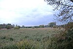
Apfelwörth |
|
NSG-00518.01 WDPA: 162232 |
District of Dillingen on the Danube |
Höchstädt Largest and best-preserved oxbow lake system in Swabia with extensive aquatic and amphibious habitats. |
⊙ | 187.82 | 1983 | |||
| Dattenhauser Ried |
NSG-00255.01 WDPA: 162711 |
District of Dillingen on the Danube |
Bachhagel One of the few Jura moors and the largest wetland in the entire Swabian Alb. |
⊙ | 209.27 | 1985 | ||||
|
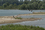
Gundelfinger moss |
|
NSG-00174.01 WDPA: 81785 |
District of Dillingen on the Danube |
Gundelfingen Remnants of a river valley bog in the Donauried , created by swamping and simultaneous spring water inflows from the Swabian Alb. |
⊙ | 225.45 | 1983 | |||
|
Neugeschüttwörth natural forest reserve |

|
NSG-00113.01 WDPA: 82218 |
District of Dillingen on the Danube |
Schwenningen alluvial forest complex of the Danube with oxbow lakes and “Brenne” opposite Gremheim. Relic space for aquatic and marsh plants and the occurrence of meadow birds. |
⊙ | 43.85 | 1978
|
|||
|
Old Danube water near Leitheim |

|
NSG-00471.01 WDPA: 162777 |
Donau-Ries district |
Kaisheim Groundwater-fed oxbow lake of the Danube under the steep slope of the Danube side near Schloss Leitheim with rich silting and water vegetation. |
⊙ | 57.96 | 1992 | |||
|
Donaualtwasser Schnödhof |

|
NSG-00468.01 WDPA: 162778 |
District of Neuburg-Schrobenhausen , District of Donau-Ries |
Marxheim Large oxbow lake / bank complex on the Danube with wide silting zones, remains of alluvial forest and poor meadow meadows. LK Neuburg-Schrobenhausen 58.62 ha, LK Donau-Ries 23.84 ha |
⊙ | 82.46 | 1994 | |||
|
Mertinger hell |

|
NSG-00208.01 WDPA: 164612 |
Donau-Ries district |
Mertingen Extensive remnants of the Donauried that used to reach here. |
⊙ | 143.28 | 1984 | |||
|
Ofnet caves near Holheim |

|
NSG-00207.01 WDPA: 82277 |
Donau-Ries district |
Holheim Dwelling cave of early humans in the Malmkalkfels. |
⊙ | 7.61 | 1984 | |||
|
Creek |

|
NSG-00283.01 WDPA: 165037 |
Donau-Ries district |
Harburg Largest Jura karst spring in Swabia in the Wörnitzschleife near Ebermergen with surrounding wet meadows along with reeds and bushes. |
⊙ | 5.73 | 1986 | |||
|
Feldheim reservoir bird sanctuary |

|
NSG-00159.01 WDPA: 82791 |
Donau-Ries district |
Niederönenfeld reservoir of the Lech just above its confluence with the Danube. |
⊙ | 99.68 | 1982
|
|||
|
Beaver hook |

|
NSG-00519.01 WDPA: 162403 |
District of Günzburg , District of Neu-Ulm |
Bibertal Complex of several - now abandoned - different large fish ponds based on an earlier oxbow lake of the Danube. LK Günzburg 6.28 ha, LK Neu-Ulm 24.06 ha |
⊙ | 30.34 | 1956 | |||
| Danube slopes and meadows between Leipheim and Offingen |
NSG-00686.01 WDPA: 378063 |
District of Günzburg |
Leipheim Large complex of semi-natural hillside forests and hardwood alluvial forests in the Danube Valley, divided into two sub-areas. |
⊙ | 58.29 | 2006 | ||||
| Jungholz near Leipheim |
NSG-00135.01 WDPA: 82020 |
District of Günzburg |
Leipheim alluvial forest and the strikingly shaped Danube Leiten slope west of the motorway bridge near Leipheim. |
⊙ | 32.05 | 1980 | ||||
|
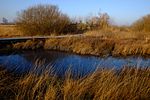
Leipheim moss |
|
NSG-00425.01 WDPA: 164424 |
District of Günzburg |
Leipheim Lime-rich fen on site degraded after drainage, relic of a formerly larger bog in the Danube lowland. |
⊙ | 183.18 | 1992 | |||
|
Mindelried paradise |

|
NSG-00091.01 WDPA: 164626 |
District of Günzburg |
Balzhausen Drained and therefore shrubby moor on the Flossach. |
⊙ | 31.79 | 1970 | |||
|
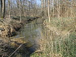
Nauwald |
|
NSG-00164.01 WDPA: 82219 |
District of Günzburg |
Günzburg Near-natural hardwood floodplain forest remnants. |
⊙ | 167.92 | 1982 | |||
| Taubried |
NSG-00623.01 WDPA: 165838 |
District of Günzburg |
Ellzee moorland in the Günztal, reaching from the wooded Günzleite to the Günzlauf, which emerged from the swamping of a hollow in the valley floor. |
⊙ | 56.66 | 2003 | ||||
| Topflet and Obere Aschau | NSG-00749.01 | District of Günzburg , District of Dillingen on the Danube |
Günzburg , Gundelfingen on the Danube The section of the Danube includes near-natural alluvial forest, lime grasslands, a branched network of water bodies and the terrain relief typical of the floodplain. LK Dillingen 22.55 ha, LK Günzburg 105.30 ha |
⊙ | 127.85 | 2013 | ||||
|
Oberegger reservoir bird sanctuary |

|
NSG-00341.01 WDPA: 166074 |
District of Günzburg |
Wiesenbach The shallow lake of the Günz dammed up in 1942 south of the Oberegg district, with silted vegetation in the inlet area and especially on the west bank. |
⊙ | 38.85 | 1989
|
|||
| Bichlweiher and Bichlweihermoos |
NSG-00103.01 WDPA: 81396 |
District of Lindau (Lake Constance) |
Bodolz A shallow pond in an extensively used meadow environment, developed through centuries-old brook damming. |
⊙ | 12.71 | 1983 | ||||
| Degermoos |
NSG-00423.01 WDPA: 162714 |
District of Lindau (Lake Constance) |
Hergatz Large, pre-drained bog complex, mostly less intensive land use with wide transition areas to the mineral soil. |
⊙ | 71.72 | 1985 | ||||
|
Eistobel |

|
NSG-00093.01 WDPA: 81596 |
District of Lindau (Lake Constance) |
Grünenbach Unobstructed gorge route of the Upper Argen in molasse rocks of the Westallgäu mountainous region with waterfalls, rapids, whirlpool holes, rock falls and geological-morphologically interesting formations. |
⊙ | 70.15 | 1985 | |||
| Middle sea moss |
NSG-00110.01 WDPA: 82168 |
District of Lindau (Lake Constance) |
Wasserburg (Bodensee) Mulden Flachmoor northeast of Wasserburg between drumlins of the ground moraine over a post-glacial silted lake (Mittelsee). |
⊙ | 6.68 | 1978 | ||||
|
Reutin Bay |

|
NSG-00676.01 WDPA: 344831 |
District of Lindau (Lake Constance) |
Lindau With complete zoning typical for Lake Constance, a near-natural section of the Bavarian shores of Lake Constance has been preserved here. |
⊙ | 27.04 | 2005 | |||
|
Rohrach Gorge |

|
NSG-00424.01 WDPA: 165206 |
District of Lindau (Lake Constance) |
Scheidegg The ravine dug deep into the Molasse of the Rohrach (Rickenbach) draining to Lake Constance with cracks, sliding slopes and a multitude of source outlets. |
⊙ | 170.09 | 1992 | |||
| Sparrow angle |
NSG-00624.01 WDPA: 319120 |
District of Lindau (Lake Constance) |
Lindau The Spatzenwinkel near the hamlet of Goldschmidsmühle is a low moor complex that has arisen on waterlogged ground. |
⊙ | 25.76 | 2003 | ||||
| Stockenweiler pond |
NSG-00206.01 WDPA: 165748 |
District of Lindau (Lake Constance) |
Hergensweiler Pond in the retreat basin of the cold-age Rhine glacier with reed beds and litter meadow surroundings. Rich water and bank vegetation, special bird occurrences as well as amphibians, butterflies and dragonfly species. |
⊙ | 34.22 | 1984 | ||||
| Trogen moors |
NSG-00560.01 WDPA: 319228 |
District of Lindau (Lake Constance) |
Weiler-Simmerberg Only accessible in the marginal forests, the predominant part of the moorland is inaccessible. |
⊙ | 45.76 | 1999 | ||||
|
Wasserburg Bay |

|
NSG-00237.01 WDPA: 82868 |
District of Lindau (Lake Constance) |
Wasserburg (Bodensee) Shallow Bodensee bay with complete silting zone. |
⊙ | 5.77 | 1985
|
|||
| Upper and Lower Au |
NSG-00552.01 WDPA: 318874 |
District of Neu-Ulm |
Send on the left bank of the Iller to the west of Send on the state border with Baden-Württemberg. |
⊙ | 63.81 | 1998 | ||||
| Wasenlöcher near Illerberg |
NSG-00490.01 WDPA: 166181 |
District of Neu-Ulm |
Send the remainder of one of the few moors in the Lower Illertal, with a connection to the eastern Illerleite, with a belt of hillside forest crossed by springs. |
⊙ | 68.81 | 1995 | ||||
| Wochenau and Illerzeller Auwald |
NSG-00473.01 WDPA: 166345 |
District of Neu-Ulm |
Send Near-natural alluvial forest complex on both sides of the lower Iller, which is occasionally flooded on the western Iller side. |
⊙ | 185.35 | 1994
|
||||
|
Allgäu high alps |

|
NSG-00400.01 WDPA: 64661 |
District of Oberallgäu |
Sonthofen Hochmontaner to high alpine Swabian part of the Northern Limestone Alps. |
⊙ | 20,796.64 | 1992 | |||
|
Breitenmoos |

|
NSG-00489.01 WDPA: 162551 |
District of Oberallgäu |
Buchenberg Bog main occurrence of the ground moraine in a montane location above the molasse base. Mire stock types in typical and mostly complete zoning. |
⊙ | 85.77 | 1980 | |||
| Raised moors in the Kemptener Wald: State forest departments Teufelsküche, Sommerhof, Unterlangmoos, Oberlangmoos of the Kemptener Wald forestry district in Ausmark |
NSG-00071.01 WDPA: 163712 |
District of Oberallgäu |
Kempter Wald Mountain pine forest moors of the Kempter Forest, which have formed in hollows of the ground moraine landscape. |
⊙ | 303.10 | 1955 | ||||
|
High Ifen |

|
NSG-00081.01 WDPA: 4412 |
District of Oberallgäu |
Balderschwang mountain range in the area of the Helvetic Chalk made of hard Schrattenkalk with peculiar weathering forms. |
⊙ | 2,450.66 | 1964 | |||
|
Hölzler's Tobel |

|
NSG-00085.01 WDPA: 81927 |
District of Oberallgäu |
Buchenberg steep slope mixed forest complex on the upper Rottach. |
⊙ | 6.28 | 1966 | |||
|
Rohrbachtobel in the Wierlinger Forest |

|
NSG-00080.01 WDPA: 82433 |
District of Oberallgäu |
Waltenhofen , Buchenberg Deeply cut ravine of the Rohrbach in the Wirlinger Wald with steep slopes. |
⊙ | 13.96 | 1960 | |||
| Rottachmoos |
NSG-00082.01 WDPA: 82453 |
District of Oberallgäu |
Oy-Mittelberg high moor in the upper Rottachtal near Unterzollhaus with a wood-free moor center. |
⊙ | 4.94 | 1964 | ||||
|
Schlappolt |

|
NSG-00298.01 WDPA: 165402 |
District of Oberallgäu |
Oberstdorf The only flysch area in Bavaria that almost reaches the alpine level. |
⊙ | 163.43 | 1986 | |||
|
Schönleitenmoos in the Wierlinger Forest |

|
NSG-00079.01 WDPA: 82549 |
District of Oberallgäu |
Weitnau Spirken high moor with a typical mountain pine moor transition. |
⊙ | 23.49 | 1960 | |||
|
Widdumer Weiher |

|
NSG-00539.01 WDPA: 319328 |
District of Oberallgäu |
Waltenhofen , Sulzberg (Oberallgäu) Moist complex, characterized by a eutrophic former fish pond with pronounced floating leaf and silting vegetation. |
⊙ | 29.96 | 1998
|
|||
|
Aggenstein |

|
NSG-00084.01 WDPA: 81251 |
District of Ostallgäu |
Pfronten rock pyramid (1987 m above sea level) made of main dolomite with rich calcareous alpine flora. |
⊙ | 87.23 | 1965 | |||
|
Ammer Mountains |

|
NSG-00274.01 WDPA: 4419 |
Garmisch-Partenkirchen , Ostallgäu |
Schwangau One of the most representative high-altitude moorlands in the entire Alps. LK Garmisch-Partenkirchen 18,496.84 ha, LK Ostallgäu 10,380.07 ha |
⊙ | 28,876.91 | 1993 | |||
|
Attlesee |

|
NSG-00106.01 WDPA: 81322 |
District of Ostallgäu |
Nesselwang Voralpensee the ground moraine landscape near the edge of the Alps. |
⊙ | 37.15 | 2000 | |||
|
Bannwaldsee |

|
NSG-00495.01 WDPA: 162336 |
District of Ostallgäu |
Schwangau Partially silted Zungenbeckensee with a large network of moors, wet meadows and semi-arid grasslands. |
⊙ | 557.86 | 2003 | |||
| Räsenmoos |
NSG-00509.01 WDPA: 165103 |
District of Ostallgäu |
Marktoberdorf Largely original raised bog and transition bog of the Spirkenfilz type. |
⊙ | 49.27 | 1996 | ||||
| Schornmoos |
NSG-00072.01 WDPA: 82554 |
District of Ostallgäu |
Unterthingau Natural mountain pine raised bog in one of retreat and ground moraines. |
⊙ | 75.62 | 1956
|
||||
|
Benninger Ried |

|
NSG-00086.01 WDPA: 81384 |
Memmingen , Unterallgäu district |
Benningen Last extensive limestone swamp in the northern foothills of the Alps just before the moraine belt. Memmingen 0.04 ha, Unterallgäu district 21.29 ha |
⊙ | 21.33 | 1992 | |||
|
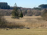
Hundsmoor |
|
NSG-00293.01 WDPA: 163826 |
District of Unterallgäu |
Westerheim One of the few relatively well-preserved vineyards on the valley floors of Central Swabia close to the groundwater in the natural area. |
⊙ | 21.24 | 1986 | |||
| Kettershausener Ried |
NSG-00551.01 WDPA: 318645 |
District of Unterallgäu |
Kettershausen valley bog from dents swamping the Günztal relief, not far from the wooded Günztalleite, in the east almost adjacent to the Günzlauf. |
⊙ | 44.33 | 1998 | ||||
|
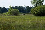
Pfaffenhauser Moos |
|
NSG-00128.01 WDPA: 82316 |
District of Unterallgäu |
Pfaffenhausen Mindeltal-Nieder-Zwischenmoor north of Mindelheim, formed in a swampy, low-drainage basin under the influence of regular Mindel floods. |
⊙ | 51.52 | 1980
|
|||
| Legend for nature reserve | ||||||||||
See also
- List of landscape protection areas in Swabia (Bavaria)
- List of FFH areas in Swabia (Bavaria)
- List of EU bird sanctuaries in Swabia (Bavaria)
- List of geotopes in Swabia (Bavaria)
Individual evidence
- ↑ Green list of nature reserves in Swabia. (PDF; 84 kB) Bavarian State Office for the Environment, December 31, 2014, accessed on May 23, 2016 .
Web links
Commons : Pictures on Wikimedia Commons - collection of pictures, videos and audio files