| Surname
|
image
|
Identifier
|
circle
|
details
|
position
|
Area
hectares
|
date
|
Alzenau sands 
|

|
NSG-00439.01
WDPA: 162136
|
Aschaffenburg district
|
|
⊙
|
95.44
|
1993
|
Summer ground amphibious reserve 
|

|
NSG-00232.01
WDPA: 162205
|
Aschaffenburg district
|
|
⊙
|
24.44
|
1999
|
Speckkahl amphibian sanctuary 
|

|
NSG-00187.01
WDPA: 81307
|
Aschaffenburg district
|
|
⊙
|
43.44
|
1985
|
|
Alluvial forest near Erlenfurt
|
BW
|
NSG-00562.01
WDPA: 318128
|
Aschaffenburg district
|
|
⊙
|
10.9
|
1991
|
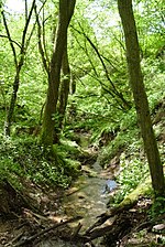
Dörngraben near Haibach 
|
|
NSG-00339.01
WDPA: 162787
|
Aschaffenburg district , Aschaffenburg
|
Aschaffenburg district : 3.76 ha
Aschaffenburg : 2.63 ha
|
⊙
|
6.39
|
1986
|
Hafenlohrtal 
|

|
NSG-00333.01
WDPA: 163472
|
Aschaffenburg district
|
|
⊙
|
71.94
|
1988
|
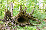
Metzgergraben - Krone 
|
|
NSG-00414.01
WDPA: 81688
|
Aschaffenburg district
|
|
⊙
|
7.46
|
1992
|
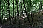
Eichhall natural forest reserve 
|
|
NSG-00740.01
WDPA: 378133
|
Aschaffenburg district
|
|
⊙
|
72.06
|
2005
|
|
High Knuck natural forest reserve
|
BW
|
NSG-00596.01
WDPA: 318833
|
Aschaffenburg district
|
|
⊙
|
121.85
|
1952
|
|
Kreuzbuckel natural forest reserve
|

|
NSG-00597.01
WDPA: 318834
|
Aschaffenburg district
|
|
⊙
|
66.38
|
2001
|
Rohrberg 
|

|
NSG-00116.01
WDPA: 82434
|
Aschaffenburg district
|
|
⊙
|
9.86
|
1979
|
Gustavsee bird sanctuary 
|

|
NSG-00382.01
WDPA: 166085
|
Aschaffenburg district
|
|
⊙
|
18.19
|
1991
|
Former training area Aschaffenburg and Altenbachgrund 
|

|
NSG-00748.01
WDPA: 555546333
|
Aschaffenburg , Miltenberg district
|
Aschaffenburg : 288.58 ha
Miltenberg district : 4.89 ha
|
⊙
|
293.47
|
2010
|
|
Feuerbachmoor
|

|
NSG-00479.01
WDPA: 81659
|
Bad Kissingen district
|
|
⊙
|
25.22
|
1988
|
|
Grundwiese (Hornwiese)
|
BW
|
NSG-00024.01
WDPA: 318479
|
Bad Kissingen district
|
|
⊙
|
2.33
|
1939
|
|
Haarberg
|
BW
|
NSG-00354.01
WDPA: 163420
|
Bad Kissingen district
|
|
⊙
|
23.8
|
1989
|
|
Buchwald natural forest island
|
BW
|
NSG-00709.01
WDPA: 344596
|
Bad Kissingen district
|
|
⊙
|
4.13
|
2003
|
|
Dachsbau natural forest reserve
|
BW
|
NSG-00601.01
WDPA: 318829
|
Bad Kissingen district
|
|
⊙
|
27.01
|
2001
|
|
Dianensruh natural forest reserve
|
BW
|
NSG-00600.01
WDPA: 318830
|
Bad Kissingen district
|
|
⊙
|
21.33
|
2001
|
|
Reiterswiesener Höhe-house teal grove
|
BW
|
NSG-00571.01
WDPA: 318973
|
Bad Kissingen district
|
|
⊙
|
405.59
|
2000
|
|
Chess flower meadows near Zeitlofs
|
BW
|
NSG-00100.01
WDPA: 82503
|
Bad Kissingen district
|
|
⊙
|
19.26
|
1975
|
Black mountains 
|

|
NSG-00440.01
WDPA: 64699
|
Bad Kissingen district
|
|
⊙
|
3,170.67
|
1993
|
Sodenberg goose 
|

|
NSG-00540.01
WDPA: 319116
|
Bad Kissingen district , the district of Main-Spessart
|
Bad Kissingen district : 442.8 ha
Main-Spessart district : 50.06 ha
|
⊙
|
492.86
|
1998
|
|
Arid areas near Machtilshausen
|
BW
|
NSG-00409.01
WDPA: 165952
|
Bad Kissingen district
|
|
⊙
|
252.31
|
1992
|
Juniper heaths south of Münnerstadt 
|

|
NSG-00363.01
WDPA: 166115
|
Bad Kissingen district
|
|
⊙
|
100.85
|
1989
|
|
Forest meadows in the Neuwirtshauser forest
|
BW
|
NSG-00428.01
WDPA: 166155
|
Bad Kissingen district
|
|
⊙
|
158.41
|
1992
|
|
Wurmberg-Possenberg
|
BW
|
NSG-00042.01
WDPA: 82949
|
Bad Kissingen district
|
|
⊙
|
201.8
|
1941
|
|
Core zones in the Bavarian part of the Rhön Biosphere Reserve
|
BW
|
NSG-00751.01
|
Bad Kissingen district , the district of Rhön-grave field
|
Bad Kissingen district : 2106.848 hectares
Rhön-Grabfeld district : 1,377.57 hectares
|
⊙
|
3,484,427
|
2013
|
Altmain and sandy grassland near Limbach 
|

|
NSG-00408.01
WDPA: 162127
|
Haßberge district
|
|
⊙
|
273.5
|
1992
|
Ebelsberg 
|

|
NSG-00122.01
WDPA: 81568
|
Haßberge district
|
|
⊙
|
49.1
|
1982
|
|
Galgenberg-Goßberg
|
BW
|
NSG-00265.01
WDPA: 163191
|
Haßberge district
|
|
⊙
|
45.52
|
1985
|
High when 
|

|
NSG-00517.01
WDPA: 163738
|
Haßberge district
|
|
⊙
|
1,029.69
|
1996
|
Mainaue near Augsfeld 
|

|
NSG-00595.01
WDPA: 318762
|
Haßberge district
|
|
⊙
|
616.23
|
2001
|
|
Mordgrund natural forest reserve
|
BW
|
NSG-00604.01
WDPA: 318835
|
Haßberge district
|
|
⊙
|
24.76
|
2002
|
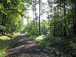
Stachel natural forest reserve 
|
|
NSG-00605.01
WDPA: 318839
|
Haßberge district
|
|
⊙
|
23.28
|
2002
|
Pfaffenberg 
|

|
NSG-00289.01
WDPA: 164988
|
Haßberge district
|
|
⊙
|
20.14
|
1986
|
Shoulderbachtal 
|

|
NSG-00375.01
WDPA: 165471
|
Haßberge district
|
|
⊙
|
34.08
|
1990
|
|
Simonsberg-Fuchsrangen
|
BW
|
NSG-00334.01
WDPA: 165578
|
Haßberge district
|
|
⊙
|
14.32
|
1988
|
Tretzendorfer Weiher 
|

|
NSG-00455.01
WDPA: 165945
|
Haßberge district
|
|
⊙
|
202.58
|
1993
|
Urlesbachtal 
|

|
NSG-00565.01
WDPA: 319251
|
Haßberge district
|
|
⊙
|
24.32
|
2000
|
Dry slopes and primeval meadow near Junkersdorf 
|

|
NSG-00376.01
WDPA: 165957
|
Haßberge district
|
|
⊙
|
132.34
|
1990
|
Gray heron colony near Dippach am Main 
|

|
NSG-00542.01
WDPA: 82794
|
Haßberge district
|
Dippach
parts of the Altmain, Mainaue and Mainprall slope.
|
⊙
|
143.84
|
1998
|
Weilersbachtal 
|

|
NSG-00499.01
WDPA: 166218
|
County Haßberge , district of Schweinfurt
|
Haßberge district : 57.15 ha
Schweinfurt district : 36.6 ha
|
⊙
|
93.75
|
1995
|
Alter Main near Volkach 
|

|
NSG-00350.01
WDPA: 162115
|
Kitzingen district
|
Volkach , Nordheim am Main
Original flowing water of the Main, including the river terraces rich in small reliefs, which are used as hay meadows and willow trees.
|
⊙
|
63.66
|
1989
|
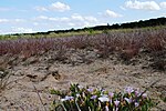
Astheimer Dürringswasen 
|
|
NSG-00574.01
WDPA: 81320
|
Kitzingen district
|
|
⊙
|
10.89
|
1999
|
|
Belkers near Großlangheim
|
BW
|
NSG-00403.01
WDPA: 162367
|
Kitzingen district
|
|
⊙
|
31.25
|
1983
|
Semi-dry lawn on the Schwanberg 
|

|
NSG-00393.01
WDPA: 163498
|
Kitzingen district
|
Iphofen
Magerwiese, semi-arid grassland and old vineyards as a habitat for insects.
|
⊙
|
9.28
|
1991
|
|
Kranzer
|
BW
|
NSG-00222.01
WDPA: 164238
|
Kitzingen district
|
|
⊙
|
7.7
|
1984
|
Mainaue between Sommerach and Koehler 
|

|
NSG-00500.01
WDPA: 164554
|
Kitzingen district
|
|
⊙
|
93.31
|
1995
|
|
Marktstefter Tännig
|
BW
|
NSG-00516.01
WDPA: 164573
|
Kitzingen district
|
|
⊙
|
74.11
|
1996
|
Wolfsee natural forest reserve 
|

|
NSG-00603.01
WDPA: 318843
|
Kitzingen district
|
|
⊙
|
75.99
|
2001
|
Right bank of the Main near Sommerach 
|

|
NSG-00372.01
WDPA: 165118
|
Kitzingen district
|
Sommerach
groyne fields of the various stages of siltation in their interlinking with willow bushes, remains of alluvial forest, herbaceous hillside forests and meadows.
|
⊙
|
19.45
|
1990
|
|
Sands on the fir bush near Kleinlangheim
|
BW
|
NSG-00498.01
WDPA: 165303
|
Kitzingen district
|
|
⊙
|
37.92
|
1995
|
Sand corridors near Volkach, Schwarzach a.Main and Sommerach 
|

|
NSG-00543.01
WDPA: 319044
|
Kitzingen district
|
Volkach
lean sand lawns and sand grass heaths in their interlocking with forest edges, meadows, arable land, orchards, wetlands and watercourses as well as the protection of sand dunes and drifting sand areas.
|
⊙
|
105.36
|
1998
|
Sand grass heaths at Elgersheimer Hof 
|

|
NSG-00285.01
WDPA: 165305
|
Kitzingen district
|
Volkach's
purpose is to preserve the silver loin, which is endangered throughout Europe. Relic site of the sandy grass heaths, which have some rare flowering plants, mosses, mushrooms and various types of lichen.
|
⊙
|
3.39
|
1986
|
Schloßbergsattel near Markt Einersheim 
|

|
NSG-00612.01
WDPA: 165422
|
Kitzingen district
|
Markt Einersheim
Complex open land area.
|
⊙
|
78.47
|
2002
|
Forest at the Hallburg 
|

|
NSG-00383.01
WDPA: 166135
|
Kitzingen district
|
Volkach
Rare expression of a hillside forest with its biodiversity, especially spring geophytes, mixed deciduous forest with transitions to hardwood floodplain and light forest structure.
|
⊙
|
9.61
|
1991
|
Gable (NSG) 
|

|
NSG-00544.01
WDPA: 318438
|
Main-Spessart district
|
|
⊙
|
26.88
|
1998
|
Grainberg-Kalbenstein and Saupurzel 
|

|
NSG-00743.01
WDPA: 378088
|
Main-Spessart district
|
Karlstadt , Eußenheim
Complex dry area network
|
⊙
|
301.91
|
2005
|
|
Gray heron colony on the Salzberg
|
BW
|
NSG-00101.01
WDPA: 81753
|
Main-Spessart district
|
|
⊙
|
158.32
|
1976
|
Kallmuth 
|

|
NSG-00349.01
WDPA: 164007
|
Main-Spessart district
|
|
⊙
|
18.14
|
1989
|
Kreuzberg near Marktheidenfeld 
|

|
NSG-00587.01
WDPA: 318690
|
Main-Spessart district
|
|
⊙
|
36.64
|
2001
|
Mäusberg-Rammersberg-Ständelberg 
|

|
NSG-00613.01
WDPA: 318771
|
Main-Spessart district
|
|
⊙
|
273.85
|
2002
|
|
Gansbrunn natural forest reserve
|
BW
|
NSG-00598.01
WDPA: 318832
|
Main-Spessart district
|
|
⊙
|
32.31
|
2001
|
|
Schubertswald natural forest reserve
|
BW
|
NSG-00599.01
WDPA: 318838
|
Main-Spessart district
|
|
⊙
|
19.49
|
2001
|
Romberg 
|

|
NSG-00536.01
WDPA: 165216
|
Main-Spessart district
|
|
⊙
|
55.74
|
1997
|
Homburg ruins 
|

|
NSG-00581.01
WDPA: 344832
|
Main-Spessart district
|
|
⊙
|
613.15
|
2000
|
Reason 
|

|
NSG-00559.01
WDPA: 319114
|
Main-Spessart district
|
|
⊙
|
379.76
|
1999
|
Spessart meadows 
|

|
NSG-00586.01
WDPA: 319123
|
Main Spessart district , Aschaffenburg
|
Main-Spessart district : 277.5 ha
Aschaffenburg district : 76.15 ha
|
⊙
|
353.65
|
2000
|
|
Lower Schondratal
|
BW
|
NSG-00195.01
WDPA: 82756
|
Main Spessart district , the district of Bad Kissingen
|
Main-Spessart district : 108.24 ha
Bad Kissingen district : 71.03 ha
|
⊙
|
179.27
|
1983
|
Weihersgrund 
|

|
NSG-00550.01
WDPA: 319300
|
Main-Spessart district
|
|
⊙
|
42.59
|
1998
|
|
Aubachtal near Wildensee
|
BW
|
NSG-00380.01
WDPA: 162257
|
Miltenberg district
|
|
⊙
|
62.98
|
1977
|
|
Red sand quarry Reistenhausen
|
BW
|
NSG-00172.01
WDPA: 318268
|
Miltenberg district
|
|
⊙
|
15.37
|
1987
|
Red sand quarries near Bürgstadt 
|

|
NSG-00173.01
WDPA: 81491
|
Miltenberg district
|
|
⊙
|
24.59
|
1983
|
Red sand quarries near Dorfprozelten 
|

|
NSG-00297.01
WDPA: 162638
|
Miltenberg district
|
|
⊙
|
16.48
|
1983
|
|
Udder bottom at Bullau
|
BW
|
NSG-00326.01
WDPA: 163012
|
Miltenberg district
|
|
⊙
|
3.97
|
1982
|
|
Wet meadows in the Sulzbachtal
|

|
NSG-00262.01
WDPA: 163085
|
Miltenberg district
|
|
⊙
|
25.39
|
1984
|
Grohberg 
|

|
NSG-00290.01
WDPA: 163327
|
Miltenberg district
|
|
⊙
|
38.68
|
1986
|
Main meadows near Sulzbach and Kleinwallstadt 
|

|
NSG-00476.01
WDPA: 164553
|
Miltenberg district
|
|
⊙
|
89.21
|
1994
|
|
Forest on the Busigberg near Großheubach
|
BW
|
NSG-00606.01
WDPA: 319271
|
Miltenberg district
|
|
⊙
|
27.69
|
2002
|
|
Forest at the Mainhölle near Großheubach
|
BW
|
NSG-00607.01
WDPA: 319272
|
Miltenberg district
|
|
⊙
|
17.38
|
2002
|
|
Altenburg near Trappstadt
|
BW
|
NSG-00387.01
WDPA: 162109
|
District of Rhön-Grabfeld
|
|
⊙
|
253.29
|
1991
|
Dünsberg 
|

|
NSG-00537.01
WDPA: 162824
|
District of Rhön-Grabfeld
|
|
⊙
|
75.39
|
1942
|
|
Wet areas on the Steizbrunn-Graben
|
BW
|
NSG-00505.01
WDPA: 163050
|
District of Rhön-Grabfeld
|
|
⊙
|
99.06
|
2000
|
Gangolfsberg 
|

|
NSG-00065.01
WDPA: 81711
|
District of Rhön-Grabfeld
|
|
⊙
|
182.6
|
1952
|
|
Hubholz near Mühlfeld
|
BW
|
NSG-00390.01
WDPA: 163808
|
District of Rhön-Grabfeld
|
|
⊙
|
86.25
|
1991
|
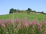
Long Rhön 
|
|
NSG-00152.01
WDPA: 7005
|
District of Rhön-Grabfeld
|
|
⊙
|
3,292.25
|
1982
|
|
Mühlwiesen in the Elsbach valley
|
BW
|
NSG-00459.01
WDPA: 164728
|
District of Rhön-Grabfeld
|
|
⊙
|
70.55
|
1993
|
|
Eisgraben natural forest reserve
|
BW
|
NSG-00590.01
WDPA: 318831
|
District of Rhön-Grabfeld
|
|
⊙
|
29.93
|
2001
|
|
Natural forest reserve Nesselsee
|
BW
|
NSG-00592.01
WDPA: 318836
|
District of Rhön-Grabfeld
|
|
⊙
|
51.5
|
2001
|
|
Schloßberg natural forest reserve
|
BW
|
NSG-00591.01
WDPA: 318837
|
District of Rhön-Grabfeld
|
|
⊙
|
28.74
|
2001
|
|
Nettle bottom
|
BW
|
NSG-00248.01
WDPA: 164776
|
District of Rhön-Grabfeld
|
|
⊙
|
9.88
|
1985
|
|
Poppenholz
|
BW
|
NSG-00386.01
WDPA: 165021
|
District of Rhön-Grabfeld
|
|
⊙
|
210.36
|
1991
|
Saalewiesen between Bad Neustadt and Salz 
|

|
NSG-00567.01
WDPA: 319032
|
District of Rhön-Grabfeld
|
|
⊙
|
152.9
|
1999
|
|
Sinnquellgebiet and Arnsbergsüdhang
|
BW
|
NSG-00352.01
WDPA: 165580
|
District of Rhön-Grabfeld
|
|
⊙
|
161.24
|
1989
|
|
Steinberg and Wein-Berg
|
BW
|
NSG-00342.01
WDPA: 165681
|
District of Rhön-Grabfeld
|
|
⊙
|
302.77
|
1989
|
|
Dry areas northwest of Mittelstreu
|
BW
|
NSG-00744.01
|
District of Rhön-Grabfeld
|
|
⊙
|
268.54
|
2010
|
Dry slopes near Unsleben 
|

|
NSG-00336.01
WDPA: 165954
|
District of Rhön-Grabfeld
|
|
⊙
|
40.89
|
1988
|
|
Dry grass on the Kapellenberg
|
BW
|
NSG-00388.01
WDPA: 165958
|
District of Rhön-Grabfeld
|
|
⊙
|
26.88
|
1991
|
Weyhershauk 
|

|
NSG-00249.01
WDPA: 166281
|
District of Rhön-Grabfeld
|
|
⊙
|
26.3
|
1985
|
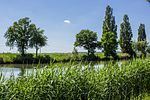
Alter Main near Bergrheinfeld and Grafenrheinfeld 
|
|
NSG-00367.01
WDPA: 162114
|
Schweinfurt district
|
Bergrheinfeld , Grafenrheinfeld
|
⊙
|
20.98
|
1990
|
|
Sinkholes in the millwood
|
BW
|
NSG-00405.01
WDPA: 162770
|
Schweinfurt district
|
Gerolzhofen
|
⊙
|
31.39
|
1980
|
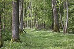
Elmuss 
|
|
NSG-00121.01
WDPA: 81602
|
Schweinfurt district
|
Grafenrheinfeld
|
⊙
|
44.71
|
2001
|
Extension of the Garstadt bird sanctuary 
|

|
NSG-00608.01
WDPA: 318373
|
Schweinfurt district
|
Röthlein , Grafenrheinfeld , Bergrheinfeld
|
⊙
|
83.19
|
2001
|
|
Garstadter wood
|
BW
|
NSG-00165.01
WDPA: 81714
|
Schweinfurt district
|
|
⊙
|
51.65
|
1982
|
Hausener valley slopes 
|

|
NSG-00625.01
WDPA: 318512
|
Schweinfurt district
|
|
⊙
|
145.72
|
2002
|
|
Hörnau Forest
|
BW
|
NSG-00464.01
WDPA: 163796
|
Schweinfurt district
|
Frankenwinheim , Sulzheim , Gerolzhofen
|
⊙
|
180.52
|
1994
|
|
Wildacker natural forest reserve
|
BW
|
NSG-00602.01
WDPA: 318842
|
Schweinfurt district
|
|
⊙
|
15.48
|
2001
|
|
Zwerchstück natural forest reserve
|
BW
|
NSG-00545.01
WDPA: 318871
|
Schweinfurt district
|
|
⊙
|
28.46
|
1998
|
Riedholz and Grettstädter Meadows 
|

|
NSG-00576.01
WDPA: 82413
|
Schweinfurt district
|
Schwebheim , Kolitzheim , Grettstadt
|
⊙
|
119.12
|
2000
|
|
Schleifwiesen and Nußloch near Lindach
|
BW
|
NSG-00264.01
WDPA: 165409
|
Schweinfurt district
|
|
⊙
|
15.54
|
1985
|
|
Spitalgrund-Oberes Volkachtal
|
BW
|
NSG-00260.01
WDPA: 165614
|
Schweinfurt district
|
Michelau im Steigerwald , Hundelshausen (unincorporated area)
|
⊙
|
41.89
|
1985
|
Sulzheimer gypsum hill 
|

|
NSG-00118.01
WDPA: 82676
|
Schweinfurt district
|
Sulzheim
|
⊙
|
8.31
|
1979
|
|
Lauer valley slopes near Stadtlauringen
|
BW
|
NSG-00410.01
WDPA: 165820
|
Schweinfurt district
|
Stadtlauringen
|
⊙
|
93.33
|
1992
|
|
Spitalholz near Gochsheim
|
BW
|
NSG-00553.01
WDPA: 319125
|
Schweinfurt district
|
Gochsheim
|
⊙
|
25.88
|
1998
|
|
Bird sanctuary Alter and Neuer See
|
BW
|
NSG-00192.01
WDPA: 82816
|
Schweinfurt district
|
|
⊙
|
38.47
|
1983
|
Garstadt bird sanctuary 
|

|
NSG-00329.01
WDPA: 166084
|
Schweinfurt district
|
|
⊙
|
48.42
|
1988
|
|
Wernaue near Ettleben
|
BW
|
NSG-00307.01
WDPA: 166249
|
Schweinfurt district
|
|
⊙
|
7.57
|
1987
|
Wipfelder Mainaue near St. Ludwig 
|

|
NSG-00485.01
WDPA: 166335
|
Schweinfurt district
|
|
⊙
|
72.84
|
1994
|
Saumain in the city of Schweinfurt 
|

|
NSG-00458.01
WDPA: 165338
|
Schweinfurt
|
|
⊙
|
11.58
|
1993
|
|
Bärnthal-Hüttenthal
|
BW
|
NSG-00186.01
WDPA: 81367
|
Würzburg district
|
|
⊙
|
15.16
|
1992
|
|
Berg near Unterleinach
|
BW
|
NSG-00385.01
WDPA: 162375
|
Würzburg district
|
|
⊙
|
9.48
|
1966
|
|
Piles of blue grass
|
BW
|
NSG-00041.01
WDPA: 81418
|
Würzburg district
|
|
⊙
|
9.44
|
1984
|
Blutsee-Moor 
|

|
NSG-00556.01
WDPA: 318208
|
Würzburg district
|
Box
|
⊙
|
5.8
|
1941
|
|
Noble forest
|
BW
|
NSG-00040.01
WDPA: 81572
|
Würzburg district
|
|
⊙
|
18.87
|
1942
|
Höhfeldplatte and Scharlachberg 
|

|
NSG-00610.01
WDPA: 318561
|
Würzburg district
|
|
⊙
|
34.3
|
2002
|
Main slope at the Vogelsburg 
|

|
NSG-00454.01
WDPA: 164556
|
District of Würzburg , District of Kitzingen
|
District of Würzburg : 26.66 ha
District of Kitzingen : 26.31 ha
|
⊙
|
52.97
|
1993
|
|
Main valley slope Kleinochsenfurter Berg
|
BW
|
NSG-00241.01
WDPA: 164557
|
Würzburg district
|
|
⊙
|
28.71
|
1985
|
|
Marsberg-Wachtelberg
|
BW
|
NSG-00225.01
WDPA: 164574
|
Würzburg district
|
|
⊙
|
67.2
|
1984
|
|
Waldkugel natural forest reserve
|
BW
|
NSG-00609.01
WDPA: 318841
|
Würzburg district , Würzburg
|
Würzburg district : 49.58 ha
Würzburg : 24.26 ha
|
⊙
|
73.84
|
2002
|
Dry slopes near Böttigheim 
|

|
NSG-00742.01
WDPA: 349943
|
Würzburg district
|
|
⊙
|
2.89
|
1999
|
Dry slopes near Böttigheim 
|

|
NSG-00742.06
WDPA: 389981
|
Würzburg district
|
|
⊙
|
67.25
|
1999
|
Dry slopes near Böttigheim 
|
BW
|
NSG-00742.02
WDPA: 389982
|
Würzburg district
|
|
⊙
|
7.46
|
1999
|
Dry slopes near Böttigheim 
|
BW
|
NSG-00742.03
WDPA: 389983
|
Würzburg district
|
|
⊙
|
14.98
|
1999
|
Dry slopes near Böttigheim 
|
BW
|
NSG-00742.04
WDPA: 389984
|
Würzburg district
|
|
⊙
|
27.08
|
1999
|
Dry slopes near Böttigheim 
|
BW
|
NSG-00742.05
WDPA: 389985
|
Würzburg district
|
|
⊙
|
31.36
|
1999
|
|
Zeubelried Moor
|
BW
|
NSG-00064.01
WDPA: 82957
|
Würzburg district
|
|
⊙
|
5.29
|
1952
|
|
Bromberg rose garden
|
BW
|
NSG-00569.01
WDPA: 162571
|
Würzburg , Würzburg district
|
Würzburg : 35.49 ha
Würzburg district : 1.27 ha
|
⊙
|
36.76
|
1983
|
| Legend for nature reserve
|


