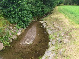
Dörnbach (Hensbach)
| Dörnbach | ||
|
The Dörnbach in Schweinheim |
||
| Data | ||
| location |
Spessart
|
|
| River system | Rhine | |
| Drain over | Hensbach → Main → Rhine → North Sea | |
| source | in Haibach 49 ° 57 ′ 48 ″ N , 9 ° 12 ′ 1 ″ E |
|
| Source height | 245 m above sea level NHN | |
| muzzle | in Schweinheim in den Hensbach Coordinates: 49 ° 57 '23 " N , 9 ° 10' 40" E 49 ° 57 '23 " N , 9 ° 10' 40" E |
|
| Mouth height | 168 m above sea level NHN | |
| Height difference | 77 m | |
| Bottom slope | 41 ‰ | |
| length | 1.9 km | |
| Catchment area | 1.5 km² | |
|
The Dörnbach (back left) flows into the Hensbach (from back to front) |
||
The Dörnbach or Dörngraben is an almost two kilometer long and right tributary of the Hensbach in the Lower Franconian district of Aschaffenburg and in the independent city of Aschaffenburg in Bavaria .
geography
course
The Dörnbach rises on the southern outskirts on the district of Haibach in the district of Aschaffenburg at an altitude of 245 m above sea level. NHN .
It runs in a south-westerly direction through the nature reserve Dörngraben near Haibach and forms the border to the city of Aschaffenburg for about 900 m. There two small brooks flow to the Dörnbach from the right. It still crosses the street Am Königsgraben (AB 11) and finally flows into the Dimpelsmühle in Schweinheim at an altitude of 168 m above sea level. NHN from the right into the Hensbach approaching from the east-southeast .
The approximately 1.9 km long course of the Dörnbach ends approximately 77 meters below its source, so it has a mean bed gradient of approximately 41 ‰.
Catchment area
The approximately 1.5 km² catchment area of the Dörnbach lies in the Spessart and is drained through it via the Hensbach, the Main and the Rhine to the North Sea.
It borders
- in the northeast to the catchment area of the Haibach , which drains into the Main via the Röderbach and the Aschaff
- on the east of Morsbach , who in the Aschaffzufluss Bessenbach opens
- in the southeast to that of the Birkbach , which flows into the Morsbach
- in the south to that of the Hensbach tributary Neuwiesenbach and that of the Hensbach
- and in the north to that of the Kühruhgraben and that of its tributary Hechelsgraben .
Dörngraben nature reserve near Haibach
The approximately 6.3 hectare large nature reserve Dörngraben in Haibach was made in 1934 under special protection. It was only designated as a nature reserve in 1986.
It is a typical notch valley of the pre- Spessart , with steep slopes that is cut about 20-30 m deep into the gneiss and mica schist . The approximately one kilometer long gorge is located south of Haibach. The protection purpose is the development of certain parts of nature and landscape as well as the protection of the animals and plants adapted to this habitat.
See also
- List of rivers in the Spessart
- List of nature reserves in the city of Aschaffenburg
- List of nature reserves in the Aschaffenburg district
Web links
- The Dörnbach on the BayernAtlas


