List of nature reserves in Upper Franconia
The list of nature reserves in Upper Franconia includes the following lists of nature reserves in Upper Franconian counties and cities:
- List of nature reserves in the Bamberg district
- List of nature reserves in the city of Bamberg
- List of nature reserves in the Bayreuth district
- List of nature reserves in the city of Bayreuth
- List of nature reserves in the Coburg district
- List of nature reserves in the city of Coburg
- List of nature reserves in the Forchheim district
- List of nature reserves in the district of Hof
- List of nature reserves in the district of Kronach
- List of nature reserves in the district of Kulmbach
- List of nature reserves in the Lichtenfels district
- List of nature reserves in the district of Wunsiedel in the Fichtelgebirge
The selection corresponds to the administrative region of Upper Franconia . There are 95 nature reserves in the administrative district (as of November 2015). The largest nature reserve in the district is the shell limestone area on Oschenberg.
| Surname | image | Identifier
|
circle | details | position | Area hectares |
date | |||
|---|---|---|---|---|---|---|---|---|---|---|
|
Börstig near Hallstadt |

|
NSG-00477.01 WDPA: 162516 |
Bamberg district |
Hallstadt Remnant of a larger sand area with dry sand grass and light pine forest. |
⊙ | 13.72 | 1956 | |||
|
Burglesau valley |

|
NSG-00359.01 WDPA: 162656 |
Bamberg district |
Burglesau valley with special natural beauty. Near-natural flowing water. |
⊙ | 56.81 | 1986 | |||
| Slopes on the Kraiberg |

|
NSG-00463.01 WDPA: 163520 |
Bamberg district |
Baunach Characteristic landscape through hillside location, surface design, vegetation and cultivation with a large variety of species, biotopes and structures. |
⊙ | 65.7 | 1994 | |||
|
Slopes on Spitzlberg and Kunkelsbühl |

|
NSG-00332.01 WDPA: 163521 |
Bamberg district |
Staffelbach Former vineyard slopes with a mosaic of bushes, hedges, grasslands and other vegetation. |
⊙ | 21.66 | 1988 | |||
|
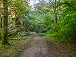
Leidingshofer valley |
|
NSG-00292.01 WDPA: 164419 |
Bamberg district |
Leidingshof Gorge-like Jura valley with typical vegetation, especially rock vegetation, semi-arid grassland, shrub succession, beech and steep slope forest. |
⊙ | 22.51 | 1986 | |||
|
Main valley arm near Dörfleins |

|
NSG-00371.01 WDPA: 164550 |
Bamberg district |
Dörflein's longest back arm in the Upper Franconian Main Valley. Typical communities as well as locations from alluvial forest remnants to open water areas. |
⊙ | 12.67 | 1990 | |||
|
Brunnstube natural forest reserve |

|
NSG-00589.01 WDPA: 318828 |
Bamberg district |
Ebrach Natural and characteristic deciduous forest communities. Large, uncut, poorly structured, mixed deciduous forests with near-natural local tree species composition. |
⊙ | 49.15 | 2001 | |||
|
Lohn Valley natural forest reserve |

|
NSG-00202.01 WDPA: 164760 |
Bamberg district |
Lohndorf Rare and characteristic deciduous forest communities on the Jura edge in the south. |
⊙ | 51.36 | 1984 | |||
|
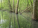
Waldhaus natural forest reserve with wetland in the Handthalgrund |
|
NSG-00566.01 WDPA: 318840 |
Bamberg district |
Ebrach deciduous forest communities of the Steigerwald, natural and characteristic. |
⊙ | 107.56 | 2000 | |||
|
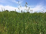
Sandgrassheide Pettstadt |
|
NSG-00111.01 WDPA: 82485 |
Bamberg district |
Pettstadt Relic occurrences of the vegetation type sandgrass heather, which used to be widespread in the Regnitz and Main valleys, on the terrace sands of the Regnitz. |
⊙ | 7.33 | 1978 | |||
| Lock peninsula and oxbow lake at Viereth |
NSG-00657.01 WDPA: 344835 |
Bamberg district |
Viereth Ecologically very valuable peninsula and adjacent oxbow and oxbow water areas. |
⊙ | 26.21 | 2005 | ||||
| Spitzberg near Ebrach |
NSG-00320.01 WDPA: 165617 |
Bamberg district |
Ebrach Near-natural and species-rich mixed deciduous forest with a high proportion of old wood. |
⊙ | 25.53 | 1987 | ||||
| Stocksee and surroundings |

|
NSG-00738.01 WDPA: 378367 |
Bamberg district |
Memmelsdorf Ecologically extremely valuable lake with riparian zones and adjacent meadows and forest areas. |
⊙ | 30.63 | 2006 | |||
|
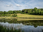
Weihergrund near Ebrach |
|
NSG-00335.01 WDPA: 166209 |
Bamberg district |
Ebrach Near-natural valley section on the upper reaches of the Mittelebrach with a diverse mosaic of habitats. |
⊙ | 24.72 | 1988
|
|||
| Muna site in Bamberg |

|
NSG-00584.01 WDPA: 318822 |
Bamberg |
Bamberg silver grass meadows and sandy grasslands in connection with a characteristic nutrient-poor still water on sand. |
⊙ | 10.83 | 2001 | |||
|
Wolfsruhe natural forest reserve |

|
NSG-00301.01 WDPA: 164763 |
Bamberg |
Bug Natural deciduous mixed forest communities with the flora and fauna typical of this habitat. |
⊙ | 32.75 | 1986
|
|||
|
Craimoos pond |

|
NSG-00257.01 WDPA: 162685 |
Bayreuth district |
Schnabelwaid A still water that is extraordinarily rich in plant and animal species. |
⊙ | 18.84 | 1989 | |||
|
Haberstein |

|
NSG-00020.01 WDPA: 81791 |
Bayreuth district |
Bischofsgrün Blockmeer and granite towers with weathered forms. |
⊙ | 10.63 | 1939 | |||
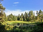
| Rooster felt at Mehlmeisel |
|
NSG-00209.01 WDPA: 163478 |
Bayreuth district |
Flour chisel Peeled former raised bog. |
⊙ | 11.74 | 1984 | |||
| Haidenaabtal and Gabellohe |
NSG-00549.01 WDPA: 318490 |
Bayreuth district |
Immenreuth Wetland- bound habitat types with endangered animal groups. |
⊙ | 75.44 | 1998 | ||||
|
Knock at Obernsees |

|
NSG-00527.01 WDPA: 164167 |
Bayreuth district |
Obernsee Valuable mixed deciduous forest with warmth-loving edges and areas of grassland on a hilltop of particular scenic beauty and character. |
⊙ | 14.3 | 1997 | |||
|
Mixed deciduous forest in the upper Aufseßal |

|
NSG-00319.01 WDPA: 164392 |
Bayreuth district |
Sachsendorf Natural and species-rich mixed deciduous forest with flora and fauna typical of this habitat. |
⊙ | 20.71 | 1987 | |||
| Moosbachaue |
NSG-00279.01 WDPA: 164684 |
Bayreuth district |
Fichtelberg wetland with the only fossil pingo in Northern Bavaria (hollow terrain created during the Ice Age). |
⊙ | 11.68 | 1986 | ||||
|
Fichtelseemoor natural forest reserve |

|
NSG-00155.01 WDPA: 82213 |
District of Bayreuth , the district Wunsiedel |
Fichtelberg Former raised bog. Bayreuth district : 107.41 ha Wunsiedel district : 30.51 ha |
⊙ | 137.92 | 1982
|
|||
|
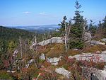
Nusshardt |
|
NSG-00019.01 WDPA: 82263 |
Bayreuth district |
Boulder sea hill and rock wilderness with forms of weathering. |
⊙ | 7.36 | 1939 | |||
|
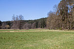
Pegnitzau between Ranna and Michelfeld |
|
NSG-00548.01 WDPA: 318939
|
Neuhaus , Auerbach , Pegnitz valley meadows. Area distribution: District of Nürnberger Land = 99.34ha District Amberg-Sulzbach = 79.83ha District Bayreuth = 19.24ha |
⊙ | 198.71 | 1998 | ||||
| Steinachtal with drawbar sticks |
NSG-00261.01 WDPA: 165670 |
Bayreuth district |
Döhlau Semi-natural mixed deciduous forests, alluvial forests and natural running waters as habitats for typical plant and animal species. |
⊙ | 11.97 | 1985 | ||||
|
Devil's hole |

|
NSG-00035.01 WDPA: 82703 |
Bayreuth district |
Eckersdorf A meadow valley close to nature with ecologically important peripheral areas, wetland complexes and a largely natural course of water. |
⊙ | 7.62 | 1941 | |||
|
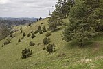
Dry slopes around Pottenstein |
|
NSG-00496.01 WDPA: 165956 |
Bayreuth district |
Pottenstein Valuable vegetation complexes made of rock heaths, semi-arid and dry grasslands, heat-loving edges, bushes and light forests. |
⊙ | 51.87 | 1995
|
|||
|
Muschelkalkgebiet on the Oschenberg |

|
NSG-00739.01 WDPA: 378336 |
Bayreuth , district of Bayreuth |
Bayreuth Ecologically very valuable biotope complex with lowland hay meadows and semi-arid grassland, as well as a variety of hedges, field trees and mixed deciduous forests. Bayreuth : 246.2 ha County Bayreuth : 78.34 ha |
⊙ | 324.54 | 2006
|
|||
| Glender Wiesen bird sanctuary |
NSG-00355.01 WDPA: 166071 |
Coburg , district of Coburg |
Beiersdorf near Coburg One of the few wet meadow areas in Upper Franconia with undisturbed water areas and silting areas. Coburg : 184.18 Coburg district : 10.68 ha |
⊙ | 194.86 | 1989
|
||||
| Althellinger reason |
NSG-00402.01 WDPA: 162124 |
District of Coburg |
Seßlach One of the few wet meadow areas that still exist in Upper Franconia |
⊙ | 83.81 | 1992 | ||||
| Eichelberg and Bischofsau |

|
NSG-00366.01 WDPA: 162880 |
District of Coburg |
Roßfeld Near-natural and species-rich mixed deciduous forest (middle forests) with adjacent species-rich wet and poor meadows |
⊙ | 99.23 | 1984 | |||
| Big pond and Tambachau |
NSG-00417.01 WDPA: 163363 |
District of Coburg |
Tambach pond area and adjoining natural stream floodplain with wet meadows, tall herbaceous areas, reed areas and large sedge stands |
⊙ | 17.25 | 1992 | ||||
| Heiligenwiesen and Heiligenleite |
NSG-00401.01 WDPA: 163600 |
District of Coburg |
Gemünda One of the few wet meadow areas still in existence in Upper Franconia |
⊙ | 54.52 | 1992 | ||||
| Hühnerberg near Tiefenlauter |
NSG-00482.01 WDPA: 163815 |
District of Coburg |
Deep, natural and species-rich deciduous forest with fringing areas and semi-arid grass in front |
⊙ | 56.68 | 1994 | ||||
|
Itztal and Effeldertal near Weißenbrunn in front of the forest |

|
NSG-00538.01 WDPA: 318608 |
District of Coburg |
Weißenbrunn vorm Wald Valley areas with near-natural flowing waters, well-developed riparian wooded lines , brook reed beds, wet meadows, large sedge swamps and tall herbaceous meadows |
⊙ | 41.85 | 1997 | |||
| Mixed deciduous forest near Ahlstadt |

|
NSG-00294.01 WDPA: 164391 |
District of Coburg |
Ahlstadt Near-natural and species-rich mixed deciduous forest. Protection of the flora and fauna typical of this habitat, the soil properties required for these communities and the water balance of the soil |
⊙ | 20.71 | 1986 | |||
| Lauterberg |

|
NSG-00481.01 WDPA: 164406 |
District of Coburg |
Oberlauter Extensive semi-arid grassland on shell limestone with hedges and adjacent forest areas |
⊙ | 191.75 | 1994 | |||
| Meilschnitzwiesen |

|
NSG-00418.01 WDPA: 164599 |
District of Coburg |
Meilschnitz Large meadow area with wet meadows, reed areas, wet fallow land as well as tall herbaceous meadows and strips of wood |
⊙ | 31.8 | 1992 | |||
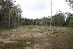
| Moor near Rottenbach |
|
NSG-00140.01 WDPA: 82176 |
District of Coburg |
Rottenbach Large primary moor on the southern edge of the Thuringian Forest with a natural character and an attractive landscape |
⊙ | 8.03 | 1981 | |||
| Mühlberg north of Sülzfeld |
NSG-00450.01 WDPA: 164719 |
District of Coburg |
Sülzfeld Near-natural deciduous forest area with upstream valuable borders, grasslands and hedges |
⊙ | 45.20 | 1993 | ||||
| Schwengbrunn natural forest reserve |
NSG-00305.01 WDPA: 164761 |
District of Coburg |
Oberwohlsbach Characteristic and near-natural deciduous forest communities in the floodplain and slope area of the Fornbach Valley with typical flora and fauna |
⊙ | 27.66 | 1987 | ||||
| Salzberg and Heugrund |
NSG-00480.01 WDPA: 165289 |
District of Coburg |
Rottenbach Natural and species-rich mixed deciduous forest with warmth-loving edges. Diversity of plants and animals, including rare, sensitive and endangered species |
⊙ | 73.96 | 1994 | ||||
| Sennigshöhe |
NSG-00451.01 WDPA: 165559 |
District of Coburg |
Ottowind Valuable vegetation complex of semi-arid grass, warmth-loving edges and light pine forest |
⊙ | 20.77 | 1993 | ||||
| Steinachwiesen near Wörlsdorf |
NSG-00421.01 WDPA: 165671 |
District of Coburg |
Wörlsdorf Valuable wet meadow area. Habitat, breeding, resting and feeding area, also for highly endangered bird species |
⊙ | 38.12 | 1992 | ||||
| Clay pits near Muggenbach |

|
NSG-00575.01 WDPA: 319218 |
District of Coburg |
Muggenbach Characteristic pit sites with their structures such as precipices, landslides, temporary bodies of water, wet, raw soil and pioneer areas as habitats for threatened species as well as adjacent forest edge zones |
⊙ | 23.15 | 2000
|
|||
|
Büg near Eggolsheim |

|
NSG-00642.01 WDPA: 329314 |
Forchheim district |
Eggolsheim sand terrace of the Regnitz with adjacent oxbow lake. |
⊙ | 65.70 | 2004 | |||
|
Honorary citizen |

|
NSG-00321.01 WDPA: 162874 |
Forchheim district |
Forchheim Zeugenberg with outstanding natural beauty and character on the western slope of the Northern Franconian Alb with warmth-loving deciduous forests, bushes, semi-arid and dry grassland and rock band societies. |
⊙ | 161.44 | 2001 | |||
|
Langenbachgrund and Haarweiherkette |

|
NSG-00512.01 WDPA: 164350 |
County Forchheim , Erlangen-Höchstadt |
Willersdorf chain of ponds with adjacent meadows. Forchheim district = 142.14 ha Erlangen-Höchstadt district = 0.03 ha |
⊙ | 142.14 | 1996 | |||
|
Mixed deciduous forest on the Hetzleser Berg |

|
NSG-00317.01 WDPA: 164390 |
Forchheim district |
Hetzles Near-natural and species-rich mixed deciduous forest and this enclosed limestone bog areas with the flora and fauna typical of these habitats. |
⊙ | 17.39 | 1987 | |||
|
Eibenwald natural forest reserve near Gößweinstein |

|
NSG-00109.01 WDPA: 82212 |
Forchheim district |
Gößweinstein Near-natural beech slope forest with the largest occurrence of the yew tree (Taxus baccata L.) in Upper Franconia. |
⊙ | 32.03 | 1978
|
|||
|
Hell Valley |

|
NSG-00526.01 WDPA: 163768 |
Hof district |
Lichtenberg Valley of the Selbitz with its alluvial forest areas, near-natural forest communities on the valley slopes and valuable vegetation complexes consisting of rock heaths, warmth-loving edges and bushes. |
⊙ | 163.95 | 1997 | |||
| Southern Regnitz and Zinnbach |
NSG-00594.01 WDPA: 319176 |
Hof district |
Regnitzlosau Near-natural watercourses and valleys with floodplain meadows, remains of alluvial forests, bank fringes, tall herbaceous meadows, alder and willow stands along the banks as well as wet meadows that accompany the river. |
⊙ | 145.41 | 2001 | ||||
| Tannbach near Mödlareuth |
NSG-00395.01 WDPA: 165826 |
Hof district |
Mödlareuth Near-natural brook course with dense wood fringes, adjoining tall herbaceous and old grass fields as well as meadow areas. |
⊙ | 19.79 | 1992 | ||||
| Thronbachtal |
NSG-00114.01 WDPA: 82711 |
Hof district |
Schauenstein valley with typical plant communities of the meadow valleys of the Franconian Forest. |
⊙ | 20.77 | 1978 | ||||
| Thuringian Muschwitz |
NSG-00427.01 WDPA: 165884 |
District of Hof , District of Kronach |
Carlsgrün Near-natural brook course with adjoining tall herbaceous and old grass fields as well as meadow and alluvial forest areas. District of Hof : 20.05 ha District of Kronach : 2.03 ha |
⊙ | 22.26 | 1992 | ||||
|
Forest stone peaks |

|
NSG-00052.01 WDPA: 82858 |
Hof district |
Sparneck Particularly interesting forms of weathering. Rock towers and boulders. |
⊙ | 19.64 | 1950 | |||
|
Wojaleite |

|
NSG-00102.01 WDPA: 82934 |
Hof district |
Woja Extensive occurrence of serpentinite. Charming landscape with a natural character. |
⊙ | 28.89 | 1976
|
|||
| Bärenbachtal near Langenau |
NSG-00406.01 WDPA: 162340 |
District of Kronach |
Langenau brook valleys with extensive Groß- Seggenried . |
⊙ | 9.52 | 1995 | ||||
| Buchbachtal with Ramschleite and Buchbachsleite |
NSG-00445.01 WDPA: 162600 |
District of Kronach |
Buchbach Natural floodplain of the Buchbach with diverse types of vegetation. |
⊙ | 62.57 | 1998 | ||||
| Beech slopes |
NSG-00217.01 WDPA: 162610 |
District of Kronach |
Nordhalben Rare and characteristic slope and ravine forest communities of the Franconian Forest as well as lime-poor spring meadows. |
⊙ | 37.81 | 1993 | ||||
| Falkenstein and Pechleite east of Lauenstein |
NSG-00452.01 WDPA: 163024 |
District of Kronach |
Lauenstein Scenic valley slope with richly structured rock formations and a multitude of rare, Ewm-sensitive and endangered plant and animal species. |
⊙ | 66.61 | 1987 | ||||
| Foeritzau |
NSG-00508.01 WDPA: 163127 |
District of Kronach |
Black village floodplain with adjacent wetlands, silted ponds and former gravel pits with specific animal and plant communities, especially fish, mussels and dragonflies. |
⊙ | 59.60 | 1980 | ||||
| Franconian Muschwitz |
NSG-00432.01 WDPA: 163138 |
District of Kronach |
Langenbacher Forst Near-natural stream with alluvial forest remains and surrounding wet fallow land. |
⊙ | 45.53 | 1996 | ||||
| Moor in the Krötensee forest |
NSG-00434.01 WDPA: 164668 |
District of Kronach |
Langenbacher Forst Valuable moorland with near-natural quarry forest and swamp areas as well as spring meadows. |
⊙ | 20.99 | 1993 | ||||
| Rabensteiner Höhe with the Zeyerner wall |

|
NSG-00234.01 WDPA: 165080 |
District of Kronach |
Zeyern Natural exposure of the Lower Muschelkalk. |
⊙ | 12.32 | 1985 | |||
| Regina Lake, Path Lake and Schnitzersteich |
NSG-00233.01 WDPA: 165122 |
District of Kronach |
Schwärzdorf A group of ponds close to nature with floating plants and silting areas. |
⊙ | 7.46 | 1985 | ||||
| Schmidtsberg |
NSG-00219.01 WDPA: 165439 |
District of Kronach |
Nordhalben Rare and characteristic slope and ravine forest communities of the Franconian Forest as well as lime-poor spring meadows. |
⊙ | 21.74 | 1984 | ||||
| Tettautal and Sattelgrund |
NSG-00431.01 WDPA: 165855 |
District of Kronach |
Langenau Near-natural flowing waters with wooded fringes, tall herbaceous and old grass corridors as well as meadow areas. |
⊙ | 17.52 | 1993 | ||||
| Tschirner and Nordhalbener Ködeltal with a mouse bag |
NSG-00467.01 WDPA: 165970 |
District of Kronach |
Tschirn Near-natural streams and surrounding floodplain areas with a variety of different types of vegetation. |
⊙ | 275.48 | 1994
|
||||
| Ködnitzer Weinleite |
NSG-00296.01 WDPA: 164178 |
District of Kulmbach |
Kulmbach South-exposed hillside location in the Muschelkalk from the lower (upper limit of the Wavy Limestone) over the Middle to the Upper Muschelkalk (main Muschelkalk). |
⊙ | 32.87 | 1986 | ||||
| Main river near Mainleus |
NSG-00256.01 WDPA: 164551 |
District of Kulmbach |
Mainleus One of the last near-natural oxbow lakes in the Main Valley with particularly species-rich flora and fauna, rich woodland on the banks and remains of alluvial forests. |
⊙ | 4.46 | 1985 | ||||
| Kühberg natural forest reserve |
NSG-00197.01 WDPA: 82216 |
District of Kulmbach |
Stadtsteinach Rare and characteristic slopes, gorges and alluvial forests of the Franconian Forest as well as spring meadows and limestone heaths that are extremely rare in this natural area. |
⊙ | 27.79 | 1984 | ||||
| Juniper slopes at Wonsees |
NSG-00136.01 WDPA: 82838 |
District of Kulmbach |
Wonsees semi- arid grassland with dolomite rocks and juniper stands. |
⊙ | 13.17 | 1980
|
||||
|
Gaabsweiher |

|
NSG-00318.01 WDPA: 163179 |
Lichtenfels district |
Lichtenfels One of the last backwaters in the Main Valley, including its immediate surroundings, habitat of rich vegetation. |
⊙ | 10.48 | 1987 | |||
| Kitsch valley ranges |
NSG-00218.01 WDPA: 164105 |
Lichtenfels district |
Lichtenfels Rare and characteristic forest communities of the Jura steep edge in northern exposure. |
⊙ | 42.00 | 1984 | ||||
| Mainaltwasser near Theisau |
NSG-00259.01 WDPA: 164552 |
Lichtenfels district |
Theisau One of the last backwaters of the Main with rich vegetation. |
⊙ | 1.75 | 1985 | ||||
|
Mainaue near Oberau |

|
NSG-00583.01 WDPA: 318763 |
Lichtenfels district |
Oberau One of the last near-natural oxbow lakes in the Main Valley with particularly species-rich flora and fauna, rich woodland on the banks and remains of alluvial forests. |
⊙ | 27.83 | 2001 | |||
|
Staffelberg |

|
NSG-00252.01 WDPA: 165640 |
Lichtenfels district |
Bad Staffelstein The landscape is excellent with great local history and geological importance. |
⊙ | 42.93 | 1985 | |||
|
Juniper slopes near Kleinziegenfeld |

|
NSG-00162.01 WDPA: 82836 |
Lichtenfels district |
Small goat field Characteristic vegetation created by sheep grazing with semi-arid grass, dry grass, stone grass corridors and crevices of the limestone cliffs and juniper stands. |
⊙ | 16.75 | 1982 | |||
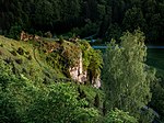
| Juniper slopes near Wallersberg |
|
NSG-00160.01 WDPA: 82837 |
Lichtenfels district |
Wallersberg Characteristic vegetation created by sheep grazing with semi-arid grass, dry grass, stone grass corridors and crevices of limestone cliffs and juniper stands. |
⊙ | 9.18 | 1982
|
|||
|
Breeding pond and meadows near Neuhaus ad Eger |

|
NSG-00478.01 WDPA: 162598 |
District of Wunsiedel |
Neuhaus ad Eger Natural pond with extensive silting zones and surrounding woody and meadow areas. |
⊙ | 9.20 | 1984 | |||
|
Egertal near Neuhaus |

|
NSG-00346.01 WDPA: 162851 |
District of Wunsiedel |
Neuhaus ad Eger A section of the valley, unique in Upper Franconia, of outstanding natural beauty. |
⊙ | 263.22 | 1941 | |||
|
Summit of the Great Kosseine |

|
NSG-00027.01 WDPA: 81733 |
District of Wunsiedel |
Reichenbach granite tower with mighty block fields. |
⊙ | 13.35 | 1940 | |||
|
House loo |

|
NSG-00115.01 WDPA: 81837 |
District of Wunsiedel |
Selb Former bog with Spirkenmoorwald. |
⊙ | 69.01 | 1979 | |||
| Little labyrinth |
NSG-00243.01 WDPA: 164135 |
District of Wunsiedel |
Kleinwendern Protection of the boulders and weathering forms of the granite as well as the typical vegetation around the rocks and on the boulders. |
⊙ | 15.77 | 1985 | ||||
|
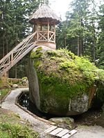
Luisenburg |
|
NSG-00006.01 WDPA: 82121 |
District of Wunsiedel |
Wunsiedel Diverse forms of erosion and weathering of granite. |
⊙ | 33.18 | 1938 | |||
| Wunsiedler Weiher moorland |
NSG-00258.01 WDPA: 164677 |
District of Wunsiedel |
Same former raised bog with relict stocking (bog birch forest) and its regeneration stages (flat bog, transitional bog) as well as its forms of use (pipe grass litter meadow, bristle grass lawn, filamentous wet meadow, oligotrophic water). |
⊙ | 59.70 | 1985 | ||||
| Hengstberg natural forest reserve |
NSG-00198.01 WDPA: 82211 |
District of Wunsiedel |
Selb For the natural area very rare natural deciduous mixed forest. |
⊙ | 41.07 | 1984 | ||||
|
Plate summit |

|
NSG-00023.01 WDPA: 82334 |
District of Wunsiedel |
Fichtelberg rock lichen flora on granite blocks of the rock sea. |
⊙ | 3.84 | 1939 | |||
| Ruhberg south of Arzberg |
NSG-00585.01 WDPA: 319018 |
District of Wunsiedel |
Arzberg Close to nature and rich in species with rare, sensitive and endangered animal species. |
⊙ | 27.37 | 2001 | ||||
|
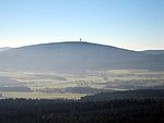
Snow mountain peak |
|
NSG-00036.01 WDPA: 82540 |
District of Wunsiedel |
Weißenstadt Lichen and moss flora with species that are particularly worth protecting from high montane to alpine. |
⊙ | 37.07 | 1941 | |||
|
Zeitelmoos |

|
NSG-00351.01 WDPA: 166397 |
District of Wunsiedel |
Wunsiedel Former raised bog with its diverse regeneration stages. |
⊙ | 77.74 | 1989 | |||
| Legend for nature reserve | ||||||||||
See also
- List of landscape protection areas in Upper Franconia
- List of FFH areas in Upper Franconia
- List of EU bird protection areas in Upper Franconia
- List of geotopes in Upper Franconia
Web links
Commons : Nature reserves in Upper Franconia - collection of images, videos and audio files
Individual evidence
- ↑ Green list of nature reserves in Upper Franconia. (PDF; 106 kB) Bavarian State Office for the Environment, December 31, 2014, accessed on May 23, 2016 .