Rabensteiner Höhe with the Zeyerner wall
Coordinates: 50 ° 15 ′ 54 ″ N , 11 ° 23 ′ 47 ″ E
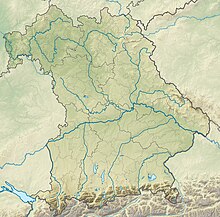
The nature reserve Rabensteiner Höhe with Zeyerner Wand is located in the Marktrodach market in the Kronach district in Upper Franconia .
The 12.3 hectare area with the number NSG-00234.01, which was placed under nature protection in 1985 , extends west of the core town of Zeyern directly along the Rodach flowing on the southeastern edge . The B 173 runs to the east .
It is a natural outcrop of the Lower Muschelkalk .
See also
Web links
Commons : Rabensteiner Höhe with Zeyerner Wand - collection of images, videos and audio files


