Tschirner and Nordhalbener Ködeltal with a mouse bag
Coordinates: 50 ° 21 ′ 58 " N , 11 ° 28 ′ 37" E
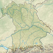
The nature reserve Tschirner and Nordhalbener Ködeltal with Mäusasche lies in the area of the municipality Tschirn in the administrative district Kronach in Upper Franconia . It is the largest nature reserve in the district.
The 275.5 ha area with the number NSG-00467.01, which was placed under nature protection in 1994 , extends in two parts east and southeast of the core town of Tschirn, directly north of the Mauthaus dam . The St 2200 runs to the west and the St 2198 to the east. The state border with Thuringia runs not far to the northeast .
The area includes near-natural streams and surrounding floodplain areas with a variety of different types of vegetation.

