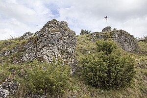
Dry slopes around Pottenstein
|
Dry slopes around Pottenstein
|
||
|
Dry slope with rocks |
||
| location | Pottenstein | |
| surface | 51.87 | |
| Identifier | NSG-00496.01 | |
| WDPA ID | 165956 | |
| Geographical location | 49 ° 47 ' N , 11 ° 25' E | |
|
|
||
| Setup date | 1995 | |
The dry slopes around Pottenstein are a nature reserve near Pottenstein in the Bayreuth district in Bavaria . They extend east of the core town of Pottenstein.
meaning
The 51.87 hectare area has been designated as a nature reserve since 1995. It includes valuable vegetation complexes from rock heaths, semi-arid and dry grasslands , heat-loving edges, bushes and sparse forests.
See also
Web links
Commons : Dry slopes around Pottenstein - collection of images, videos and audio files


