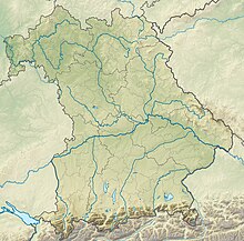
Haidenaabtal and Gabellohe
Coordinates: 49 ° 53 ′ 29 ″ N , 11 ° 49 ′ 59 ″ E
The nature reserve Haidenaabtal Gabellohe and is largely (75.41 hectares ) on the territory of the municipality memory village in the district of Bayreuth , and to a lesser extent (0.03 ha) on the territory of the municipality Immenreuth in Tirschenreuth in Oberfranken .
The 75.44 hectare area with the number NSG-00549.01, which was placed under nature protection in 1998 , extends directly northeast of the core town of Haidenaab , a district of Speichersdorf, along the Haidenaab , a western source river of the Naab .
The area includes wetland-bound habitat types with endangered animal groups.

