Haidenaab
| Haidenaab | ||
|
Haidenaab and Waldnaab unite to form Naab (2016) |
||
| Data | ||
| Water code | EN : 142 | |
| location | Bavaria , Germany | |
| River system | Danube | |
| Drain over | Naab → Danube → Black Sea | |
| source | northeast of Kirchenpingarten 49 ° 56 ′ 17 ″ N , 11 ° 48 ′ 7 ″ E |
|
| Source height | 686 m | |
| muzzle | Confluence with the Waldnaab to the Naab near Unterwildenau (Gem. Luhe-Wildenau ) Coordinates: 49 ° 36 '11 " N , 12 ° 7' 56" E 49 ° 36 '11 " N , 12 ° 7' 56" E |
|
| Mouth height | 380 m | |
| Height difference | 306 m | |
| Bottom slope | 4.4 ‰ | |
| length | 69.1 km | |
| Catchment area | 724.36 km² | |
| Discharge at the Wildenau A Eo gauge : 714 km² Location: 800 m above the mouth |
NNQ (08/01/1964) MNQ 1941–2006 MQ 1941–2006 Mq 1941–2006 MHQ 1941–2006 HHQ (07/12/1954) |
402 l / s 1.49 m³ / s 6.42 m³ / s 9 l / (s km²) 60 m³ / s 118 m³ / s |
The Haidenaab is the right or western source river of the Naab in the Upper Palatinate ( Bavaria , Germany ).
Surname
The Haidenaab takes its name from the heathland in the Nasse Heide headwaters of its longest arm, the Heinersbach. This was formerly seen as the upper reaches and flows into the Haidenaab near Göppmannsbühl as the Tauritzbach . In 1285 they wrote “Heydnab”, 1340 “Haydnab”, 1491 “Haidenab”, 1796 “Heidenabe” and 1832 “Heiden-Naab”. The nickname was given the Naabquellfluss to distinguish it from the Waldnaab.
River course
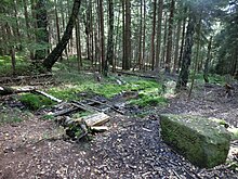
The river rises in Kohlholz in the district of Bayreuth ( Upper Franconia ) on the southern edge of the Fichtelgebirge 1900 meters northeast of Kirchenpingarten and 900 meters southwest of the Platte mountain ( 830 m above sea level ), about seven kilometers north of Speichersdorf .
From there, the Haidenaab flows in a south-easterly direction and reaches the Tirschenreuth district after a few kilometers at the Renaissance Schlackenhof Castle , where the Flernitzbach coming from the north-west joins . Passing Kaibitz Castle , after another short distance, it reaches the Neustadt an der Waldnaab district . Its largest tributary, the Creußen, flows at Dorfgmünd . The Haidenaab flows on via Pressath and Mantel to Luhe-Wildenau , where it joins the Waldnaab to Naab in the Unterwildenau district , which flows into the Danube .
Tributaries
- Blumenbach (left)
- Kaltenbach (left)
- Goldbach (right)
- Weiherlohe (left)
- Tauritzbach (right)
- Flernitzbach (right)
- Mooswiesengraben (left)
- Fallbach (left)
- Grünbach (left)
- Mühlbach (right)
- Fire ditch (left)
- Siechenbach (left)
- Pressather Bach (left)
- Schwarzenbach (left)
- Creußen (right)
- Hohlbach (left)
- Heilinglohbach (left)
- Röthenbach (right)
- Eichelbach (right)
- Mühllohbach (right)
- Stockweiherbach (right)
River-accompanying cycle route
The Haidenaab cycle path leads across the towns of Kastl , Trabitz , Pressath, Schwarzenbach , Mantel, Weiherhammer , Etzenricht , Oberwildenau and Unterwildenau along the Haidenaab. The route to Regensburg continues with the Naab cycle path.
literature
- Franz Xaver Bogner: The Naab - with Waldnaab, Fichtelnaab, Haidenaab . Pustet Verlag, Regensburg 2004, ISBN 3-7917-1915-7 .
Individual evidence
- ↑ http://www.lfu.bayern.de/wasser/gewaesserverzeichnis/doc_pic/tab14.pdf#page=33
- ↑ http://www.lfu.bayern.de/wasser/gewaesserverzeichnis/doc_pic/tab14.pdf#page=33
- ^ Deutsches Gewässerkundliches Jahrbuch Danube Region 2006 Bavarian State Office for the Environment, p. 155, accessed on October 4, 2017, from: bestellen.bayern.de (PDF, German, 24.2 MB).
- ↑ Wolf-Armin Frhr. v. Reitzenstein : Lexicon of Bavarian place names. Origin and meaning . CH Beck, Munich 2006, ISBN 3-406-55206-4 , p. 111 .

