List of nature reserves in Lower Bavaria
The list of nature reserves in Lower Bavaria includes the following lists of nature reserves in Lower Bavarian districts and cities from the article namespace:
- List of nature reserves in the Freyung-Grafenau district
- List of nature reserves in the Deggendorf district
- List of nature reserves in the district of Dingolfing-Landau
- List of nature reserves in the Kelheim district
- List of nature reserves in Landshut
- List of nature reserves in the Landshut district
- List of nature reserves in Passau
- List of nature reserves in the Passau district
- List of nature reserves in the Regen district
- List of nature reserves in the Rottal-Inn district
- List of nature reserves in Straubing
- List of nature reserves in the Straubing-Bogen district
The selection corresponds to the administrative region of Lower Bavaria . There are 66 nature reserves in the administrative district (as of February 2017). The difference in the number of protected areas between the Green List and this list is due to negligible overlaps. The largest nature reserve in the district is the mouth of the Isar.
| Surname | image | Identifier
|
circle | details | position | Area hectares |
date
|
|||
|---|---|---|---|---|---|---|---|---|---|---|
|
Haidfilz |

|
NSG-00182.01 WDPA: 81801 |
Freyung-Grafenau district | ⊙ | 38.73 | 1983 | ||||
|
High forest |

|
NSG-00184.01 WDPA: 81901 |
Freyung-Grafenau district | ⊙ | 268.67 | 1983 | ||||
|
Mitternacher Ohe |

|
NSG-00240.01 WDPA: 164637 |
Freyung-Grafenau , district of Regen | Freyung-Grafenau district 76.70 ha, Regen district 30.28 ha | ⊙ | 106.98 | 1985 | |||
|
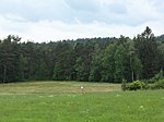
Moor forest near Kirchl |
|
NSG-00180.01 WDPA: 82180 |
Freyung-Grafenau district | ⊙ | 7.90 | 1983 | ||||
|
Upper Ilz |

|
NSG-00535.01 WDPA: 164864 |
Freyung-Grafenau , Passau | Freyung-Grafenau district 286.38 ha, Passau district 81.42 ha | ⊙ | 367.80 | 1997 | |||
|
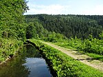
Saußbachleite |
|
NSG-00025.01 WDPA: 82501 |
Freyung-Grafenau district | ⊙ | 20.47 | 1939 | ||||
| Jungle on the Dreisessel |
NSG-00003.01 WDPA: 82763 |
Freyung-Grafenau district |
Neureichenau remains of the primeval forest. |
⊙ | 3.80 | 1938 | ||||
|
Gusset felt |

|
NSG-00017.01 WDPA: 82966 |
Freyung-Grafenau district |
Philippsreut |
⊙ | 6.45 | 1939
|
|||
|
Altlaufsenke between the outer Mühlgraben and Kühmoos |

|
NSG-00263.01 WDPA: 162126 |
Deggendorf district | ⊙ | 0.77 | 1985 | ||||
|
Danube Old Water State Pile |

|
NSG-00196.01 WDPA: 81537 |
Deggendorf district | ⊙ | 57.90 | 1994 | ||||
|
Donaualtwasser Winzerer Letten |

|
NSG-00330.01 WDPA: 162779 |
Deggendorf district | ⊙ | 62.23 | 1983 | ||||
|
Forchenhügel and Moosleiten |

|
NSG-00741.01 WDPA: 389591 |
District of Deggendorf , Passau | LK Deggendorf 94.06 ha, LK Passau 60.15 ha | ⊙ | 154.21 | 2007 | |||
|
Hoiberhügel |

|
NSG-00741.02 WDPA: 389603 |
Deggendorf district | ⊙ | 90.04 | 2007 | ||||
|
Isar river at Neutiefenweg |

|
NSG-00210.01 WDPA: 163925 |
Deggendorf district | ⊙ | 36.91 | 1984 | ||||
|
Isar mouth |

|
NSG-00369.01 WDPA: 163929 |
Deggendorf district | ⊙ | 807.74 | 1990 | ||||
|
Runstwiesen and dead moss |

|
NSG-00568.01 WDPA: 319024 |
Deggendorf district | ⊙ | 149.43 | 2000 | ||||
|
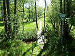
Rubble bog |
|
NSG-00189.01 WDPA: 82558 |
Deggendorf district | ⊙ | 15.75 | 1983 | ||||
|
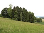
Stockhügel and Auerbach |
|
NSG-00741.04 WDPA: 389979 |
Deggendorf district | ⊙ | 6.02 | 2007 | ||||
|
Todtenau and surrounding meadows |

|
NSG-00188.01 WDPA: 82719 |
District of Deggendorf , District of Regen | LK Deggendorf 6.71 ha, LK Regen 138.11 ha | ⊙ | 144.82 | 1983 | |||
|
Gray heron colony near Kleinschwarzach |

|
NSG-00338.01 WDPA: 166072 |
District of Deggendorf , District of Straubing-Bogen | LK Deggendorf 27.29 ha, LK Straubing-Bogen 35.78 ha | ⊙ | 63.07 | 1988 | |||
|
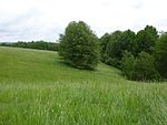
Deggendorf Kingdom of Heaven |
|
NSG-00752.01 WDPA: 555560671 |
Deggendorf district | ⊙ | 103,953 | 2012
|
||||
|
Isar cold water and burning area near Mamming |

|
NSG-00486.01 WDPA: 163926 |
Dingolfing-Landau district | ⊙ | 51.41 | 1994 | ||||
|
Isar floodplains near Goben |

|
NSG-00461.01 WDPA: 163927 |
Dingolfing-Landau district | ⊙ | 75.07 | 1994 | ||||
|
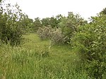
Lean locations near Rosenau |
|
NSG-00462.01 WDPA: 164536 |
Dingolfing-Landau district | ⊙ | 9.57 | 1994 | ||||
|
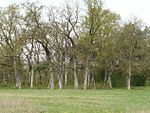
Rosenau |
|
NSG-00449.01 WDPA: 82439 |
Dingolfing-Landau district | ⊙ | 10.65 | 1993 | ||||
|
Vilstal near Marklkofen |

|
NSG-00220.01 WDPA: 166061 |
Dingolfing-Landau district | ⊙ | 171.94 | 1984 | ||||
| Walperstetten spring moor | NSG-00474.01 WDPA: 166164 |
Dingolfing-Landau district | ⊙ | 4.19 | 1994
|
|||||
|
Inland dunes near Siegenburg and Offenstetten |

|
NSG-00221.01 WDPA: 162422 |
District of Kelheim |
Siegenburg , Abensberg deposits of drift sand, deck sand and terrace sand. |
⊙ | 25.14 | 1984 | |||
|
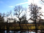
Goldau |
|
NSG-00203.01 WDPA: 163270 |
District of Kelheim |
Neustadt an der Donau oxbow lakes and reed beds. |
⊙ | 24.59 | 1984 | |||
| Hirschberg and Altmühlleiten | NSG-00503.01 WDPA: 163698 |
District of Kelheim | ⊙ | 374.98 | 1995 | |||||
|
Klamm and Kastlhang |

|
NSG-00088.01 WDPA: 82070 |
District of Kelheim | ⊙ | 250.15 | 1969 | ||||
| Ludwigshain |
NSG-00008.01 WDPA: 82117 |
District of Kelheim |
Hienheim part of the forest. |
⊙ | 2.16 | 1939 | ||||
|
Mattinger slopes |

|
NSG-00037.01 WDPA: 82144 |
District of Kelheim , District of Regensburg |
Matting Wooded slope with striking rock formations. Kelheim district 11.25 ha, Regensburg district 48.05 ha |
⊙ | 59.30 | 1941 | |||
| Niedermoor south of Niederleierndorf | NSG-00212.01 WDPA: 164808 |
District of Kelheim | ⊙ | 62.15 | 1984 | |||||
|
Sandharland Heath |

|
NSG-00090.01 WDPA: 82486 |
District of Kelheim | ⊙ | 11.12 | 1970 | ||||
|
Prunn Castle |

|
NSG-00075.01 WDPA: 82527 |
District of Kelheim |
Riedenburg The slopes of the Jura between the towns of Prunn and Pillhausen, which slopes down towards the Altmühl, with the center of "Schloss Prunn". |
⊙ | 77.46 | 1956 | |||
|
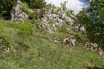
Schulerloch |
|
NSG-00087.01 WDPA: 82557 |
District of Kelheim |
Essing steppe heather forest, limestone beech forest and karst cave. |
⊙ | 12.67 | 1968 | |||
|
Sippenauer Moor |

|
NSG-00009.01 WDPA: 82597 |
District of Kelheim |
Mitterfecking Unique sulfur spring moor on the edge of the Alb. |
⊙ | 8.72 | 1939 | |||
|
Former NATO training ground in Siegenburg |

|
NSG-00755.01 | District of Kelheim |
Siegenburg |
⊙ | 273.71 | 2015 | |||
|
Weltenburger narrow |

|
NSG-00089.01 WDPA: 6977 |
District of Kelheim |
Kelheim The Danube Valley from Weltenburg to Kelheim. |
⊙ | 559.25 | 1970
|
|||
|
Former training ground in Landshut with Isarleite |

|
NSG-00593.01 WDPA: 318323 |
Landshut | ⊙ | 278.93 | 1982
|
||||
|
Bird sanctuary Middle Isar reservoirs |

|
NSG-00170.01 WDPA: 82804 |
Freising district , district of Landshut | Freising district 191.12 ha, Landshut district 399.13 ha | ⊙ | 590.25 | 1982-09-23
|
|||
| Audobel | NSG-00741.03 WDPA: 389576 |
District of Passau | ⊙ | 8.97 | 2007 | |||||
|
Halser Ilz loops |

|
NSG-00456.01 WDPA: 163505 |
Passau , District of Passau | City of Passau 54.16 ha, LK Passau 35.30 ha | ⊙ | 89.46 | 1993 | |||
|
Lower Inn |

|
NSG-00094.01 WDPA: 82753 |
District of Passau , district of Rottal-Inn | LK Passau 260.74 ha, LK Rottal-Inn 438.50 ha | ⊙ | 699.24 | 1972 | |||
|
Vils Engtal |

|
NSG-00533.01 WDPA: 166060 |
District of Passau |
Vilshofen on the Danube |
⊙ | 78.54 | 1997
|
|||
|
Donauleiten from Passau to Jochenstein |

|
NSG-00277.01 WDPA: 162782 |
Passau , District of Passau | City of Passau 17.65 ha, district of Passau 373.61 ha |
⊙ | 391.26 | 1987
|
|||
|
Bach learner Moos |

|
NSG-00626.01 WDPA: 318152 |
Regen district | ⊙ | 8.65 | 1993 | ||||
|
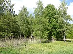
Birkenbruchwald Oed |
|
NSG-00214.01 WDPA: 162431 |
Regen district | ⊙ | 18.77 | 1984 | ||||
|
Großer Arbersee and Arberseewand |

|
NSG-00021.01 WDPA: 163348 |
Regen district | ⊙ | 148.57 | 1939 | ||||
|
Large stake and stake bolt St. Antonius stake |

|
NSG-00012.01 WDPA: 81769 |
Regen district | The pile , a ridge in the Bavarian Forest | ⊙ | 24.03 | 1939 | |||
|
Yard stake |

|
NSG-00013.01 WDPA: 81905 |
Regen district |
Allersdorf |
⊙ | 15.93 | 1939 | |||
|
Kiesau |

|
NSG-00448.01 WDPA: 164068 |
Regen district | ⊙ | 9.59 | 1993 | ||||
|
Moosbach stake |

|
NSG-00011.01 WDPA: 82182 |
Regen district |
Moosbach |
⊙ | 10.98 | 1939 | |||
|
Post at the ruins of Weißenstein |

|
NSG-00028.01 WDPA: 82319 |
Regen district | Weissenstein ruins | ⊙ | 4.61 | 1940 | |||
|
Riesloch |

|
NSG-00016.01 WDPA: 318989 |
Regen district |
Ground corn |
⊙ | 33.40 | 1939 | |||
|
Red felt |

|
NSG-00095.01 WDPA: 82449 |
Regen district | ⊙ | 12.88 | 1973 | ||||
|
Stockau meadows |

|
NSG-00134.01 WDPA: 82647 |
Regen district |
Zwiesel |
⊙ | 10.99 | 1980 | |||
|
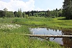
Stockwiesen near Schollenried |
|
NSG-00178.01 WDPA: 82650 |
Regen district | ⊙ | 12.33 | 1983
|
||||
|
Salzach estuary bird sanctuary |

|
NSG-00419.01 WDPA: 166076 |
Altötting , Rottal-Inn | LK Altötting 288.03 ha, LK Rottal-Inn 281.51 ha | ⊙ | 569.54 | 1992
|
|||
|
Öberauer Danube loop |

|
NSG-00288.01 WDPA: 164857 |
Straubing , District of Straubing-Bogen | City of Straubing 230.02 ha, LK Straubing-Bogen 60.57 ha |
⊙ | 290.59 | 1986
|
|||
|
Bogenberg |

|
NSG-00074.01 WDPA: 81433 |
District of Straubing-Bogen | ⊙ | 7.77 | 1998 | ||||
|
Brandmoss |

|
NSG-00137.01 WDPA: 81450 |
District of Straubing-Bogen | ⊙ | 26.17 | 1996 | ||||
|
Buchberg and Helmberg near Münster |

|
NSG-00555.01 WDPA: 318251 |
District of Straubing-Bogen | Lime clods in the Gäuboden south of Münster (Steinach) . Partial areas of Buchberg (2.95 ha) and Helmberg (approx. 12 ha). | ⊙ | 15.29 | 1994 | |||
|
Donauauen near Stadldorf |

|
NSG-00315.01 WDPA: 162781 |
District of Straubing-Bogen |
Kirchroth Near-natural sections of the Danube floodplain rich in old water with softwood floodplain vegetation in the upland area of the dike foreland. |
⊙ | 89.52 | 1992 | |||
|
Pond landscape near Wiesenfelden |

|
NSG-00622.01 WDPA: 319299 |
District of Straubing-Bogen | ⊙ | 77.05 | 2003
|
||||
| Legend for nature reserve | ||||||||||
See also
- List of landscape protection areas in Lower Bavaria
- List of FFH areas in Lower Bavaria
- List of EU bird protection areas in Lower Bavaria
- List of geotopes in Lower Bavaria
Individual evidence
- ↑ Green list of nature reserves in Lower Bavaria. (PDF; 87 kB) Bavarian State Office for the Environment, July 15, 2016, accessed on February 28, 2017 .
Web links
Commons : Nature reserves in Lower Bavaria - collection of images, videos and audio files