List of nature reserves in the Upper Palatinate
The list of nature reserves in the Upper Palatinate includes the following lists of nature reserves in Upper Palatinate districts and cities from the article namespace:
- List of nature reserves in the district of Amberg-Sulzbach
- List of nature reserves in the Cham district
- List of nature reserves in the Neumarkt district in the Upper Palatinate
- List of nature reserves in the Neustadt an der Waldnaab district
- List of nature reserves in the city of Regensburg
- List of nature reserves in the Regensburg district
- List of nature reserves in the Schwandorf district
- List of nature reserves in the Tirschenreuth district
The selection corresponds to the administrative region of Upper Palatinate . There are 63 nature reserves in the administrative district. The difference in the number of protected areas between the Green List and this list is due to negligible overlaps. The largest nature reserve in the district is the Regentalaue between Cham and Pösing.
| Surname | image | Identifier
|
circle | details | position | Area hectares |
date
|
|||
|---|---|---|---|---|---|---|---|---|---|---|
|
Mine fields Leonie |

|
NSG-00513.01 WDPA: 163390 |
Amberg-Sulzbach district |
Auerbach in the Upper Palatinate Visible subsidence and faults that can be traced back to the collapse of underground cavities. |
⊙ | 87.41 | 1996 | |||
|
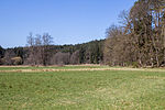
Pegnitzau between Ranna and Michelfeld |
|
NSG-00548.01 WDPA: 318939
|
Neuhaus , Auerbach , Pegnitz valley meadows. Area distribution: District of Nürnberger Land = 99.34ha District Amberg-Sulzbach = 79.83ha District Bayreuth = 19.24ha |
⊙ | 198.71 | 1998 | ||||
|
Schergenbuck with Neidstein Castle |

|
NSG-00096.01 WDPA: 82519 |
Amberg-Sulzbach district |
Etzelwang Culturally significant ridge with species-rich deciduous forest. |
⊙ | 17.65 | 1973 | |||
| Lower Pfistertal north of Vilshofen |
NSG-00357.01 WDPA: 166023 |
Amberg-Sulzbach district |
Vilshofen Large number of habitats found in the Middle Franconian Alb natural area. |
⊙ | 13.72 | 1989 | ||||
| Großfalz desert |
NSG-00308.01 WDPA: 166383 |
Amberg-Sulzbach district |
Grossenfalz Extremely species-rich habitat. |
⊙ | 6.91 | 1987
|
||||
|
hell |

|
NSG-00048.01 WDPA: 81919 |
District of Cham , District of Regensburg |
Rettenbach , Brennberg Typical stream of the Falkensteiner Vorwald forest . LK Cham 16.45 ha, LK Regensburg 2.25 ha |
⊙ | 18.70 | 1976 | |||
|
Small Arbersee |

|
NSG-00546.01 WDPA: 164117 |
Cham district |
Lohberg Artificial damming of a small natural lake for the purpose of the wood drift. |
⊙ | 410.59 | 1998 | |||
|
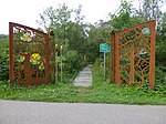
Moor area near Arrach |
|
NSG-00504.01 WDPA: 164674 |
Cham district |
Arrach moor area with different moor development stages. |
⊙ | 12.75 | 1995 | |||
|
Neubäuer pond |

|
NSG-00429.01 WDPA: 164784 |
Cham district |
Neubau shallow water zones and the adjacent forest area. |
⊙ | 34.33 | 1992 | |||
|
Schwärzenberg pile ruin |

|
NSG-00033.01 WDPA: 82321 |
Cham district |
Roding Pile quartz and castle ruins clearly visible. |
⊙ | 0.93 | 1941 | |||
|
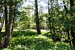
Ponnholzbachtal |
|
NSG-00392.01 WDPA: 165020 |
Cham district |
Arnschwang Significance for endangered, disturbance-sensitive bird species. |
⊙ | 30.18 | 1991 | |||
|
Rain flood plains between Cham and Pösing |

|
NSG-00746.01 WDPA: 555514017 |
Cham district |
Cham , Pemfling , Pösing , Roding river valley and the Regen floodplain area between Cham and Pösing. |
⊙ | 1,427.15 | 2010 | |||
|
Rain valley slopes between Kirchenrohrbach and Zenzing |

|
NSG-00497.01 WDPA: 165121 |
Cham district |
Walderbach , Roding Near-natural river landscape and the historical use of the slopes as coppice. |
⊙ | 22.46 | 1995 | |||
|
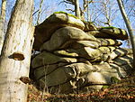
Schlossberg von Sattelpeilnstein |
|
NSG-00049.01 WDPA: 14480 |
Cham district |
Traitsching observation object for natural reforestation processes. |
⊙ | 6.80 | 1950 | |||
|
Falkenstein Castle Park |

|
NSG-00139.01 WDPA: 319077 |
Cham district |
Falkenstein Wooded granite cone with preserved castle complex. |
⊙ | 13.73 | 1981
|
|||
|
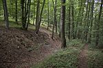
Night eaves at Pollanten |
|
NSG-00148.01 WDPA: 81261 |
District of Neumarkt in the Upper Palatinate |
Pollanten Numerous spring outlets and characteristic beech forest communities. |
⊙ | 23.70 | 1982 | |||
| Deusmauer Moor |
NSG-00130.01 WDPA: 81521 |
District of Neumarkt in the Upper Palatinate |
Deusmauer Extensive low moor complex on the Schwarzen Laaber . Significant because of the occurrence of rare plants as Ice Age relics. |
⊙ | 71.83 | 1952 | ||||
|
Neumarkt sand dunes |

|
NSG-00231.01 WDPA: 164798 |
District of Neumarkt in the Upper Palatinate |
Neumarkt in der Oberpfalz During the Würme Ice Age , sands from the Nuremberg Basin and a. faded into the Alb ascent and deposited there in mighty inland dunes . |
⊙ | 65.15 | 1985 | |||
|
Valley of the White Laaber near Deining |

|
NSG-00327.01 WDPA: 165813 |
District of Neumarkt in the Upper Palatinate |
Deining Richly structured valley section with a diverse range of habitats for animal and plant species bound to the wetlands. |
⊙ | 29.06 | 1987 | |||
| Schwarzachwiesen bird sanctuary near Freystadt |
NSG-00331.01 WDPA: 166077
|
Ebenried , Freystadt Large meadow complex with partially extensively used meadows, which provides an important habitat for sensitive, meadow-breeding bird species. District of Neumarkt in the Upper Palatinate : 20.83 ha, District of Roth : 21.41 ha |
⊙ | 42.24 | 1988 | |||||
| White Laaber near Waltersberg |
NSG-00193.01 WDPA: 82883 |
District of Neumarkt in the Upper Palatinate |
Waltersberg Diversely structured and near-natural valley section of the Weißen Laaber . As a wetland complex of great importance for endangered animal and plant species. |
⊙ | 35.92 | 1983 | ||||
|
Wolfsberg near Dietfurt |

|
NSG-00436.01 WDPA: 166352 |
District of Neumarkt in the Upper Palatinate |
Dietfurt an der Altmühl Diversity of locations with an extraordinarily high number of plant communities, especially of lean and dry locations, which z. T. are very rare. |
⊙ | 119.70 | 1993
|
|||
|
Dost |

|
NSG-00001.01 WDPA: 81549 |
Neustadt an der Waldnaab district |
Raft sea of blocks made of mighty, rounded granite blocks. |
⊙ | 11.23 | 1988 | |||
| Eschenbacher pond area |
NSG-00364.01 WDPA: 163001 |
Neustadt an der Waldnaab district |
Eschenbach in the Upper Palatinate Water-bound and amphibious communities. |
⊙ | 101.97 | 2003 | ||||
|
Etzenrichter Kirchberg |

|
NSG-00005.01 WDPA: 81635 |
Neustadt an der Waldnaab district |
Etzenricht Unwooded ridge that is crowned by a 14th century Protestant church. |
⊙ | 5.92 | 1938 | |||
|
Lerautal near Leuchtenberg |

|
NSG-00004.01 WDPA: 82089 |
Neustadt an der Waldnaab district |
Leuchtenberg valley section of the Lerau with adjacent forest areas. |
⊙ | 90.96 | 1938 | |||
| Gscheibte Loh natural forest reserve |
NSG-00138.01 WDPA: 82214 |
Neustadt an der Waldnaab district |
Manteler Forst Moist lowlands with peat storage facilities. |
⊙ | 108.96 | 1981 | ||||
| Moorland near Georgenberg |
NSG-00484.01 WDPA: 164809 |
Neustadt an der Waldnaab district |
Georgenberg Extensive wetland complex. |
⊙ | 63.20 | 1994 | ||||
|
Park stone |

|
NSG-00002.01 WDPA: 82305 |
Neustadt an der Waldnaab district |
Parkstein Volcanic cone formed in the Tertiary, in whose vent the lava slowly cooled down. |
⊙ | 2.82 | 1937 | |||
| Schießlweiher near Schwarzenbach |
NSG-00547.01 WDPA: 319065 |
Neustadt an der Waldnaab district |
Schwarzenbach part of an old chain of ponds. |
⊙ | 27.73 | 1998 | ||||
|
Schlossberg Flossenbürg |

|
NSG-00010.01 WDPA: 165419 |
Neustadt an der Waldnaab district |
Flossenbürg Steep granite dome with a wonderfully situated castle ruin. |
⊙ | 16.50 | 1939 | |||
| Peat fleas and Pfrentschwiese |
NSG-00310.01 WDPA: 165929 |
Neustadt an der Waldnaab district |
Eslarn habitats with their disturbance-sensitive range of species. |
⊙ | 172.06 | 1987 | ||||
|
Bird sanctuary Großer Rußweiher |

|
NSG-00058.01 WDPA: 82795 |
Neustadt an der Waldnaab district |
Eschenbach in the Upper Palatinate Water-bound and amphibious communities. |
⊙ | 137.15 | 1951 | |||
| Weiherhammer bird sanctuary |
NSG-00014.01 WDPA: 82810 |
Neustadt an der Waldnaab district |
Weiherhammer water surface and siltation zones. |
⊙ | 19.38 | 1939
|
||||
|
At the Keilstein |

|
NSG-00015.01 WDPA: 164046 |
regensburg |
Regensburg Important retreat area for extremely warm and drought-loving animal and plant species. |
⊙ | 46.40 | 1939 | |||
|
Brandlberg |

|
NSG-00510.01 WDPA: 162533 |
regensburg |
Regensburg Large, contiguous, semi-arid grassland with extensive hedge structures. |
⊙ | 40.77 | 1994 | |||
|
Southeastern Jura foothills near Regensburg |

|
NSG-00430.01 WDPA: 165789 |
regensburg |
Regensburg semi-arid lawn and warmth-loving fringe societies. |
⊙ | 24.75 | 1992
|
|||
| Draba rocks |
NSG-00043.01 WDPA: 81551 |
Regensburg district |
Nittendorf Occurrence of the yew tree. |
⊙ | 0.38 | 1937 | ||||
|
Eichenberg |

|
NSG-00230.01 WDPA: 162885 |
Regensburg district |
Kallmünz Valuable evidence of an extensive cultural landscape. |
⊙ | 32.58 | 1990 | |||
|
Gmünder Au |

|
NSG-00411.01 WDPA: 163267 |
Regensburg district |
Pfatter backwater area with large, extensively used meadows, ponds with silting zones and woody areas in the softwood meadows. |
⊙ | 181.02 | 1992 | |||
| Greifenberg and Waltenhofen slopes |
NSG-00391.01 WDPA: 163315 |
Regensburg district |
Pettendorf Warmth-loving fringe and forest communities with a high proportion of extremely warmth-loving plant and animal species. |
⊙ | 40.67 | 1991 | ||||
|
hell |

|
NSG-00048.01 WDPA: 81919 |
District of Cham , District of Regensburg |
Rettenbach , Brennberg Typical stream of the Falkensteiner Vorwald forest . LK Cham 16.45 ha, LK Regensburg 2.25 ha |
⊙ | 18.70 | 1976 | |||
| Hutberg near Fischbach |
NSG-00413.01 WDPA: 163834 |
Regensburg district |
Kallmünz South-exposed, largely unwooded slope area. |
⊙ | 19.92 | 1992 | ||||
|
Mattinger slopes |

|
NSG-00037.01 WDPA: 82144 |
District of Kelheim , District of Regensburg |
Matting Wooded slope with striking rock formations. Kelheim district 11.25 ha, Regensburg district 48.05 ha |
⊙ | 59.30 | 1941 | |||
|
Max-Schultze-Steig |

|
NSG-00018.01 WDPA: 82148 |
Regensburg district , Regensburg |
Regensburg Refuge for warmth-loving plant communities. City of Regensburg 7.44 ha, Regensburg district 5.01 ha |
⊙ | 12.45 | 1939 | |||
|
Pfatterer Au |

|
NSG-00394.01 WDPA: 164994 |
Regensburg district |
Pfatter river valley landscape of the Danube with the typical, diverse range of habitats. |
⊙ | 343.81 | 1991 | |||
|
Stöcklwörth |

|
NSG-00365.01 WDPA: 165751 |
Regensburg district |
Pfatter , Wörth an der Donau Habitat and retreat area for meadow-breeding bird species. |
⊙ | 67.65 | 1989 | |||
| Western Naab Valley slopes near Pielenhofen |
NSG-00412.01 WDPA: 319319 |
Regensburg district |
Brunn Typical forest communities on the slopes of the Jura valley. |
⊙ | 54.02 | 1992 | ||||
| Wuzenfelsen |
NSG-00356.01 WDPA: 166386 |
Regensburg district |
Hemau , Deuerling Natural mixed forest, with fringes and remnants of formerly used semi-arid grassland. |
⊙ | 13.96 | 1989
|
||||
|
Charlottenhofer pond area |

|
NSG-00343.01 WDPA: 162674 |
Schwandorf district |
Schwandorf , Wackersdorf , Schwarzenfeld , Schwarzach near Nabburg Remnants of an old pond area. |
⊙ | 861.66 | 1988 | |||
|
Hirtlohweiher near Schwandorf |
|
NSG-00437.01 WDPA: 163701 |
Schwandorf district |
Schwandorf , Steinberg am See water surface in the center and extensive silting areas. |
⊙ | 64.17 | 1993 | |||
|
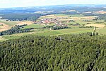
Stake |
|
NSG-00022.01 WDPA: 82318 |
Schwandorf district |
Bodenwöhr , Neunburg vorm Wald Quartz weathered strikingly out of the surrounding softer rock. |
⊙ | 172.60 | 1939 | |||
|
Prackendorfer and Kulzer Moos |

|
NSG-00328.01 WDPA: 165031 |
Schwandorf district |
Prackendorf high, transition and low moor areas with the corresponding vegetation spectrum. |
⊙ | 80.54 | 1987 | |||
|
Weichselbrunn pond and dry pine forest near Bodenwöhr |

|
NSG-00435.01 WDPA: 166198 |
Schwandorf district |
Bodenwöhr Mostly dry, lichen-rich sandy pine forests. |
⊙ | 106.56 | 1993 | |||
| Forest and heathland east of Bodenwöhr and Bruck id OPf. | NSG-00756.01 | Schwandorf district |
Bodenwöhr , Bruck Mosaic of warmth-loving sandy pine forests, dry fringing structures, dwarf shrub heaths, sandy grasslands and alternately moist hollows. |
⊙ | 283.6 | 2016
|
||||
| Föhrenbühl |
NSG-00131.01 WDPA: 81683 |
Tirschenreuth district |
Erbendorf Schütter of wooded serpentine ridges. |
⊙ | 33.73 | 1999 | ||||
| Great Teichelberg |
NSG-00507.01 WDPA: 163364 |
Tirschenreuth district |
Pechbrunn Graduated and richly structured mixed hardwood forests. |
⊙ | 118.94 | 1996 | ||||
|
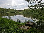
Hirschberg and Heidweiher in the Gabellohe |
|
NSG-00161.01 WDPA: 81887 |
Tirschenreuth district |
Immenreuth pond landscape of the Gabellohe. |
⊙ | 28.18 | 1982 | |||
| Langweiher Moor |
NSG-00269.01 WDPA: 164373 |
Tirschenreuth district |
Kastl transition moor |
⊙ | 15.45 | 1986 | ||||
|
Moor area near Bärnau |

|
NSG-00466.01 WDPA: 164675 |
Tirschenreuth district |
Bärnau Regionally characteristic wetland types. |
⊙ | 37.54 | 1994 | |||
|
Waldnaabtal |

|
NSG-00050.01 WDPA: 82857 |
District Neustadt an der Waldnaab , District Tirschenreuth |
Falkenberg , Windischeschenbach Boulder seas in the water. LK Neustadt an der Waldnaab 28.78 ha, LK Tirschenreuth 153.55 ha |
⊙ | 182.33 | 1950 | |||
| Wondrebaue |
NSG-00358.01 WDPA: 166359 |
Tirschenreuth district |
Tirschenreuth Natural valley section of the Wondreb. |
⊙ | 213.04 | 1989
|
||||
| Legend for nature reserve | ||||||||||
See also
- List of landscape protection areas in the Upper Palatinate
- List of FFH areas in the Upper Palatinate
- List of EU bird sanctuaries in the Upper Palatinate
- List of geotopes in the Upper Palatinate
Individual evidence
- ↑ www.regierung.oberpfalz.bayern.de, brief info
- ↑ Green list of nature reserves in the Upper Palatinate
Web links
Commons : Nature reserves in the Upper Palatinate - collection of images, videos and audio files