List of landscape protection areas in the Upper Palatinate
The list of landscape protection areas in the Upper Palatinate includes the following lists of landscape protection areas in Upper Palatinate counties and cities from the article namespace:
Counties and municipalities
- List of landscape protection areas in the district of Amberg-Sulzbach
- List of landscape protection areas in Amberg
- List of landscape protection areas in the Cham district
- List of landscape protection areas in the Neumarkt district in the Upper Palatinate
- List of landscape protection areas in the Neustadt an der Waldnaab district
- List of landscape protection areas in the city of Regensburg
- List of landscape protection areas in the district of Regensburg
- List of landscape protection areas in the district of Schwandorf
- List of landscape protection areas in the Tirschenreuth district
- List of landscape protection areas in Weiden in the Upper Palatinate
The selection corresponds to the administrative region of Upper Palatinate . There are 88 landscape protection areas in the administrative district (as of November 2018).
Notes on the information in the table
- Area name : Official designation of the protected area
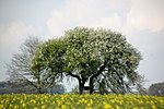
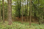
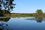
- Image / Commons : Image and link to other images from the protected area
- LSG-ID : Official number of the protected area
- WDPA-ID : Link to the World Database on Protected Areas database of the protected area
- Wikidata : Link to the Wikidata entry for the protected area
- Designation : Date of designation as a protected area
- Municipality (s) : Municipalities in which the protected area is located
- Location : geographical location
- Area : total area of the protected area in hectares
- Area share : Proportionate areas of the protected area in counties / municipalities, given in% of the total area
- Comment : Special features and comments
Except for the Position column , all columns can be sorted.
| Territory name | Image / Commons | LSG ID | WDPA ID | Wikidata | Expulsion | Parish (noun) | location | Area ha | Area share | comment |
|---|---|---|---|---|---|---|---|---|---|---|
| Protection strip along the B 85 new | LSG-00125.05 | 395591 | Q59654972 | 1965 | position | 153.1 | Amberg (99.9%) | |||
| On Mariahilfberg |
 |
LSG-00580.01 | 396130 | Q59655020 | 2004 | position | 476.26 | Amberg (99.5%) | ||
| Köferinger Tal, Köferinger Heide, Hirschwald and Vilstal south of Amberg |
 |
LSG-00125.01 | 395587 | Q59654968 | 1965 | position | 181.6 | Amberg (99.9%) | ||
| Krumbach | LSG-00590.01 | 396139 | Q59656940 | 1965 | position | 181.6 | Amberg (99.9%) | |||
| Erzberg | LSG-00598.01 | 555552626 | Q59655023 | 2009 | position | 163.38 | Amberg (100%) | |||
| Ammerbachtal |
 |
LSG-00604.01 | Q59656949 | 2015 | position | 183.22 | Amberg (100%) |
|
||
| Ammerthal |
 |
LSG-00125.02 | 395588 | Q59654969 | 1965 | position | 172.55 | District of Amberg-Sulzbach (100%) | ||
| Annaberg |
 |
LSG-00191.11 | 395668 | Q59654997 | 1970 | position | 11.27 | District of Amberg-Sulzbach (100%) | ||
| Breitenbrunn valley |
 |
LSG-00191.09 | 395666 | Q59654995 | 1970 | position | 70.26 | District of Amberg-Sulzbach (100%) | ||
| Breitenstein with Steinberg |
 |
LSG-00191.01 | 395660 | Q59654989 | 1970 | position | 105.38 | District of Amberg-Sulzbach (100%) | ||
| Buchberg |
 |
LSG-00105.06 | 395532 | Q59654940 | 1962 | position | 242.58 | District of Amberg-Sulzbach (100%) | ||
| Buchenberg between Hirschricht and Schwend | LSG-00191.04 | 395662 | Q59654991 | 1970 | position | 135.85 | District of Amberg-Sulzbach (100%) | |||
| Freihung - Seugast | LSG-00125.10 | 395596 | Q59654977 | 1965 | position | 440.74 | District of Amberg-Sulzbach (100%) | |||
| Freudenberg, Wutschdorf and Etsdorf |
 |
LSG-00125.03 | 395589 | Q59654970 | 1965 | position | 1617.12 | Amberg-Sulzbach district (99.9%) | ||
| Hahnbach - Frohnberg | LSG-00125.08 | 395594 | Q59654975 | 1965 | position | 33.95 | District of Amberg-Sulzbach (100%) | |||
| Hammerweiher | LSG-00125.09 | 395595 | Q59654976 | 1965 | position | 79.43 | Amberg-Sulzbach district (98.9%) | |||
| Hirschau - north |
 |
LSG-00125.11 | 395597 | Q59654978 | 1965 | position | 571.53 | District of Amberg-Sulzbach (100%) | ||
| Hirschau - south | LSG-00125.04 | 395590 | Q59654971 | 1965 | position | 1013.69 | District of Amberg-Sulzbach (100%) | |||
| Högenbachtal, Lichtenegg, Beselberg with western Birgland |
 |
LSG-00191.07 | 395665 | Q59654994 | 1970 | position | 2524.78 | Amberg-Sulzbach district (99.8%) | ||
| Katzenbergl with rupture area north of Sulzbach | LSG-00191.13 | 395670 | Q59655001 | 1970 | position | 128.77 | District of Amberg-Sulzbach (100%) | |||
| Köferinger Tal, Köferinger Heide, Hirschwald and Vilstal south of Amberg |
 |
LSG-00125.01 | 395587 | Q59654968 | 1965 | position | 8786.12 | Amberg-Sulzbach district (99.6%) | ||
| District ordinance on the protection of parts of the landscape in Markt Hohenburg and in the municipality of Adertshausen in the district of Amberg |
 |
LSG-00109.01 | 395537 | Q59654942 | 1963 | position | 541.55 | Amberg-Sulzbach district (98.7%) | ||
| Landscape strip along the B 85 |
 |
LSG-00191.03 | 395661 | Q59654990 | 1970 | position | 660.14 | District of Amberg-Sulzbach (100%) | ||
| Landscape strips along the Nuremberg - Amberg motorway | LSG-00191.14 | 395671 | Q59655002 | 1970 | position | 506.24 | Amberg-Sulzbach district (99.9%) | |||
| Lauterachtal with the valleys of the Hausener and Utzenhofener Bach and the Jura region between Kastl and Utzenhofen |
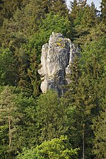 |
LSG-00121.09 | 395581 | Q59654964 | 1965 | position | 4682.01 | District of Amberg-Sulzbach (97.7%), District of Neumarkt in the Upper Palatinate (2.3%) | ||
| Lauterachtal and Vilstal (east side) |
 |
LSG-00119.11 | 395556 | Q59654957 | 1964 | position | 812.2 | District of Amberg-Sulzbach (70.4%), District of Schwandorf (28.3%) | ||
| LSG within the Franconian Switzerland Nature Park - Veldensteiner Forst (formerly protection zone) |
 |
LSG-00566.01 | 396116 | Q59655009 | 1995 | position | 11981.99 | Amberg-Sulzbach district (98.8%) | ||
| LSG within the Upper Palatinate Forest Nature Park (formerly protection zone) |
 |
LSG-00567.01 | 396117 | Q59655010 | 1995 | position | 55355.95 | District of Schwandorf (100%) | ||
| Upper Vils between Reisach and Irlbach | LSG-00125.06 | 395592 | Q59654973 | 1965 | position | 275.03 | District of Amberg-Sulzbach (100%) | |||
| Poppberg |
 |
LSG-00191.06 | 395664 | Q59654993 | 1970 | position | 71.09 | Amberg-Sulzbach district (99.8%) | ||
| Sackdillinger-Krottenseer Forest | LSG-00191.17 | 395672 | Q59655003 | 1970 | position | 306.37 | District of Amberg-Sulzbach (100%) | |||
| Protection strip along the B 85 new | LSG-00125.05 | 395591 | Q59654972 | 1965 | position | 153.1 | Amberg (99.9%) | |||
| Spittlberg | LSG-00191.12 | 395669 | Q59654999 | 1970 | position | 2.67 | District of Amberg-Sulzbach (100%) | |||
| Star stone | LSG-00191.10 | 395667 | Q59654996 | 1970 | position | 46.91 | District of Amberg-Sulzbach (100%) | |||
| Dry valley above Ammerthal with Hainsburg |
 |
LSG-00191.05 | 395663 | Q59654992 | 1970 | position | 918.67 | District of Amberg-Sulzbach (100%) | ||
| Ursensollen and Rängberg |
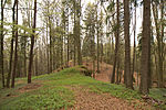 |
LSG-00125.13 | 395599 | Q59654980 | 1965 | position | 269.34 | District of Amberg-Sulzbach (100%) | ||
| Weißenberg (bird sanctuary) | LSG-00125.07 | 395593 | Q59654974 | 1965 | position | 4.07 | District of Amberg-Sulzbach (100%) | |||
| Zant |
 |
LSG-00125.14 | 395600 | Q59654981 | 1965 | position | 197.41 | District of Amberg-Sulzbach (100%) |
|
|
| Upper Bavarian Forest |
 |
LSG-00579.01 | 396128 | Q59655018 | 2004 | position | 132238.44 | District of Cham (100%) |
|
|
| Buchberg |
 |
LSG-00605.01 | Q59657004 | 2017 | position | 592.74 | District of Neumarkt in the Upper Palatinate (100%) | |||
| Federal motorways Berlin - Munich, Nuremberg - Amberg, and Nuremberg - Regensburg |
 |
LSG-00121.06 | 395578 | Q59654961 | 1965 | position | 629.15 | District of Neumarkt in the Upper Palatinate (99.9%) | ||
| Dietrichstein | LSG-00121.10 | 395582 | Q59654965 | 1965 | position | 281.82 | District of Neumarkt in the Upper Palatinate (100%) | |||
| Forellenbachtal | LSG-00104.03 | 395527 | Q59654935 | 1962 | position | 588.36 | District of Neumarkt in the Upper Palatinate (100%) | |||
| Gnadenberg |
 |
LSG-00121.04 | 395577 | Q59654960 | 1965 | position | 269.85 | District of Neumarkt in the Upper Palatinate (100%) | ||
| Habsberg |
 |
LSG-00104.10 | 395530 | Q59654938 | 1962 | position | 40.49 | District of Neumarkt in the Upper Palatinate (100%) | ||
| Haimburg - Wallerbuch - Ottenberg | LSG-00121.12 | 395583 | Q59654966 | 1965 | position | 818.75 | District of Neumarkt in the Upper Palatinate (100%) | |||
| Landscape protection area near Velburg |
 |
LSG-00104.09 | 395529 | Q59654937 | 1962 | position | 341.38 | District of Neumarkt in the Upper Palatinate (100%) | ||
| Parsberg landscape protection area |
 |
LSG-00104.07 | 395528 | Q59654936 | 1962 | position | 291.22 | District of Neumarkt in the Upper Palatinate (100%) | ||
| Lauterachtal |
 |
LSG-00104.02 | 395526 | Q59654934 | 1962 | position | 583.81 | District of Neumarkt in the Upper Palatinate (99.8%) | ||
| Lauterachtal and Vilstal (west side) |
 |
LSG-00119.12 | 395557 | Q59654958 | 1964 | position | 578.47 | District of Neumarkt in the Upper Palatinate (100%) | ||
| LSG Dillberg-Heinrichsberg |
 |
LSG-00553.01 | 396104 | Q59656819 | 2001 | position | 1916.46 | District of Neumarkt in the Upper Palatinate (99.9%) | ||
| LSG Rohrenstädter Bachtal |
 |
LSG-00578.01 | 396127 | Q59656833 | 2004 | position | 819.56 | District of Neumarkt in the Upper Palatinate (100%) | ||
| LSG Sindlbachtal |
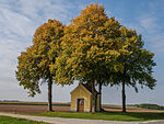 |
LSG-00577.01 | 396126 | Q59655015 | 2004 | position | 869.28 | District of Neumarkt in the Upper Palatinate (100%) | ||
| LSG Tyrolsberg |
 |
LSG-00557.01 | 396108 | Q59655006 | 2001 | position | 704.66 | District of Neumarkt in the Upper Palatinate (100%) | ||
| Pilsachtal, Wünnaubachtal and Pfeffershofener Bachtal |
 |
LSG-00592.01 | 396141 | Q59655022 | 2007 | position | 917.58 | District of Neumarkt in the Upper Palatinate (100%) | ||
| Castle hill with ruins of Helfenburg |
 |
LSG-00104.01 | 395525 | Q59654933 | 1962 | position | 28.77 | District of Neumarkt in the Upper Palatinate (100%) | ||
| Protection zone in the Altmühltal nature park |
 |
LSG-00565.01 | 396115 | Q23787649 | 1995 | position | 163135.05 | Ingolstadt (0.1%), District of Eichstätt (36.3%), District of Neuburg-Schrobenhausen (4.0%), District of Kelheim (8.7%), District of Neumarkt in der Oberpfalz (8.2%), District Regensburg (1.5%), Roth district (6.4%), Weißenburg-Gunzenhausen district (22.8%), Donau-Ries district (11.8%) | ||
| Staufer Berg |
 |
LSG-00575.01 | 396124 | Q59655014 | 2003 | position | 99.12 | District of Neumarkt in the Upper Palatinate (100%) | ||
| Sulzbürg with Schlüpfelberg |
 |
LSG-00121.01 | 395575 | Q59654959 | 1965 | position | 740.57 | District of Neumarkt in the Upper Palatinate (100%) | ||
| Traunfelder Bachtal |
 |
LSG-00121.14 | 395584 | Q59654967 | 1965 | position | 196.53 | District of Neumarkt in the Upper Palatinate (99.9%) | ||
| Voggenthal |
 |
LSG-00121.07 | 395579 | Q59654962 | 1965 | position | 213.64 | District of Neumarkt in the Upper Palatinate (100%) | ||
| Wolfstein |
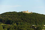 |
LSG-00121.08 | 395580 | Q59654963 | 1965 | position | 319.88 | District of Neumarkt in the Upper Palatinate (100%) |
|
|
| LSG within the Northern Upper Palatinate Forest Nature Park (formerly a protection zone) |
 |
LSG-00564.01 | 396114 | Q59655008 | 1997 | position | 44161.93 | Pastures in the Upper Palatinate (2.6%), Neustadt an der Waldnaab district (88.7%), Tirschenreuth district (8.6%) | ||
| LSG Oberpfälzer Hügelland in the western district of Neustadt adWaldnaab |
 |
LSG-00574.01 | 396123 | Q59655013 | 2003 | position | 36048.6 | Pastures in the Upper Palatinate (0.6%), Neustadt an der Waldnaab district (99.3%) |
|
|
| Protection of the Danube landscape with the Winzerer heights |
 |
LSG-00265.01 | 395743 | Q59655004 | 1973 | position | 667.88 | Regensburg (61.9%), Regensburg district (38.1%) | ||
| Ordinance on the landscape protection areas in the district of Regensburg |
 |
LSG-00558.01 | 396109 | Q59655007 | 1989 | position | 55971.7 | District of Regensburg (99.4%) |
|
|
| Castle hill of Burglengenfeld |
 |
LSG-00119.03 | 395549 | Q59654950 | 1964 | position | 25.96 | District of Schwandorf (100%) | ||
| Charlottenhofer Weiher |
 |
LSG-00119.10 | 395555 | Q59654956 | 1964 | position | 793.29 | District of Schwandorf (100%) | ||
| Dreifaltigkeitsberg - Miesberg - near Schwarzenfeld |
 |
LSG-00105.02 | 395531 | Q59654939 | 1962 | position | 15.08 | District of Schwandorf (100%) | ||
| Katzdorfer Weihergruppe |
 |
LSG-00119.01 | 395547 | Q59656468 | 1964 | position | 90.49 | District of Schwandorf (100%) | ||
| Kreuzberg from Burglengenfeld |
 |
LSG-00119.06 | 395551 | Q59654952 | 1964 | position | 19.29 | District of Schwandorf (100%) | ||
| Leonberger wood | LSG-00119.09 | 395554 | Q59654955 | 1964 | position | 125.78 | District of Schwandorf (99.9%) | |||
| LSG within the Upper Palatinate Forest Nature Park (formerly protection zone) |
 |
LSG-00567.01 | 396117 | Q59655010 | 1995 | position | 55355.95 | District of Schwandorf (100%) | ||
| Magdalenenthal | LSG-00105.07 | 395533 | Q59654941 | 1962 | position | 320.32 | District of Schwandorf (100%) | |||
| Upper Bavarian Forest |
 |
LSG-00579.02 | 396129 | Q59656890 | 2004 | position | 15935.84 | District of Schwandorf (100%) | ||
| Upper Naabtal: Münchshofer Berg with Brunnberg from Burglengenfeld |
 |
LSG-00119.07 | 395552 | Q59654953 | 1964 | position | 347.84 | District of Schwandorf (100%) | ||
| Upper Naab Valley: Naabeck - Strießendorf | LSG-00119.02 | 395548 | Q59654949 | 1964 | position | 98.6 | District of Schwandorf (100%) | |||
| Lower Naab Valley - east side | LSG-00119.05 | 395550 | Q59654951 | 1964 | position | 198.97 | District of Schwandorf (100%) | |||
| Lower Naab Valley: Field cross north of Zaar to Burglengenfeld (west side) |
 |
LSG-00119.08 | 395553 | Q59654954 | 1964 | position | 365.3 | District of Schwandorf (100%) |
|
|
| LSG within the Fichtelgebirge Nature Park (formerly protection zone) |
 |
LSG-00571.01 | 396121 | Q59655012 | 1990 | position | 6516.81 | Tirschenreuth district (99.9%) | ||
| LSG within the Steinwald Nature Park (formerly a protection zone) |
 |
LSG-00568.01 | 396118 | Q59655011 | 1987 | position | 13629.15 | District of Tirschenreuth (100%) | ||
| LSG Ostmarkstraße - northern part | LSG-00146.01 | 395618 | Q59654982 | 1967 | position | 522.82 | Tirschenreuth district (99.6%) | |||
| LSG Rothenbürger Weiher |
|
LSG-00117.01 | 395545 | Q59654946 | 1963 | position | 273.85 | District of Tirschenreuth (100%) | ||
| LSG Seidlersreuther Weiher | LSG-00110.01 | 395538 | Q59654944 | 1963 | position | 43.7 | District of Tirschenreuth (100%) |
|
||
| Field and forest area Almesbach - Im Ibelnest - Eichrangen - Fischerberg - Buchrangen plain - Hint. Neuried - Hl. Staude - Sauhübel |
 |
LSG-00174.01 | 395642 | Q59654983 | 1969 | position | 770.27 | Pastures in the Upper Palatinate (99.9%) |
|
|
| Protection strip flood canal | LSG-00174.06 | 395646 | Q59654988 | 1969 | position | 58.03 | Pastures in the Upper Palatinate (100%) | |||
| Ostmarkstrasse protective strip | LSG-00174.02 | 555560779 | Q59654984 | 2013 | position | 26.57 | Pastures in the Upper Palatinate (100%) | |||
| Schweinenaabniederung - Orthegelmühlbach | LSG-00174.04 | 395644 | Q59654986 | 1969 | position | 19.05 | Pastures in the Upper Palatinate (100%) | |||
| Schweinenaabniederung - Moosloh forest area - Sauerbachniederung |
 |
LSG-00174.05 | 395645 | Q59654987 | 1969 | position | 391.11 | Pastures in the Upper Palatinate (99.9%) | ||
| Waldnaabniederung | LSG-00174.03 | 395643 | Q59654985 | 1969 | position | 204.68 | Pastures in the Upper Palatinate (99.9%) |
See also
- List of nature reserves in the Upper Palatinate
- List of FFH areas in the Upper Palatinate
- List of EU bird sanctuaries in the Upper Palatinate
- List of geotopes in the Upper Palatinate
Individual evidence
- ↑ Green List, Landscape Protection Areas , status at the end of 2011, accessed on December 10, 2015.
Web links
Commons : Pictures on Wikimedia Commons - collection of pictures, videos and audio files