List of landscape protection areas in Middle Franconia
The list of landscape protection areas in Middle Franconia includes the following lists of landscape protection areas in Central Franconian counties and cities from the article namespace:
Counties and municipalities
- List of landscape protection areas in the district of Ansbach
- List of landscape protection areas in Ansbach
- List of landscape protection areas in the city of Erlangen
- List of landscape protection areas in the district of Erlangen-Höchstadt
- List of landscape protection areas in Fürth
- List of landscape protection areas in the Fürth district
- List of landscape protection areas in the district of Neustadt an der Aisch-Bad Windsheim
- List of landscape protection areas in the city of Nuremberg
- List of landscape protection areas in the district of Nürnberger Land
- List of landscape protection areas in the district of Roth
- List of landscape protection areas in Schwabach
- List of landscape protection areas in the Weißenburg-Gunzenhausen district
The selection corresponds to the administrative region Middle Franconia . There are 91 landscape protection areas in the administrative district (as of October 2018).
Notes on the information in the table
- Area name : Official designation of the protected area
- Image / Commons : Image and link to other images from the protected area
- LSG-ID : Official number of the protected area
- WDPA-ID : Link to the World Database on Protected Areas database of the protected area
- Wikidata : Link to the Wikidata entry for the protected area
- Designation : Date of designation as a protected area
- Municipality (s) : Municipalities in which the protected area is located
- Location : geographical location
- Area : total area of the protected area in hectares
- Area share : Proportionate areas of the protected area in counties / municipalities, given in% of the total area
- Comment : Special features and comments
Except for the Position column , all columns can be sorted.
| Territory name | Image / Commons | LSG ID | WDPA ID | Wikidata | Expulsion | Parish (noun) | location | Area ha | Area share | comment |
|---|---|---|---|---|---|---|---|---|---|---|
| LSG Hesselberg in the district of Ansbach |
 |
LSG-00372.01 | 395881 | Q59586305 | 1985 | position | 1475.52 | District of Ansbach (100%) | ||
| LSG within the Frankenhöhe Nature Park (formerly a protection zone) |
 |
LSG-00570.01 | 396120 | Q59586306 | 1988 | position | 76583.5 | Ansbach (2.3%), Ansbach district (70.5%), Neustadt an der Aisch district (27.1%) |
|
|
| Grünau | LSG-00340.01 | 395830 | Q59585102 | 2004 | position | 56.74 | Erlangen (99.8%) | |||
| Dechsendorfer pond area |
 |
LSG-00340.02 | 395831 | Q59585104 | 2004 | position | 169.83 | Erlangen (99.9%) | ||
| Mönau |
 |
LSG-00340.03 | 395832 | Q59585105 | 2004 | position | 554.53 | Erlangen (99.9%) | ||
| Dechsendorfer Lohe | LSG-00340.04 | 395833 | Q59585107 | 2004 | position | 67.18 | Erlangen (99.9%) | |||
| Seebachgrund |
 |
LSG-00340.05 | 395834 | Q59585109 | 2004 | position | 114.48 | Erlangen (99.9%) | ||
| Moorbachtal |
 |
LSG-00340.06 | 395835 | Q59585110 | 2004 | position | 49.55 | Erlangen (99.9%) | ||
| Regnitz Valley |
 |
LSG-00340.07 | 395836 | Q59585112 | 2004 | position | 927.48 | Erlangen (99.9%) | ||
| Meilwald with ice pit |
 |
LSG-00340.08 | 395837 | Q59585114 | 1983 | position | 226.38 | Erlangen (99.9%) | ||
| Schwabach Valley |
 |
LSG-00340.09 | 395838 | Q59585116 | 2004 | position | 66.71 | Erlangen (100%) | ||
| Steinforstgraben with Kosbacher ponds and permanent forest strips east of the Main-Danube Canal |
 |
LSG-00340.10 | 395839 | Q59585118 | 2004 | position | 142.12 | Erlangen (100%) | ||
| Bimbachtal |
 |
LSG-00340.11 | 395840 | Q59585119 | 2004 | position | 51.75 | Erlangen (100%) | ||
| Rittersbachtal |
 |
LSG-00340.12 | 395841 | Q59585121 | 2004 | position | 68.69 | Erlangen (100%) | ||
| Protective strips on both sides of the A3 federal motorway | LSG-00340.13 | 395842 | Q59585123 | 2004 | position | 52.27 | Erlangen (100%) | |||
| Monastery forest with Lobersweihern and the green corridor west of the Neuses district |
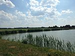 |
LSG-00340.14 | 395843 | Q59585124 | 2004 | position | 193.96 | Erlangen (100%) | ||
| Aurach Valley |
 |
LSG-00340.15 | 395844 | Q59585126 | 2004 | position | 192.81 | Erlangen (99.9%) | ||
| Römerreuth and the surrounding area | LSG-00340.16 | 395845 | Q59585128 | 1983 | position | 107.88 | Erlangen (99.9%) | |||
| Hat trench with angular field and wolf cloak |
 |
LSG-00340.17 | 395846 | Q59585129 | 1983 | position | 188.33 | Erlangen (99.9%) | ||
| Creek ditch |
 |
LSG-00340.18 | 395847 | Q59585131 | 1983 | position | 9.59 | Erlangen (100%) | ||
| Bruck pool with Langenauffeld |
 |
LSG-00340.19 | 395848 | Q59585133 | 1983 | position | 322.4 | Erlangen (100%) |
|
|
| Protection of parts of the landscape in the area of the district of Höchstadt an der Aisch, LSG Großdechsendorfer Weihergebiet |
 |
LSG-00222.01 | 395700 | Q59586183 | 1971 | position | 490.75 | Erlangen-Höchstadt district (100.0%) | ||
| LSG Bischofsmeilwald, protection of parts of the landscape in the area of the district of Erlangen (LSG in the area of the municipality of Bubenreuth) |
 |
LSG-00256.01 | 395734 | Q59586153 | 1973 | position | 141.56 | Erlangen-Höchstadt district (99.9%) | ||
| LSG Mohrhof | LSG-00362.01 | 395871 | Q59586154 | 1984 | position | 485.86 | District of Erlangen-Höchstadt (100%) | |||
| LSG Mönau |
 |
LSG-00393.01 | 395901 | Q59586235 | 1986 | position | 204.32 | Erlangen-Höchstadt district (99.9%) | ||
| Protection of landscape areas in the area of the city of Herzogenaurach | LSG-00399.01 | 395907 | Q59586156 | 1987 | position | 1598.55 | Erlangen-Höchstadt district (99.9%) | |||
| Buckenhof |
 |
LSG-00589.01 | 396138 | Q59586158 | 2006 | position | 60.07 | Erlangen (1.9%), Erlangen-Höchstadt district (98.1%) |
|
|
| Rednitz, Pegnitz and Regnitztal systems |
 |
LSG-00523.01 | 396044 | Q59584801 | 1998 | position | 696.48 | Fuerth (100.0%) | ||
| Mannhof forest area |
 |
LSG-00523.02 | 396045 | Q59584802 | 1998 | position | 136.26 | Fuerth (100.0%) | ||
| Trappenholz (forest at the Burgfarrnbach shooting range) | LSG-00523.03 | 396046 | Q59584803 | 1998 | position | 12.42 | Fuerth (100%) | |||
| Zenntal / Zennwald |
 |
LSG-00523.04 | 396047 | Q59584804 | 1998 | position | 184.38 | Fuerth (100%) | ||
| Heidestrasse valley train |
 |
LSG-00523.05 | 396048 | Q59584806 | 1998 | position | 9.01 | Fuerth (100%) | ||
| Poppenreuther Landgraben | LSG-00523.06 | 396049 | Q59584808 | 1998 | position | 4.81 | Fuerth (100%) | |||
| At the (Bucher) Landgraben |
 |
LSG-00523.07 | 396050 | Q59584809 | 1966 | position | 63.82 | Fuerth (100%) | ||
| Herboldshofer Landgraben |
 |
LSG-00523.08 | 396051 | Q59584810 | 1998 | position | 9.28 | Fuerth (100%) | ||
| Bucher Landgraben, Bisloher drainage ditch | LSG-00523.09 | 396052 | Q59584812 | 1998 | position | 10.93 | Fuerth (100%) | |||
| Scherbsgraben | LSG-00523.10 | 396053 | Q59584813 | 1998 | position | 11.64 | Fuerth (100%) | |||
| Farrnbachtal |
 |
LSG-00523.11 | 396054 | Q59584814 | 1998 | position | 131.38 | Fuerth (100%) | ||
| Michelbachtal |
 |
LSG-00523.12 | 396055 | Q59584815 | 1998 | position | 45.59 | Fuerth (100%) | ||
| City forest |
 |
LSG-00523.13 | 396056 | Q59584816 | 1998 | position | 443.28 | Fuerth (100%) |
|
|
| LSG stone |
|
LSG-00485.01 | 395993 | Q59584937 | 1994 | position | 696.7 | Fürth district (100.0%) | ||
| LSG Rossal |
|
LSG-00512.01 | 396023 | Q59584938 | 1997 | position | 1612.14 | Fürth district (100.0%) | ||
| LSG Obermichelbach-Puschendorf-Tuchenbach |
 |
LSG-00530.01 | 396063 | Q59584940 | 1999 | position | 493.96 | Fürth district (99.8%) | ||
| Ordinance on the Seukendorf-Veitsbronn landscape protection area |
 |
LSG-00539.01 | 396090 | Q59584942 | 2000 | position | 804.86 | Fürth district (100.0%) |
|
|
| Forest and pond landscapes in the eastern district | LSG-00502.01 | 396010 | Q59586336 | 1996 | position | 1747.09 | District Neustadt an der Aisch (100.0%) | |||
| A look | LSG-00502.02 | 396011 | Q59586337 | 1996 | position | 422.91 | District Neustadt an der Aisch (99.8%) | |||
| Valley grounds in the Iff and Gollachgau | LSG-00502.03 | 396012 | Q59586338 | 1996 | position | 588.29 | District Neustadt an der Aisch (100%) | |||
| Deciduous forests south of Uffenheim | LSG-00502.04 | 396013 | Q59586339 | 1996 | position | 1009.76 | District Neustadt an der Aisch (100.0%) | |||
| LSG within the Steigerwald Nature Park (formerly a protection zone) |
 |
LSG-00569.01 | 396119 | Q59586157 | 1988 | position | 88558.46 | Bamberg district (20.3%), Erlangen-Höchstadt district (3.6%), Neustadt an der Aisch district (38.4%), Haßberge district (17.0%), Kitzingen district (14.0%), District of Schweinfurt (6.7%) |
|
|
| Royal court |
 |
LSG-00536.01 | 396069 | Q59527015 | 2000 | position | 823.47 | Nuremberg (99.9%) | ||
| Fischbach |
 |
LSG-00536.02 | 396070 | Q59527016 | 2000 | position | 55.62 | Nuremberg (99.7%) | ||
| Worzeldorfer Berg - Glasersberg |
 |
LSG-00536.03 | 396071 | Q59527019 | 2000 | position | 57.02 | Nuremberg (99.6%) | ||
| Rednitztal - middle |
|
LSG-00536.04 | 396072 | Q59527021 | 2000 | position | 280.75 | Nuremberg (99.7%) | ||
| Pegnitztal East |
 |
LSG-00536.05 | 396073 | Q59527022 | 2000 | position | 261.16 | Nuremberg (99.9%) | ||
| Wöhrder See |
 |
LSG-00536.06 | 396074 | Q59527570 | 2000 | position | 115.22 | Nuremberg (100%) | ||
| Pegnitztal West |
 |
LSG-00536.07 | 396075 | Q59527026 | 2000 | position | 59.38 | Nuremberg (100%) | ||
| Eichenwaldgraben - Stockweiher |
 |
LSG-00536.08 | 396076 | Q59527027 | 2000 | position | 343.32 | Nuremberg (100%) | ||
| Holzheim |
|
LSG-00536.09 | 396077 | Q59527028 | 2000 | position | 79.87 | Nuremberg (99.7%) | ||
| Rednitz Valley - North | LSG-00536.10 | 396078 | Q59527030 | 2000 | position | 41.39 | Nuremberg (99.6%) | |||
| Brunn - net stall |
 |
LSG-00536.11 | 396079 | Q59527031 | 2000 | position | 310.4 | Nuremberg (99.8%) | ||
| Pearwood |
 |
LSG-00536.12 | 396080 | Q59527033 | 2000 | position | 30.4 | Nuremberg (99.4%) | ||
| Gründlachtal - east |
 |
LSG-00536.13 | 396081 | Q59527035 | 2000 | position | 352.47 | Nuremberg (99.8%) | ||
| Kraftshofer forest |
 |
LSG-00536.14 | 396082 | Q59528003 | 2000 | position | 356.56 | Nuremberg (99.3%) | ||
| Tiefgraben and Kohlbuck |
 |
LSG-00536.15 | 396083 | Q59527039 | 2000 | position | 119.61 | Nuremberg (99.9%) | ||
| Schmausenbuck |
 |
LSG-00536.16 | 396084 | Q59528120 | 2000 | position | 134.36 | Nuremberg (99.9%) | ||
| Rednitz Valley - South |
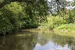 |
LSG-00536.17 | 396085 | Q59527042 | 2000 | position | 261.97 | Nuremberg (99.7%) | ||
| Kornburg |
 |
LSG-00536.18 | 396086 | Q59527045 | 2000 | position | 265.18 | Nuremberg (99.8%) | ||
| Long water |
 |
LSG-00536.19 | 396087 | Q59527047 | 2000 | position | 460.36 | Nuremberg (99.9%) |
|
|
| LSG Nuschelberg |
|
LSG-00190.01 | 395659 | Q59524568 | 1970 | position | 533.28 | District of Nürnberger Land (100%) | ||
| Designation of the LSG Northern Jura |
 |
LSG-00543.01 | 396094 | Q59524756 | 2001 | position | 21886.84 | District of Nürnberger Land (100.0%) | ||
| Designation of the LSG Südlicher Jura with Moritzberg and the surrounding area |
 |
LSG-00544.01 | 396095 | Q59525703 | 2001 | position | 16637.46 | District of Nürnberger Land (100.0%) | ||
| LSG Pegnitzaue Schwaig |
 |
LSG-00576.01 | 396125 | Q59526170 | 2002 | position | 169.73 | District of Nürnberger Land (100.0%) | ||
| LSG Rückersdorf |
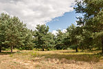 |
LSG-00583.01 | 396133 | Q59525859 | 2005 | position | 158.68 | District of Nürnberger Land (100%) | ||
| Schwarzachtal with side valleys |
 |
LSG-00587.01 | 396136 | Q59525860 | 2006 | position | 3990.64 | District of Nürnberger Land (100.0%) |
|
|
| Protection of the landscape in the area of the district of Roth - southern Central Franconian Basin west of the Swabian Rezat and the Rednitz with Spalter Hügelland, Abenberger Hügelgruppe and Heidenberg (LSG West) |
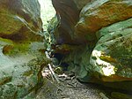 |
LSG-00427.01 | 395935 | Q25340132 | 1989 | position | 14546.56 | District of Roth (100.0%) | ||
| Protection of the landscape in the area of the district of Roth - Southern Central Franconian Basin east of the Swabian Rezat and the Rednitz with the foreland of the Middle Franconian Alb (LSG Ost) |
 |
LSG-00428.01 | 395936 | Q25340133 | 1989 | position | 25348.33 | District of Roth (100.0%) |
|
|
| Landscape protection ordinance for the former training ground of the US Army (LSchV-US Army) |
|
LSG-00508.01 | 396019 | Q59533536 | 1997 | position | 37.99 | Schwabach (100%) | ||
| Upper Schwabachtal with Nadlersbach and Mittelbach |
|
LSG-00517.01 | 396028 | Q59533538 | 1998 | position | 611.28 | Schwabach (100.0%) | ||
| eastern section of the west-east facing valley floor Pointwiesen |
|
LSG-00517.02 | 396029 | Q59533655 | 1998 | position | 17.74 | Schwabach (100%) | ||
| Confluence of Rednitz and Schwabach |
|
LSG-00517.03 | 396030 | Q59533540 | 1998 | position | 327.78 | Schwabach (99.9%) | ||
| Area south of the built-up area of the Obermainbach district and the road from Obermainbach to Walpersdorf |
|
LSG-00517.04 | 396031 | Q59533542 | 1998 | position | 121.23 | Schwabach (99.9%) | ||
| Maisenlach forest area |
|
LSG-00517.05 | 396032 | Q59533543 | 1998 | position | 223.93 | Schwabach (100%) | ||
| The valley floor along Rittersbacher Straße and in the Steigäcker area |
|
LSG-00517.06 | 396033 | Q59533544 | 1998 | position | 26.19 | Schwabach (100%) | ||
| Volkachtal between the city limits and the built-up area of the Unterreichenbach district |
|
LSG-00517.07 | 396034 | Q59533545 | 1998 | position | 76.63 | Schwabach (100%) | ||
| middle section of the Schwabach valley |
|
LSG-00517.08 | 396035 | Q59533548 | 1998 | position | 20.84 | Schwabach (100%) | ||
| western section of the west-east facing valley floor Pointwiesen |
|
LSG-00517.09 | 396036 | Q59533934 | 1998 | position | 7.12 | Schwabach (100%) | ||
| Northern section of the Rednitz valley |
|
LSG-00517.10 | 396037 | Q59533551 | 1998 | position | 93.81 | Schwabach (100.0%) | ||
| In the Kappelberg and Ellbogental area | LSG-00517.11 | 396038 | Q59534011 | 1998 | position | 89.68 | Schwabach (100%) |
|
||
| Protection of parts of the landscape (Landscape Protection Ordinance) - Absberg southern slope |
 |
LSG-00469.01 | 395977 | Q25340079 | 1992 | Absberg | position | 16.4 | Weißenburg-Gunzenhausen district (100%) | |
| Protection of parts of the landscape (Landscape Protection Ordinance) - Kleiner Brombachsee |
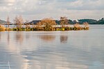 |
LSG-00526.01 | 396059 | Q25340032 | 1998 | Absberg, Pfofeld | position | 255.23 | Weißenburg-Gunzenhausen district (100%) | |
| Protection zone in the Altmühltal nature park |
 |
LSG-00565.01 | 396115 | Q23787649 | 1995 | position | 163135.05 | Ingolstadt (0.1%), District of Eichstätt (36.3%), District of Neuburg-Schrobenhausen (4.0%), District of Kelheim (8.7%), District of Neumarkt in der Oberpfalz (8.2%), District Regensburg (1.5%), Roth district (6.4%), Weißenburg-Gunzenhausen district (22.8%), Donau-Ries district (11.8%)
%) |
See also
- List of nature reserves in Middle Franconia
- List of FFH areas in Middle Franconia
- List of EU bird protection areas in Middle Franconia
- List of geotopes in Middle Franconia
Individual evidence
- ↑ Green List, Landscape Protection Areas , accessed on November 21, 2015.
Web links
Commons : Pictures on Wikimedia Commons - collection of pictures, videos and audio files