List of geotopes in Middle Franconia
The list of geotopes in Middle Franconia automatically includes the following lists of geotopes in Middle Franconian counties and cities from the article namespace:
- List of geotopes in the district of Ansbach
- List of geotopes in the Erlangen-Höchstadt district
- List of geotopes in Fürth
- List of geotopes in the Fürth district
- List of geotopes in the district of Neustadt an der Aisch-Bad Windsheim
- List of geotopes in the district of Nürnberger Land
- List of geotopes in Nuremberg
- List of geotopes in the district of Roth
- List of geotopes in the Weißenburg-Gunzenhausen district
The selection corresponds to the administrative region Middle Franconia .
This list is incomplete. Around 3,400 geotopes are recorded in the Bavarian geotope register. The Bavarian State Office for the Environment (LfU) does not consider some geotopes suitable for publication on the Internet. For example, some objects are not safely accessible or may only be entered to a limited extent for other reasons.
| Surname | image | Geotope ID | Municipality / location | Geological unit of space | description | Area m² / extension m | geology | Digestion type | value | Protection status | comment |
|---|---|---|---|---|---|---|---|---|---|---|---|
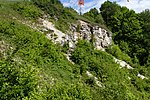
| Former Quarry on the Hesselberg NE of Gerolfingen |
 |
571A001 |
Gerolfingen position |
Southwest Albrand region | The quarry on the Hesselberg opens up the border between Malm Gamma and Beta and is rich in fossils. | 5000 100 × 50 |
Type: Layer sequence, Animal fossils Type: Limestone |
Quarry | precious | Landscape protection area, FFH area | Bavaria's most beautiful geotopes No. 28 |
| Quarry NE of Wittelshofen | 571A002 |
Wittelshofen position |
Southwest Albrand region | In the quarry, the layer sequence Posidonia slate / Jurensis marl / Opalinus Clay is exposed. The outcrop is fenced in to prevent the overexploitation of fossils. Information boards are set up. Fossil-rich Posidonia schist fragments can also be found outside the fence. | 10000 200 × 50 |
Type: Layer sequence, Animal fossils Type: Mudstone |
Clay pit / clay pit / marl pit | precious | Natural monument, landscape protection area | ||
| Former SSE quarry in Illenschwang | 571A003 |
Wittelshofen position |
Southwest Albrand region | Former quarry on the edge of a rubble dump that opens up the border between ariet sandstone and angulate sandstone . The Angulate sandstone here is rich in rounded concretions that are locally called Swedish spheres. | 1200 40 × 30 |
Type: Layer sequence Type: Sandstone |
Quarry | precious | Natural monument | ||
| Former Quarry SE from Wilburgstetten | 571A004 |
Weiltingen position |
Southwest Albrand region | Former break in ariet sandstone, today almost completely overgrown. | 10000 100 × 100 |
Type: Rock Type: Sandstone |
Quarry | precious | Natural monument | ||
| Former sand pit NE von Winden | 571A005 |
Leutershausen position |
Sandstone Keuper Region | Former sand pit near Winds , on the outcrop wall of which sedimentary structures in the bubble sandstone are clearly visible. | 40 20 × 2 |
Type: Rock Type: Sandstone |
Gravel pit / sand pit | significant | Landscape component, landscape protection area, nature park | ||
| Former quarry NW of Vorbach | 571A006 |
Rothenburg ob der Tauber position |
Eastern Franconian Plates | The quarry near Vorbach provides an insight into the rock sequence of the Upper Muschelkalks at the transition to the rectangular limestone facies. | 15000 150 × 100 |
Type: Rock Type: Limestone |
Quarry | precious | FFH area, bird sanctuary, nature park | ||
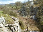
| Gypsum break SSE from Endsee |
 |
571A007 |
Steinsfeld position |
Gypsum Keuper Region | The lower myophoric layers are exposed in the gypsum quarry , it is one of the “100 most beautiful geotopes in Bavaria” . Marl banks and plaster layers follow over base gypsum (7 m). Haunschild described here galena Bank as light gray, fossil-free stone marl location with Kalkspatdrusen . | 16000 200 × 80 |
Type: Rock type, tunnels, carts / fields, folds / troughs / saddles Type: plaster, mudstone |
Quarry | significant | Landscape component, landscape protection area, FFH area | Bavaria's most beautiful geotopes No. 10 |
| Marl pit N of Cadolzhofen | 571A008 |
Windelsbach position |
Gypsum Keuper Region | In the marl pit north of Cadolzhofen , layers of estheria are exposed . The rock consists mainly of dark gray clays and marls with white plaster strings. | 3000 150 × 20 |
Type: Rock Type: Marlstone |
Clay pit / clay pit / marl pit | precious | Nature reserve, landscape protection area, FFH area | ||
| Former clay pit N of Burghausen | 571A009 |
Windelsbach position |
Gypsum Keuper Region | In the former clay pit north of Burghausen , mainly gray to greenish black clay stones and marls from the Estherian layers have been developed. Plaster layers are occasionally turned on in the lower area. | 3000 100 × 30 |
Type: Rock Type: Clay Marlstone |
Clay pit / clay pit / marl pit | significant | Landscape component, landscape protection area, nature park | ||
| Former Clay pit NE of Bellershausen | 571A010 |
Diebach position |
Gypsum Keuper Region | In the clay pit near Bellershausen , the border between myophoria and estheria layers is exposed. | 3000 100 × 30 |
Type: Layer sequence Type: Mudstone |
Clay pit / clay pit / marl pit | significant | Landscape protection area, nature park | ||
| Former clay pit N von Gastenfelden | 571A011 |
Book at the forest position |
Gypsum Keuper Region | In the former clay pit near Gastenfelden , a displacement of approx. 150 cm can be seen in the outcrop in the Lehrberg layers . | 4000 200 × 20 |
Type: Rock type, Fault type: Clay marl |
Slope crack / rock wall | precious | Nature reserve, landscape protection area, FFH area | ||
| Street outcrop N of Seitendorf | 571A012 |
Heilsbronn position |
Sandstone Keuper Region | The road outcrop near Seitendorf shows the type locality of the Seitendorf intermediate layers. According to Fuchs (1959) this is a sequence of bubble sandstone in which sandstone and Latvian layers alternate. | 150 50 × 3 |
Type: Standard / Reference Profile Type: Sandstone |
embankment | precious | Natural monument | ||
| Former marl pit SW of Auerbach | 571A013 |
Colmberg position |
Sandstone Keuper Region | In the overgrown part of the Auerbach marl pit , the "Frommetsfeldener fault" was previously exposed, where the Lehrberg layers bordered on sandstone reeds. Today only Lehrberg layers are recognizable, in 2010 only the northern part was preserved. The rest is completely overgrown and partly recultivated. | 40 20 × 2 |
Type: fault, rock type: marlstone |
Clay pit / clay pit / marl pit | precious | Natural monument, landscape protection area, nature park | ||
| Former sand pit NE of Rühlingstetten | 571A014 |
Wilburgstetten position |
Southwest Albrand region | Former sand pit near Rühlingstetten , in which white to reddish, mostly unsolidified sandstones with kaolinized feldspars from the Upper Castle sandstone are exposed . | 10000 100 × 100 |
Type: Rock Type: Sandstone |
Slope crack / rock wall | significant | Natural monument | ||
| Gorge SE from Schlierberg | 571A015 |
Ehingen position |
Southwest Albrand region | In the valley of the Kesselbach , the complete sequence of layers of the hettangium (psilonate layer, angulate sandstone) is exposed. The outcrops are easily accessible on the upper stream, but are partly covered by debris. The lower stream is heavily overgrown. Some of the outcrops are rich in fossils. | 15000 150 × 100 |
Type: Rock type, stream / river course Type: Sandstone |
Impact slope / river bed / stream profile | precious | Natural monument | ||
| Clay pit NNE by Schwand | 571A016 |
Leutershausen position |
Gypsum Keuper Region | In the clay pit near Schwand , the Lehrberg layers are open. They are up to 10 m thick here, and their benches are easily recognizable over a length of 100 m. The pit is used by the city of Leutershausen. | 2000 100 × 20 |
Type: Rock Type: Marlstone |
Clay pit / clay pit / marl pit | precious | Landscape protection area, nature park | ||
| Bubble sandstone outcrop at Rüdern | 571A017 |
Dietenhofen position |
Sandstone Keuper Region | In the case of Rüdern , inclined sandstone is exposed in alternation with clay stones. | 80 20 × 4 |
Type: sedimentary structures, rock type: sandstone, mudstone |
embankment | precious | Natural park | ||
| Dogger outcrop on Hesselberg NW of Wittelshofen | 571A018 |
Gerolfingen position |
Southwest Albrand region | In the middle part of the geological nature trail on the Hesselberg, a small dig opens up the approximately 1 m thick sand-lime brick of the Dogger Gamma, including the overlying and underlying layers. Information boards point out the fossils in the sand-lime brick. | 12 6 × 2 |
Type: Layer sequence Type: sandstone, marlstone |
Schurf | precious | Landscape protection area, FFH area | ||
| Castle sandstone outcrop NE of Fürnheim | 571A019 |
Wassertrüdingen position |
Southwest Albrand region | At the outcrop near Fürnheim you can see coarse-grained, sloping upper castle sandstone with numerous mudstone rubble. | 200 40 × 5 |
Type: sedimentary structures, rock type: sandstone, gravel |
embankment | precious | no protected area | ||
| Road exposure SSE from Oberoestheim | 571A021 |
Diebach position |
Gypsum Keuper Region | High road embankment near Oberoestheim , where layers of plaster of paris are exposed . Easily accessible for good excursions because of the parking lot opposite. | 250 50 × 5 |
Type: Rock Type: Marl, Gypsum |
embankment | precious | Landscape protection area, nature park | ||
| Gypsum karst spring Bottomless hole |
 |
571Q002 |
Diebach position |
Gypsum Keuper Region | The karst spring Bodenlos Loch SW of Unteroestheim lies in the area of the base gypsum. It is a 15 m wide spring pot with a depth of approx. 6 m. | 300 20 × 15 |
Type: Constriction Source Type: Plaster of Paris |
no information | precious | Natural monument, landscape protection area, nature park | Bavaria's most beautiful geotopes No. 40 |
| Hill slide W from Obergailnau |
 |
571R002 |
Wettringen position |
Gypsum Keuper Region | In February 1958 there was a landslide west of Obergailnau below the Schloßberg . An approximately 120 m long and 20 m wide floe made of sandstone reed slid about 10 m. The reed sandstone is strongly fissured, which is why seeping water soaked the layers of estheria and myophoria underneath, which then served as a sliding surface. | 7500 150 × 50 |
Type: landslide, rock type: claystone |
Slope crack / rock wall | precious | Natural monument, landscape protection area, FFH area | |
| Malmkalkscholle Turtelberg W from Ostheim | 571R003 |
Wassertrüdingen position |
Southwest Albrand region | Distinctive little knoll west of Ostheim from Malmkalk on Bunter Breccia . The limestone clod was thrown into this place by the Ries event . | 400 20 × 20 |
Type: Ejecta Material (Impact) Type: Limestone |
Slope crack / rock wall | especially valuable | no protected area | ||
| Doline N by Bettenfeld | 571R004 |
Rothenburg ob der Tauber position |
Eastern Franconian Plates | Ponordoline north of Bettenfeld (Rothenburg ob der Tauber) , which is only temporarily active. It is located in the Lower Keuper , in the subsoil there is karstified shell limestone . | 80 10 × 8 |
Type: sinkhole Type: mudstone, limestone |
no information | precious | Natural park |
|
|
| Shift level NE from Rathsberg |
 |
562R001 |
Bubenreuth position |
Northern Albrand region | Striking layer of the Rhätolias sandstone near Rathsberg . In the south the step breaks up into many small knolls and valleys. In the north exposure of the profile on a ten meter high rock face. Below is a rock fall with large sandstone blocks. | 200000 2000 × 100 |
Type: Layer level, layer sequence Type: sandstone, claystone |
Slope crack / rock wall | precious | Nature reserve, landscape protection area | |
| Former Sandstone quarries on the Hinteren Giesberg E von Dechsendorf |
 |
572A001 |
Mark position |
Sandstone Keuper Region | Several old quarries in the Middle Burgsandstein near Dechsendorf . The walls are partly used for climbing. | 250000 500 × 500 |
Type: Rock Type: Sandstone |
Quarry | significant | Landscape reserve, bird sanctuary | |
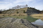
| Former clay pit N von Marloffstein |
 |
572A002 |
Marloffstein position |
Northern Albrand region | Disused clay pit in the Lias Delta with numerous fossils, e.g. B. Pyritized cephalopods . In Toneisensteinknollen also are barite , galena , pyrite and sphalerite find. | 112500 450 × 250 |
Type: Standard / Reference Profile, Animal Fossils Type: Clay Marlstone |
Clay pit / clay pit / marl pit | especially valuable | no protected area | |
| Exposure at the Wunderburg E von Marloffstein |
 |
572A003 |
Marloffstein position |
Northern Albrand region | Old quarry in the Rhaetian sandstone , with plant clays on its west side. In the upper part, ariet sandstone has been developed in places. | 700 70 × 10 |
Type: Layer sequence Type: Sandstone |
Quarry | significant | no protected area | |
| Former Sand pit W of Kleinseebach | 572A004 |
Möhrendorf position |
Sandstone Keuper Region | Former sand pit in the castle sandstone and its base. Loose sandstone with quartz pebbles and sandstone pebbles. | 37500 250 × 150 |
Type: Rock Type: Sand |
Gravel pit / sand pit | significant | Bird sanctuary | ||
| Lias outcrop in the Teufelsgraben S of Oedhof |
 |
572A005 |
Eckental position |
Northern Albrand region | Outcrop of rocks of the Lias Delta and Epsilon over a length of approx. 50 m. From bottom to top: approx. 1.3 m Lias Epsilon, the Amaltheenton Formation (Lias Delta), approx. 0.4 m marl slate with calcareous Siemensi tubers, three approx. 10 cm thick limestone banks separated by equally thick layers of marl slate , another 30 cm marl slate, 5 cm thick fossil-rich marl limestone (so-called belemnite battlefield ). | 150 50 × 3 |
Type: Layer sequence, Animal fossils Type: Mudstone, Marlstone |
Impact slope / river bed / stream profile | precious | no protected area | |
| Teufelsbadstube gorge in SW Kalchreuth |
 |
572R001 |
Kalchreuther Forst position |
Northern Albrand region | Gorge in the Rhätsandstein. Good outcrops at a waterfall, otherwise strongly overgrown. | 37500 500 × 75 |
Type: Canyon, Rock Type: Sandstone |
Impact slope / river bed / stream profile | significant | Part of the landscape, bird sanctuary | |
| Gründlach (stream bed) SW of Heroldsberg |
 |
572R002 |
Kalchreuther Forst position |
Sandstone Keuper Region | Meander , impact and sliding slopes of the green roof in its natural state. | 150,000 1000 × 150 |
Type: meander, stream / river course, impact slope Type: silt, sand |
Impact slope / river bed / stream profile | significant | Part of the landscape, bird sanctuary |
|
| Former Quarries in the Fürth city forest W of Fürth |
 |
563A001 |
Fürth position |
Sandstone Keuper Region | The Lower Burgsandstein is developed in the still available outcrops in the Nuremberg facies. This consists of medium to coarse-grained sandstones, some of which are only slightly resistant to weathering. The sometimes very thick sandstone banks show oblique layers and show signs of cutting. | 10000 100 × 100 |
Type: Rock Type: Sandstone |
Quarry | significant | Natural monument, landscape protection area, FFH area |
|
| Former clay pit E von Langenzenn | 573A001 |
Langenzenn position |
Sandstone Keuper Region | Stone marl banks and a red Letten parcel in the Lehrbergschichten are open-minded. There are several clay pits in the vicinity of the geotope, some of which are still in operation and some of which are in danger of being lost due to subsequent uses. During an inspection in 2010, the geotope was completely overgrown and the rock was only visible in erosion channels. | 2000 100 × 20 |
Type: Layer sequence Type: Clay marlstone |
Slope crack / rock wall | significant | no protected area | ||
| Former Quarries at Druidenstein SE von Keidenzell | 573A002 |
Langenzenn position |
Sandstone Keuper Region | Several historical sandstone quarries in the Middle Burgsandstein, which also contains uranium-containing active agents. Nearby, a memorial stone reminds of the former rock formation. | 1000 50 × 20 |
Type: Rock Type: Sandstone |
Quarry | significant | no protected area | ||
| Fault near Banderbach |

|
573A003 |
Zirndorf position |
Sandstone Keuper Region | The artificial embankment on the northeastern edge of the village opens up poorly consolidated clay and sandstones in the bubble sandstone. As a special feature, several fault areas can be seen here. A small floe was lifted about three meters between two closely spaced faults dipping northeast. An information board explains the geology at the outcrop. | 30 15 × 2 |
Type: fault, rock type: sandstone, mudstone |
embankment | precious | Natural monument |
|
| Eastern quarry WNW of Obernzenn |
 |
575A002 |
Illesheim position |
Gypsum Keuper Region | A red to brown reed sandstone with red iron stone lumps, pebbles and sediment structures is exposed. | 6250 125 × 50 |
Type: Rock type, Sedimentary structures Type: Sandstone |
Quarry | significant | Landscape protection area, FFH area, nature park | |
| Former Reed sand quarry NW of Obernesselbach | 575A003 |
Neustadt an der Aisch position |
Gypsum Keuper Region | It is one of the largest and best-preserved sandstone quarries in the district. It lies in the upper half of the reed sandstone layers, which are present here in the so-called flood formation. It shows many details that give clues to the formation of the reed sandstone (e.g. breaches with sliding folds). The quarry is also of historical value, as numerous buildings were built from the material of this quarry in the surrounding villages. | 32500 250 × 130 |
Type: sedimentary structures, quarry / pit, rock type: sandstone |
Quarry | precious | Landscape reserve, bird sanctuary, nature park | ||
| Former Reed sand quarry SW of Humprechtsau | 575A004 |
Market Nordheim position |
Gypsum Keuper Region | In this quarry one finds negatives of silicified primitive coniferous plants from the Mesozoic. The break lies in the lower half of the reed sandstone layers in the so-called flood formation. | 15000 300 × 50 |
Type: Vegetable Fossils, Quarry / Pit, Sedimentary Structures, Rock Type: Sandstone |
Quarry | especially valuable | Landscape reserve, bird sanctuary, nature park | ||
| Gypsum quarry on the Häfringsberg near Wüstphül | 575A006 |
Market Nordheim position |
Gypsum Keuper Region | The gypsum quarry on the Häfringsberg is still well preserved. It is a continuation of a drainage ditch of the fields further to the west (subrosion basin!). | 1500 50 × 30 |
Type: Rock, Trench, Canal Type: Gypsum |
Quarry | precious | FFH area, nature park | ||
| Former plaster quarry Katzenloch near Bad Windsheim |
 |
575A007 |
Bad Windsheim position |
Gypsum Keuper Region | The former break gives a good insight into the sequence of layers of the base plaster. The stone was also used to build houses, for example the town hall in Bad Windsheim was built from Bad Windsheim plaster, known under the trade name. The area is fenced. | 25000 200 × 125 |
Type: Standard / Reference Profile Type: Plaster of Paris |
Quarry | precious | Part of the landscape, nature park | |
| Exposure wall in the ravine S from Untertief | 575A008 |
Bad Windsheim position |
Gypsum Keuper Region | The outcrop lies in the middle part of the myophoric layers. The missing galena bank is represented by a 0.30 m thick slate of gypsum. | 400 40 × 10 |
Type: Layer sequence Type: claystone, plaster |
embankment | significant | Landscape protection area, nature park | ||
| Slope outcrop N of Unteresselbach | 575A009 |
Neustadt an der Aisch position |
Gypsum Keuper Region | In the slope outcrop near Unteresselbach, the border between the middle layers of estheria and the hanging sandstone reed is exposed. It is characterized by a breach layer of resident, mostly angular, fine sandstone and siltstone chunks. | 1500 75 × 20 |
Type: Layer sequence Type: claystone, sandstone |
embankment | significant | Natural park | ||
| Oyster reef near Langensteinach | 575A015 |
Uffenheim position |
Eastern Franconian Plates | The oyster reef in the Upper Main Muschelkalk is designated as a protected part of the landscape. It is mentioned as an excursion point in numerous publications. In the otherwise well-banked limestone there is an approximately 3 m wide and 2 m high reef body, which consists almost entirely of oyster shells (Placunopsis). The oysters, which hindered each other's growth due to the dense population, are only about 1 cm in size. | 400 40 × 10 |
Type: Standard / Reference Profile, Animal Fossils Type: Limestone |
Quarry | especially valuable | Part of the landscape, nature park | ||
| Former clay pit SE from Gunzendorf | 575A017 |
Emskirchen position |
Sandstone Keuper Region | The largely dilapidated outcrop opened up the upper part of the Lehrberschichten up to the first boundary bank of the bubble sandstone. | 1000 50 × 20 |
Type: Layer sequence Type: claystone, sandstone |
Clay pit / clay pit / marl pit | inferior | Landscape protection area | ||
| Former quarry NE of Scheinfeld | 575A018 |
Apparent field position |
Sandstone Keuper Region | The surrounding rock is mostly thin banked and z. Sometimes developed in a slate manner, sedimentary structures (oblique stratification) are also evident. It is a typical channel formation, as there are layers of estheria 75 m to the west at the level of the upper edge of the break! On the western wall of the quarry, coal-like layers with chopped plants are exposed. | 2500 50 × 50 |
Type: Rock type, Vegetable fossils, Sedimentary structures Type: Sandstone |
Quarry | precious | Natural park | ||
| Hohlweg and former quarry SE from Nenzenheim | 575A019 |
Sugenheim position |
Gypsum Keuper Region | Above the leveling of the Acrodus-Corbula horizon, the steep ascent through the Estheria layers begins at the level of the Judensee, which is covered by the channel filling of the reed sandstone. In the hollow path (quarry path) the typical features of the reed sandstone, such as ripple marks, oblique stratification and angle discordances, can be seen. | 50000 500 × 100 |
Type: Rock type, Sedimentary structures Type: Sandstone |
embankment | significant | Landscape protection area, FFH area, bird sanctuary | ||
| Former quarry W von Birnbaum | 575A021 |
Gerhardshofen position |
Sandstone Keuper Region | The heavily buried wall shows the lower part of the lower castle sandstone. Beyond the road, the baselets of the Lower Burgsandstein spread out. There is a small cave at the foot of the quarry wall. | 150 15 × 10 |
Type: Layer sequence, tunnel type: Sandstone |
Quarry | significant | no protected area | ||
| Street section SW of Uehlfeld | 575A022 |
Uehlfeld position |
Sandstone Keuper Region | This road exposure is suitable for placing the otherwise poorly exposed bubble sandstone under protection, as it is repeatedly released in the course of mowing work. | 500 50 × 10 |
Type: Rock Type: Sandstone |
embankment | significant | Natural park | ||
| NNE reed sand quarry in Oberaltenbernheim | 575A024 |
Obernzenn position |
Sandstone Keuper Region | Red to brown colored massive reed sandstone, which merges into the teaching layers (Ansbacher sandstone) in the hanging wall, is open. | 2000 100 × 20 |
Type: Layer sequence Type: sandstone, clay marlstone |
Quarry | precious | Landscape protection area, nature park | ||
| Former Gypsum break in Bad Windsheim Ost |
 |
575A026 |
Bad Windsheim position |
Gypsum Keuper Region | The disused gypsum quarry is located in the middle of a new development area and has been converted into my biotope. The dismantling walls are z. Some of them are in very good condition and show large folds of swelling. The easily accessible break offers a good excursion point. | 10000 200 × 50 |
Type: fold / trough / saddle, rock type: plaster of paris |
Quarry | precious | Natural park | |
| Exposure ENE from Weimersheim | 575A027 |
Ipsheim position |
Sandstone Keuper Region | Just below the steep slope of the plateau, bubble sandstone is exposed here, partly clayey and partly sandy. In addition to quartz pebbles, the sandstone layers also contain deformed pebbles of clay marl up to about 2 cm in size. The layer boundary to the underlying Lehrberg layers lies in the lowest, heavily decayed part of the profile. | 30 15 × 2 |
Type: sequence of layers, sediment structures Type: claystone, sandstone |
embankment | significant | no protected area | ||
| Former quarry Fingalshöhle WNW von Obernzenn |
 |
575G001 |
Illesheim position |
Gypsum Keuper Region | In 1806, the former quarry served as field quarters for an Imperial French regiment for several months. French inscriptions as well as names of Seckendorff families are carved on the walls. In the protected part of the landscape, red reed sandstone with red iron stone lumps and pebbles (gutter filling) are exposed. Opposite the road there is an old quarry in a wood with traces of mining and sediment structures in the sandstone. | 5000 100 × 50 |
Type: Quarry / Pit, Rock Type: Sandstone |
Quarry | especially valuable | Part of the landscape, ground monument | |
| Felsenkeller SSE by Marktbergel | 575G002 |
Marktbergel position |
Gypsum Keuper Region | In a small space there are a total of 5 entrances to underground storage rooms in the reed sandstone. Three of them are solidly closed with grids, one is open and can be walked around 15 m. The deepest is about half filled with mud, its portal bears the year 1863. | 90 30 × 3 |
Type: rock cellar, gallery type: sandstone |
Rock cellar | significant | Landscape protection area, FFH area, nature park | ||
| Gypsum cave Höllern S from Markt Nordheim |
 |
575H001 |
Market Nordheim position |
Gypsum Keuper Region | The corridors of the labyrinthine cave system are based on the fracture system in the base plaster and show the typical forms of the plaster solution. Depending on the groundwater level, the lower parts of the cave are more or less flooded. | 450 000 1250 × 360 |
Type: Karst horizontal cave, sinkhole Type: Gypsum |
cave | especially valuable | Nature reserve, landscape protection area, FFH area | |
| Source pot Walsbrunnen NE from Sontheim |
 |
575Q001 |
Illesheim position |
Gypsum Keuper Region | The source pot is located in the myophoric layers. Due to the surrounding agricultural use, the spring pot shows a strong growth of algae. | 28 7 × 4 |
Type: Constriction Source Type: Plaster of Paris |
no information | precious | Natural monument, landscape protection area, nature park | |
| Häfeleinsbrunnen N gypsum karst spring from Bad Windsheim |
 |
575Q002 |
Bad Windsheim position |
Gypsum Keuper Region | The small spring (a few l / s) rises from several water catchments in the immediate vicinity. The high electrical conductivity indicates a high proportion of dissolved gypsum in the water. | 6 6 × 1 |
Type: Constriction Source Type: Plaster of Paris |
no information | significant | Natural park | |
| Origin of the Aisch WSW from Illesheim |
 |
575Q003 |
Burgbernheim position |
Gypsum Keuper Region | The pooled spring at the resting place with the numerous side outlets in the vicinity represent a very important gypsum karst spring area. | 12000 300 × 40 |
Type: Constriction Source Type: Plaster of Paris |
no information | significant | no protected area | |
| Sandheidehügel WNW from Obernzenn |
 |
575R001 |
Illesheim position |
Gypsum Keuper Region | The sand heather hill is a hardy made of reed sandstone. At the east end of the hill this was also dismantled. | 2250 75 × 30 |
Type: Hardening Type: Sandstone |
Slope crack / rock wall | precious | Natural monument, landscape protection area, nature park | |
| Sinkhole at Häfringsberg SE von Wüstphül | 575R003 |
Market Nordheim position |
Gypsum Keuper Region | It is an active sinkhole over a karst system in the base gypsum. Several small sinkholes are spread over the hill. Smaller caves have been explored. | 100 10 × 10 |
Type: sinkhole Type: clay marlstone |
other information | precious | Natural monument, landscape protection area, FFH area | ||
| Külsheimer Hirtenhügel NE of Külsheim | 575R004 |
Ipsheim position |
Gypsum Keuper Region | Small, non-agricultural area. The wavy surface was created by leaching base plaster. | 20000 200 × 100 |
Type: subrosion landscape, sinkhole Type: plaster |
no information | significant | Natural monument, FFH area, nature park | ||
| Gypsum hill Sieben Buckel W from Krautostheim |
 |
575R005 |
Market Nordheim position |
Gypsum Keuper Region | The gypsum hills seven humps represent a sinkhole landscape in the base gypsum with numerous small caves. To the north is the gypsum cave Höllern, a branched cave system that lies just below the surface and traces the rift pattern in the base gypsum (approx. 360 × 1250 m area). | 150,000 500 × 300 |
Type: subrosion landscape, sinkhole, karst horizontal cave Type: plaster of paris |
other information | especially valuable | Nature reserve, landscape protection area, FFH area | |
| Sinkhole on Hundsücken NW of Berolzheim | 575R006 |
Bad Windsheim position |
Gypsum Keuper Region | The relatively steep active sinkhole is already mentioned by Emmet (1969). It lies in the middle of a field and is open, although there is at least a small amount of backfilling (corn chaff, broken bricks, etc.). | 64 8 × 8 |
Type: sinkhole Type: mudstone, plaster |
Sinkhole / sinkhole | significant | Natural park | ||
| Bach infiltration SE from Burgbernheim | 575R007 |
Burgbernheim position |
Gypsum Keuper Region | A small valley ends blindly in a large, approximately 10 m deep meadow hollow with a small ponordoline. Plaster of paris and clay stones of the myophoria layers are here. | 400 20 × 20 |
Type: Ponor Type: Plaster of Paris |
Slope crack / rock wall | precious | Landscape protection area, nature park | ||
| Ponordoline SW from Marktbergel | 575R008 |
Marktbergel position |
Gypsum Keuper Region | A wide inlet ditch with several subsidence fields leads into a deep ponordoline with pending plaster of paris. It is the largest of its kind in the area. The inflow is at times over 10 l / s. | 25000 250 × 100 |
Type: sinkhole, ponor Type: plaster of paris |
no information | precious | Landscape protection area, nature park | ||
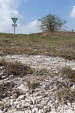
| Külsheimer gypsum hill SE from Erkenbrechtshofen |
 |
575R009 |
Bad Windsheim position |
Gypsum Keuper Region | The Külsheim gypsum hills protrude gently over the terrain and are arranged in one or two rows. | 62500 250 × 250 |
Type: Subrosion landscape Type: Plaster of Paris |
no information | significant | Nature reserve, FFH area, nature park | |
| Witness mountain landscape ENE from Erkenbrechtshofen |
 |
575R010 |
Bad Windsheim position |
Gypsum Keuper Region | The witness mountains of the Vorderer and Hinterer Berg protrude from the Windsheimer Bucht by approx. 60 m. The base lies in the myophoria layers, the top layers are formed by the estheria layers. The summit plateau of the west-east facing double summit consists of the Acrodus-Corbula bank. | 1050000 1500 × 700 |
Type: Inselberg / Zeugenberg, type of layers : claystone |
Rock slope / cliff | precious | Landscape protection area, nature park | |
| Spring pot Königsbrunnen N from Schwebheim | 575Q004 |
Burgbernheim position |
Gypsum Keuper Region | The source pot of the Königsbrunnen is located below the Schwarzenbuck near Schwebheim and is used to hold fish. Further to the east there are further, partly enclosed springs, including the Rangau spring, a medicinal and mineral spring around 650 m away, and the abandoned water protection area of Wiebelsheim. The spring water, which is already recognizable as having a high mineral content due to its characteristic color, comes from the myophoric layers, which explains increased sulfate concentrations. The Königsbrunnen feeds the heavily modified (straightened) flood ditch. Just a few meters west of the spring pot is a small rest area with a seating area. | 125 25 × 5 |
Type: Constriction Source Type: Plaster of Paris |
no information | significant | no protected area |
|
|
| Maximiliansgrotte E from Krottensee (show cave) |
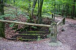 |
371H001 |
Neuhaus an der Pegnitz position |
Northern Franconian Alb | In the Franconian dolomite there is a widely branched floor system of corridors, chambers and halls. There are various sinter formations. Guided tours have been held here for the public since 1852. | 10400 130 × 80 |
Type: Karst shaft & horizontal cave Type: Dolomite stone |
cave | significant | Natural monument, FFH area, nature park | |
| Road cut below the town hall in Burgthann |
 |
574A002 |
Burgthann position |
Southwest Albrand region | Sandstones with a thickness of 4 m are exposed. The lower half is assigned to the Rhaetian transition layers, the hanging wall consists of ariet sandstone (Lias alpha 3). | 375 75 × 5 |
Type: Layer sequence Type: Sandstone |
embankment | significant | no protected area | |
| Former clay pit E from Reichenschwand |
 |
574A003 |
Reichenschwand position |
Northern Albrand region | The clay pit opens up 8 m of Amaltheenton. Clay iron lumps up to a size of a few decimeters are particularly abundant. | 14400 120 × 120 |
Type: Rock, Animal Fossils Type: Mudstone |
Clay pit / clay pit / marl pit | precious | Natural park | |
| Former quarry N von Vorra | 574A006 |
Forward position |
Northern Franconian Alb | In the old quarry you can see the transition from factory limestone to sponge stump as well as clay-filled karst crevices. | 30000 250 × 120 |
Type: Rock type, karst chimney, karst crevice Type: Limestone |
Quarry | significant | Landscape protection area, nature park | ||
| Former quarry NE of Schupf | 574A007 |
Happurg position |
Middle Franconian Alb | It is the only quarry in the district in which the fossil-rich Malm Gamma stratum facies is accessible. The break is used by sport shooters as a shooting range. | 7000 100 × 70 |
Type: Rock, Animal Fossils Type: Limestone |
Quarry | significant | Landscape protection area, FFH area | ||
| Quarry NE of Happurg |
 |
574A009 |
Happurg position |
Middle Franconian Alb | In this quarry, only the short east and north walls are accessible, as the remaining part is used by a rifle club. | 4000 100 × 40 |
Type: Rock Type: Limestone |
Quarry | inferior | Landscape protection area, FFH area | |
| Former quarry NW of Hartmannshof |
 |
574A010 |
Pommelsbrunn position |
Northern Franconian Alb | In the disused western part of the huge Hartmannshof quarry, there is a Malm standard profile. Resumption of mining is planned in the eastern part of the quarry. | 22500 300 × 75 |
Type: Standard / Reference Profile Type: Limestone |
Quarry | especially valuable | Natural park | |
| Former NNW quarry in Oberndorf | 574A011 |
Simmelsdorf position |
Northern Franconian Alb | The quarry is at risk from unauthorized backfilling. | 15000 300 × 50 |
Type: Rock Type: Limestone |
Quarry | significant | Landscape protection area, nature park | ||
| Embankment on the Ludwig-Danube-Main Canal E from Dörlbach |
 |
574A012 |
Burgthann position |
Southwest Albrand region | The canal embankments, especially at the canal bridge, give an insight into the sequence of layers of the Lower (Lias) to the Middle Jura (Dogger) from the Amaltheenton Formation to the Opalinus Clay Formation. At the time of the canal construction (1840–1841), this was the first major outcrop in these rocks in Franconia. Since then, it has been a classic reference profile. Many fossil finds have been made here, e. B. the 1.6 m long skull of the ichthyosaur Temnodontosaurus, which was found during the construction of the canal. After landslides in 2005 and 2008, the embankment was extensively renovated in 2010–2012. The fresh findings gave rise to a new scientific investigation. The embankment is on the Nuremberg - Kelheim cycle path, which runs along the canal here. | 15000 500 × 30 |
Type: standard / reference profile, animal fossils, layer sequence, sediment structures Type: clay marlstone |
embankment | especially valuable | Landscape protection area | |
| Former quarry SW of Regelsmühle | 574A013 |
Alfeld position |
Middle Franconian Alb | In the abandoned quarry, 2 reef pillars are exposed in the stratified limestone of the Lower Malm. The break has already been partially filled. | 12500 250 × 50 |
Type: sedimentary structures, rock type: limestone |
Quarry | precious | Landscape protection area | ||
| Former quarry in the SW of Oberrieden |
 |
574A014 |
Altdorf near Nuremberg position |
Middle Franconian Alb | The walls of the quarry have partly collapsed here, which makes access to the outcrops much easier. | 1500 50 × 30 |
Type: Rock Type: Limestone |
Quarry | inferior | Landscape protection area | |
| Sand pits and dunes SW of Weißenbrunn |
 |
574A016 |
Winkelhaid position |
Southwest Albrand region | The area west of Weißenbrunn is characterized by large deposits of Quaternary flying sands, some of which are underlain by terrace sands. The sands form elongated, mainly north-south running dunes. The landscape shows the typical vegetation of drift sand areas with sparse pine forests and blueberry and heather bushes. In the past, the sands were mined in many pits, today the area is designated as a nature reserve and partly as a water protection area. In the north and south there are two abandoned, very large sand pits. These pits, which are up to 40 meters deep, still have some free sand areas, but the internal sediment structures of the dunes and the underlay of the drift sand with terrace sand (with small pebbles) are no longer recognizable. The scenic area is accessible by several paths. A signposted cycle path leads past in the west (with a view of the southern sand pit), in the south and east the Franconian Dune Path leads through. | 1200000 1500 × 800 |
Type: rock type, dune type: sand |
Gravel pit / sand pit | precious | Nature reserve, bird sanctuary, water reserve | |
| Outcrop in the Steingraben W of Engelthal |
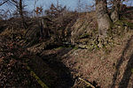 |
574A017 |
Engelthal position |
Southwest Albrand region | The limestone banks of the Lias Epsilon are exposed above the Amaltheenton. | 1 2 × 0 |
Type: stream / river course, type of layers : limestone |
Impact slope / river bed / stream profile | precious | Landscape protection area | |
| Former ESE quarry in Weißenbrunn |
 |
574A018 |
Leinburg position |
Middle Franconian Alb | In the abandoned quarry in the Kesselgrub corridor there is one of the few still generally accessible outcrops of sponge limestone from the Oxford strata in the southern part of the district. Due to decay, vegetation and partial backfilling, only a seven by three meter part of the outcrop wall of an upper excavation cable is preserved. In the area of the top, the formation of fragments caused by the weather can be seen. The outcrop is on a supraregional hiking trail (Frankenweg). | 2500 50 × 50 |
Type: Rock Type: Limestone |
Quarry | significant | Landscape protection area | |
| Felsenkeller S von Altdorf (Löwengrube near Prackenfels) |
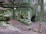 |
574G001 |
Altdorf near Nuremberg position |
Southwest Albrand region | Originally an overgrown quarry, from which the sandstone for the university buildings in Altdorf was broken in the 16th century, the place was rediscovered by students 100 years later and prepared for happy festivities. At the beginning of the 19th century, the University of Altdorf closed and Altdorf citizens built a beer cellar and a bowling alley as a gallery. The large rock cellar offers good outcrops in the Rhaetian sandstone, especially with charred woods. | 400 20 × 20 |
Type: Rock Cellar, Rock Type , Vegetable Fossils Type: Sandstone |
Rock cellar | precious | Landscape protection area | |
| Rhätschlucht Teufelskirche SE von Weinhof |
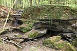 |
574G002 |
Altdorf near Nuremberg position |
Southwest Albrand region | The Teufelskirche is a Rhätsandstein gorge with a waterfall at the beginning of the gorge. The fall originated from the contact of the coarse-grained, weather-resistant arietes sandstones with the softer Rhätolias sandstones and clay horizons. Already in the years 1525, 1600 and 1720 mining on coal and silver (in pebbles) was attempted. Urlichs (1966) reported 6 m long charred tree trunks. | 35000 350 × 100 |
Type: Tunnels, Plant Fossils, Layer Sequence, Gorge, Minerals Type: Sandstone, Lignite |
Tunnel / gallery / shaft | especially valuable | Natural monument, landscape protection area, FFH area | |
| Former Heidenloch N silver sand mining from Weißenbrunn |
 |
574G003 |
Leinburg position |
Southwest Albrand region | In earlier centuries, the so-called silver sand (light-colored areas in the Dogger sandstone) was popular for scrubbing wooden floors and tables. The Heidenloch is the largest known mining site for this material. Access to the underground passages is blocked by a grille after the ceiling has been demolished (Fig. 4). The Heidenloch is bat winter quarters. | 450 30 × 15 |
Type: Stud Type: Sandstone |
Tunnel / gallery / shaft | precious | Landscape protection area | |
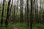
| Mine field at Moritzberg ENE von Diepersdorf |
 |
574G004 |
Röthenbach on the Pegnitz position |
Southwest Albrand region | The Moritzberg is a witness mountain separated from the Alb. From its base to the summit, the sequence of layers from the upper Keuper to the lower Malm is open. The summit is formed by a remnant of the Franconian Alb plateau, which has been heavily ransacked by quarries (gravel, scouring lime) and excavation pits (probably floor ore). | 20000 200 × 100 |
Type: Pinge / nfeld, Inselberg / Zeugenberg, type of layer sequence : Limestone |
Ping | precious | Landscape protection area | |
| Rock apartment in Thalheim (E 80) | 574G005 |
Happurg position |
Middle Franconian Alb | About four meters above the state road, between two residential buildings, there is a no longer used rock cellar carved into the Doggerstein. The property is under protection as a monument (monument no. D-5-74-128-60). | 10 5 × 2 |
Type: rock cellar Type: sandstone |
Rock cellar | significant | Monument protection | ||
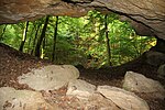
| Devil's Cave SW of Altdorf |
 |
574H001 |
Altdorf near Nuremberg position |
Southwest Albrand region | The cave (consisting of a single large room) was artificially expanded by extracting parlor sand and a thin coal seam. The regulation of fossil woods on the cave ceiling was examined by Ulrichs (1966). | 750 25 × 30 |
Type: eruption / weathering cave, plant fossils, sedimentary structures, tunnels, rock type: sandstone, lignite |
cave | precious | Landscape protection area | |
| Distlergrotte ENE by Finstermühle |
 |
574H003 |
Neuhaus an der Pegnitz position |
Northern Franconian Alb | From the entrance hall, two 90 m long corridor systems lead downwards. One corridor reaches a groundwater lake, another ends at a sandstone filling. In the winter months the entrance is closed to protect bats. | 450 90 × 5 |
Type: Karst horizontal cave, rock wall / slope Type: Dolomite stone |
cave | significant | Natural monument, landscape protection area, nature park | |
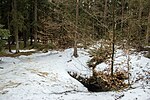
| Cave system The wind hole SSW of Kauerheim |
 |
574H005 |
Alfeld position |
Middle Franconian Alb | The length of the cave is approx. 2000 m, the depth approx. 52 m. In the wind hole there is a stone structure called the table. A documentation about this cave is currently being worked on. | 40000 1000 × 40 |
Type: Karst Shaft & Horizontal Cave Type: Limestone, Marlstone |
cave | precious | Natural monument, landscape protection area, FFH area | |
| Geißloch E from Krottensee |
 |
574H010 |
Neuhaus an der Pegnitz position |
Northern Franconian Alb | The shaft cave has a total length of 25 m and a maximum depth of 7 m. | 125 25 × 5 |
Type: Karst shaft & horizontal cave Type: Dolomite stone |
cave | significant | Landscape protection area, nature park | |
| Geißlochhöhle NNE by Münzinghof |
 |
574H011 |
Velden position |
Northern Franconian Alb | The shaft cave has a total length of 25 m and a maximum depth of 7 m. | 725 145 × 5 |
Type: Karst horizontal cave Type: Dolomite stone |
cave | significant | Soil monument, landscape protection area, FFH area | |
| Andreaskirche N of Rupprechtstegen |
 |
574H012 |
Velden position |
Northern Franconian Alb | The spacious rock hall has three entrances. | 220 11 × 20 |
Type: Karst horizontal cave Type: Dolomite stone |
cave | significant | Natural monument, landscape protection area, nature park | |
| Large Rohenloch (D18) NE of Viehhofen |
 |
574H013 |
Velden position |
Northern Franconian Alb | In the cave you can see ceiling and wall plungers, pressure pipe and leaching forms. A Pleistocene fauna and prehistoric finds have been excavated. | 335 67 × 5 |
Type: Karst horizontal cave Type: Dolomite stone |
cave | significant | Soil monument, landscape protection area, nature park | |
| Wind hole (A5) SSE from Großmeinfeld |
 |
574H015 |
Hartenstein position |
Northern Franconian Alb | A shaft 28 m deep and 10–12 m in diameter follows the 8 m deep collapse doline. This is often visited by cave tourists. | 150 15 × 10 |
Type: karst shaft cave, sinkhole Type: dolomite stone |
cave | precious | Landscape protection area, FFH area, nature park | |
| Appenloch (Michelhöhle, Friedrichshöhle) D150 SSW from Münzinghof |
 |
574H016 |
Velden position |
Northern Franconian Alb | The short horizontal cave in the folded limestone and dolomites of the middle Malm impresses with its imposing (15 m wide, 3 m high) entrance hall. Finds of large Pleistocene fauna were also made there. | 300 20 × 15 |
Type: Karst horizontal cave Type: Dolomite stone, limestone |
Slope crack / rock wall | significant | Soil monument, landscape protection area, nature park | |
| Kühloch (A67) NW of Hartenstein | 574H017 |
Hartenstein position |
Northern Franconian Alb | 25 m long passage cave with finds of Pleistocene fauna as well as prehistoric finds from the Neolithic and La Tène periods. | 38 25 × 2 |
Type: Karst horizontal cave Type: Dolomite stone |
Slope crack / rock wall | significant | Soil monument, landscape protection area, FFH area | ||
| Sophienquelle S from Grünsberg |
 |
574Q001 |
Altdorf near Nuremberg position |
Southwest Albrand region | The staircase around the Sophienquelle was built in 1720. The Sophienquelle is a typical example of a shift spring. It rises on the border between Feuerletten-Rhätolias, its discharge is approx. 4 l / s. | 100 10 × 10 |
Type: Layer Source Type: Sandstone, Mudstone |
Slope crack / rock wall | precious | Landscape protection area, FFH area | |
| Sprosselbrunnen SW from Schönberg |
 |
574Q002 |
Run at the Pegnitz position |
Southwest Albrand region | The Sprosselbrunnen (or Spratzelbrunnen) is a spring pouring up to several liters per second, which rises from adjacent sandstone just below the layer of the Rhätolia. In the coarse-grained sandstone, numerous round tubular holes with a diameter of 5 - 30 cm have been weathered over an area of about 2 × 2 m, some of which are water-flowing. | 5 5 × 1 |
Type: layer source, layer level, rock type: sandstone, claystone |
Slope crack / rock wall | precious | Landscape protection area | |
| Siebenquellental SW of Thalheim | 574Q003 |
Happurg position |
Middle Franconian Alb | In the Siebenquellental southwest of Thalheim there are numerous springs on the stratum boundary from the Malm to the underlying clayey Dogger. The source outlets are natural and scenic. There are even small natural outcrops of marl limestone from Malm Alpha. | 50 10 × 5 |
Type: film source type: Bricks, Kalkmergelstein |
other information | precious | Landscape protection area | ||
| Schwarzachschlucht SW from Schwarzenbruck |
 |
574R001 |
Schwarzenbruck position |
Sandstone Keuper Region | The Schwarzach Gorge offers the hiker typical outcrops of the Middle Burgsandstein. Scouring, erosion caves, rocky slopes and honeycomb-like weathering forms are striking. On the northern bank of the gorge, a hiking trail leads from Gsteinach over the Gustav-Adolfs-Höhle and Karlshöhle to the west. | 400000 2000 × 200 |
Type: Tafoni / honeycomb weathering, type of rock, bank / surf cave Type: sandstone |
Impact slope / river bed / stream profile | especially valuable | Nature reserve, FFH area, bird sanctuary | Bavaria's most beautiful geotopes No. 22 |
| Röthenbachklamm NW of Röthenbach |
 |
574R002 |
Winkelhaid position |
Southwest Albrand region | The Röthenbach Gorge (also popularly known as the Rumpelbach Gorge) is a Rhätsandstein gorge that is accessible to those looking for relaxation through hiking trails and resting places. At the entrance to the gorge designated as ND stands an old, half-decayed oak with a trunk circumference of 6.30 m. | 30000 300 × 100 |
Type: Canyon Type: Sandstone |
Impact slope / river bed / stream profile | significant | Natural monument, bird sanctuary | |
| NNE gorge from Sendelbach | 574R003 |
Ottensoo's position |
Southwest Albrand region | The Rhätschlucht gorge offers outcrops in the Rhaet-Lias transition layers, which are, however, partially covered by debris deposits. | 23000 460 × 50 |
Type: Canyon Type: Sandstone |
Impact slope / river bed / stream profile | significant | Landscape protection area | ||
| Wolfsschlucht NE from Wallersberg |
 |
574R004 |
Schwarzenbruck position |
Southwest Albrand region | A waterfall in the west forms the best end to the deep, small Rhätsandstein Gorge. | 12500 250 × 50 |
Type: Canyon Type: Sandstone |
Impact slope / river bed / stream profile | significant | Natural monument, landscape protection area, FFH area | |
| Bowl stone N by Fischbach |
 |
574R005 |
Laufamholzer Forst position |
Sandstone Keuper Region | The conspicuously weathered rock knoll made of middle castle sandstone is comparable to granite knolls weathered like wool sack. With the Celts these rocks had a cultic meaning. | 100 10 × 10 |
Type: Ridge Type: Sandstone |
Slope crack / rock wall | significant | Ground monument, bird sanctuary | |
| Castle sandstone cliffs in Rummelsberg |
 |
574R006 |
Schwarzenbruck position |
Southwest Albrand region | The hilltop gives an insight into the composition and structure of the Upper Burgsandstone. | 100 10 × 10 |
Type: Ridge Type: Sandstone |
Rock slope / cliff | significant | no protected area | |
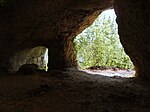
| Hohler Fels SE from Happurg |
 |
574R007 |
Happurg position |
Middle Franconian Alb | Stone Age cave finds were made on the Hohlen Fels. On the cliffs above the Malm Gamma, thick limestone of the Malm Delta (with marl slab) is exposed. Above the cave there is thick-banked dolomite with chert stones. | 14000 200 × 70 |
Type: rock wall / slope, karst horizontal cave Type: dolomite stone, limestone |
Slope crack / rock wall | precious | Soil monument, landscape protection area, FFH area | |
| Riffelfelsen E by Alfalter | 574R008 |
Forward position |
Northern Franconian Alb | The reef rock, divided by several vertical fissures, is often visited by climbers. | 2500 50 × 50 |
Type: Rock Tower / Needle Type: Limestone |
Slope crack / rock wall | significant | Natural monument, landscape protection area, FFH area | ||
| God's finger on Langenstein NW of Vorra |
 |
574R009 |
Forward position |
Northern Franconian Alb | The rugged rock tower, split in the upper part, is difficult to find on a wooded hilltop. It consists of very porous dolomite. | 25 5 × 5 |
Type: Rock tower / needle Type: Dolomite stone |
Slope crack / rock wall | significant | Natural monument, landscape protection area, nature park | |
| Sounding waterfall NNE from Haimendorf |
 |
574R011 |
Röthenbach on the Pegnitz position |
Southwest Albrand region | The Rhaetian transition layers are outstandingly open at the Klingenden Wasserfall. The hard sandstones form a layer on the edge of which the waterfall lies. | 75 15 × 5 |
Type: waterfall, layer sequence, layer level Type: sandstone, claystone |
Impact slope / river bed / stream profile | precious | no protected area | |
| Bastei at Zankelstein E from Pommelsbrunn |
 |
574R012 |
Pommelsbrunn position |
Northern Franconian Alb | On the south and south-east side of the Zankelstein, three rock towers protrude from the forest, which serve as popular observation rocks. | 400 20 × 20 |
Type: Group of rocks Type: Dolomite stone |
Slope crack / rock wall | significant | Natural monument, landscape protection area, FFH area | |
| Spurzelgrub rock group NW of Hofstetten |
 |
574R013 |
Pommelsbrunn position |
Middle Franconian Alb | Rock group in the massive Franconian dolomite with a spacious half cave. The partly massive, partly thick-banked dolomite traces a reef dome. | 70 7 × 10 |
Type: rock group, karst horizontal cave Type: dolomite stone |
Slope crack / rock wall | significant | Natural monument, ground monument, landscape protection area | |
| Düsselbacher Wand SE from Düsselbach |
 |
574R014 |
Forward position |
Northern Franconian Alb | The rock face is on the left slope of the Pegnitz. | 1500 50 × 30 |
Type: Rock Wall / Slope Type: Limestone |
Slope crack / rock wall | significant | Natural monument, ground monument, landscape protection area | |
| Enzendorfer Felsen E from Enzendorf | 574R018 |
Hartenstein position |
Northern Franconian Alb | Two high rocks protrude from the wooded area. The rock faces are popular with climbers. | 400 20 × 20 |
Type: Rock Wall / Slope Type: Limestone |
Slope crack / rock wall | significant | Natural monument, landscape protection area, FFH area | ||
| Jump stone (sole stone) NE of Fischbrunn | 574R020 |
Pommelsbrunn position |
Northern Franconian Alb | The reef dolomite protrudes from the Jura slope. | 100 10 × 10 |
Type: Rock tower / needle Type: Limestone, dolomite stone |
Slope crack / rock wall | significant | Natural monument, landscape protection area, nature park | ||
| Huberfelsen near Alfeld |
 |
574R021 |
Alfeld position |
Middle Franconian Alb | The group of three rocks dominates the landscape of Alfeld. | 1800 60 × 30 |
Type: Felsburg Type: Dolomite stone |
Slope crack / rock wall | significant | Natural monument | |
| Ponor Bachloch in Großengsee | 574R022 |
Simmelsdorf position |
Northern Franconian Alb | The ponor was used to drain the village. A corridor leading down to WNW connects to the three m deep Ponor shaft. | 4 2 × 2 |
Type: Ponor, karst horizontal cave Type: Dolomite stone |
cave | significant | Natural park | ||
| Felsburg Teufelskanzel WSW von Mittelburg |
 |
574R023 |
Happurg position |
Middle Franconian Alb | The chunky cliff has the shape of a pulpit. | 150 15 × 10 |
Type: Felsburg Type: Dolomite stone |
Slope crack / rock wall | significant | Natural monument, landscape protection area, FFH area | |
| Stream with limestone terrace W from Kainsbach |
 |
574R024 |
Happurg position |
Middle Franconian Alb | Small stream lined with tufa, which has formed mossy sintered terraces on a slope. | 16 4 × 4 |
Type: sintered terraces, streams / rivers Type: limestone, tufa |
no information | precious | Landscape protection area | |
| Stone channel W from Schrotsdorf |
 |
574R026 |
Offenhausen position |
Southwest Albrand region | On the northeast slope of the Buchenberg, a small stone channel has formed below a spring, directly on a supraregional hiking trail (Frankenweg). Their formation is based on abiogenic (pressure relief, temperature increase, carbon dioxide release to the ambient air) and biogenic (algae and moss get their carbon dioxide needs from the water, not from the atmosphere) precipitation of tufa. The feeding source rises in the border area of Dogger and Malm. The channel was damaged several times by vandalism. To protect them, a wooden walkway with a railing was made, and an information board explains the mechanism behind it. In addition to the original stone channel, which has fallen dry due to the damage, a new one is already being built. | 30 30 × 1 |
Type: Stone gutter Type: Tufa limestone |
other information | significant | Landscape protection area | |
| Stone channel SW from Raschbach |
 |
574R027 |
Altdorf near Nuremberg position |
Middle Franconian Alb | Approx. 500 m SW of Raschbach, one of the very rare stone channels has formed at one of the numerous sources of the stream of the same name. The ornate tone separates the groundwater bodies of Dogger and Malm and represents an important source horizon. The source is popularly known as the aster or Easter fountain. The formation of the stone channel is based on two factors. Abiogenic causes of the precipitation of tufa are pressure relief, temperature increase and the release of carbon dioxide in the area close to the source. Algae and moss do not meet their carbon dioxide requirements from the ambient air, but from the calcareous water (biogenic factors). After a few tens of meters, the lime content of the water has decreased so much that the separation of tufa comes to a standstill. Obviously, the water flow was interrupted at least temporarily, so that only a small part of the water flows over the stone channel, while a new watercourse has formed to the left of it, in which the precipitation of tufa is already starting. The stone channel is a protected part of the landscape and is under special protection. | 20 20 x 1 |
Type: Stone gutter Type: Tufa limestone |
no information | significant | Landscape component, landscape protection area |
|
| Sandstone rocks near the Nuremberg Imperial Castle |
 |
564A002 |
Nuremberg position |
Sandstone Keuper Region | The type locality of the widespread castle sandstone is at the Imperial Castle in Nuremberg. The castle sandstone is a fine to medium-grained sandstone. In addition to quartz grains, it contains a considerable proportion of feldspar. The building block of Nuremberg was once widely known. | 51000 170 × 300 |
Type: Type locality Type: Sandstone |
Slope crack / rock wall | precious | Ground monument | Bavaria's most beautiful geotopes No. 11 |
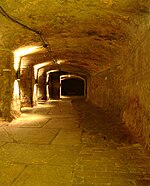
| Nuremberg rock cellar |
 |
564G001 |
Nuremberg position |
Sandstone Keuper Region | Not specified | 0 not specified |
Type: rock cellar Type: sandstone |
Rock cellar | precious | no protected area | |
| Historic sandstone quarries at Schmausenbuck E in Nuremberg |
 |
564G002 |
Nuremberg position |
Sandstone Keuper Region | There are extensive areas around the Schmausenbuck with numerous historical mining sites for castle sandstone. The sandstones were built in Nuremberg. Today they form elements that shape the landscape inside and outside the zoo. The geotope is under protection as a ground monument (monument no. D-5-6532-0558). | 150,000 500 × 300 |
Type: Quarry / Pit Type: Sandstone |
Quarry | precious | Soil monument, landscape protection area, FFH area |
|
| Historic stone quarries SE von Wernsbach |
 |
576A001 |
Georgensgmünd position |
Sandstone Keuper Region | The abandoned quarries near Wernsbach comprise the largest contiguous quarry area in the Upper Burgsandstein of the district. They provide impressive evidence of the importance of this natural stone in the construction industry. The year 1895 is engraved over a tunnel. The high break walls are visited intensively by climbers (numerous hooks!). A hiking trail leads through the area. | 125000 500 × 250 |
Type: rock type, quarry / pit, tunnel type: sandstone, mudstone |
Quarry | significant | Landscape protection area | Bavaria's most beautiful geotopes No. 95 |
| Former quarry NE of Kühedorf |
 |
576A002 |
Büchenbach position |
Sandstone Keuper Region | Several historical quarries (strongly overgrown). The western part of the outcrop offers good outcrops in the Upper Burgsandstein, in which intermediate laces are occasionally turned on. | 50000 250 × 200 |
Type: Rock Type: Sandstone |
Quarry | significant | Landscape protection area | |
| Former quarry in the SW of Greding |
 |
576A003 |
Greding position |
Southern Franconian Alb | The outcrop provides the best insight into the Oxford strata in Roth County. | 12500 250 × 50 |
Type: Layer sequence Type: Limestone |
Quarry | significant | Landscape protection area, FFH area, nature park | |
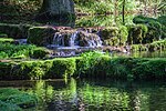
| Rock-forming sponge banks in the Kaising Valley SSE of Kaising |
 |
576A004 |
Greding position |
Southern Franconian Alb | At the upper edge of the valley there are rocks made of fossil-bearing, stratified sponge limestone of the Malm Gamma. | 600 30 × 20 |
Type: Type of rock, rock face / slope Type: Dolomite stone |
Slope crack / rock wall | significant | Landscape protection area, FFH area, nature park | |
| Former quarry W of Götzenreuth | 576A005 |
Büchenbach position |
Sandstone Keuper Region | In the historical quarries, Unterer Burgsandstein is open. | 10000 200 × 50 |
Type: Rock Type: Sandstone |
Quarry | significant | Landscape protection area | ||
| Former Offenbau WNW quarry | 576A006 |
Thalmassing position |
Southwest Albrand region | The lower marl limestone of the Malm Alpha is developed in this fracture. | 400 20 × 20 |
Type: Rock Type: Limestone |
Quarry | significant | Landscape protection area, nature park | ||
| Outcrop SW of Esselberg | 576A007 |
Greding position |
Southern Franconian Alb | The outcrop runs along the east side of the dry valley. The grasslands above are grazed. | 14000 350 × 40 |
Type: Rock Type: Limestone, Marlstone |
embankment | significant | Landscape protection area, nature park | ||
| ESE cave system from Euerwang |
 |
576H001 |
Greding position |
Southern Franconian Alb | During the mining of dolomite gravel, a paleo cave system was uncovered on the southern slope of the Euerwanger Bühl. 15 find horizons were located over a height difference of 30 m. A rich fauna as well as stone tools and artfully worked bones have been found during the excavations. | 150 30 × 5 |
Type: Karst shaft & horizontal cave Type: Dolomite stone |
Slope crack / rock wall | precious | Landscape protection area, FFH area, nature park | |
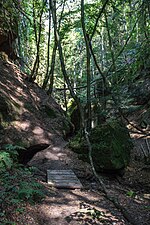
| Massendorfer Schlucht NNE from Spalt |
 |
576R001 |
Gap position |
Southwest Albrand region | The narrow gorge has some good outcrops in the Upper Burgsandstein. The Deutsche Bahn had the trees in the gorge cut down to secure their electricity pylons. The geotope was also affected. | 15000 300 × 50 |
Type: Canyon, Rock Type: Sandstone |
Impact slope / river bed / stream profile | significant | Landscape protection area | |
| Gorge Schnittlinger Loch ENE from Fünfbronn |
 |
576R002 |
Gap position |
Southwest Albrand region | The approx. 50 m deep gorge begins in the west with a narrow gorge. It opens up the Upper Burgsandstein, and sediment structures are also clearly visible. | 250 50 × 5 |
Type: Gorge, Gorge, Rock Type: Sandstone |
Impact slope / river bed / stream profile | precious | Natural monument, landscape protection area | |
| Sinter terraces in Heinrichsgraben SE von Untermässing |
 |
576R003 |
Greding position |
Southern Franconian Alb | A lime-rich spring rises in Heinrichsgraben at the Malm lower limit, which feeds the small stream in the ditch. Due to the high lime content, tuff precipitates in small mossy cascades over a length of approx. 100 m. | 15000 300 × 50 |
Type: sintered terraces, stratified spring type: limestone, tufa |
Impact slope / river bed / stream profile | precious | Landscape component, landscape protection area, FFH area | |
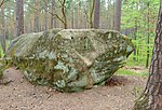
| Druid stone NE from Untersteinbach |
 |
576R004 |
Georgensgmünd position |
Sandstone Keuper Region | The large rock, weathered on all sides, lies on a wooded knoll. | 10 5 × 2 |
Type: Ridge Type: Sandstone |
Rock slope / cliff | significant | Landscape protection area |
|
| Former quarry SW of Bieswang | 577A001 |
Pappenheim position |
Southern Franconian Alb | The large, abandoned quarry provides a particularly good insight into the changeable sponge reef facies of the Mörnsheim reef range. Small independent reef domes build up in the Malm Epsilon over the Dolomites of the Malm Delta. In the Malm Zeta the reefs died and were mixed with plate dolomites. | 40000 200 × 200 |
Type: standard / reference profile, sedimentary structures Type: dolomite stone, limestone |
Quarry | precious | Natural park | ||
| Former quarry W of Osterdorf | 577A002 |
Pappenheim position |
Southern Franconian Alb | The large, abandoned break is still well preserved and shows a profile through the Treuchtlinger marble. Numerous karst cavities filled with reddish clay are exposed on the break walls. | 20000 200 × 100 |
Type: sequence of layers, karst chimney, karst crevice Type: limestone |
Quarry | significant | Natural park | ||
| Former quarry N of Osterdorf | 577A003 |
Pappenheim position |
Southern Franconian Alb | Treuchtlinger marble is very open in the disused, fossil-rich quarry. Old fracture systems and sinter formations can be studied in the northern quarry wall. | 10000 100 × 100 |
Type: Rock Type: Limestone |
Quarry | significant | Landscape protection area, nature park | ||
| Former quarry SE from Weißenburg |
 |
577A004 |
Weißenburg in Bavaria position |
Southern Franconian Alb | Good exposure of Treuchtlingen marble. It is planned to connect this former quarry with the active quarry in the north. | 20000 100 × 200 |
Type: Rock Type: Limestone |
Quarry | significant | Landscape protection area, nature park | |
| Former quarry S von Rothenstein | 577A005 |
Weißenburg in Bavaria position |
Southern Franconian Alb | The disused quarry opens up the Treuchtlinger marble (from bank 25 to around bank 9). Clay-filled karst chutes and horizontal leaching horizons are impressively cut into the quarry walls. | 5000 100 × 50 |
Type: Rock type, karst chimney, karst crevice Type: Limestone |
Quarry | precious | Natural park | ||
| Abandoned quarry E von Ursheim | 577A007 |
Polesingen position |
Riesalb | The abandoned quarry opens up well-banked and fossil-rich Lower Malm. Above the Malm Gamma there is a polished surface and colorful breccia of the giant event. In the lower eastern part of the break, short horizontal shifts can be observed in the autochthonous Malm limestone. | 20000 200 × 100 |
Type: Polished surface (impact), animal fossils, layer sequence Type: Limestone |
Quarry | especially valuable | Landscape protection area, nature park | ||
| Former quarry SE of Langenaltheimer Haardt |
 |
577A008 |
Langenaltheim position |
Riesalb | This is the only disused quarry in which Solnhofen limestone is still well exposed. Most active quarries are backfilled with excavated material during or after their exploitation. The fracture is considered to be the type locality of the plate limestone. In 1992 another specimen of the ancient Archeopteryx was found near this break. | 10000 100 × 100 |
Type: Type locality, Animal Fossils Type: Limestone |
Quarry | precious | FFH area, bird sanctuary, nature park | Bavaria's most beautiful geotopes No. 71 |
| Former suevite quarry SW of Polsingen | 577A009 |
Polesingen position |
Nördlinger Ries | The small quarry is located within the Ries crater and is developing massive suevite (4 m thick). It consists mainly of red, vesicular melt rock that includes numerous crystalline fragments (mainly granites). This suevite differs from the normal formation in the appearance of a coherent, void-rich melt rock and thus inspired the assumption of a melt layer at the crater floor, which was not confirmed, however. | 200 20 × 10 |
Type: Type locality Type: Suevite |
Quarry | especially valuable | Natural park | ||
| Exposure WNW from Weimersheim | 577A010 |
Weißenburg in Bavaria position |
Southwest Albrand region | On both sides of the mountain cut, the Upper Aalen layers are exposed with thin iron ore seams. | 5000 100 × 50 |
Type: Rock Type: Sandstone |
embankment | significant | Soil monument, landscape protection area, nature park | ||
| Huns Church NE of Weissenburg | 577A011 |
Höttingen position |
Southwest Albrand region | Below the Bismarck Tower, several Great Dane rocks have been thundered out of their surroundings in the forest. What is striking is the holey weathering of the sandstone layers that were once clayey. | 625 25 × 25 |
Type: Rock type, Tafoni / honeycomb weathering, rock wall / slope Type: Sandstone |
Slope crack / rock wall | significant | Landscape protection area, nature park | ||
| Hill on the Hüssinger Berg | 577A012 |
Westheim position |
Nördlinger Ries | The western tip of the Hüssinger Berg marks the boundary of the outer, heavily fragmented zone of the Ries crater against the Alb in the northeast. The summit is formed by the severely broken limestone and marl of the Lower Malm. A notice board explains the special feature. | 4900 70 × 70 |
Type: Rock type, ejecta material (impact) Type: Limestone marl |
Slope crack / rock wall | significant | Landscape protection area, nature park | ||
| Hollow road near Hechlingen |
 |
577A014 |
Heidenheim position |
Southwest Albrand region | The ravine-like ravine offers a very good outcrop of Doggersandstein with its ore horizons. Disturbances parallel to the slope offset the sequence of shifts several times. The ravine is part of a local and natural history educational trail. | 1500 150 × 10 |
Type: Rock type: Sandstone, iron / manganese ore |
embankment | significant | Landscape protection area, nature park | |
| Iron sandstone outcrop NE of Hohentrüdingen | 577A015 |
Heidenheim position |
Southwest Albrand region | Diagonally layered Doggersandstein with iron oid layers is exposed in the former sand pit directly on the road. | 150 30 × 5 |
Type: Rock Type: Sandstone |
Gravel pit / sand pit | significant | Landscape protection area, nature park | ||
| Former quarry NE of Hürth | 577A017 |
Treuchtlingen position |
Riesalb | The former quarry near Hürth opens up a profile from the middle Malm Gamma to the lower Malm Delta in stratified facies: at the bottom, 7 m of gray bench limestone are exposed, followed by about 2 m of Crussoliensis marl and 4 m of banked Uhlandi limestone. The bottom three benches of Treuchtlingen marble form the end. | 300 30 × 10 |
Type: Layer sequence, Animal fossils Type: Limestone, Marlstone |
Quarry | significant | Landscape protection area, nature park | ||
| Felsenkeller in Thalmannsfeld | 577A018 |
Bergen position |
Southwest Albrand region | There are approx. 25 cellars along the street that are a few meters deep. The upper ones are filled. The sandstone is unlocked at the entrances, e.g. T. with traces of weathering. The cellars are used. | 1650 110 × 15 |
Type: Sedimentary structures, rock cellars Type: Sandstone |
Rock cellar | significant | Natural park | ||
| Quarry W von Fuchsmühle | 577A019 |
Treuchtlingen position |
Riesalb | In the now disused quarry, the top two meters of the Upper Marl Limestone (Arzberg Formation, Malm Gamma) are exposed on the bottom of the entrance area. Above it is more than 30 meters of Treuchtlinger marble (Treuchtlingen formation, Malm Delta). The formation boundary is particularly easy to see here. | 30000 200 × 150 |
Type: sequence of layers, rock type: limestone, marlstone |
Quarry | precious | Landscape protection area, nature park | ||
| Former Juramarmorbruch Stiegler NW of Solnhofen | 577A020 |
Solnhofen position |
Riesalb | Treuchtlinger bank lime was mined in the abandoned Stiegler quarry. | 7000 100 × 70 |
Type: Type of rock, sequence of layers, quarry / pit type: Limestone |
Quarry | precious | Landscape protection area, FFH area, bird sanctuary | ||
| Hobby quarry ESE von Langenaltheim | 577A021 |
Langenaltheim position |
Riesalb | In the separately traced western part of the geotope 577A008, at the Urvogel discovery site Hobbysteinbruch Langenaltheim, fossils can be collected in thin-plate Solnhofen limestone for a small fee from April 1 to October 31. | 3500 70 × 50 |
Type: Rock type, Layer sequence, Animal fossils, Quarry / Pit Type: Limestone |
Quarry | precious | FFH area, bird sanctuary, nature park | ||
| Quarry area at Schrandelberg SE from Langenaltheim | 577A022 |
Langenaltheim position |
Riesalb | The abandoned quarry on Schrandelberg opens up unusually thin-plate Solnhofen limestone. | 4000 100 × 40 |
Type: Type of rock, sequence of layers, quarry / pit type: Limestone |
Quarry | precious | Landscape protection area, FFH area, bird sanctuary | ||
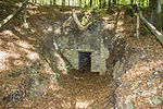
| Former Iron ore mine Grubschwart NE von Rothenstein |
 |
577G001 |
Raitenbuch position |
Southern Franconian Alb | Funnel pits, mine shafts and tunnels are reminiscent of the former iron ore mining. These were stored as floor ore in the clay filling of an extensive karst system. An educational trail about the history of mining with 21 stations clearly leads through the area. An audio guide can also be downloaded as an app for smartphone or tablet from www.infofeld.de/grubschwart.html. | 5000 1000 × 5 |
Type: tunnel, karst shaft & horizontal cave, pinge field Type: limestone, clay |
Tunnel / gallery / shaft | especially valuable | Soil monument, landscape protection area, nature park | |
| Karlsgraben |
 |
577G003 |
Treuchtlingen position |
Southwest Albrand region | The Karlsgraben testifies to one of the greatest engineering achievements of the early Middle Ages. Charlemagne wanted to connect the Rhine with the Danube through a navigable canal between the Swabian Rezat and the Altmühl, as the rivers approach here at almost 1800 m. After 1,400 m had been excavated (approx. 6,000 workers and 780,000 m³ of earth), supply bottlenecks presumably led to the abandonment of the canal project. The geotope is one of Bavaria's hundred most beautiful geotopes and is explained on site with a corresponding information board. | 50000 1000 × 50 |
Type: Trench, Canal Type: Gravel |
no information | especially valuable | Soil monument, landscape protection area, nature park | Bavaria's most beautiful geotopes No. 34 |
| Hell funnel NW of Osterdorf | 577G005 |
Pappenheim position |
Southern Franconian Alb | There are numerous former quarrying sites in a confined space, where floor ores were extracted from tertiary karst fillings. What remained were heaps, funnel pits and some 10 m deep exhumed karst shafts. | 45000 300 × 150 |
Type: Pinge field, sinkhole, karst shaft cave Type: Limestone, clay |
Ping | precious | Soil monument, landscape protection area, nature park | ||
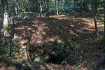
| Hollow hole SW from Raitenbuch |
 |
577H001 |
Raitenbuch position |
Southern Franconian Alb | The hollow hole opens up the dolomites of the Malm Delta. With the ordinance of the LRA WUG of May 20, 1980, the hollow hole was placed under protection as a natural monument (§ 28 BNatSchG). Because of the risk of accidents and to protect the native bats (including Myotis myotis), the natural monument is fenced in and cannot be entered. | 1000 100 × 10 |
Type: Karst shaft & horizontal cave Type: Dolomite stone |
Slope crack / rock wall | precious | Natural monument, FFH area, landscape protection area | |
| Devil's Cave W by Bieswang | 577H002 |
Pappenheim position |
Southern Franconian Alb | The approx. 100 m long horizontal cave has two entrances that lead into a vestibule. | 200 100 × 2 |
Type: Karst horizontal cave Type: Limestone, dolomite stone |
Slope crack / rock wall | significant | Landscape protection area, nature park | ||
| Source outlet The seven sources SW of Heidenheim |
 |
577Q001 |
Heidenheim position |
Southwest Albrand region | At the border between Opalimus Clay and Doggersandstein lies a spring horizon from which the seven springs arise. | 100 10 × 10 |
Type: Layer Source Type: Sandstone |
no information | significant | Landscape protection area, nature park | |
| Source outlet Steinbrunnen ESE von Göhren | 577Q002 |
Pappenheim position |
Southern Franconian Alb | Several small spring outlets arise in a spring niche set in sandstone. The stone fountain rises on the otherwise arid karst plateau on a remnant of the Upper Freshwater Molasse. The year 1706 is indistinctly visible on the stone arch of the fountain. | 1 1 × 1 |
Type: Layer Source Type: Sandstone |
no information | significant | Monument protection, ground monument, landscape protection area | ||
| Gorge Teufelsbackofen NW of Fiegenstall | 577R001 |
Höttingen position |
Southwest Albrand region | The narrow gorge in the Upper Burgsandstein shows only a few outcrops. Feuerletten is waiting at the entrance. Fallen trees make inspection more difficult, especially in the central area. | 18750 250 × 75 |
Type: Canyon, Rock Type: Sandstone |
Impact slope / river bed / stream profile | significant | Landscape protection area, nature park | ||
| Stone channel SW from Wolfsbronn |
 |
577R002 |
Meinheim position |
Riesalb | The course of the stream lies in an approximately 130 m long and up to 160 cm high tufa dam, which is interrupted by several waterfalls. Despite the protection status, the property is to be regarded as largely destroyed, as the channel was artificially walled up with stones and concrete over its entire length as a maintenance measure. A negative example! | 130 130 × 1 |
Type: Stone gutter, layer source Type: Tufa-lime |
no information | significant | Nature reserve, landscape protection area, FFH area | |
| Stone gutter SE from Spielberg |
 |
577R003 |
Gnotzheim position |
Riesalb | The stream is approx. 20 m long and a maximum of 10 cm high. The channel is deepened and lined with a little lime. The small groove is in the development stage. | 6 20 × 0 |
Type: Stone gutter, layer source Type: Tufa-lime |
no information | significant | Landscape protection area, FFH area, nature park | |
| Stone channel S from Rohrbach |
 |
577R004 |
Etten instead of position |
Southern Franconian Alb | The stone channel near Rohrbach is approx. 60 m long and up to 1 m high. A wooden walkway was installed next to the gutter. The source of the channel arises between Opalinus Clay and iron sandstone, the channel grows by 2 to 3 cm annually. This channel was also partly artificially walled up. A natural development is no longer given. The red gorge with the sintered formations of the so-called Junge Steinerne Rinne also belongs to the property. | 18 60 × 0 |
Type: Stone gutter, layer source Type: Tufa-lime |
no information | significant | Natural monument, landscape protection area, FFH area | |
| Stone channel NNE from Hechlingen |
 |
577R005 |
Heidenheim position |
Southwest Albrand region | The channel is approx. 10 m long and a maximum of 30 cm high; it has so far been largely preserved in its natural form. A notice board clarifies the specialty of the property. | 10 10 × 1 |
Type: Stone gutter, layer source Type: Tufa-lime |
no information | significant | Landscape protection area, nature park | |
| Stone gutter SE from Oberweiler |
 |
577R006 |
Meinheim position |
Riesalb | The stream, lined with tufa, is about 50 m long. The tufa excretions have not yet been anthropogenically changed. | 30 30 × 1 |
Type: Stone gutter, layer source Type: Tufa-lime |
no information | significant | Landscape protection area, nature park | |
| Dachsbaufelsen SE from Dettenheim | 577R007 |
Weißenburg in Bavaria position |
Southern Franconian Alb | The Dachsbaufelsen was shown on the geological map as sponge reef limestone in the area of Treuchtlinger marble. The rock is heavily mossed and deeply weathered in places, smaller caves lead into the rock. | 100 10 × 10 |
Type: Dome, Rock, Fissure / Tectonic Cave Type: Limestone |
Slope crack / rock wall | significant | Soil monument, landscape protection area, nature park | ||
| Rock group Twelve Apostles N of Esslingen |
 |
577R008 |
Solnhofen position |
Southern Franconian Alb | The Twelve Apostles belong to the Mörnsheimer Riffzug. The picturesque rocks are built up from the sponge algae limestone of the Middle Malm Delta. The rock group is geomorphologically classified as an ensemble, as the numerous isolated rocks represent a coherent range of reefs, which can be recognized by the garland-like coves that run from rock to rock. | 60000 600 × 100 |
Type: rock group, rock tower / needle, rock castle, sedimentary structures Type: dolomite stone |
Slope crack / rock wall | precious | Nature reserve, natural monument, landscape protection area | Bavaria's most beautiful geotopes No. 62 |
| Hilltop of the Bubenheimer Berg E von Bubenheim |
 |
577R009 |
Treuchtlingen position |
Southwest Albrand region | On the top of the Bubenheimer Berg, Malm limestone and dolomite clods form hard blocks of up to several cubic meters in size. These hardlings are allochthonous clods that were blasted out of the area of the crater during the Ries disaster. The Malmschollen are usually intensely buried and z. Sometimes baked again, so that they weathered out of the environment as hardened people. | 20000 200 × 100 |
Type: Ejecta (impact), rocky dome Type: Limestone |
Slope crack / rock wall | precious | Landscape protection area, nature park | |
| Teufelskanzel SE from Solnhofen |
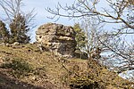 |
577R010 |
Solnhofen position |
Riesalb | The Teufelskanzel rock summit is built up from the bench-top Dolomites of the Malms. | 20000 200 × 100 |
Type: Crag Type: Dolomite stone |
Slope crack / rock wall | significant | Landscape protection area, nature park | |
| Ponordoline E by Göhren | 577R011 |
Pappenheim position |
Southern Franconian Alb | The Ponor trench is 200 m long, 25 m wide and has a maximum depth of 6 m in the western trench area. In the trench, a small stream flows to the mouth that was flooded with quarry rubble many years ago. | 5000 200 × 25 |
Type: Ponor, sinkhole Type: Breccia, dolomite stone |
no information | precious | Landscape protection area, nature park | ||
| Dolinenfeld E von Göhren | 577R012 |
Pappenheim position |
Southern Franconian Alb | Group of several sinkholes, some of which act as ponors in heavy rain. The largest of the sinkholes has a diameter of approx. 20 m and a depth of approx. 10 m. Another very large sinkhole, in which current subsidence is taking place, is 200 m WNW of the intersection and has not yet been protected as an ND. | 40000 200 × 200 |
Type: Dolinenfeld Type: Dolomite stone, limestone |
no information | precious | Landscape protection area, nature park | ||
| Quartzite blocks E from Döckingen | 577R013 |
Polesingen position |
Riesalb | Various theories exist about the age and the cause of the accumulation of quartzite blocks around Döckingen. There are 8 blocks to the east of the village. The z. Blocks of several cubic meters consist of medium-grain, quartzite cemented sandstones. Fissure structures are characteristic of the quartzites, which can possibly be traced back to the Ries event. | 20000 200 × 100 |
Type: Type locality, relict rocks Type: Sandstone |
block | especially valuable | Natural park | ||
| Ponordolinen NE from Kohnhof | 577R014 |
Polesingen position |
Riesalb | In a small wood there are three large ponordolines with a temporary flow of water in a confined space. Fresh, steep subsidence in the washed-in clay is evidence of recent activity. | 22500 150 × 150 |
Type: Ponor Type: Limestone, Loess Loam |
Sinkhole / sinkhole | precious | Landscape protection area, nature park | ||
| Döckingen sinkhole SSE | 577R015 |
Polesingen position |
Riesalb | The large sinkhole is in the area of allochthonous rift clods. Fresh subsidence is evidence of the ongoing subsidence processes. | 2000 50x40 |
Type: sinkhole Type: limestone |
no information | precious | Natural park | ||
| Hunnenstein WSW from Markt Berolzheim | 577R016 |
Market Berolzheim position |
Riesalb | These are two blocks of quartz sandstone, the assignment of which has not yet been clarified. | 1 1 × 1 |
Type: Relic Rocks Type: Sandstone |
no information | significant | Landscape protection area, FFH area, nature park | ||
| Stream with sinter basin WNW Wolfsbronn |
 |
577R017 |
Meinheim position |
Riesalb | Small sinter basins have been formed along the course of the stream over a length of 100 m. | 100 100 × 1 |
Type: Sinter formation, stream / river course Type: Limestone, sandstone |
no information | significant | Landscape protection area, FFH area, nature park | |
| Stone channel NNW from Heidenheim |
 |
577R018 |
Heidenheim position |
Southwest Albrand region | The small but beautiful Steinerne Rinne has not yet been developed for tourism. The natural development of the channel is partially disturbed by attempts to accelerate its growth. | 150 150 × 1 |
Type: Stone Gutter Type: Limestone, Sandstone |
no information | significant | Landscape protection area, FFH area, nature park | |
| Hohler Stein NW from Stahlmühle | 577R019 |
Heidenheim position |
Southwest Albrand region | The limestone rock wall of the lower Malm lies just outside the edge of the Ries, which is noticeable in the intense fissures. Several small caves with beautifully washed-out profiles start here, but narrow quickly. | 500 50 × 10 |
Type: Rock Castle Type: Limestone |
Slope crack / rock wall | precious | Landscape protection area, nature park | ||
| Dolinenfeld in the Maierholz WSW of Döckingen | 577R020 |
Polesingen position |
Riesalb | In the forest area there are numerous sinkholes in a small space, including the Ponordoline Fuchsbau. In some sinkholes there are large blocks of sandstone that resemble the Döckinger quartzites. | 300000 600 × 500 |
Type: Dolinenfeld, Ponor, relict rocks Type: Limestone, sandstone |
Sinkhole / sinkhole | significant | Landscape protection area, nature park | ||
| Ponordoline SW from Rothenstein | 577R023 |
Pappenheim position |
Southern Franconian Alb | Large ponordoline with temporary tributaries from two tapering trenches. In the deepest part of the sinkhole you can also see large blocks and rock that may be standing under the clay cover. | 2000 50x40 |
Type: Ponor Type: Limestone |
Slope crack / rock wall | precious | Landscape protection area, nature park |
See also
- List of nature reserves in Middle Franconia
- List of landscape protection areas in Middle Franconia
- List of FFH areas in Middle Franconia
- List of EU bird protection areas in Middle Franconia
Individual evidence
- ↑ LfU, Geotopes in Middle Franconia ( Memento of the original from September 23, 2015 in the Internet Archive ) Info: The archive link was inserted automatically and has not yet been checked. Please check the original and archive link according to the instructions and then remove this notice. (accessed on August 30, 2015)
Web links
Commons : Pictures on Wikimedia Commons - collection of pictures, videos and audio files