Wolfsbronn
|
Wolfsbronn
Community My Home
|
|
|---|---|
| Coordinates: 49 ° 0 ′ 48 ″ N , 10 ° 47 ′ 28 ″ E | |
| Height : | 477–488 m above sea level NN |
| Residents : | 84 (May 25 1987) |
| Incorporation : | 1st October 1972 |
| Postal code : | 91802 |
| Area code : | 09146 |
|
Place view
|
|
Wolfsbronn is a district of the community Meinheim in the district of Weißenburg-Gunzenhausen , Middle Franconia .
geography
location
Wolfsbronn is located in the West Central Franconia region at the foot of the Hahnenkamm and near the Dürrenberg , around 15 kilometers from Weißenburg and around ten kilometers from Gunzenhausen . It is traversed by the Wolfsbronner Mühlbach , a tributary of the Altmühl tributary Meinheimer Mühlbach .
Neighboring places
The neighboring towns are Papiermühle , Sägmühle , Baierleinsmühle and Oberweiler .
history
The place was first mentioned in a document in 1400. From 11./12. In the 18th century , the Lunkenburg, which was already known as the Burgstall in 1400, was located near Wolfsbronn .
In the village there is a bell tower with a flat tent roof and weather vane from 1912. There is also a historic paper mill from the 18th century.
At the beginning of the 19th century, shortly before secularization , the village, which belonged to the Ansbach Oberamt Hohentrüdingen , consisted of 22 subjects. 14 were direct Ansbach subjects, 5 Pappen native and 3 Eichstätt subjects; the latter belonged to the Oberland care and caste office Sandsee - Pleinfeld . The blood jurisdiction ( Fraisch ) and the municipality rule was Ansbachisch, the station rule and the Erbtafern Eichstättisch. At that time the Mühlbach drove a mill in front of and behind the village.
With the community edict (19th century) Wolfsbronn became a politically independent community, to which the places Baierleinsmühle , Papiermühle and Sägmühle belonged. As part of the regional reform in Bavaria , this was incorporated into the community of Meinheim on October 1, 1972.
Architectural monuments
see also : List of architectural monuments in Meinheim # Wolfsbronn
nature
Stone gutter
In the forest on the WUG 34 district road , about 300 meters southwest of Wolfsbronn, one of several stone channels in the Hahnenkamm area, a tuff dam, runs. The area is designated as a nature reserve and geotope . The channel is about 130 meters long and up to 160 centimeters high.
Stream with sinter basin
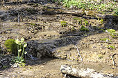
To the west of the paper mill is another geotope. The brook has formed several sinter basins over a length of about 100 meters . The condition is impaired by forest maintenance work and the basins are partly silted up (as of March 2014).
Population development
Wolfsbronn community
| year | 1910 | 1933 | 1939 |
|---|---|---|---|
| population | 132 | 127 | 110 |
traffic
The district road WUG 34 , which connects Wolfsbronn with the nearby state road St 2230 , runs through the village .
literature
- Johann Kaspar Bundschuh: Geographical statistical-topographical lexicon of Franconia . Volume 6. Stettinische Buchhandlung, Ulm 1804, DNB 790364328 , Sp. 285 f .
- Wolfgang Voigtländer: The "stone channel" near Wolfsbronn . In: Geological sheets for northeast Bavaria and adjacent areas 16 . 1966, ISSN 0016-7797 , p. 50-55 .
- Martin Winter: Lunkenburg and Burgstall near Wolfsbronn - on the question of the origins of the two castles . In: Alt-Gunzenhausen 51 . 1996, p. 10-16 .
Web links
Individual evidence
- ^ Association for Computer Genealogy e. V. ( Page no longer available , search in web archives ) Info: The link was automatically marked as defective. Please check the link according to the instructions and then remove this notice. , Wolfsbronn
- ↑ Bundschuh, 6th vol., Col. 285f.
- ^ Wilhelm Volkert (ed.): Handbook of Bavarian offices, communities and courts 1799–1980 . CH Beck, Munich 1983, ISBN 3-406-09669-7 , p. 477 .
- ↑ Geotope: creek with sinter basin southwest of Wolfsbronn (accessed on April 6, 2014)
- ↑ Gemeindeververzeichnis.de , Gunzenhausen district office
- ^ A b Michael Rademacher: German administrative history from the unification of the empire in 1871 to the reunification in 1990. Gunzenhausen district. (Online material for the dissertation, Osnabrück 2006).


