Hahnenkamm (Altmuehltal)
| Cockscomb | |
|---|---|
|
Franconian Alb with the Hahnenkamm in the southwest |
|
| Highest peak | Dürrenberg ( 656.4 m above sea level ) |
| location | Rural districts Weißenburg-Gunzenhausen and Ansbach ; Bavaria ( Germany ) |
| part of | Franconian Alb |
| Coordinates | 49 ° 1 ′ N , 10 ° 46 ′ E |
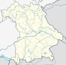
Location of the Hahnenkamm in Bavaria
|
The Hahnenkamm is a Jurassic limestone - mountain range one to 656.4 m above sea level. NHN high and around 20 km long northwest foothills of the Franconian Alb in the districts of Weißenburg-Gunzenhausen and Ansbach in Bavaria , Germany .
geography
location
The Hahnenkamm is located in the quadrangle of Gunzenhausen in the north, Weißenburg in the east, Treuchtlingen in the southeast and Wassertrüdingen in the west. It is bounded to the northeast by the Altmühl , a little to the southwest lies the Nördlinger Ries through which the Wörnitz flows ; The latter separates the Swabian Alb and the Franconian Alb. From the Altmühl, the Hahnenkamm rises about 200 m above the valley floor. The ridge, which is partly overgrown by deciduous forest, is part of the Altmühltal Nature Park .
The highest inhabited place on the Hahnenkamm is Auernheim , which is 634 m above sea level and, together with Hohenstein, shares the rank of being the highest village in Middle Franconia .
Natural allocation
The Hahnenkamm belongs to the natural spatial main unit group Franconian Alb (No. 08), in the main unit Southern Franconian Alb ( 082) and in the subunit Altmühlalb (082.2) to the natural area Hahnenkammalb (082.20). Its landscape falls from west to north to east in the main unit group Franconian Keuper-Lias-Land (No. 11), in the main unit foreland of the Southern Franconian Jura (110) and in the subunit Hahnenkamm-Vorland (110.2) in the natural area of Hahnenkamm-Vorberge (110.21).
mountains
The mountains or elevations of the Hahnenkamm and its foothills include - sorted according to height in meters (m) above mean sea level (NHN):
|
|
In the western neighborhood is the Hesselberg ( 689 m ), the highest mountain in the Franconian Alb.
Localities
The villages in and on the Hahnenkamm include - viewed roughly clockwise (starting in the north):
|
|
|
Protected areas
The nature reserves Steinerne Rinne near Wolfsbronn ( CDDA no. 82630; designated 1984; 6 hectares in size) and Buchleite near Markt Berolzheim (CDDA no. 162621; 1986; 31 hectares) are on or on the Hahnenkamm . On the ridge there are also parts of the conservation zone in the Altmühltal Nature Park ( CDDA no. 396115; 1995; 1,632.96 km² ) and the fauna-flora-habitat area Trauf of the southern Franconian Jura (FFH no. 6833-371; 43 , 24 km²).

economy
The Hahnenkamm is mainly used for agriculture, tourism and the energy sector. The Hahnenkamm barracks of the Bundeswehr, built in the 1970s on the north eaves near Heidenheim to strengthen the local economy , was closed as part of the Bundeswehr reform in 2003. The Hahnenkammsee near Hechlingen was also created during this period to promote tourism . The Hahnenkamm wind farm near Heidenheim- Degersheim , established in 1996, has consisted of twelve wind turbines since 2011.
Attractions
Among the attractions on the Hahnenkamm include:
- Numerous geotopes , see also list of geotopes in the Weißenburg-Gunzenhausen district
- Fossa Carolina (Karlsgraben near Treuchtlingen)
- Yellow mountain
- Hahnenkammsee
- Hohentrüdingen
- Heidenheim Monastery
- Spielberg Castle
Hiking trails
Hiking trails of the Hahnenkamm are:
- Altmühltal Panorama Trail
- Frankenweg
- Main-Danube Way
- Red Mountain educational forest trail
- West Albrand-Weg (with the Roter Berg car park near Hechlingen)
- Geological path (with parking lot at Hahnenkammsee near Hechlingen)
Individual evidence
literature
- Hermann Schmidt-Kaler: From the new Franconian Lake District to the Hahnenkamm and Hesselberg , series walks in the history of the earth , Volume 3 1991, 80 pages, 2 colored geol. Maps, 66 ills., 8 color plates, pbk. Treated are the Weißjura foothills of the Hahnenkamm and the Weißjura-Zeugenberg of the Hesselberg.
Web links
- Map of the Hahnenkamm on: BayernAtlas of the Bavarian State Government ( information )
- Municipal Alliance Hahnenkamm (KAH) (municipalities on the Hahnenkamm), on hahnenkamm.de
- Gunzenhausen – Hahnenkamm – Ries cycle path , on bay-rad.de
- Bike trails in the upper Altmühltal (including in the southeastern Hahnenkamm), on marktberolzheim.de


