
Stone channel from Oberweiler
Coordinates: 49 ° 0 ′ 34 ″ N , 10 ° 48 ′ 29 ″ E

The Steinerne Gully from Oberweiler is a limestone turf channel near Meinheim in the central Franconian district of Weißenburg-Gunzenhausen . The Steinerne Rinne is located on the northwest slope of the Ahaleite ( Hahnenkamm ), about 400 meters southeast of Oberweiler , a district of Meinheim.
description
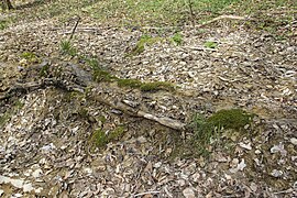
It is about 50 meters long and up to 20 centimeters high, overgrown with moss-covered calcareous turf. The low channel is interrupted several times in its course. Their growth was probably interrupted for a long time by a damming in the upper part of the stream. In order to speed it up today, part of the channel was artificially lined (as of April 2014). It is fed by two sources. These are about 5 meters apart, 80 meters above the actual channel in a spring niche. They arise above the source horizon ( Ornatenton ) in the lower White Jura . In the flat upper course the stream has formed a few smaller sinter basins . Immediately at the beginning of the channel, the remains of an abandoned storage basin are visible.
At the outlet of the channel, the stream flows into a pipe that passes under a forest road and subsequently supplies fish ponds with fresh water. The process takes place over the Oberweiler Graben , which flows into the Wolfsbronner Mühlbach .
The area is not developed for tourism and has been designated as Geotope 577R006 by the Bavarian State Office for the Environment . See also the list of geotopes in the Weißenburg-Gunzenhausen district .
See also the list of stone gutters in Bavaria
Emergence
Lime tuffs come in various morphological forms as large tufa beds , sintered terraces , tuff cascades or, as here, as limestone turf channels. Such channels are always tied to springs whose water has a particularly high lime content. Small, but constantly flowing springs, under favorable circumstances, create such stone gullies.
The groundwater cannot seep deeper here due to the underlying water-retaining layer of the regal clay and is directed to the side of the spring outlet.
The water temperature at the source fluctuates around 8 degrees. At the source outlet the water experiences a pressure relief, a mixing with the air and at the same time a change in the ambient temperature. Some of the carbon dioxide dissolved in the water escapes, causing lime to precipitate out of the water, which, favored by mosses and other plant parts, settles on the bottom of the channel. Certain algae are able to precipitate the lime dissolved in the water. The branched mosses then catch the precipitated lime. Algae and moss cause the upward growth of the stone channel on the initially flat sintered surface. The mosses find their best habitat on the edge of the stream bed in a damp and calcareous environment. In order to always get enough sunlight for their growth, they must always grow upwards or to the side out of the encrustation caused by the lime precipitation. The algae, on the other hand, prefer to live on the bottom of the flow channel; the solid lime deposited by them seals the channel downwards and to the side. In this way they ensure that the watercourse is channeled. As long as the water supply between the spring and the stone channel is not interrupted, it grows higher and higher, by a few millimeters every year.
Access
The channel is freely accessible all year round. It can be reached from Oberweiler via a well-paved forest road. About 1500 meters to the east there is another channel, the famous stone channel near Wolfsbronn .
The sensitive, porous tuff limestone must not be stepped on or destroyed. Above all, the channel must not be dammed up and the edges must not be broken. The growth of the porous limestone tuff would be permanently changed, the running of the fine channel would be impaired and further natural growth would be severely disturbed. If the water leaves the channel at any point, it will fall dry as it continues, and it will take a very long time until a new one is created on the new path of the water.
photos

One of the two sources

Stream course in front of the beginning of the channel

Remains of the former impoundment
Artificial lining of the channel

End of the gutter


Web links
Individual evidence
- ↑ Location of the Steinerne Rinne in the Bavaria Atlas (accessed April 22, 2014)
- ↑ Geotope: Steinerne Gully southeast of Oberweiler (accessed on April 22, 2014).