| Surname
|
image
|
Identifier
|
circle
|
details
|
position
|
Area
hectares
|
date
|
|
Court garden in Ansbach
|
BW
|
6629-302
WDPA: 555521641
|
Ansbach
|
|
⊙
|
13.00
|
|
Nature reserve 'Scheerweihergebiet bei Schalkhausen' 
|

|
6629-301
WDPA: 555521640
|
Ansbach
|
|
⊙
|
53.00
|
|
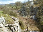
Endseer Berg 
|
|
6527-371
WDPA: 555521585
|
Ansbach district
|
|
⊙
|
125.74
|
|
|
Wetlands in the southern Central Franconian Basin
|
BW
|
6829-371
WDPA: 555521719
|
Ansbach district
|
|
⊙
|
45.94
|
|
|
Swabian and Franconian river network
|
BW
|
6832-371
WDPA: 555521722
|
District of Weissenburg-Gunzenhausen , Ansbach , Ansbach
|
|
⊙
|
1,093.90
|
|
Hesselberg 
|

|
6929-371
WDPA: 555521755
|
Weissenburg-Gunzenhausen district
|
|
⊙
|
282.03
|
|
|
Hutungen on Rother Berg and around Lehrberg
|
BW
|
6628-371
WDPA: 555521637
|
Weissenburg-Gunzenhausen district
|
|
⊙
|
182.48
|
|
|
Guarding of the franc height
|
BW
|
6627-301
WDPA: 555521635
|
Weissenburg-Gunzenhausen district
|
|
⊙
|
78.00
|
|
|
Combed newt habitats around Eichelberg and spruce wood near Colmberg
|
BW
|
6628-372
WDPA: 555521638
|
Weissenburg-Gunzenhausen district
|
|
⊙
|
562.01
|
|
|
Klosterberg and Gailnauer Berg
|
BW
|
6727-371
WDPA: 555521689
|
Weissenburg-Gunzenhausen district
|
|
⊙
|
375.11
|
|
|
Natural forest reserves of the Frankenhöhe
|
BW
|
6527-372
WDPA: 555521586
|
Neustadt an der Aisch-Bad Windsheim district
|
|
⊙
|
243.91
|
|
|
Obere Altmühl with Brunst-Schwaigau and Wiesmet
|
BW
|
6830-371
WDPA: 555521720
|
District of Weissenburg-Gunzenhausen , Ansbach
|
|
⊙
|
4,507.98
|
|
|
Sonnensee and Birkenfelser Forest
|
BW
|
6629-371
WDPA: 555521642
|
Ansbach district
|
|
⊙
|
174.44
|
|
Taubertal north of Rothenburg and Steinbachtal 
|

|
6627-371
WDPA: 555521636
|
Ansbach district
|
|
⊙
|
1,061.70
|
|
|
Animal ponds at Hinterholz and ponds at Aubühl
|
BW
|
6628-373
WDPA: 555521639
|
Ansbach district
|
|
⊙
|
12.30
|
|
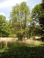
Wörnitztal 
|
|
7029-371
WDPA: 555521786
|
Ansbach district
|
|
⊙
|
3,893.33
|
|
|
Aurach between Emskirchen and Herzogenaurach
|
BW
|
6430-371
WDPA: 555521541
|
District Neustadt an der Aisch-Bad Windsheim , District Erlangen-Höchstadt
|
|
⊙
|
199.08
|
|
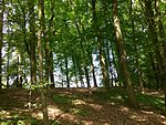
Occurrence of stag beetles near Kleinseebach 
|
|
6332-373
WDPA: 555521471
|
Erlangen-Höchstadt district
|
|
⊙
|
0.89
|
|
Labyrinth 
|

|
6432-371
WDPA: 555521543
|
Erlangen-Höchstadt district
|
|
⊙
|
111.82
|
|
Markwald near Baiersdorf 
|

|
6332-371
WDPA: 555537764
|
Erlangen-Höchstadt , Forchheim district
|
|
⊙
|
308.09
|
|
Nature reserve 'Wildnis am Rathsberg' 
|

|
6332-302
WDPA: 555521468
|
Erlangen-Höchstadt district
|
|
⊙
|
25.00
|
|
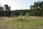
Sand heaths in the Middle Franconian basin 
|
|
6432-301
WDPA: 555521542
|
Erlangen-Höchstadt , Fürth district
|
|
⊙
|
1,168.00
|
|
Ponds and wet areas in the Aischgrund, pond area near Mohrhof 
|

|
6331-371
WDPA: 555521466
|
Erlangen-Höchstadt district
|
|
⊙
|
422.44
|
|
Fürth and Zirndorfer city forest 
|

|
6531-301
WDPA: 555521589
|
Fürth , Fürth district
|
|
⊙
|
828.00
|
|
Bibert and Haselbach 
|

|
6630-301
WDPA: 555521643
|
Ansbach , Fürth district
|
|
⊙
|
240.00
|
|
Chain of ponds north of Weinzierlein 
|

|
6531-371
WDPA: 555521590
|
Fürth district
|
|
⊙
|
5.26
|
|
|
Zenn from Stöckach to the mouth
|
BW
|
6530-371
WDPA: 555521588
|
District Neustadt an der Aisch-Bad Windsheim , District Fürth , Fürth
|
|
⊙
|
609.31
|
|
|
Bat winter quarters in the Steigerwald and the Frankenhöhe
|
BW
|
6427-371
WDPA: 555521537
|
Ansbach , district Neustadt an der Aisch-Bad Windsheim , Kitzingen
|
|
⊙
|
4.74
|
|
Gypsum hills near Külsheim and Wüstphül 
|

|
6428-371
WDPA: 555521540
|
Neustadt an der Aisch-Bad Windsheim district
|
|
⊙
|
61.09
|
|
|
Mouse-eared colonies in Steigerwald, Frankenhöhe and Windsheimer Bucht
|
BW
|
6428-302
WDPA: 555521539
|
Ansbach , district Neustadt an der Aisch-Bad Windsheim
|
|
⊙
|
0.00
|
|
|
Moor ponds in the Aischgrund and in the Grethelmark
|
BW
|
6330-371
WDPA: 555521465
|
District Neustadt an der Aisch-Bad Windsheim , District Erlangen-Höchstadt
|
|
⊙
|
215.11
|
|
|
Natural forest reserves of the Frankenhöhe
|
BW
|
6527-372
WDPA: 555521586
|
District Neustadt an der Aisch-Bad Windsheim , Ansbach
|
|
⊙
|
243.91
|
|
|
Swath ditch
|
BW
|
6428-301
WDPA: 555521538
|
Neustadt an der Aisch-Bad Windsheim district
|
|
⊙
|
6.00
|
|
Vorderer Steigerwald with Schwanberg 
|

|
6327-371
WDPA: 555521463
|
District Neustadt an der Aisch-Bad Windsheim , District Kitzingen
|
|
⊙
|
8,350.89
|
|
Kornberge near Worzeldorf 
|

|
6632-372
WDPA: 555521645
|
Nuremberg , district of Roth
|
|
⊙
|
137.88
|
|
Rednitz Valley in Nuremberg 
|

|
6632-371
WDPA: 555521644
|
Nuremberg , Schwabach
|
|
⊙
|
337.76
|
|
Clearing islands in the Reichswald 
|

|
6533-371
WDPA: 555521593
|
Nuremberg
|
Species-rich, mostly poor grassland on sandstone keuper.
|
⊙
|
43.47
|
|
Nuremberg Zoo with Schmausenbuck 
|

|
6532-372
WDPA: 555521592
|
District of Nürnberger Land , Nuremberg
|
|
⊙
|
613.20
|
|
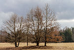
Erlenstegen waterworks 
|
|
6532-371
WDPA: 555521591
|
Nuremberg
|
|
⊙
|
213.33
|
|
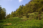
Stream valleys of the Hersbrucker Alb 
|
|
6534-371
WDPA: 555521594
|
District of Nürnberger Land
|
Flyer: Stream valleys of the Hersbrucker Alb
|
⊙
|
698.33
|
|
|
Dolomitkuppenalb
|
BW
|
6335-306
WDPA: 555521477
|
District of Nürnberger Land
|
Flyer: Dolomitkuppenalb
|
⊙
|
2,195.00
|
|
|
Wetlands in the Pegnitz Valley near Reichenschwand
|
BW
|
6434-371
WDPA: 555521546
|
District of Nürnberger Land
|
|
⊙
|
37.87
|
|
Caves of the northern Franconian Alb 
|

|
6335-305
WDPA: 555521476
|
District of Nürnberger Land , District of Bayreuth
|
Winter quarters for the great mouse-eared mouse and other bat species in natural karst caves.
|
⊙
|
0.01
|
|
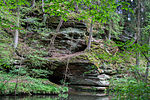
NSG 'Schwarzach-Durchbruch' and Rhätschluchten near Burgthann 
|
|
6633-371
WDPA: 555521646
|
District of Nürnberger Land
|
Deep gorge-like valleys of the Schwarzach and their tributaries with a high proportion of forest cut into the sandstone Keuper or Black Jura.
Flyer: NSG 'Schwarzach-Durchbruch' and Rhätschluchten near Burgthann
|
⊙
|
147.12
|
|
Eastern Vogelherd in the Veldenstein Forest 
|

|
6335-372
WDPA: 555521479
|
District of Nürnberger Land , District of Bayreuth
|
|
⊙
|
248.52
|
|
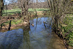
Pegnitz between Michelfeld and Hersbruck 
|
|
6335-371
WDPA: 555521478
|
District of Nürnberger Land , District of Amberg-Sulzbach , District of Bayreuth
|
|
⊙
|
310.54
|
|
Rothenberg ruins near Schnaittach 
|

|
6434-302
WDPA: 555521545
|
District of Nürnberger Land
|
|
⊙
|
3.00
|
|
Eaves slopes of the Hersbrucker Alb 
|

|
6434-301
WDPA: 555521544
|
District of Nürnberger Land , District of Amberg-Sulzbach
|
Flyer: Eaves slopes of the Hersbrucker Alb
|
⊙
|
1,472.00
|
|
Forests in the Upper Palatinate Jura 
|

|
6535-371
WDPA: 555521595
|
District of Nürnberger Land , District of Amberg-Sulzbach , District of Neumarkt in the Upper Palatinate
|
|
⊙
|
803.73
|
|
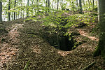
Wellucker Forest north of Koenigstein 
|
|
6335-302
WDPA: 555521475
|
District of Nürnberger Land , District of Amberg-Sulzbach
|
|
⊙
|
899.00
|
|
|
Moorings south of Allersberg and at Seligenporten
|
BW
|
6733-372
WDPA: 555521691
|
District of Roth , District of Neumarkt in the Upper Palatinate
|
|
⊙
|
11.88
|
|
|
Schwarzach from the Main-Danube Canal to Obermässing
|
BW
|
6833-372
WDPA: 555521726
|
District of Roth , District of Neumarkt in the Upper Palatinate
|
|
⊙
|
206.46
|
|
|
Burgstallwald near Gunzenhausen
|
BW
|
6830-372
WDPA: 555521721
|
Weissenburg-Gunzenhausen district
|
|
⊙
|
118.27
|
|
|
Erlenbach near Syburg
|
BW
|
6932-301
WDPA: 555521757
|
Weissenburg-Gunzenhausen district
|
|
⊙
|
59.00
|
|
|
Feuerletten slopes around Dorsbrunn and Arbachtal east of Pleinfeld
|
BW
|
6931-371
WDPA: 555521756
|
Weissenburg-Gunzenhausen district
|
|
⊙
|
159.25
|
|
Bat winter quarters in the southern Franconian Alb 
|

|
6932-371
WDPA: 555521758
|
District of Weissenburg-Gunzenhausen , Eichstätt , Neuburg-Schrobenhausen
|
|
⊙
|
7.97
|
|
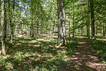
Arbor book 
|
|
7032-301
WDPA: 555521789
|
Weissenburg-Gunzenhausen district
|
|
⊙
|
20.00
|
|
Mausohrwochenstuben in the middle Franconian Alb 
|
BW
|
6833-302
WDPA: 555521724
|
District of Nürnberger Land , District of Roth , District of Weissenburg-Gunzenhausen
|
|
⊙
|
0.00
|
|
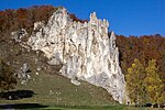
Middle Altmühltal with Wellheimer dry valley and Schambach valley 
|
|
7132-371
WDPA: 555521819
|
District of Weissenburg-Gunzenhausen , Eichstätt , Neuburg-Schrobenhausen
|
|
⊙
|
4,204.50
|
|
Nature reserve ' Auwald bei Westheim '
|
BW
|
7029-302
WDPA: 555521785
|
Weissenburg-Gunzenhausen district
|
|
⊙
|
50.00
|
|
|
Röttenbach Forest
|
BW
|
6832-372
WDPA: 555521723
|
Weissenburg-Gunzenhausen district
|
|
⊙
|
282.36
|
|
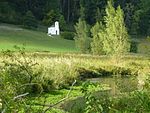
Schambachried 
|
|
7031-371
WDPA: 555521787
|
Weissenburg-Gunzenhausen district
|
|
⊙
|
11.20
|
|
|
Schambachtal with side valleys
|
BW
|
7031-373
WDPA: 555521788
|
Weissenburg-Gunzenhausen district
|
|
⊙
|
207.38
|
|
|
Quarry on Schrandelberg near Langenaltheim
|
BW
|
7131-372
WDPA: 555521818
|
Weissenburg-Gunzenhausen district
|
|
⊙
|
13.83
|
|
|
Langenaltheim quarry
|
BW
|
7131-371
WDPA: 555521817
|
Weissenburg-Gunzenhausen district
|
|
⊙
|
78.50
|
|
Eaves of the southern Franconian Alb
|

|
6833-371
WDPA: 555521725
|
District of Roth , District of Weißenburg-Gunzenhausen , District of Eichstätt
|
|
⊙
|
4,324.42
|
|
| Legend for fauna-flora-habitat
|


