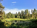
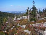
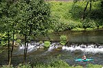
List of FFH areas in the Bayreuth district
The list of FFH areas in the Bayreuth district shows the FFH areas in the Upper Franconian district of Bayreuth in Bavaria . They partially overlap with existing nature - landscape protection and EU bird protection areas . There are a total of 25 FFH areas in the district, some of which overlap with other districts.
| Surname | image | Identifier
|
circle | details | position | Area hectares |
date | ||
|---|---|---|---|---|---|---|---|---|---|
| Maple Valley |
6134-371 WDPA: 555521377 |
Bayreuth district | ⊙ | 314.27 | |||||
| Mountain and moor meadows near Kornbach |
5936-302 WDPA: 555521256 |
Bayreuth district | ⊙ | 41.00 | |||||
|
Mountain meadows in the southern Fichtel Mountains |

|
6037-371 WDPA: 555521327 |
District of Bayreuth , the district Wunsiedel | ⊙ | 384.87 | ||||
| Bernecker cliffs |
5936-301 WDPA: 555521255 |
Bayreuth district | ⊙ | 115.00 | |||||
| Blumenau near Bad Berneck |
5935-303 WDPA: 555521254 |
County Bayreuth , district of Kulmbach | ⊙ | 71.00 | |||||
| Ehrlichbachaue near Obernsees |
6034-302 WDPA: 555521320 |
Bayreuth district | ⊙ | 7.00 | |||||
| Wetlands in the Limmersdorfer Forest |
5934-302 WDPA: 555521251 |
County Bayreuth , district of Kulmbach | ⊙ | 135.00 | |||||
| Haidenaab spring moors |
6036-301 WDPA: 555521326 |
Bayreuth district | ⊙ | 11.00 | |||||
| Haidenaabtal and Gabellohe |
6137-301 WDPA: 555521380 |
County Bayreuth , Tirschenreuth | ⊙ | 112.00 | |||||
| Heinersreuther Bach |
5936-371 WDPA: 555521258 |
Bayreuth district | ⊙ | 44.30 | |||||
|
Caves of the northern Franconian Alb |

|
6335-305 WDPA: 555521476 |
District of Nürnberger Land , District of Bayreuth , District of Amberg-Sulzbach | Winter quarters for the great mouse-eared mouse and other bat species in natural karst caves. | ⊙ | 0.01 | |||
| Kalktufmoorwiese near Wohnsdorf |
6034-303 WDPA: 555521321 |
Bayreuth district | ⊙ | 14.00 | |||||
| Landscape component 'Niederwald bei Kosbrunn' |
6234-301 WDPA: 555521424 |
Bayreuth district | ⊙ | 14.00 | |||||
| Mouse-eared colonies in the Upper Main Hills natural area |
5733-302 WDPA: 555521096 |
County Bayreuth , County Kulmbach , County Kronach | ⊙ | 0.00 | |||||
| Mouse-ear colonies in Franconian Switzerland |
6134-301 WDPA: 555521376 |
Bayreuth district | ⊙ | 2.00 | |||||
|
Shell limestone slopes northeast of Bayreuth |

|
6035-371 WDPA: 555521323 |
Bayreuth district , Bayreuth | ⊙ | 375.54 | ||||
|
Nature reserve 'Craimoosweiher' |

|
6135-301 WDPA: 555521378 |
Bayreuth district | ⊙ | 19.00 | ||||
|
Eastern Vogelherd in the Veldenstein Forest |

|
6335-372 WDPA: 555521479 |
District of Nürnberger Land , District of Bayreuth | ⊙ | 248.52 | ||||
|
Pegnitz between Michelfeld and Hersbruck |

|
6335-371 WDPA: 555521478 |
District of Nürnberger Land , District of Amberg-Sulzbach , District of Bayreuth | ⊙ | 310.54 | ||||
|
Rhätschluchten west of Bayreuth |

|
6034-301 WDPA: 555521319 |
Bayreuth district , Bayreuth | ⊙ | 37.00 | ||||
| Rotmain, Mistelbach and Ölschnitztal around Bayreuth |
6035-372 WDPA: 555521324 |
Bayreuth district , Bayreuth , Kulmbach district | ⊙ | 705.21 | |||||
|
Schneeberg massif with Fichtelseemoor |

|
5937-371 WDPA: 555521261 |
District of Bayreuth , the district Wunsiedel | ⊙ | 3,047.79 | ||||
| Forests southwest of Betzenstein |
6334-371 WDPA: 555521474 |
Bayreuth district | ⊙ | 62.60 | |||||
|
Wiesent valley with side valleys |

|
6233-371 WDPA: 555521422 |
Bamberg district , the district of Bayreuth , the district of Forchheim | ⊙ | 6,934.41 | ||||
| Intermediate moors north of Creußen |
6135-302 WDPA: 555521379 |
Bayreuth district | ⊙ | 3.00 | |||||
| Legend for fauna-flora-habitat | |||||||||
See also
- List of nature reserves in the Bayreuth district
- List of landscape protection areas in the Bayreuth district
- List of protected landscape components in the Bayreuth district
- List of natural monuments in the Bayreuth district
- List of geotopes in the Bayreuth district
- List of nature reserves in the city of Bayreuth
- List of landscape protection areas in the city of Bayreuth
- List of FFH areas in the city of Bayreuth
- List of geotopes in Bayreuth
Web links
Commons : FFH areas in the Bayreuth district - collection of images, videos and audio files