List of FFH areas in the Ostallgäu district
The list of FFH areas in the Ostallgäu district shows the FFH areas in the Swabian district of Ostallgäu in Bavaria . They partially overlap with existing nature - landscape protection and EU bird protection areas . There are 29 FFH areas in the district, some of which overlap with other districts.
| Surname | image | Identifier
|
circle | details | position | Area hectares |
date | ||
|---|---|---|---|---|---|---|---|---|---|
|
Aggenstein |
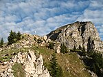
|
8429-304 WDPA: 81251 |
District of Ostallgäu | ⊙ | 130.00 | ||||
|
Alpine rim spring lakes |

|
8429-302 WDPA: 555522271 |
District of Ostallgäu | ⊙ | 233.00 | ||||
|
Ammer Mountains |
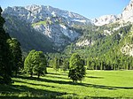
|
8431-371 WDPA: 4419 |
Garmisch-Partenkirchen , Ostallgäu | ⊙ | 27,581.80 | ||||
|
Attlesee |
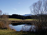
|
8329-304 WDPA: 81322 |
District of Ostallgäu | ⊙ | 69.00 | ||||
|
Elbsee |

|
8229-301 WDPA: 555522178 |
District of Ostallgäu | ⊙ | 151.00 | ||||
|
Falkenstein, Alatsee, Faulenbacher and Lech valleys |

|
8430-303 WDPA: 555522276 |
District of Ostallgäu | ⊙ | 987.00 | ||||
| Fronhalde and Holdersberg |
8229-302 WDPA: 555522179 |
District of Ostallgäu | ⊙ | 18.00 | |||||
|
Gennachhauser Moor |

|
8130-301 WDPA: 555522133 |
District of Ostallgäu | ⊙ | 234.00 | ||||
| Gillenmoos |
8128-302 WDPA: 555522132 |
District of Ostallgäu | ⊙ | 86.00 | |||||
|
Günzhangwälder Markt Rettenbach - Obergünzburg |
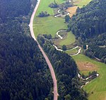
|
8128-301 WDPA: 555522131 |
Ostallgäu , Unterallgäu | ⊙ | 449.00 | ||||
| Semi-arid grassland on the Forggensee |
8330-302 WDPA: 555522234 |
District of Ostallgäu | ⊙ | 171.00 | |||||
| Tuff swamps and fens in the Ostallgäu |
8430-372 WDPA: 555522277 |
District of Ostallgäu | ⊙ | 115.55 | |||||
|
Kempter Forest with Upper Rottachtal |

|
8228-301 WDPA: 555522177 |
Oberallgäu , Ostallgäu | ⊙ | 4,096.00 | ||||
|
Kienberg with poor grass in the valley of the Steinacher Ach |
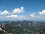
|
8429-303 WDPA: 555522272 |
District of Ostallgäu | ⊙ | 624.00 | ||||
|
Mouse-ear colonies in Eastern and Lower Allgäu |

|
7728-301 WDPA: 555522011 |
Günzburg , Ostallgäu , Unterallgäu | ⊙ | 0.00 | ||||
| Mindel spring area |
8028-371 WDPA: 555522093 |
Ostallgäu , Unterallgäu | ⊙ | 81.68 | |||||
|
Moors around Bernbeuren |

|
8230-371 WDPA: 555522181 |
Weilheim-Schongau , Ostallgäu | ⊙ | 325.95 | ||||
|
Nature reserve 'Bannwaldsee' |

|
8430-301 WDPA: 555522275 |
District of Ostallgäu | ⊙ | 558.00 | ||||
|
Upper Mindel |
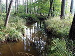
|
8028-373 WDPA: 555522095 |
Ostallgäu , Unterallgäu | ⊙ | 88.65 | ||||
| Pfrontener Wasenmoos and Moore near Hopferau |
8429-371 WDPA: 555522274 |
District of Ostallgäu | ⊙ | 158.44 | |||||
| Meltwater channels and dead ice holes near Pfronten |
8429-301 WDPA: 555522270 |
District of Ostallgäu | ⊙ | 38.00 | |||||
| Senkele |
8329-305 WDPA: 555522233 |
District of Ostallgäu | ⊙ | 159.00 | |||||
|
Staffelwald near Irsee and Hammerschmiede clay pit |
 Hammerschmiede clay pit |
8029-371 WDPA: 555522096 |
Kaufbeuren , Ostallgäu district | ⊙ | 329.89 | ||||
|
Sulzschneider Moore |

|
8329-303 WDPA: 395806 |
District of Ostallgäu | ⊙ | 1,795.00 | ||||
|
Trauchberger Ach, moors and forests on the northern edge of the Ammer Mountains |

|
8331-303 WDPA: 555522239 |
Weilheim-Schongau , Ostallgäu | ⊙ | 1,129.00 | ||||
| Lower Halch |
8330-303 WDPA: 555522235 |
District of Ostallgäu | ⊙ | 120.00 | |||||
| Original felt, Premer felt and cattle pastures |
8330-371 WDPA: 555522236 |
Weilheim-Schongau , Ostallgäu | ⊙ | 546.57 | |||||
| Weihermoos wood people |
8329-302 WDPA: 555522230 |
District of Ostallgäu | ⊙ | 144.00 | |||||
|
Wertach breakthrough |

|
8329-301 WDPA: 555537965 |
Oberallgäu , Ostallgäu | ⊙ | 876.00 |
|
|||
| Legend for fauna-flora-habitat | |||||||||
See also
- List of nature reserves in the Ostallgäu district
- List of landscape protection areas in the Ostallgäu district
- List of geotopes in the Ostallgäu district
Web links
Commons : Special Areas of Conservation in the Ostallgäu district - collection of images, videos and audio files