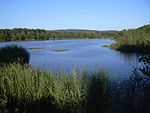
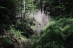
List of landscape protection areas in Lower Franconia
The list of landscape protection areas in Lower Franconia includes the following lists of landscape protection areas in Lower Franconian counties and cities from the article namespace:
Counties and municipalities
- List of landscape protection areas in the Aschaffenburg district
- List of landscape protection areas in Aschaffenburg
- List of landscape protection areas in the Bad Kissingen district
- List of landscape protection areas in the Haßberge district
- List of landscape protection areas in the Kitzingen district
- List of landscape protection areas in the Main-Spessart district
- List of landscape protection areas in the Miltenberg district
- List of landscape protection areas in the Rhön-Grabfeld district
- List of landscape protection areas in the district of Schweinfurt
- List of landscape protection areas in Schweinfurt
- List of landscape protection areas in the Würzburg district
The selection corresponds to the administrative region of Lower Franconia . There are 37 landscape protection areas in the administrative district (as of October 2018).
Notes on the information in the table
- Area name : Official designation of the protected area
- Image / Commons : Image and link to other images from the protected area
- LSG-ID : Official number of the protected area
- WDPA-ID : Link to the World Database on Protected Areas database of the protected area
- Wikidata : Link to the Wikidata entry for the protected area
- Designation : Date of designation as a protected area
- Municipality (s) : Municipalities in which the protected area is located
- Location : geographical location
- Area : total area of the protected area in hectares
- Area share : Proportionate areas of the protected area in counties / municipalities, given in% of the total area
- Comment : Special features and comments
Except for the Position column , all columns can be sorted.
| Territory name | Image / Commons | LSG ID | WDPA ID | Wikidata | Expulsion | Parish (noun) | location | Area ha | Area share | comment |
|---|---|---|---|---|---|---|---|---|---|---|
| LSG in the districts of Kahl am Main and Alzenau in Ufr. |
 |
LSG-00293.01 | 395770 | Q59634073 | 1978 | position | 2579.84 | Aschaffenburg district (100%) |
|
|
| LSG Lindigwald in the Karlstein district |

|
LSG-00293.02 | 395771 | Q59634077 | 1978 | position | 245.97 | Aschaffenburg district (100%) | ||
| LSG Unter- and Oberhübnerwald in the Stockstadt district |

|
LSG-00293.03 | 395772 | Q59634081 | 1978 | position | 951.81 | Aschaffenburg district (100%) | ||
| Main meadows |

|
LSG-00594.01 | 396143 | Q59634083 | 2006 | position | 50.68 | Aschaffenburg district (100%) | ||
| Protection of a landscape area in the Großostheim district, Aschaffenburg district - former Höfling gravel pit |

|
LSG-00274.01 | 395751 | Q59634069 | 1975 | position | 9.93 | Aschaffenburg district (100%) |
|
|
| LSG Bavarian Rhön |
 |
LSG-00563.01 | 396113 | Q59632925 | 1983 | position | 96076.6 | Bad Kissingen district (56%), Rhön-Grabfeld district (43.9%) | ||
| LSG Höret and Zückberg in the Arnshausen district, City of Bad Kissingen, Bad Kissingen district | LSG-00466.01 | 395974 | Q59633388 | 1992 | position | 62.3 | Bad Kissingen district (100%) |
|
||
| LSG within the Hassberge Nature Park (formerly protection zone) |
 |
LSG-00573.01 | 396122 | Q59632927 | 1987 | position | 56385.96 | Bamberg district (12.3%), Rhön-Grabfeld district (19.5%), Haßberge district (66.6%), Schweinfurt district (1.6%) | ||
| LSG within the Steigerwald Nature Park (formerly a protection zone) |
 |
LSG-00569.01 | 396119 | Q59586157 | 1988 | position | 88558.46 | Bamberg district (20.3%), Erlangen-Höchstadt district (3.6%), Neustadt an der Aisch district (38.4%), Haßberge district (17.0%), Kitzingen district (14.0%), District of Schweinfurt (6.7%) | ||
| Wässernachtal in the Haßfurt district - Part I | LSG-00139.01 | 395611 | Q59633311 | 1967 | position | 361.66 | District of Haßberge (99.7%) | |||
| Wässernachtal in the Haßfurt district - Part II |
 |
LSG-00139.02 | 395612 | Q59633312 | 1967 | position | 783.65 | District of Haßberge (99.9%) |
|
|
| Protection of parts of the landscape in the municipality of Reupelsdorf, district of Gerolzhofen - Reupelsdorf state forest area | LSG-00210.01 | 395690 | Q59633230 | 1971 | position | 210.8 | District of Kitzingen (100%) | |||
| Volkacher Mainschleife |
 |
LSG-00170.01 | 395639 | Q59633208 | 1969 | position | 5326.93 | District of Kitzingen (61.9%), District of Schweinfurt (16.3%), District of Würzburg (21.7%) |
|
|
| LSG within the Spessart Nature Park (formerly a protection zone) |
 |
LSG-00561.01 | 396111 | Q59633087 | 1982 | position | 136627.09 | District Aschaffenburg (33.4%), District Miltenberg (16.8%), District Main-Spessart (48.7%) |
|
|
| LSG within the Bavarian Odenwald Nature Park (formerly a protection zone) |
 |
LSG-00562.01 | 396112 | Q59633088 | 1982 | position | 30541.4 | Aschaffenburg district (2.9%), Miltenberg district (97.1%) |
|
|
| Herlheim meadows | LSG-00481.01 | 395989 | Q59633663 | 1994 | position | 67.57 | District of Schweinfurt (100%) | |||
| LSG Ellertshäuser See |
 |
LSG-00327.01 | 395817 | Q59633646 | 1981 | position | 256.41 | District of Schweinfurt (100%) | ||
| LSG Hausener Tal |
|
LSG-00377.01 | 395886 | Q59633651 | 1985 | position | 1206.96 | District of Schweinfurt (100%) | ||
| LSG Im Kies and Unterer Unkenbach | LSG-00407.01 | 395915 | Q59633656 | 1987 | position | 50.96 | District of Schweinfurt (100%) |
|
||
| LSG Üchtelhäuser reason | LSG-00386.01 | 395894 | Q59633655 | 1986 | position | 39.55 | District of Schweinfurt (99.7%) | |||
| LSG area around the old and new lake | LSG-00433.01 | 395941 | Q59633658 | 1989 | position | 158.18 | District of Schweinfurt (100%) | |||
| LSG Weipoltshäuser- and Jeusing-Grund | LSG-00459.01 | 395967 | Q59633660 | 1992 | position | 366.27 | District of Schweinfurt (100%) | |||
| LSG Zeller Grund | LSG-00381.01 | 395889 | Q59633653 | 1986 | position | 106.21 | District of Schweinfurt (99.5%) | |||
| Mainau landscape near Sennfeld | LSG-00473.01 | 395981 | Q59633662 | 1993 | position | 50.01 | District of Schweinfurt (99.9%) | |||
| Protection of the landscape around the Sulzheimer gypsum hill in the Sulzheim district, Schweinfurt district |
 |
LSG-00335.01 | 395825 | Q59633649 | 1982 | position | 34.98 | District of Schweinfurt (100%) | ||
| Protection of parts of the landscape in the Schweinfurt district | LSG-00074.01 | 395498 | Q59633640 | 1956 | position | 90.46 | District of Schweinfurt (100%) | |||
| Protection of parts of the landscape in the Abersfeld district, Schweinfurt district | LSG-00201.01 | 395681 | Q59633645 | 1971 | position | 180.4 | District of Schweinfurt (99.8%) | |||
| Weyerer Bergheide with hillside forests and oxbow lakes | LSG-00498.01 | 396006 | Q59633665 | 1996 | position | 34.49 | District of Schweinfurt (100%) |
|
||
| Landscape protection of the Mainleite in the area of the city of Schweinfurt and the district of Schweinfurt |
 |
LSG-00075.01 | 395499 | Q59633642 | 1956 | position | 40.89 | Schweinfurt (86.5%), district of Schweinfurt (13.5%) | ||
| Protection of part of the landscape in the area of the city of Schweinfurt and the district of Schweinfurt | LSG-00084.01 | 395505 | Q59633643 | 1956 | position | 31.55 | Schweinfurt (76.9%), district of Schweinfurt (23.0%) |
|
||
| LSG Polisina in the Ochsenfurt and Frickenhausen districts | LSG-00453.01 | 395961 | Q59633450 | 1991 | position | 58.89 | District of Würzburg (99.8%) | |||
| LSG valleys of the Tauber, Gollach, Steinach and surrounding forests in the districts of Aub, Baldersheim, Burgerroth, Bieberehren, Buch, Klingen, Strüth, Aufstetten, Tauberrettersheim and Riedenheim | LSG-00447.01 | 395955 | Q59633449 | 1990 | position | 2863.62 | District of Würzburg (99.9%) | |||
| Main valley protection landscape Thüngersheim | LSG-00083.01 | 395504 | Q59633443 | 1956 | position | 283.22 | District of Würzburg (100%) | |||
| Ochsenfurter Forst and Hübnerholz | LSG-00261.01 | 395739 | Q59633447 | 1973 | position | 146.47 | District of Würzburg (100%) | |||
| Thierbachtal | LSG-00050.01 | 395478 | Q59633442 | 1955 | position | 139.23 | District of Würzburg (100%) | |||
| Riverside strip on the Main between the market in Zell am Main and the border between the Würzburg district and the district of Main-Spessart | LSG-00152.01 | 395623 | Q59633444 | 1968 | position | 80.14 | District of Würzburg (100%) | |||
| Volkenberg | LSG-00152.02 | 395624 | Q59633446 | 1968 | position | 380.13 | District of Würzburg (99.8%) |
See also
- List of nature reserves in Lower Franconia
- List of FFH areas in Lower Franconia
- List of EU bird protection areas in Lower Franconia
- List of geotopes in Lower Franconia
Individual evidence
- ↑ Green List, Landscape Protection Areas Lower Franconia , accessed on November 27, 2015.
Web links
Commons : Landscape protection areas in Lower Franconia - collection of images, videos and audio files