List of landscape protection areas in Upper Bavaria
The list of landscape protection areas in Upper Bavaria includes the following lists of landscape protection areas in Upper Bavarian districts and cities from the article namespace:
Counties and municipalities
- List of landscape protection areas in the Altötting district
- List of landscape protection areas in the Bad Tölz-Wolfratshausen district
- List of landscape protection areas in the Berchtesgadener Land district
- List of landscape protection areas in the district of Dachau
- List of landscape protection areas in the district of Ebersberg
- List of landscape protection areas in the Eichstätt district
- List of landscape protection areas in the district of Erding
- List of landscape protection areas in the Freising district
- List of landscape protection areas in the Fürstenfeldbruck district
- List of landscape protection areas in the Garmisch-Partenkirchen district
- List of landscape protection areas in Ingolstadt
- List of landscape protection areas in the Landsberg am Lech district
- List of landscape protection areas in the Miesbach district
- List of landscape protection areas in the Mühldorf am Inn district
- List of landscape protection areas in the Munich district
- List of landscape protection areas in Munich
- List of landscape protection areas in the district of Neuburg-Schrobenhausen
- List of protected landscape areas in the Pfaffenhofen an der Ilm district
- List of landscape protection areas in Rosenheim
- List of landscape protection areas in the district of Rosenheim
- List of landscape protection areas in the Starnberg district
- List of landscape protection areas in the Traunstein district
- List of landscape protection areas in the Weilheim-Schongau district
There are 248 landscape protection areas in the administrative district (as of November 2018).
Notes on the information in the table
- Area name : Official designation of the protected area
- Image / Commons : Image and link to other images from the protected area
- LSG-ID : Official number of the protected area
- WDPA-ID : Link to the World Database on Protected Areas database of the protected area
- Wikidata : Link to the Wikidata entry for the protected area
- Designation : Date of designation as a protected area
- Municipality (s) : Municipalities in which the protected area is located
- Location : geographical location
- Area : total area of the protected area in hectares
- Area share : Proportionate areas of the protected area in counties / municipalities, given in% of the total area
- Comment : Special features and comments
Except for the Position column , all columns can be sorted.
| Territory name | Image / Commons | LSG ID | WDPA ID | Wikidata | Expulsion | Parish (noun) | location | Area ha | Area share | comment |
|---|---|---|---|---|---|---|---|---|---|---|
| Protection of the Schloßberg in Wald an der Alz as LSG |
 |
LSG-00168.01 | 395637 | Q59643664 | 1969 | position | 30.94 | Altötting district (100%) | ||
| LSG Dachlwand in the communities of Perach, Schutzing, Marktlberg and Marktl, district of Altötting |
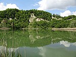 |
LSG-00162.01 | 395632 | Q59643485 | 1969 | position | 74.77 | Altötting district (100%) | ||
| LSG Mörnbachtal-Gries in the area of the towns of Altötting and Neuötting | LSG-00311.01 | 395798 | Q59643769 | 1979 | position | 18.52 | Altötting district (100%) | |||
| LSG Salzachtal in the area of the municipality of Haiming, the city of Burghausen and the municipalities of Raitenhaslach and Burgkirchen an der Alz |
 |
LSG-00289.01 | 395767 | Q59643839 | 1977 | position | 1092.88 | Altötting district (100%) | ||
| LSG Steinhausener Burgberg and Quellsumpf in the area of the municipality of Erlbach | LSG-00310.01 | 395797 | Q59643714 | 1979 | position | 25.27 | Altötting district (100%) | |||
| Protection of the Mörnbachtal with subsequent high terrace and parts of the Osterwiese in the area of the communities of Tüßling, Untersteukirchen and Garching an der Alz, district of Altötting | LSG-00305.01 | 395784 | Q59643517 | 1979 | position | 623.9 | Altötting district (100%) |
|
||
| Order to protect the Altenberg felt in the Manhartshofen community |
 |
LSG-00055.01 | 395483 | Q59643685 | 1955 | position | 29.82 | Bad Tölz-Wolfratshausen district (100%) | ||
| Eglinger and Ascholdinger felts |
 |
LSG-00326.01 | 395814 | Q59643530 | 1981 | position | 59.02 | Bad Tölz-Wolfratshausen district (100%) | ||
| Großer Weiher (= Harmatinger Weiher) |
 |
LSG-00326.03 | 395816 | Q59643589 | 1981 | position | 47.36 | Bad Tölz-Wolfratshausen district (100%) | ||
| Protection of the Oberallmannshauser Filze as LSG in the area of the communities of Höhenrain and Münsing |
 |
LSG-00206.01 | 395686 | Q59643489 | 1971 | position | 73.57 | Bad Tölz-Wolfratshausen district (99.9%) | ||
| Landscape protection for the high moor near the Schemeralm, Lenggries municipality | LSG-00005.01 | 395449 | Q59643745 | 1950 | position | 22.97 | Bad Tölz-Wolfratshausen district (100%) | |||
| LSG Ebenbergfilze in the Dietramszell community |
 |
LSG-00329.01 | 395819 | Q59643773 | 1982 | position | 17.36 | Bad Tölz-Wolfratshausen district (100%) | ||
| LSG Isarauen |
 |
LSG-00202.01 | 395682 | Q59643836 | 1971 | position | 1103.75 | Bad Tölz-Wolfratshausen district (100%) | ||
| LSG east bank of Lake Starnberg near Münsing |
 |
LSG-00425.01 | 395933 | Q59643442 | 1988 | position | 85.64 | Bad Tölz-Wolfratshausen district (99.9%) | starnberger Lake | |
| LSG Schönberg in the municipalities of Deining and Egling, now Egling, Bad Tölz-Wolfratshausen district |
 |
LSG-00264.01 | 395742 | Q59643750 | 1973 | position | 213.57 | Bad Tölz-Wolfratshausen district (100%) | ||
| LSG Sylvensteinsee and upper Isar valley in the communities of Lenggries and Jachenau |
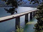 |
LSG-00341.01 | 395849 | Q59643565 | 1983 | position | 5105.16 | Bad Tölz-Wolfratshausen district (99.9%) | ||
| LSG Walchensee |
 |
LSG-00492.01 | 396000 | Q59643643 | 1995 | position | 3506.76 | Bad Tölz-Wolfratshausen district (100%) | ||
| Mooshamer pond |
 |
LSG-00326.02 | 395815 | Q59643558 | 1981 | position | 53.12 | Bad Tölz-Wolfratshausen district (100%) | with spade felt | |
| Protection of part of the landscape in the municipality of Jachenau, high moor at Rauthof | LSG-00002.01 | 390713 | Q59643456 | 1949 | position | 8.02 | Bad Tölz-Wolfratshausen district (100%) | |||
| Protection of parts of the landscape in the area of the so-called Bergl northeast of Ramsau in the municipality of Oberbuchen, now Bad Heilbrunn | LSG-00098.01 | 395520 | Q59643847 | 1961 | position | 1.01 | Bad Tölz-Wolfratshausen district (100%) | |||
| Protection of parts of the landscape in the Hirschbachtal |
 |
LSG-00214.01 | 395693 | Q59643846 | 1971 | position | 1001.96 | Bad Tölz-Wolfratshausen district (100%) | ||
| Protection of parts of the landscape in the Isar valley between Icking and Königsdorf |
 |
LSG-00155.01 | 395625 | Q59643841 | 1968 | position | 1037.65 | Bad Tölz-Wolfratshausen district (100%) | ||
| Protection of parts of the landscape in the municipality of Dietramszell (Kreuzbichl) |
 |
LSG-00527.01 | 396060 | Q59651115 | 1998 | position | 49.09 | Bad Tölz-Wolfratshausen district (100%) | ||
| Position of the Rothenrainer Moore, Unterfischbach municipality, under landscape protection | LSG-00065.01 | 395490 | Q59643777 | 1955 | position | 166.2 | Bad Tölz-Wolfratshausen district (100%) | |||
| Position of the Auerfilzes with carp lakes, community Schönrain, under landscape protection |
 |
LSG-00066.01 | 395491 | Q59242010 | 1955 | position | 90.27 | Bad Tölz-Wolfratshausen district (100%) |
Carp lakes
|
|
| LSG Ainringer and Peracher Moos |
 |
LSG-00487.01 | 395995 | Q59643608 | 1995 | position | 401.96 | District of Berchtesgadener Land (100%) | Ainringer moss | |
| LSG Aschau, Bischofswiesen community | LSG-00441.01 | 395949 | Q59643536 | 1989 | position | 57.2 | District of Berchtesgadener Land (100%) | |||
| LSG on the Tumpen and the Krumbichl, Marzoll municipality |
 |
LSG-00224.01 | 395702 | Q59643454 | 1971 | position | 81.23 | District of Berchtesgadener Land (99.9%) | ||
| LSG Barmstein, district Scheffau, Marktschellenberg market |
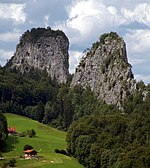 |
LSG-00347.01 | 395855 | Q59643802 | 1983 | position | 148.5 | District of Berchtesgadener Land (99.9%) | Barmsteine | |
| LSG Burgergraben, Bischofswiesen community | LSG-00348.01 | 395856 | Q59643430 | 1983 | position | 9.91 | District of Berchtesgadener Land (100%) | |||
| LSG Höglwörther See, municipality of Anger |
 |
LSG-00219.01 | 395697 | Q59651246 | 1971 | position | 123.28 | District of Berchtesgadener Land (100%) | Höglwörther See | |
| LSG Kirchholz, City of Bad Reichenhall and the municipality of Bayerisch Gmain |
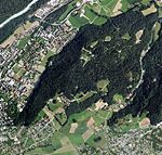 |
LSG-00394.01 | 395902 | Q59643798 | 1986 | position | 152.29 | District of Berchtesgadener Land (100%) | Kirchholz | |
| LSG Kulbinger Filz, City of Laufen |
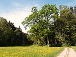 |
LSG-00349.01 | 395857 | Q59643429 | 1983 | position | 90.19 | District of Berchtesgadener Land (100%) | ||
| LSG Lattengebirge |
|
LSG-00220.01 | 395698 | Q59643675 | 1971 | position | 2946.27 | District of Berchtesgadener Land (100%) | Lattengebirge | |
| LSG Upper Saalachtal with Wendelberg and Kienberg, municipality of Schneizlreuth |
 |
LSG-00430.01 | 395938 | Q59643461 | 1989 | position | 783.7 | District of Berchtesgadener Land (100%) | Saalachtal | |
| LSG upper reaches of the Kleine Sur | LSG-00488.01 | 395996 | Q59643474 | 1995 | position | 77.2 | District of Berchtesgadener Land (100%) | |||
| LSG Ortelbach in the area of the municipality of Bayerisch Gmain | LSG-00321.01 | 395808 | Q59643567 | 1981 | position | 51.15 | District of Berchtesgadener Land (100%) | |||
| LSG Rostwald / Stanggaß |
 |
LSG-00383.01 | 395891 | Q59643654 | 1986 | position | 326.2 | District of Berchtesgadener Land (100%) | ||
| LSG Saalachauen north of Bad Reichenhall |
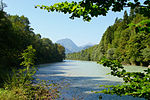 |
LSG-00226.01 | 395704 | Q59643549 | 1971 | position | 533.51 | District of Berchtesgadener Land (99.9%) | ||
| LSG Taubensee, municipality of Ramsau near Berchtesgaden |
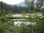 |
LSG-00346.01 | 395854 | Q59651182 | 1983 | position | 28.7 | District of Berchtesgadener Land (100%) | Pigeon lake | |
| LSG Thumsee, City of Bad Reichenhall and the municipality of Schneizlreuth |
 |
LSG-00385.01 | 395893 | Q59643840 | 1986 | position | 1074.66 | District of Berchtesgadener Land (100%) | Thumsee | |
| LSG Untersberg with outlying areas, the community of Bischofswiesen, Markt Berchtesgaden and Marktschellenberg as well as the community-free area Schellenberger Forst |
 |
LSG-00442.01 | 395950 | Q59643633 | 1989 | position | 3595.47 | District of Berchtesgadener Land (99.9%) | Untersberg | |
| Saalach-Salzachauen |
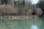 |
LSG-00497.01 | 396005 | Q59643568 | 1996 | position | 504.93 | District of Berchtesgadener Land (100%) | Saalachauen (city of Freilassing) and Saalach-Salzachauen (city of Laufen) | |
| Protection of the Abtsdorfer See and the surrounding landscape |
 |
LSG-00303.01 | 395782 | Q19964654 | 1979 | position | 551.62 | District of Berchtesgadener Land (100%) | ||
| Protection of Ulrichshögl, Ainring community |
 |
LSG-00070.01 | 395495 | Q59643464 | 1956 | position | 78.66 | District of Berchtesgadener Land (100%) |
|
|
| Parts of the landscape near Thalhausen | LSG-00216.01 | 395694 | Q59643747 | 1971 | position | 22.6 | District of Dachau (100%) | |||
| LSG Amperauen with Hebertshauser Moos and Inhauser Moos |
 |
LSG-00342.01 | 395850 | Q59643761 | 1983 | position | 1840.3 | District of Dachau (100%) | ||
| Ordinance of the district of Dachau on a LSG in the Glonntal |
 |
LSG-00270.01 | 395748 | Q59643763 | 1974 | position | 1833.48 | District of Dachau (99.9%) | ||
| Ordinance of the district of Dachau on a LSG in Palsweiser Moos | LSG-00271.01 | 395749 | Q59643660 | 1974 | position | 311.74 | District of Dachau (100%) |
|
||
| LSG Dobelgebiet and Atteltal in the area of the city of Grafing near Munich and the municipality of Aßling |
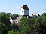 |
LSG-00382.01 | 395890 | Q59643524 | 1986 | position | 598.39 | District of Ebersberg (100%) | ||
| LSG Katzenreuther Filze in the city of Grafing near Munich | LSG-00429.01 | 395937 | Q59643437 | 1989 | position | 88.03 | District of Ebersberg (100%) | |||
| LSG Kirchseeoner Moos |
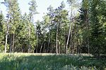 |
LSG-00529.01 | 396062 | Q59643514 | 1999 | position | 65.61 | District of Ebersberg (100%) | ||
| LSG Kupferbachtal and the surrounding area in Markt Glonn and the municipality of Egmating |
 |
LSG-00367.01 | 395876 | Q59643658 | 1985 | position | 315.33 | District of Ebersberg (100%) | ||
| LSG Steinsee, Moosach, Doblbach, Brucker Moos and the surrounding area |
 |
LSG-00406.01 | 395914 | Q59643715 | 1987 | position | 2486.88 | District of Ebersberg (99.9%) | Steinsee | |
| LSG Toteiskessellandschaft Kastenseeon in Markt Glonn and the municipality of Egmating |
 |
LSG-00376.01 | 395885 | Q59643535 | 1985 | position | 575.59 | District of Ebersberg (99.9%) | Kastenseeoner See | |
| Protection of the chain of ponds in the city of Ebersberg as LSG |
 |
LSG-00515.01 | 396026 | Q59643793 | 1998 | position | 154.18 | District of Ebersberg (100%) | ||
| Protection of the Ebersberg Forest in the Ebersberg district as LSG |
 |
LSG-00354.01 | 395863 | Q59651097 | 1984 | position | 7552.76 | District of Ebersberg (100%) | ||
| Protection of Lake Egglburg and the surrounding area |
 |
LSG-00514.01 | 396025 | Q59643781 | 1998 | position | 163.61 | District of Ebersberg (100%) | ||
| Protection of the terminal moraine between the city of Ebersberg and the market in Kirchseeon as LSG |
 |
LSG-00339.01 | 395829 | Q59643629 | 1983 | position | 368.03 | District of Ebersberg (100%) | ||
| Protection of the Kitzelsee and its surroundings in the municipality of Moosach and the market town of Glonn as LSG |
 |
LSG-00337.01 | 395827 | Q59643753 | 1982 | position | 20.31 | District of Ebersberg (100%) |
|
|
| Protection zone in the Altmühltal nature park |
 |
LSG-00565.01 | 396115 | Q23787649 | 1995 | position | 163135.05 | Ingolstadt (0.1%), District of Eichstätt (36.3%), District of Neuburg-Schrobenhausen (4.0%), District of Kelheim (8.7%), District of Neumarkt in der Oberpfalz (8.2%), District Regensburg (1.5%), Roth district (6.4%), Weißenburg-Gunzenhausen district (22.8%), Donau-Ries district (11.8%) |
|
|
| Isental and southern source streams |
 |
LSG-00506.01 | 396017 | Q59643751 | 1997 | position | 2110.74 | District of Erding (99.9%) | Isen | |
| LSG Peat moorland near Klösterlschwaige | LSG-00364.01 | 395873 | Q59643817 | 1984 | position | 135.45 | District of Erding (100%) | |||
| LSG north of Zengermoos (birch forest) |
 |
LSG-00304.01 | 395783 | Q59651231 | 1979 | position | 226.6 | District of Erding (100%) | Zengermoss | |
| LSG Sempt- and Schwillachtal |
 |
LSG-00397.01 | 395905 | Q59643789 | 1986 | position | 1553.87 | District of Erding (100%) | ||
| Notzinger Weiher and surroundings | LSG-00486.01 | 395994 | Q59643830 | 1994 | position | 118.96 | District of Erding (100%) | |||
| Headwaters of the Schwillach | LSG-00505.01 | 396016 | Q59643783 | 1997 | position | 162.46 | District of Erding (100%) | |||
| Protection of the Kempfinger Lohes near Eichenried, municipality of Moosinning | LSG-00022.01 | 395465 | Q59643433 | 1953 | position | 9.65 | District of Erding (100%) | |||
| Protection of Eicherloh and the surrounding area, municipality of Finsing |
 |
LSG-00053.01 | 395481 | Q59643600 | 1955 | position | 432.39 | District of Erding (100%) |
|
|
| District ordinance for the protection of the tertiary edge of the hill from Maisteig to the city limits of Freising | LSG-00181.01 | 395653 | Q59643593 | 1970 | position | 444.85 | District of Freising (100%) | |||
| LSG Ampertal in the Freising district |
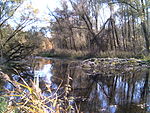 |
LSG-00546.01 | 396097 | Q59643438 | 1960 | position | 8729.18 | District of Freising (100%) | ||
| Ordinance of the district of Upper Bavaria on the protection of parts of the landscape along the Isar in the districts of Bad-Tölz-Wolfratshausen, Munich, Freising and Erding as LSG |
 |
LSG-00384.01 | 395892 | Q59643434 | 1986 | position | 8931.65 | Bad Tölz-Wolfratshausen district (7.2%), Erding district (4.0%), Freising district (52.8%), Munich district (36.0%) | ||
| Ordinance of the district of Freising on the LSG Freisinger Moos and Echinger Gfild |
 |
LSG-00552.01 | 396103 | Q59643542 | 2001 | position | 5476.07 | District of Freising (100%) | ||
| Ordinance of the Freising district on the LSG Mooslandschaft south of Hallbergmoos |
 |
LSG-00452.01 | 395960 | Q59643559 | 1990 | position | 524.33 | District of Freising (100%) |
|
|
| Ampermoos and Eichbühl | LSG-00500.01 | 396008 | Q59643452 | 1996 | position | 81.42 | Fürstenfeldbruck district (100%) | |||
| Fußberger moss | LSG-00309.02 | 395789 | Q59643803 | 1979 | position | 148.46 | Fürstenfeldbruck district (100%) | |||
| Graßlfinger Moos and Olchinger See |
 |
LSG-00309.09 | 395796 | Q59643527 | 1979 | position | 598.11 | Fürstenfeldbruck district (100%) | Olchinger See , a quarry pond in the west of the city of Olching | |
| Haspelmoor |
 |
LSG-00309.04 | 395791 | Q59651198 | 1979 | position | 265.08 | Fürstenfeldbruck district (100%) | ||
| Kreuzling Forest |
 |
LSG-00309.07 | 395794 | Q59643683 | 1979 | position | 290.99 | Fürstenfeldbruck district (100%) | ||
| LSG Scharwerkholz |
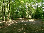 |
LSG-00484.01 | 395992 | Q59643767 | 1994 | position | 18.77 | Fürstenfeldbruck district (100%) | ||
| Middle amperes, pond catching Fürstenfeldbruck |
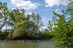 |
LSG-00309.08 | 395795 | Q59643545 | 1979 | position | 541.69 | Fürstenfeldbruck district (100%) | ||
| Upper amperes |
 |
LSG-00309.01 | 395788 | Q59643749 | 1979 | position | 2135.82 | Fürstenfeldbruck district (99.9%) | ||
| Parsberg |
 |
LSG-00309.06 | 395793 | Q59643585 | 1979 | position | 488.51 | Fürstenfeldbruck district (100%) | ||
| Triftwiesen Germering |
 |
LSG-00309.03 | 395790 | Q59643801 | 1979 | position | 148.8 | Munich (1.3%), Fürstenfeldbruck district (98.6%) | ||
| Lower amperes |
 |
LSG-00480.01 | 395988 | Q59643537 | 1994 | position | 566.69 | Fürstenfeldbruck district (100%) | ||
| Ordinance of the district of Fürstenfeldbruck on the LSG Emmeringer Leite , Eichenauer Wald |
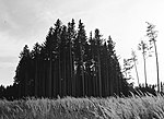 |
LSG-00503.01 | 396014 | Q59643544 | 1996 | position | 547.78 | Fürstenfeldbruck district (100%) | ||
| Wild moss | LSG-00309.05 | 395792 | Q59643843 | 1979 | position | 102.67 | Fürstenfeldbruck district (100%) |
|
||
| Landslide area Vorderbichl in Grainau | LSG-00281.02 | 395757 | Q59643666 | 1976 | position | 30.29 | District of Garmisch-Partenkirchen (100%) | |||
| Protection of the Soiener See and its surroundings |
 |
LSG-00015.01 | 395458 | Q59643743 | 1952 | position | 221.65 | District of Garmisch-Partenkirchen (100%) | ||
| Landscape south of the Estergebirge |
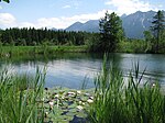 |
LSG-00281.03 | 395758 | Q59643805 | 1976 | position | 1473.99 | District of Garmisch-Partenkirchen (100%) | ||
| Loisach Valley between Schmölz and Griesen |
 |
LSG-00281.04 | 395759 | Q59643634 | 1976 | position | 359.77 | District of Garmisch-Partenkirchen (100%) | ||
| Ramsachleiten and Alte Loisach near Murnau am Staffelsee |
 |
LSG-00507.01 | 396018 | Q59643710 | 1997 | position | 259.52 | District of Garmisch-Partenkirchen (100%) | ||
| Protection of the Staffelsee area |
 |
LSG-00062.01 | 395488 | Q59643713 | 1955 | position | 2545.64 | District of Garmisch-Partenkirchen (100%) | ||
| Protection of landscape areas at the Riegsee (Landscape Protection Ordinance Riegsee) |
 |
LSG-00336.01 | 395826 | Q59643694 | 1982 | position | 282.26 | District of Garmisch-Partenkirchen (100%) | ||
| Wetterstein area including mountain pine belt near Mittenwald |
 |
LSG-00281.01 | 395756 | Q59643440 | 1976 | position | 8589.19 | District of Garmisch-Partenkirchen (100%) |
|
|
| LSG Auwald south of the Danube |
 |
LSG-00344.01 | 395852 | Q59643515 | 1983 | position | 637.62 | Ingolstadt (99.9%) | ||
| LSG alluvial forest remains south of Wankelstrasse | LSG-00501.01 | 396009 | Q59643775 | 1996 | position | 17.27 | Ingolstadt (100%) | |||
| LSG Danube bulk landscape in the Roten Gries | LSG-00545.01 | 396096 | Q59643510 | 2001 | position | 67 | Ingolstadt (100%) | |||
| LSG Gerolfinger Eichenwald |
 |
LSG-00287.01 | 395765 | Q59643471 | 1977 | position | 772.22 | Ingolstadt (100%) | ||
| LSG tendril complex west of Irgertsheim | LSG-00531.01 | 396064 | Q59643670 | 1999 | position | 3.72 | Ingolstadt (100%) | |||
| LSG Sandrachaue southwest of Unterbrunnenreuth | LSG-00559.01 | 396110 | Q59643812 | 2002 | position | 14.94 | Ingolstadt (100%) | |||
| LSG Zucheringer grove |
 |
LSG-00345.01 | 395853 | Q59643495 | 1983 | position | 72.42 | Ingolstadt (100%) |
|
|
| Ammersee-West |
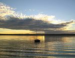 |
LSG-00509.01 | 396020 | Q59643435 | 1997 | position | 8823.75 | Landsberg am Lech district (100%) | ||
| Protection of the Weldner Weiher (Hof-, Kreuz-, Neu- and Mühlweiher) and the adjacent parts of the landscape in the municipality of Fuchstal, municipality part of Welden, district of Landsberg am Lech as LSG |
 |
LSG-00294.01 | 395773 | Q59643835 | 1978 | position | 114.05 | Landsberg am Lech district (100%) | ||
| Protection of the Breiten Moos, municipality of Apfeldorf and Birkland under landscape protection |
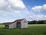 |
LSG-00011.01 | 395456 | Q59643539 | 1952 | position | 56.73 | Landsberg am Lech district (100%) | ||
| Protection of parts of the landscape on both sides of the Lech from the city of Landsberg to the northern boundary of the Landsberg district as LSG Lechtal-Nord |
 |
LSG-00419.01 | 395927 | Q59643736 | 1988 | position | 2277.99 | Landsberg am Lech district (100%) | ||
| Protection of parts of the landscape on both sides of the Lech from the city of Landsberg to the southern border of the Landsberg near Kinsau as LSG Lechtal-Süd |
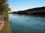 |
LSG-00420.01 | 395928 | Q59643620 | 1988 | position | 3904.1 | Landsberg am Lech district (100%) | ||
| Parts of the landscape around the Windach reservoir |
 |
LSG-00241.01 | 395718 | Q59643507 | 1972 | position | 693.26 | Landsberg am Lech district (100%) | ||
| Protection of the Beermoos mountain pine stand in the community-free area of Bayerdießen near Abtsried (Markt Dießen am Ammersee) as LSG | LSG-00227.01 | 395705 | Q59643829 | 1972 | position | 12.22 | Landsberg am Lech district (100%) | |||
| Protection of the oak grove northwest of Unterigling in the municipality of Igling | LSG-00275.01 | 395752 | Q59643672 | 1975 | position | 3.56 | Landsberg am Lech district (100%) | |||
| Protection of the Engelsrieder See in the municipality of Rott as LSG |
 |
LSG-00244.01 | 395722 | Q59643449 | 1972 | position | 83.01 | Landsberg am Lech district (100%) | ||
| Protection of the Oberhauser Weiher with the western surrounding area in the communities of Dettenschwang, Issing, Ludenhausen and Thaining as LSG |
 |
LSG-00187.01 | 395657 | Q59643636 | 1970 | position | 359.63 | Landsberg am Lech district (100%) | ||
| Protection of the Singoldlauf in the communities of Holzhausen near Buchloe and Igling as LSG |
 |
LSG-00243.01 | 395721 | Q59643726 | 1972 | position | 239.96 | Landsberg am Lech district (100%) | ||
| Protection of the Westerholz in the municipalities of Kaufering, Scheuring and Weil as LSG |
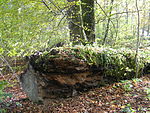 |
LSG-00242.01 | 395720 | Q18632808 | 1972 | position | 600.1 | Landsberg am Lech district (100%) | ||
| Protection of the Windach valley in the market in Dießen a. Ammersee and the municipalities of Hofstetten, Finning and Windach as LSG |
 |
LSG-00241.02 | 395719 | Q59643681 | 1972 | position | 293.19 | Landsberg am Lech district (100%) |
|
|
| LSG Hofoldinger and Höhenkirchner Forst |
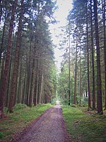 |
LSG-00198.01 | 395679 | Q59643575 | 1971 | position | 4975.92 | District of Munich (100%) | ||
| LSG Rotwand |
 |
LSG-00402.01 | 395910 | Q59643597 | 1987 | position | 4349.61 | District of Miesbach (99.9%) | ||
| LSG Seehamer See with Wattersdorfer Moor |
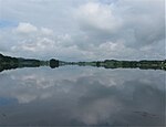 |
LSG-00434.01 | 395942 | Q59643556 | 1989 | position | 532.48 | District of Miesbach (100%) | ||
| LSG Sutten and the surrounding area |
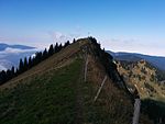 |
LSG-00461.01 | 395969 | Q59643509 | 1992 | position | 674 | District of Miesbach (100%) | ||
| LSG Untere Leitzach |
 |
LSG-00551.01 | 396102 | Q59643426 | 2001 | position | 90.97 | District of Miesbach (99.9%) | ||
| Protection of the garden landscape around Miesbach |
 |
LSG-00550.01 | 396101 | Q59643820 | 2001 | position | 12477 | District of Miesbach (100%) | ||
| Protection of the Obersten Leitzach Valley and its surroundings near Bayerischzell |
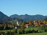 |
LSG-00064.01 | 395489 | Q59643638 | 1955 | position | 3578.73 | District of Miesbach (99.9%) | ||
| Protection of the Schliersee and its surroundings |
 |
LSG-00052.01 | 395480 | Q59643797 | 1955 | position | 1539.97 | District of Miesbach (100%) | ||
| Protection of the Spitzingsee and its surroundings |
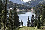 |
LSG-00060.01 | 395486 | Q59643792 | 1955 | position | 1547.59 | District of Miesbach (100%) | ||
| Protection of the Tegernsee and the surrounding area |
 |
LSG-00072.01 | 395496 | Q59643425 | 1956 | position | 9272.97 | District of Miesbach (100%) | ||
| Protection of the Weissach valley |
 |
LSG-00029.01 | 395468 | Q59643552 | 1953 | position | 5327.28 | District of Miesbach (99.9%) |
|
|
| LSG Am Stampflberg in the Gars am Inn market area |
 |
LSG-00435.01 | 395943 | Q59643795 | 1989 | position | 154.01 | District of Mühldorf am Inn (100%) | ||
| Protection of the stream including bank vegetation between Bergham and Polling in the area of the municipality of Polling | LSG-00208.01 | 395688 | Q59643615 | 1971 | position | 4.14 | District of Mühldorf am Inn (100%) | |||
| Protection of the Mühldorfer Hart area as LSG | LSG-00307.01 | 395786 | Q59643833 | 1979 | position | 1147.15 | District of Mühldorf am Inn (100%) | |||
| Protection of the spring moor slope near Lippach in the area of the municipality of Flossing | LSG-00207.01 | 395687 | Q59643623 | 1971 | position | 39.07 | District of Mühldorf am Inn (100%) | |||
| Protection of parts of the landscape on both sides of the Inn between the parts of the municipality Ebing (municipality of Pürten) and Ecksberg (municipality of Altmühldorf), district of Mühldorf | LSG-00169.01 | 395638 | Q59643444 | 1969 | position | 85.49 | District of Mühldorf am Inn (100%) |
|
||
| Hachinger Valley in the area of the municipalities of Oberhaching and Taufkirchen |
 |
LSG-00600.01 | 555589346 | Q59643756 | 2014 | Oberhaching | position | 192.75 | District of Munich (100%) | |
| LSG Bahnhofswald in the area of the communities Neubiberg and Ottobrunn |
 |
LSG-00280.01 | 395755 | Q59643732 | 1976 | position | 23.9 | District of Munich (100%) | ||
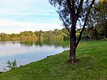
| LSG Dachauer Moos in the area of the municipalities of Ober- and Unterschleißheim |
 |
LSG-00328.01 | 395818 | Q59643508 | 1981 | position | 692.62 | District of Munich (100%) | ||
| LSG Deisenhofener Forst |
 |
LSG-00113.01 | 395541 | Q59643748 | 1963 | position | 2173.91 | District of Munich (100%) | ||
| LSG Forstenrieder Park including Forst Kasten and Fürstenrieder Wald |
 |
LSG-00114.01 | 395542 | Q59643582 | 1963 | position | 4911.03 | District of Munich (100%) | Forstenrieder Park , Forst Kasten | |
| LSG green corridor north of Aschheim in the area of the communities of Aschheim and Kirchheim near Munich | LSG-00343.01 | 395851 | Q59643436 | 1983 | position | 88.26 | District of Munich (100%) | |||
| LSG Hofoldinger and Höhenkirchner Forst |
 |
LSG-00198.01 | 395679 | Q59643575 | 1971 | position | 4975.92 | District of Munich (100%) | Hofoldinger Forest | |
| LSG Munich North in the area of the municipalities of Garching near Munich, Ober- and Unterschleißheim |
 |
LSG-00436.01 | 395944 | Q59643728 | 1989 | position | 2381.15 | District of Munich (100%) | ||
| LSG outskirts of Neuried | LSG-00597.01 | 555552625 | Q59643734 | 2012 | Neuried | position | 23.64 | District of Munich (100%) | ||
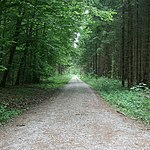
| LSG Perlacher and Grünwalder Forst including the Gleißentall |
 |
LSG-00534.01 | 396067 | Q59643649 | 2000 | position | 3447.65 | District of Munich (100%) | Perlacher Forst , Grünwalder Forst , Gleißental | |
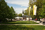
| LSG Planegger wood |
 |
LSG-00123.01 | 395585 | Q59643632 | 1965 | position | 364.04 | District of Munich (100%) | ||
| LSG Südliches Gleißental in the area of the communities Dingharting and Oberbiberg |
 |
LSG-00286.01 | 395764 | Q59643702 | 1977 | position | 265.95 | District of Munich (100%) |
Gleißental , Deininger Weiher
|
|
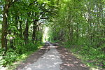
| Allacher Forest |
 |
LSG-00120.06 | 395563 | Q59643842 | 1964 | position | 103.75 | Munich (100%) | ||
| Angerlohe |
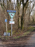 |
LSG-00120.18 | 395573 | Q59651120 | 1964 | position | 40.2 | Munich (100%) | ||
| Aubinger Lohe and Moosschwaige with extension |
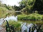 |
LSG-00120.02 | 395559 | Q59643516 | 1964 | position | 623.94 | Munich (100%) | Aubinger Lohe , Moosschwaige | |
| Area of the Kapuzinerhölzl including part of the area around Hartmannshofen |
 |
LSG-00120.07 | 395564 | Q56045984 | 1964 | position | 84.55 | Munich (100%) | ||
| Area around the Warnberg monastery with subsequent forest areas in the direction of Forstenried and Solln |
 |
LSG-00120.14 | 395570 | Q59643816 | 1964 | position | 135.59 | Munich (100%) | ||
| Area around the Hachinger Bach from the city limits to the infiltration point |
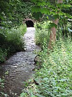 |
LSG-00120.12 | 395568 | Q59651093 | 1964 | position | 8.85 | Munich (100%) | Hachinger Bach | |
| Area around the Langwieder Autobahnsee including the adjoining area to the left of the Munich-Stuttgart Autobahn |
 |
LSG-00120.01 | 395558 | Q59643712 | 1964 | position | 256.07 | Munich (100%) | Lang again Lake District | |
| Hirschau and Obere Isarau |
 |
LSG-00599.01 | 395565 | Q59643486 | 2013 | Munich | position | 737.71 | Munich (100%) | Hirschau , Upper Isarau |
| Deer garden |
 |
LSG-00120.16 | 395572 | Q59651194 | 1964 | position | 27.09 | Munich (100%) | ||
| Isar floodplains (with a detailed description of the protected areas between the city limits of Oberföhring and St.-Quirin-Platz) |
 |
LSG-00120.09 | 395565 | Q59643467 | 1964 | position | 779.91 | Munich (99.9%) | English garden , Maximilians and Gasteig facilities , spring facilities , Flaucher , Bischweiler tree nursery , southern Isar facilities , Hellabrunn zoo , Maria Einsiedel , Hinterbrühl | |
| Perforated wood |
 |
LSG-00120.05 | 395562 | Q59643504 | 1964 | position | 7.13 | Munich (100%) | ||
| LSG Hartelholz, City of Munich |
 |
LSG-00596.01 | 396145 | Q59651252 | 1963 | position | 115.87 | Munich (99.9%) | ||
| Nymphenburg |
 |
LSG-00588.01 | 396137 | Q59643691 | 2005 | position | 287.35 | Munich (100%) | ||
| Schwarzhölzl with the area adjoining it to the south and east, the Würm Canal and the area around the quarry pond in Feldmoching |
 |
LSG-00120.13 | 395569 | Q59643419 | 1964 | position | 972.82 | Munich (99.9%) | Schwarzholzl | |
| Forest cemetery, area to the north of Fürstenried Castle including the castle and park, strip of land along the avenue between Kreuzhof and Fürstenried, forest area south of Albert-Roßhaupter-Str. (Sendlinger Wald) as well as the avenue of Albert-Roßhaupter-Str |
 |
LSG-00120.15 | 395571 | Q59651162 | 1964 | position | 318.91 | Munich (100%) | Forest cemetery , Fürstenried Castle , Sendling Forest | |
| Forest area near Trudering including the Friedenspromenade |
 |
LSG-00120.11 | 395567 | Q59643617 | 1964 | position | 397.23 | Munich (100%) | ||
| Remnants of the forest on the Munich-Stuttgart motorway near the Munich-West campsite | LSG-00120.04 | 395561 | Q59643819 | 1964 | position | 13.04 | Munich (100%) | |||
| Remnants of forest on Siemensallee including the Siemens sports park south of it and a piece of forest south of this park |
 |
LSG-00120.10 | 395566 | Q59643784 | 1964 | position | 16.54 | Munich (100%) | ||
| Forest on the city limits south of Freiham | LSG-00120.03 | 395560 | Q59643688 | 1964 | position | 29.67 | Munich (100%) | |||
| Würm lowland with extensions up to the city limits |
|
LSG-00120.19 | 395574 | Q59643814 | 1964 | position | 137.98 | Munich (100%) |
|
|
| Asperwald | LSG-00235.01 | 395711 | Q59611791 | 1972 | position | 11.4 | District of Neuburg-Schrobenhausen (37.1%), District of Aichach-Friedberg (62.9%) | |||
| LSG Dachsholz | LSG-00457.01 | 395965 | Q59643724 | 1992 | position | 24.58 | District of Neuburg-Schrobenhausen (100%) | |||
| Protection of the Danube floodplains east of the city of Neuburg in the city of Neuburg and the communities Weichering and Bergheim, the district of Neuburg and the Branst area in the community Weichering as LSG |
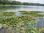 |
LSG-00400.01 | 395908 | Q59643757 | 1987 | position | 1907.92 | District of Neuburg-Schrobenhausen (100%) | ||
| Protection of the Paarauen in the area of the city of Schrobenhausen, the Mühlried district and the municipality of Waidhofen |
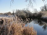 |
LSG-00350.01 | 395858 | Q59643532 | 1983 | position | 583.88 | District of Neuburg-Schrobenhausen (100%) | ||
| Protection of the Paarauen in the communities of Hörzhausen, Peutenhausen and the city of Schrobenhausen, district of Schrobenhausen |
 |
LSG-00238.01 | 395714 | Q59643500 | 1972 | position | 704.71 | District of Neuburg-Schrobenhausen (100%) | ||
| Protection of the Bruck Forest in the city of Neuburg and in the community of Weichering, district of Neuburg-Schrobenhausen | LSG-00338.01 | 395828 | Q59643451 | 1983 | position | 828.35 | District of Neuburg-Schrobenhausen (100%) | |||
| Protection of the Danube valley west of Neuburg in the area of the city of Neuburg as well as the markets of Burgheim and Rennertshofen and the municipality of Oberhausen, district of Neuburg-Schrobenhausen |
 |
LSG-00432.01 | 395940 | Q59643718 | 1989 | position | 2439.59 | District of Neuburg-Schrobenhausen (100%) | ||
| Protection of the area Am Albersbach as LSG in the community of Brunnen, district of Neuburg-Schrobenhausen | LSG-00411.01 | 395919 | Q59643506 | 1988 | position | 7.12 | District of Neuburg-Schrobenhausen (100%) | |||
| Protection of the spawn at Ludwigsmoos (Sandizeller Laich) as LSG in the area of the municipality of Königsmoos, district of Neuburg-Schrobenhausen | LSG-00405.01 | 395913 | Q59643827 | 1987 | position | 12.66 | District of Neuburg-Schrobenhausen (100%) | |||
| Protection of the Polnhölzl as LSG in the area of the municipality of Karlskron, district of Neuburg-Schrobenhausen | LSG-00412.01 | 395920 | Q59643668 | 1988 | position | 3.82 | District of Neuburg-Schrobenhausen (100%) | |||
| Protection of the Ussel valley in the Rennertshofen market, Neuburg-Schrobenhausen district | LSG-00365.01 | 395874 | Q59643624 | 1985 | position | 378.3 | District of Neuburg-Schrobenhausen (99.9%) | |||
| Protection of the Wellheim Danube Dry Valley in the Rennertshofen market, Neuburg-Schrobenhausen district |
|
LSG-00357.01 | 395866 | Q59643755 | 1984 | position | 1921.4 | District of Eichstätt (1.9%), District of Neuburg-Schrobenhausen (98.0%) | ||
| Protection of parts of the landscape in the communities of Adelshausen, Freinhausen and in Markt Hohenwart, district of Schrobenhausen | LSG-00234.01 | 395710 | Q59643708 | 1972 | position | 26.74 | District of Neuburg-Schrobenhausen (100%) | |||
| Protection of parts of the landscape in the communities of Gachenbach and Peutenhausen, district of Schrobenhausen | LSG-00180.01 | 395652 | Q59643627 | 1969 | position | 37.5 | District of Neuburg-Schrobenhausen (100%) |
|
||
| LSG Baarer Weiher | LSG-00037.01 | 395474 | Q59643831 | 1954 | position | 117.92 | District of Pfaffenhofen an der Ilm (100%) | |||
| LSG Feilenforst Manching | LSG-00308.01 | 395787 | Q59643591 | 1979 | position | 447.23 | District of Pfaffenhofen an der Ilm (100%) | |||
| Couple valley | LSG-00476.01 | 395984 | Q59643720 | 1993 | position | 2415.64 | District of Pfaffenhofen an der Ilm (100%) |
|
||
| LSG Innauen-Nord | LSG-00458.01 | 395966 | Q59643491 | 1992 | position | 73.3 | Rosenheim (100%) | |||
| LSG Innauen-Süd |
 |
LSG-00516.01 | 396027 | Q59643711 | 1998 | position | 256.88 | Rosenheim (100%) | ||
| Protection of the green areas on the Mangfall (LSG Mangfall) |
 |
LSG-00322.01 | 395809 | Q59643417 | 1981 | position | 98.89 | Rosenheim (100%) |
|
|
| Attel |
 |
LSG-00106.01 | 395534 | Q59643810 | 1962 | position | 145.64 | District of Rosenheim (100%) | ||
| Halfinger Freimoos | LSG-00582.01 | 396132 | Q59643529 | 2004 | position | 591.04 | District of Rosenheim (100%) | |||
| Inn valley south |
 |
LSG-00595.01 | 396144 | Q23833433 | 2007 | position | 4021.91 | District of Rosenheim (100%) | ||
| Protection of the Thalkirchner Achen and its surroundings as LSG | LSG-00147.01 | 395619 | Q59643420 | 1967 | position | 972.67 | District of Rosenheim (100%) | |||
| Protection of the Bärnsee and its surroundings as LSG |
 |
LSG-00144.01 | 395616 | Q59643689 | 1967 | Aschau im Chiemgau | position | 287.44 | District of Rosenheim (100%) | |
| Protection of the Mühlau-Schöffau area as LSG |
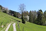 |
LSG-00133.01 | 395607 | Q59643534 | 1967 | Kiefersfelden | position | 576.21 | District of Rosenheim (100%) | |
| Protection of the Hofstätter and Rinssee lakes in the municipalities of Prutting, Söchtenau and Vogtareuth |
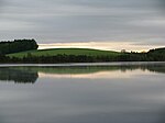 |
LSG-00247.01 | 395725 | Q59643560 | 1972 | Prutting , Söchtenau , Vogtareuth | position | 516.72 | District of Rosenheim (100%) | |
| Protection of the Litzelsee and its surroundings as LSG | LSG-00145.01 | 395617 | Q59643522 | 1967 | Prutting , Stephanskirchen | position | 60.29 | District of Rosenheim (100%) | ||
| Protection of the Prientales as LSG | LSG-00134.01 | 395608 | Q59643631 | 1967 | Frasdorf , Bernau am Chiemsee , Prien am Chiemsee | position | 365.58 | District of Rosenheim (100%) | ||
| Protection of the Black Lake and the surrounding area as LSG | LSG-00135.01 | 395609 | Q59643799 | 1967 | Samerberg | position | 15.15 | District of Rosenheim (100%) | ||
| Protection of the so-called Brandl, district Degerndorf / Inn, municipality of Brannenburg |
 |
LSG-00118.01 | 395546 | Q59643613 | 1964 | Brannenburg | position | 4.6 | District of Rosenheim (100%) | |
| Protection of an alluvial forest in the Kaltenbach floodplains in the municipality of Pang as LSG |
 |
LSG-00246.01 | 395724 | Q59643646 | 1972 | Raubling | position | 35.55 | District of Rosenheim (100%) | Kaltenbach |
| Protection of parts of the landscape in the extended Soinkar area in the municipalities of Brannenburg, Flintsbach am Inn and Oberaudorf |
 |
LSG-00223.01 | 395701 | Q59651111 | 1971 | Brannenburg , Flintsbach am Inn , Oberaudorf | position | 492.07 | District of Rosenheim (100%) | Soin |
| Protection of the Kupferbachtal as LSG in the Bad Aibling district |
 |
LSG-00157.01 | 395627 | Q59643603 | 1968 | Feldkirchen-Westerham | position | 42.95 | District of Rosenheim (100%) | |
| LSG Hochrunstfilze |
 |
LSG-00448.01 | 395956 | Q59643722 | 1990 | position | 240.7 | District of Rosenheim (100%) | ||
| LSG moor and valley landscapes near Söchtenau |
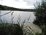 |
LSG-00489.01 | 395997 | Q59643587 | 1995 | position | 483.66 | District of Rosenheim (100%) | ||
| LSG Rote Filze north of Bad Aibling | LSG-00418.01 | 395926 | Q59643547 | 1988 | position | 54.01 | District of Rosenheim (100%) | |||
| LSG Tuffberg south of Vagen | LSG-00423.01 | 395931 | Q59643478 | 1988 | position | 75.9 | District of Rosenheim (100%) | |||
| Protection of the Outer Lohe west of the Penzinger See (between the villages of Neudeck and Penzing, Wasserburg district) | LSG-00025.01 | 395467 | Q59643572 | 1953 | position | 5.6 | District of Rosenheim (100%) | |||
| Protection of the Innauen near Vogtareuth | LSG-00008.01 | 395452 | Q59643595 | 1951 | position | 444.24 | District of Rosenheim (100%) | |||
| Protection of the Auerbach valley including Regau (am Förchenbach) and Bichlersee, municipalities of Niederaudorf, Oberaudorf, Flintsbach and Kiefersfelden |
 |
LSG-00047.01 | 395477 | Q59643601 | 1955 | position | 4219.15 | District of Rosenheim (100%) | Bichlersee , Auerbach | |
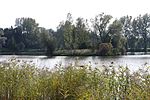
| Protection of the Inn valley |
 |
LSG-00535.01 | 396068 | Q59643807 | 2000 | position | 1465.96 | District of Rosenheim (100%) | ||
| Protection of the Benediktenfilze part of the landscape in the area of Markt Bruckmühl and the municipality of Beyharting | LSG-00203.01 | 395683 | Q59643458 | 1971 | position | 79.51 | District of Rosenheim (100%) | |||
| Protection of the Eckersberg part of the landscape in the area of the municipality of Dettendorf, Bad Aibling district | LSG-00192.01 | 395673 | Q59643661 | 1970 | position | 31.79 | District of Rosenheim (100%) | |||
| Protection of the Pfaffinger Moos near Evenhausen | LSG-00018.01 | 395461 | Q59643772 | 1952 | position | 17.6 | District of Rosenheim (100%) | |||
| Protection of the Simssees and its surroundings |
 |
LSG-00111.01 | 395539 | Q56450597 | 1963 | position | 2211.75 | District of Rosenheim (100%) | ||
| Protection of the so-called wide felt in the state forest subdivision I 1f Jägerwald | LSG-00010.01 | 395455 | Q59643653 | 1951 | position | 33.88 | District of Rosenheim (100%) | |||
| Protection of the Soyensee and its surroundings |
 |
LSG-00054.01 | 395482 | Q59651100 | 1955 | position | 72.74 | District of Rosenheim (100%) | ||
| Protection of parts of the landscape in the area of the Griesstätter Bridge, Feldkirchen, Griesstätt, Holzhausen, Ramerberg districts |
 |
LSG-00006.01 | 395450 | Q59643605 | 1950 | position | 402.85 | District of Rosenheim (100%) | ||
| Protection of parts of the landscape around the Altensee in the municipality of Soyen | LSG-00100.01 | 395521 | Q59643828 | 1961 | position | 12.29 | District of Rosenheim (100%) | |||
| Protection of parts of the landscape around Friedlsee, Evenhausen and Amerang | LSG-00102.01 | 395523 | Q59643786 | 1961 | position | 16 | District of Rosenheim (100%) | |||
| Protection of parts of the landscape around Lake Penzing, municipality of Penzing |
 |
LSG-00101.01 | 395522 | Q59643758 | 1961 | position | 19.87 | District of Rosenheim (100%) | ||
| Protection of parts of the landscape around Lake Staudhamer in the municipalities of Steppach, Soyen, Attel and Edling |
 |
LSG-00164.01 | 395634 | Q59643701 | 1969 | position | 268.25 | District of Rosenheim (100%) |
|
|
| Kreuzling Forest |
 |
LSG-00375.01 | 395884 | Q59643683 | 1985 | position | 2300.51 | Starnberg district (100%) | ||
| LSG Starnberger See - East |
 |
LSG-00299.01 | 395778 | Q59643674 | 1979 | position | 2955.16 | Starnberg district (100%) | ||
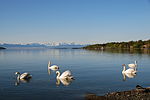
| Starnberger See and adjacent areas to the west |
 |
LSG-00403.01 | 395911 | Q59643423 | 1987 | position | 9467.5 | Starnberg district (100%) | ||
| Steinberg | LSG-00374.01 | 395883 | Q59643424 | 1985 | position | 94.55 | Starnberg district (100%) | |||
| Western part of the Starnberg district |
 |
LSG-00542.01 | 396093 | Q59643780 | 2001 | position | 16335.17 | Starnberg district (100%) | ||
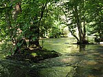
| Würmtal |
 |
LSG-00361.01 | 395870 | Q59643641 | 1984 | position | 3533.45 | Starnberg district (100%) |
|
|
| LSG moor lakes near Schnaitsee | LSG-00306.01 | 395785 | Q59643844 | 1979 | position | 102.37 | District of Traunstein (100%) | |||
| LSG Upper Alztal |
 |
LSG-00431.01 | 395939 | Q59643416 | 1989 | position | 998.11 | District of Traunstein (100%) | ||
| LSG Ponlachgraben with adjacent parts of deciduous forest |
 |
LSG-00398.01 | 395906 | Q59643838 | 1987 | position | 11.16 | District of Traunstein (100%) | ||
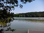
| LSG Tüttensee |
 |
LSG-00456.01 | 395964 | Q59651104 | 1991 | position | 66.6 | District of Traunstein (100%) | ||
| LSG Weidsee |
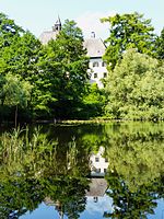 |
LSG-00404.01 | 395912 | Q59643845 | 1987 | position | 101.26 | District of Traunstein (100%) | ||
| Protection of the environment of the Mettenhamer Filz nature reserve in the Traunstein district | LSG-00057.01 | 395484 | Q59643448 | 1955 | position | 83.89 | District of Traunstein (100%) | |||
| Protection of the Chiemsee, its islands and riverside areas in the districts of Rosenheim and Traunstein as LSG (Chiemsee Protection Ordinance) |
 |
LSG-00396.01 | 395904 | Q59643826 | 1986 | position | 12125.52 | District of Rosenheim (17.4%), District of Traunstein (82.6%) | ||
| Protection of the Leitgeringer See and the surrounding landscape |
 |
LSG-00236.01 | 395712 | Q59651078 | 1972 | position | 85.12 | District of Traunstein (100%) | ||
| Protection of the Waginger and Tachinger lakes and the surrounding landscape |
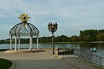 |
LSG-00237.01 | 395713 | Q59643730 | 1972 | position | 2350.96 | District of Traunstein (100%) | Waginger See , Tachinger See | |
| Protection of a landscape strip on both sides of the federal highway 305 (alpine road) in the section Zwing-Sichertsau and the Rauschberg |
 |
LSG-00079.01 | 395501 | Q59643791 | 1956 | position | 1551.57 | District of Traunstein (100%) |
|
|
| LSG Ammertal, Böbing, Hohenpeißenberg, Peißenberg, Peiting |
 |
LSG-00422.01 | 395930 | Q59643813 | 1988 | position | 1376.12 | District of Weilheim-Schongau (100%) | ||
| LSG Hardtlandschaft and Eberfinger Drumlinfelder, Weilheim, Wiedenbach, Bernried, Seeshaupt, Eberting |
 |
LSG-00371.01 | 395880 | Q59643531 | 1985 | position | 5845.87 | District of Weilheim-Schongau (100%) | ||
| LSG Hohenkastener Filz with Stadler Weiher and Mühlgraben, Eberfing |
 |
LSG-00478.01 | 395986 | Q59643771 | 1994 | position | 176.44 | District of Weilheim-Schongau (100%) | Stadler pond | |
| LSG Langer Filz and Gruber See in the communities of Peiting and Steingaden |
 |
LSG-00023.01 | 395466 | Q59643501 | 1953 | position | 70.44 | District of Weilheim-Schongau (100%) | ||
| LSG Raistinger Lichtenau and the Rott valley between Stillern and Zellsee |
 |
LSG-00520.01 | 396041 | Q59643562 | 1998 | position | 516.7 | District of Weilheim-Schongau (100%) | ||
| LSG kettle between Burggen and Bernbeuren |
 |
LSG-00016.01 | 395459 | Q59643800 | 1952 | position | 15.08 | District of Weilheim-Schongau (100%) | ||
| LSG riverside area at Lake Starnberg Bernried, Seeshaupt |
 |
LSG-00368.01 | 395877 | Q59643497 | 1985 | position | 706.73 | District of Weilheim-Schongau (100%) | starnberger Lake | |
| Protection of the Loisach and Erlfilze in the area of the city of Penzberg and the community of Sindelsdorf |
 |
LSG-00295.01 | 395774 | Q59643677 | 1978 | position | 294.49 | District of Weilheim-Schongau (100%) | ||
| Protection of the Osterseen and their surroundings in the municipalities of Frauenrain, Iffeldorf and Seeshaupt |
 |
LSG-00059.01 | 395485 | Q59643823 | 1955 | position | 1234.94 | District of Weilheim-Schongau (100%) | ||
| Protection of the wide felt district of Schönberg, district of Schongau |
 |
LSG-00068.01 | 395493 | Q59643663 | 1955 | position | 31.62 | District of Weilheim-Schongau (100%) | ||
| Protection of the castle hill, municipality of Burggen |
 |
LSG-00228.01 | 395706 | Q59643759 | 1972 | position | 19.77 | District of Weilheim-Schongau (100%) | ||
| Protection of the area around the Wies |
 |
LSG-00603.01 | Q59651168 | position | 2933.13 | Weilheim-Schongau district (99.9%) | ||||
| Protection of the Haslacher See in the municipalities of Burggen u. Bernbeuren |
 |
LSG-00229.01 | 395707 | Q59643422 | 1972 | position | 97.71 | District of Weilheim-Schongau (100%) | ||
| Protection of the Hirschberg, the Kerschlacher Forest and the subsequent moraine landscape, municipality of Pähl |
 |
LSG-00209.01 | 395689 | Q59643808 | 1971 | position | 1460.15 | Weilheim-Schongau district (99.9%) | ||
| Protection of the linden trees east of Schwaig in the area of the Wildsteig community |
 |
LSG-00014.01 | 395457 | Q59643502 | 1952 | position | 7.99 | District of Weilheim-Schongau (100%) | ||
| Protection of parts of the landscape on the south bank of the Ammersee, Pähl |
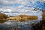 |
LSG-00225.01 | 395703 | Q59643693 | 1971 | position | 285.96 | District of Weilheim-Schongau (100%) | Ammersee | |
| Protection of parts of the landscape of the Lech and its bank areas between Gründl, the municipality of Prem and Niederwies, Markt Peiting (Bernbeuren, Steingaden, Burggen, Peiting) |
 |
LSG-00358.01 | 395867 | Q59643482 | 1984 | position | 743.23 | District of Weilheim-Schongau (100%) |
See also
- List of nature reserves in Upper Bavaria
- List of FFH areas in Upper Bavaria
- List of EU bird protection areas in Upper Bavaria
- List of geotopes in Upper Bavaria
Individual evidence
- ↑ Green List, Landscape Protection Areas , accessed on March 10, 2016.
Web links
Commons : Landscape protection areas in Upper Bavaria - collection of images, videos and audio files