Ampermoos
Coordinates: 48 ° 6 ′ 19 ″ N , 11 ° 8 ′ 5 ″ E
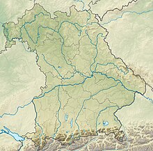
The Ampermoos nature reserve is located in the districts of Fürstenfeldbruck , Landsberg am Lech and Starnberg in Upper Bavaria . It is FFH area (7832-371) and part of the EU bird sanctuary "Ammerseegebiet" (7932-471).
The 528.46 hectare area with the number NSG-00168.01, which was placed under nature protection in 1982 , extends between Grafrath in the north and the Ammersee in the south. The B 471 runs along the north-eastern edge of the area and the A 96 runs along the southern edge . The Amper flows through it in a south-north direction .
See also
- List of nature reserves in the Fürstenfeldbruck district
- List of nature reserves in the Landsberg am Lech district
- List of nature reserves in the Starnberg district
Web links
Commons : Ampermoos - collection of images, videos and audio files
- World Database on Protected Areas - Ampermoos (English)
- The Ampermoos on starnberg.lbv.de


