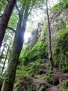
Deer Forest Nature Park
The Hirschwald Nature Park is a nature park in the Upper Palatinate district of Amberg-Sulzbach and the associated district town of Amberg in Bavaria .
description
The comparatively small nature park with an area of 277.60 km² is located north of the center of the natural spatial main unit of the Middle Franconian Alb and only barely exceeds its area in the city of Amberg in the north. It includes the natural area of the Lauterach valley , which, due to its west-east orientation, forms dry grassland locations . The Jurabach is also the border to the Hohenfels military training area ( Neumarkt district in the Upper Palatinate ).
The nature park was designated on December 18, 2006 as the 17th Bavarian nature park. It is maintained by the sponsoring association “Naturpark Hirschwald e. V. “, which is based in Amberg . The municipalities of Ensdorf , Hohenburg , Kastl , Kümmersbruck , Rieden , Ursensollen and Schmidmühlen also have a share in the nature park . The Deer Forest Nature Park is home to the last nursery of the endangered Great Horseshoe Bat . This last retreat is in a house on the market square of Hohenburg. The animals survived due to their proximity to the Hohenfels training area.
Unregulated area and village of Hirschwald
Within the nature park was the 19.57 km², uninhabited, community-free area of Hirschwald , which completely included the place of the same name (community Ensdorf ) as an enclave . On September 1, 2015, the area was dissolved. It was divided between the municipalities of Ensdorf, Hohenburg , Kümmersbruck and Rieden .
Nature reserves
See also
Web links
Individual evidence
-
↑ Map services of the Federal Agency for Nature Conservation ( information )
- The landscape map service shows the boundaries of individual partial landscapes and makes landscape profiles with area information (81xxx = Middle Franconian Alb) clickable
- Map service for protected areas shows mountain heights down to TK 25;
Nature reserves, FFH areas, nature parks (each with area information), main units and communal boundaries can be displayed
- ^ Official Journal of the Upper Palatinate , accessed on September 1, 2015
Coordinates: 49 ° 22 ′ 2 ″ N , 11 ° 52 ′ 19 ″ E


