Franconian Forest Nature Park
|
Franconian Forest
|
||
|
map |
||
| location | Franconian Forest | |
| surface | 1023 km² | |
| Identifier | NP-00005 | |
| Geographical location | 50 ° 17 ' N , 11 ° 32' E | |
|
|
||
| Setup date | 1973 | |
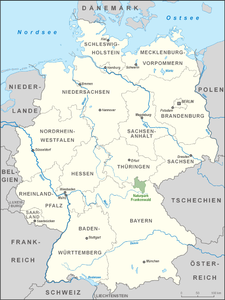
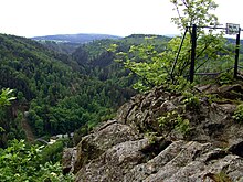
The Franconian Forest Nature Park is located in the north of the Bavarian administrative district of Upper Franconia . The nature park in the Franconian Forest was founded on April 23, 1973. It is 1,023 km² and includes the district of Kronach as well as parts of the districts of Kulmbach and Hof , here especially the former district of Naila . Almost 140,000 people live in the nature park. It adjoins the Thuringian Forest and Thuringian Slate Mountains-Obere Saale nature parks . Together with the two Thuringian nature parks, the Franconian Forest Nature Park forms a closed nature park area with approx. 4,000 km².
Information centers
- Nature park information point in the Gerlas forest house
- Blechschmidtenhammer information center near Lichtenberg
- Nature park information point at the Rosenberg Fortress in Kronach
- Stadtsteinach nature park information points
- Information center in Steinwiesen train station
See also
Web links
Commons : Franconian Forest Nature Park - Collection of images, videos and audio files
- Franconian Forest Nature Park in OpenStreetMap (accessed January 1, 2016)
- www.naturpark-frankenwald.de - Homepage
- Brief information from the Association of German Nature Parks


