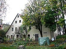
Bischberg (mountain near Neumarkt in the Upper Palatinate)
|
Bischberg
Municipality
Coordinates: 49 ° 22 ′ 17 ″ N , 11 ° 28 ′ 18 ″ E
Berg bei Neumarkt in the Upper Palatinate |
|
|---|---|
| Height : | 520 m above sea level NHN |
| Residents : | 98 (December 31, 2015) |
| Postal code : | 92348 |
| Area code : | 09181 |
|
Bischberg
|
|
Bischberg is part of the Bavarian municipality of Berg bei Neumarkt in the Upper Palatinate in the Upper Palatinate district of Neumarkt in the Upper Palatinate .
geography
The village is located in the Upper Palatinate Jura at about 520 m above sea level, about 5 km northeast of the municipality.
history
In 1356 a place "Pischofsperg" appears, in 1466 "Bischofsperg", which is possibly identical to today's Bischberg, which appears for the first time in this spelling on a map from 1635. "Büschberg" is entered on an earlier map from 1519.
Bischberg belonged to the Palatinate Nursing Authority Haimburg . The Kastl monastery and the Gnadenberg monastery owned properties in the village . When in 1639 the government of Amberg requested reports from its subordinate offices about the availability of winter quarters for troops in the individual locations, Gnadenberg Monastery specified two farms for "Bischofsberg" and Haimburg nine farms in "Bischlberg". Towards the end of the Old Kingdom , around 1800, the village consisted of 14 subjects. 11 belonged to the caste office Haimburg, one each to the Kastl monastery, the monastery judge office Gnadenberg and the imperial city of Nuremberg . The Haimburg Nursing Office, which was last run in personal union with the Pfaffenhofen Nursing Office, exercised high jurisdiction .
In the new Kingdom of Bavaria (1806) the tax district Sindlbach was formed, when the community was formed around 1810/20 the community Sindlbach was formed. In addition to the parish villages of Sindlbach, Burkertshof and Langenthal, it also included Bischberg. On April 1, 1939 Gebertshof and Haimburg were added. This community was subordinate to the district court Kastl in the district office Velburg .
In the course of the regional reform in Bavaria , Sindlbach and thus also Bischberg were incorporated into Berg on May 1, 1978.
Population development
- 1830: 100 (17 houses)
- 1836: 100 (17 houses)
- 1871: 108
- 1900: 101 (19 residential buildings)
- 1937: 99
- 1950: 111 (18 residential buildings)
- 1961: 91 (17 residential buildings)
- 1970: 83
- 1987: 88 (23 residential buildings, 24 apartments)
- 2015: 98 (45 male, 53 female)
Chapels
- Marienkapelle at the exit to Ballertshofen, 18./19. Century.
- Another chapel, built in 1925, is dedicated to the Holy Family.
- Between Bischberg and Rohrenstadt, a corridor “Zum Heiligen Johannes” is reminiscent of an abandoned chapel from the 19th century; possibly the hallway belonged to the brotherhood of St. John of Nepomuk introduced in Stöckelsberg in 1765.
See also the list of architectural monuments in Berg near Neumarkt in the Upper Palatinate # Bischberg
Transport links
Bischberg can be reached via a local connection road that branches off from the NM 8 district road in Sindlbach in a north-easterly direction, and via local connection roads from Mitterrohrenstadt and Ballertshofen or Unterried .
literature
- Bernhard Heinloth: Historical Atlas of Bavaria. Part of Old Bavaria, issue 16: Neumarkt. Commission for Bavarian State History, Munich 1967.
- Negotiations of the historical association of Upper Palatinate and Regensburg , 1831/32 ff., Various printing locations.
- Franz Xaver Buchner : The diocese of Eichstätt. Volume I, Eichstätt: Brönner & Däntler, 1937, Volume II 1938.
Individual evidence
- ↑ Josef Breinl: Berg Chronicle with local history of all districts , Berg 1996, p. 136
- ↑ Heinloth, pp. 134, 158
- ^ Negotiations, 84 (1934), p. 132
- ↑ Heinloth, p. 291
- ↑ Heinloth, p. 329
- ^ Karl Friedrich Hohn: The rain district of the Kingdom of Bavaria, described geographically and statistically , Stuttgart and Tübingen: Cotta, 1830, p. 107
- ↑ Popp, Th. D. (ed.): Matrikel des Bissthumes Eichstätt , Eichstätt: Ph. Brönner, 1836, p. 141
- ↑ Kgl. Statistical Bureau in Munich (edit.): Complete list of localities of the Kingdom of Bavaria ... based on the results of the census of December 1st. 1875 , Munich 1876, column 974
- ↑ Kgl. Statistical Bureau in Munich (edit.): List of localities of the Kingdom of Bavaria ... [based on the results of the census of Dec. 1, 1900] , Munich 1904, column 874
- ↑ Buchner II, p. 515
- ^ Official register of places for Bavaria, edited on the basis of the census of September 13, 1950 , Munich 1952, Col. 748
- ^ Official register of places for Bavaria. Territorial status on October 1, 1964 with statistical information from the 1961 census , Munich 1964, column 553
- ^ Official register of places for Bavaria. Territory: May 1, 1978. Munich 1978, p. 120
- ^ Official register of places for Bavaria, territorial status: May 25, 1987 , Munich 1991, p. 257
- ↑ As of December 31, 2015; Bulletin of the Berg municipality from February 2016, p. 8
- ↑ Buchner II, p. 516
- ↑ Buchner II, p. 557
Web links
- Bischberg in the location database of the Bayerische Landesbibliothek Online . Bavarian State Library


