
Mulde (river)
|
Mulde United Mulde (in contrast to the hydrological river course) |
||
 The hollow near Bad Düben . |
||
| Data | ||
| Water code | DE : 549, part of the Mulde (DE: 54) | |
| location | Germany | |
| River system | Elbe | |
| Drain over | Elbe → North Sea | |
| River basin district | Elbe | |
| confluence | Union of Zwickauer and Freiberger Mulde near Sermuth 51 ° 9 ′ 37 ″ N , 12 ° 47 ′ 53 ″ E |
|
| Source height | 132.4 m above sea level NHN , source of the Zwickauer Mulde 770 m above sea level. NHN | |
| muzzle | near Dessau-Roßlau in the Elbe Coordinates: 51 ° 52 '8 " N , 12 ° 13' 52" E 51 ° 52 '8 " N , 12 ° 13' 52" E |
|
| Mouth height | approx. 57 m above sea level NHN | |
| Height difference | approx. 75.4 m | |
| Bottom slope | approx. 0.51 ‰ | |
| length | 147 km (United Mulde), 314 km (Zwickauer + United Mulde) |
|
| Catchment area | 7400 km² | |
| Discharge at the Bad Düben 1 A Eo gauge : 6170 km² Location: 68.1 km above the mouth |
NNQ (09/02/1976) MNQ 1961–2014 MQ 1961–2014 Mq 1961–2014 MHQ 1961–2014 HHQ (08/14/2002) |
5.4 m³ / s 15.8 m³ / s 64.8 m³ / s 10.5 l / (s km²) 504 m³ / s 2200 m³ / s |
| Discharge at the Priorau A Eo gauge: 6990 km² Location: 23.9 km above the mouth |
NNQ (08/01/2008) MNQ 1996–2013 MQ 1996–2013 Mq 1996–2013 MHQ 1996–2013 HHQ (06/03/2008) |
12.5 m³ / s 18.5 m³ / s 71.5 m³ / s 10.2 l / (s km²) 507 m³ / s 1440 m³ / s |
| Drain |
MQ |
73 m³ / s |
| Medium-sized cities | Grimma , Bitterfeld-Wolfen , Dessau-Roßlau | |
| Small towns | Wurzen , Eilenburg , Bad Düben | |
The Mulde , also United Mulde or United Mulde , is a left, non- navigable tributary of the Elbe . It arises south-east of Leipzig near Sermuth ( Saxony ) by the union of two large source rivers, the longer Zwickauer Mulde and the Freiberg Mulde, which drains a larger catchment area with a larger drainage .
The catchment area of the river includes large parts of Saxony and in particular the vast majority of the northern roofing of the Ore Mountains . With a water flow of almost 73 m³ / s at the mouth, it is the fourth largest tributary of the Elbe.
The old name form of the Mulde, Milda , is translated by name researchers as the water kingdom. The word component Mel with reference to grinding is sometimes associated with the name in view of a large number of mills that used to be operated on the river, disregarding the fact that river names represent the oldest, often pre-Germanic, geographical layer of names.
Catchment area
Although the union of the two source rivers takes place at about half of the entire length of the Mulde, the Freiberger and Zwickauer Mulde already supply over 80% of the total amount of water. This is due, on the one hand, to the shape of the catchment area, which is very wide in the Ore Mountains and becomes narrow towards the Elbe, and, on the other hand, to the higher levels of precipitation in the mountains and, at the same time, higher proportions of draining water. The shape of the catchment areas also means that the longer Zwickauer Mulde at the confluence is the smaller of the source rivers.
The strongly dominating main hydrological branch of the Freiberg Mulde river system is the Zschopau . In its upper catchment area, the Flöha is in turn a tributary of the same name , which brings in the larger water flow and is thus the actual source flow of the Mulde. The Mulde is around 267 kilometers long along this main flow route, and over 314 kilometers along the longest flow route (Zwickauer Mulde).
The catchment area of the Mulde has a total gradient of 600 to 900 meters for many important flow paths, so that exceptionally high flow speeds prevail here for northern Germany. The Mulde is sometimes even referred to as the fastest flowing river in Central Europe .
course
The Mulde runs exclusively in the north German lowlands , initially flowing through the Saxon hill country and passing Grimma , Nerchau and Trebsen . Around Wurzen , on the western edge of which it runs, the Mulde reaches the Elbe-Mulde lowlands. It then flows through Eilenburg and Bad Düben and shortly afterwards it leaves Saxon territory. The Mulde in Saxony-Anhalt covers the rest of the flow path to its mouth.
In the further course the Mulde flowed until 1975 west of the two places Pouch and Friedersdorf in the area of today's Goitzschesees . Since then it has been dammed east of the two places in the Muldestausee - a former opencast mine. The Mulde then flows past Muldenstein , Jeßnitz , Raguhn and Dessau and flows into the Elbe after 147 km between Dessau and Roßlau .
The “Wilde Mulde” revitalization project for the lower reaches of Dessau was recognized as an official project of the UN Decade of Biological Diversity in November 2018 .
geology
At the end of the Elster Glaciation , the Mulde flowed from Großbothen and Großbardau further north-west through today's city of Leipzig, where the Saale also flowed to it for a time. In the process, it eroded several gullies, which it filled up until the Saale Glacial Period - the Markkleeberger Muldelauf, the Espenhainer Gully and the Leipzig Muldelauf, the Naunhofer Gully.
About 130,000 to 160,000 years ago, at the end of the Saale Glaciation, the Mulde broke through at Grimma and flowed northwards in what is now the river bed. The remaining Leipzig Mulde valley has been traversed by the Parthe ever since .
Flood
During the flood of the century in 2002 , the river basin of the Mulde was hardest hit along with those of the Elbe, Müglitz and Weißeritz . During the floods in June 2013 , a dam on the Mulde leading to Lake Seelhausen had to be blown up to relieve the lake.
burden
In July 2005 the Federal Environment Agency in Dessau published the results of a study from 2004, according to which a concentration of beta-HCH that was up to 18 times above the limit value was measured in fish. Beta-HCH is a residue from the earlier lindane production in Bitterfeld , which has been discontinued since 1984 .
Artistic representations
The river landscape on the troughs has often been an artistic motif; a study published in 2013 lists around 260 works that span the period from the beginnings of landscape painting to the beginning of the 20th century. More recently, the artist and art educator Marion Bekker (* 1958) has captured the landscape and architecture of the Saxon Mulde valley in numerous of her pictures in an expressionist manner.
gallery

Confluence at Sermuth

Ship mill Höfgen

The Grimma suspension bridge

Kollau weir with fish ladder
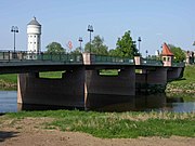
Mulde bridge in Eilenburg (built in 1999)

Mulde near Eilenburg

Mulde near Bad Düben
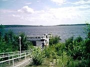
Mulde reservoir

Muldestausee and Friedersdorf

Mulde near Friedersdorf
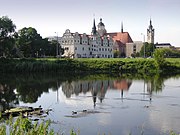
Dessau with Mulde

Hunting bridge over the Mulde near Dessau

Mulde near Dessau


.jpg)


See also
literature
- Adolf Böhm: The floods in the United Mulde . in: Sächsische Heimatblätter 47 (2001) 2, pp. 93–95
- Hansjörg Küster : The Elbe. Landscape and history . Chapter 12: Die Mulde , 1st edition, Munich 2007, ISBN 978-3-406-56209-9 .
- Andreas Martin (ed.): The river landscape Mulde. History and perception. Dresden: Thelem 2013. ISBN 978-3-942411-83-7
- Saxon State Office for Environment, Geology and Agriculture (ed.): Flood 2002 in the Mulde area . Series of publications by the State Office for the Environment, Agriculture and Geology, issue 32/2009, Dresden 2009. ( digitized version ).
- Hans-Joachim Böttcher : Along the Mulde - between Eilenburg and Dessau. Erfurt 2010. ISBN 978-3-86680-653-5
- Hans-Joachim Böttcher : A river like no other - the Mulde. In: Bitterfelder Heimatblätter, Issue XXVIII, 2010. pp. 55–60. Bitterfeld 2010. ISSN 0232-8585
- Thomas Böttger: The Mulde: A journey through pictures along the fastest river in Europe . Bildverlag Böttger GbR, Witzschdorf 2009, ISBN 978-3-937496-26-9
- International Commission for the Protection of the Elbe: The Elbe and its catchment area - a geographical, hydrological and water management overview , Chapter 4.6 - The Mulde, no year, published after 2002 in digital form
Web links
Individual evidence
- ↑ Topographic map 1: 25,000
- ↑ a b page no longer available , search in web archives: FFH - compatibility test for the SPA area "Vereinigte Mulde" Saxony motorway office, 2009 (pdf)
- ↑ a b Gewaesser profile-Elbe, Plan flood prevention Dresden, 2010 On: dresden.de (pdf; 8.3 MB)
- ↑ The August flood in 2002 in the Elbe region ( Memento from July 2, 2007 in the Internet Archive ) Federal Institute for Hydrology, 2002 (pdf)
- ^ German Hydrological Yearbook Elbe Region, Part I 2014. (PDF) State Office for Flood Protection and Water Management Saxony-Anhalt, p. 132 , accessed on November 3, 2018 (from: lhw.sachsen-anhalt.de).
- ↑ Level: Priorau ( Memento of the original from June 8, 2013 in the Internet Archive ) Info: The archive link was inserted automatically and has not yet been checked. Please check the original and archive link according to the instructions and then remove this notice. On: flood forecast.sachsen-anhalt.de
- ↑ a b MQ derived from the data of the Bad Düben (Mulde) gauges and indirectly the Golzern 1 and Dessau Brücke (Mulde) gauges , from which the area runoff below Golzern 1 was determined and related to the catchment area below it.
- ^ Albrecht Greule: From Memoria to Cognitive Notepad. Name types and memoria . In: Nomen et Fraternitas: Festschrift for Dieter Gruenich on his 65th birthday, p. 201, Berlin 2008 ISBN 978-3-11-020238-0 .
- ↑ Note: This can only be considered for higher water levels and only apply in comparison with rivers of at least the same size. However, the comparison with large alpine rivers casts doubt on the statement.
- ↑ Wild river landscape "Wilde Mulde" receives UN Decade award. November 29, 2018, accessed January 16, 2019 .
- ↑ Wild Mulde. WWF Germany, accessed January 16, 2019 .
- ↑ Dietrich Sames, Birgit Carl: KliWEP - assessment of the impact of the climate changes forecast for Saxony on the water and material balance in the Parthe catchment area . Part 2: Update of the existing surface water / groundwater model for the catchment area of the Parthe (PCGEOFIM) and dynamic coupling of PCGEOFIM to a soil water balance model. Subsection 2.2.2 Geological overview. Ingenieurbüro für Grundwasser GmbH, Leipzig October 2004 ( PDF; 1.13 MB [accessed November 30, 2015]).
- ↑ Villages in Saxony are being evacuated , in the live ticker on welt.de on June 5, 2013
- ↑ Andreas Martin and Anke Fröhlich: The river landscape on the troughs. Early perceptions in visual arts and travel literature. Thelem, Dresden, 2013, ISBN 978-3-942411-66-0 (partially digitized: flipbook )