Muldenstein
|
Muldenstein
Community Muldestausee
|
|
|---|---|
| Coordinates: 51 ° 40 ′ 20 ″ N , 12 ° 20 ′ 22 ″ E | |
| Height : | 90 m above sea level NN |
| Area : | 3.57 km² |
| Residents : | 2099 (Dec. 31, 2008) |
| Population density : | 588 inhabitants / km² |
| Incorporation : | January 1, 2010 |
| Postal code : | 06774 |
| Area code : | 03493 |
Muldenstein is a district of the community Muldestausee in the district of Anhalt-Bitterfeld in Saxony-Anhalt .
Geography and traffic
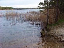
Muldenstein is located on the Mulde about five kilometers northeast of Bitterfeld . To the south of the community there are two very large lakes, the Muldestausee and the Großer Goitzschesee , in the east there are four smaller lakes named after colors (green, red, blue and black). To the south-west rises at 117 m above sea level. NN the Muldensteiner Berg, also called Steinberg. The mountain, accessible via hiking trails, is of volcanic origin and has a drinking water reservoir on its summit.
The Berlin – Halle railway runs through the municipality and had to be relocated to the town because of the opencast mine. Muldenstein station is served hourly by lines S2 and S8 of the S-Bahn Central Germany , the reception building is empty. The B 183 runs south of the community. The nearby A 9 can be reached via the Bitterfeld junction about eleven kilometers away .
history
Muldenstein was first mentioned in a document in 1346. The place is likely to be older, so the church with a former monastery dates from the 11th century. Lausk, Lawsk, Lawssk, Laussig, Steinlausigk, Mildenstein and Müldenstein also appear as place names. From 1668 to 1822 Muldenstein was owned by the von Pfuel family . The place belonged to the Electoral Saxon Office Bitterfeld until 1815 . The decisions of the Congress of Vienna he came to Prussia and in 1816 the district Bitterfeld in the administrative district of Merseburg of the Province of Saxony assigned to which he belonged until 1944th
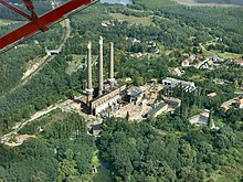
In 1912, the lignite-fired railway power station Muldenstein went into operation, which provided the traction current with a frequency of 16⅔ Hertz for the electrification of the central German railway network between Dessau, Bitterfeld and Leipzig. With the beginning of the First World War , the electric railroad operation was stopped again because the copper contact lines were used for armaments production and the electricity was used to generate chemicals for the production of explosives and fertilizers. Electric rail operations were only resumed from 1921.
In the old Muldenstein paper mill, Junkers Flugzeug- und Motorenwerke set up a branch with Muldenwerke AG from the mid-1930s to manufacture aircraft engines for combat aircraft. The Jumo 211 aircraft engine was built here from 1937 and the world's first series-ready jet engine Jumo 004 from 1944 . Numerous Soviet and Italian people who were deported to the German Reich during the Second World War had to do forced labor .
After the Second World War, the technical facilities of the Muldenstein railway power plant were dismantled together with the aircraft engine plant Muldenwerke AG as a reparation payment for the Soviet Union . In 1953 the power generators, transformers and switchgear of the railway power station were bought back from the Soviet Union and reinstalled in order to be able to resume the electrical railway operation, which was interrupted again in 1946.
Since January 1, 2010, the formerly independent community of Muldenstein has been part of the Muldestausee community. It previously belonged to the administrative community of Muldestausee-Painbach .
politics
The last mayor of the community was Walter Schmidt.
coat of arms
Blazon :
The coat of arms was designed by the heraldist Frank Jung.
Partner municipality
The partner community was Guntersblum in Rhineland-Palatinate
memorial
A memorial in the old cemetery commemorates the death of the numerous slave laborers in the Junkers factories.
Attractions
- Steinberg natural monument ( porphyry ) with a drinking water tank on the Mulde
- Church from the 11th / 12th centuries Century (former monastery church)
- lock
literature
- Emil Obst: Muldenstein near Bitterfeld and the former Stein-Lausigk monastery . Bitterfeld 1895 ( digitized version )
Web links
- Website of the former administrative association
- Muldenstein community
- Muldenstein at www.muldestausee.de
- Muldenstein Estate in the Alexander Duncker Collection (PDF; 290 kB)
Individual evidence
- ↑ muldenstein.de: Chronicle
- ↑ Rainer Baldofski: Chronicle church . Retrieved April 26, 2017.
- ^ Karlheinz Blaschke , Uwe Ulrich Jäschke : Kursächsischer Ämteratlas. Leipzig 2009, ISBN 978-3-937386-14-0 ; P. 22 f.
- ^ The district of Bitterfeld in the municipality register 1900
- ↑ StBA: Area changes from January 01 to December 31, 2010


