Sermuth
|
Sermuth
Colditz parish
Coordinates: 51 ° 9 ′ 30 ″ N , 12 ° 47 ′ 21 ″ E
|
||
|---|---|---|
| Height : | 139 m above sea level NN | |
| Residents : | 600 | |
| Incorporation : | March 1, 1991 | |
| Incorporated into: | Sermuth-Schönbach | |
| Postal code : | 04680 | |
| Area code : | 034381 | |
|
Location of Sermuth in Saxony |
||
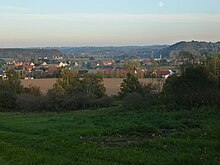
Sermuth is a district of the city of Colditz in the Leipzig district in Saxony . The three smaller districts of Kleinsermuth , Großsermuth and Kötteritzsch together form the district of Sermuth.
Location and accessibility
Sermuth is about 4 km north of the city of Colditz and is connected to it via the B 107 and the K8340. The Freiberger Mulde and the Zwickauer Mulde unite in Sermuth to form the Mulde , which makes the place known nationwide.
history
As a settlement of Sorbian origin, Sermuth was first mentioned in documents in 1286 under the name Sermut .
The castle in Kötteritzsch was converted into a neo-renaissance castle in the 19th century.
With its 600 inhabitants, the district is one of the larger districts of the city of Colditz.
Web links
Commons : Sermuth - collection of images, videos and audio files
Individual evidence
- ↑ Freiberger Mulde - Mulderadweg in the Erzgebirgskreis - www.mulderadweg.info. In: mulderadweg.info. Retrieved March 23, 2015 .
- ↑ Muldental Cycle Path Zwickauer Mulde. In: muldentalradweg.de. Retrieved March 23, 2015 .
- ^ District Sermuth - City of Colditz. (No longer available online.) In: colditz.de. Archived from the original on April 2, 2015 ; accessed on March 22, 2015 . Info: The archive link was inserted automatically and has not yet been checked. Please check the original and archive link according to the instructions and then remove this notice.


