
Hofstede (Bochum)
|
district of Bochum |
|
|---|---|
 |
|
| Coordinates | 51 ° 30 '19 " N , 7 ° 11' 45" E |
| height | 60 m above sea level NHN |
| surface | 3.17 km² |
| Residents | 9889 (December 31, 2016) |
| Population density | 3120 inhabitants / km² |
| Incorporation | Apr 1, 1904 |
| Post Code | 44809 |
| district | center |
| Source: | |
Hofstede is a district in Bochum - Mitte with an area of 317 ha (3.17 km²). The district is north of Bochum city center . It has 9,889 inhabitants (as of 12/2016).
history
The manor house Nosthausen was in Hofstede between the places Eickel and Hamme. The castle stood on the western part of the lands on Dorstener Strasse that were not yet divided between the communities of Eickel and the community of Hofstede and belonged to the parish of Eickel . In 1350, Röttger von Dorneburg was enfeoffed with Nosthausen and since then it has been a daughter of this family. The sideline was later only called "from Aschebrock to Nosthausen". The name of the Hannibal colliery registered in the mining certificate from 1846 was Nosthausen I / II.
Until 1904 Hofstede belonged to the district of Bochum Nord; it was both an official and a rural community. The settlement of the city of Bochum had expanded beyond the original city limits towards the end of the 19th century. There was continuous development to the north in the direction of the new underground mining, which particularly affected the hamlet of Hamme . Due to the expansion of the Zeche President , the shafts of which were partly in the Bochum and Hammer area, Hamme experienced a strong increase in population. Herner Strasse in particular was built on. Between the original Bochum urban area and Riemke , part of Herner Strasse belongs to Hofstede. In the first big wave of incorporation in 1904, Hamme was incorporated into Bochum together with Hofstede, Grumme and Wiemelhausen. In addition to steel production ( Bochumer Verein ), several coal mines were now part of the expanded urban area of Bochum.
Bochum was particularly interested in the incorporation of Hofstede, as the construction of a branch canal from the Rhine-Herne Canal was expected, which, however, was never realized. At the time of incorporation, Hofstede had 8000 inhabitants and the district was still largely agricultural. The Constantin der Große colliery , shafts I and II on Herner Strasse and the Hannibal mine shaft I on Dorstener Strasse were of industrial importance .
The shaft Hannibal I was in 1848 sunk . The first houses of the Hannibal colony were built in the 1860s. The colony comprised several streets of Herzogstraße and In der Provitze . The simple houses were designed uniformly and had extensions that were used, for example, as stables. At a distance from the miners' houses on the west of Dorstener Strasse, south of the former level crossing, the much more spacious houses for the socially higher-ranking managers, climbers, civil servants and commercial employees were built. The colliery colony was destroyed in World War II and not rebuilt. The hammer head tower on Shaft I of the Hannibal colliery (built in 1930) was the symbol of the district for decades until it was demolished in 1974. Another prominent building was the coke silo. It was built in 1921/22 and served its original purpose until 1935. After that it was used as a coal silo. The structure was severely damaged in World War II. The demolition followed in 1974 when the colliery was closed.
To the west of the railway line and spatially separated from the Hannibal colony stood some older houses that made up the Marmelshagen district .
Sinking of the Constantin I shaft began in 1850 and mining began in 1857. The Constantin II shaft was completed in 1866. To the east of shaft 1, a colony was built for the colliery between 1869 and 1874, comprising 65 houses and 123 apartments. The development extended in the 1870s to Herner Strasse.
In 1989 the Hofsteder Weiher was added to the list of nature reserves in Bochum .

Mining finds at the Hannibal shopping center: defused bomb from the Second World War, coal cart, 145-year-old mine slab

Riemke signal box on the railway line to Herne

Degassing hood on the filled Constantin I shaft

Filled area in the area of the demolished Constantin I mine with the memorial for the 475 employees of the Constantin mine who died in the First World War; The sculpture is popularly known as " Bone Karl "

"Bone Karl"


Incorporation
The mining director of Hannibal I, Franz Ruppel, was a deserving community director who was the first alderman in the old Bochum I office until the division on April 1, 1900. Three new offices then emerged from the Bochum-Nord municipality: Hamme, Harpen and Hofstede. The office Hofstede consisted of the four rural communities Hofstede, Hordel, Riemke and Bergen and together had 16188 inhabitants and an area of 7.96 km². The seat of this office was Bochum. At that time, the discussion about incorporation was already underway.
On April 1, 1904, Hofstede was finally incorporated into Bochum.
Transport links
East of the Hannibal colliery runs the railway line to Herne , which was built in 1867 as a branch line of the Cologne-Mindener Eisenbahn-Gesellschaft . A chemical plant for the treatment of sulfuric acid (Ruhr sulfuric acid) was built between the mine site and the railway line. The site was later used by the Society for Material Recovery and Environmental Protection mbH (GMU). Today the complex formed an industrial wasteland that is contaminated by contaminated sites and is currently being renovated. In the area between the slaughterhouse and Hofsteder Bach there was a larger garbage dump that was closed in the 1960s and is now covered and forested. The Hofsteder Bach was used as a sewer ( Köttelbecke ) . At the border to Hordel behind Ortelsburger Strasse, Hofsteder Bach and Marbach meet in front of the former sewage treatment plant. The Hofsteder Bach is currently being renatured and the sewer is being laid in concrete pipes below the brook bed.
Soon after Bochum, Hofstede was also connected to the railway network. The railway line from Bochum via Riemke to Herne, which was put into operation in 1871, was an important traffic route . To the east of the chemical factory in the area of the street Auf dem Dahlacker was the Bochum Riemke train station, which is located in the Hofsted area.
The Hannibal Railway branched off from the route to Herne at the chemical factory. It led on the current footpath north of the Hannibal shopping center across Dorstener Strasse. It ran along Riemker Strasse, crossed Hordeler Strasse and continued along the city limits to Herne-Eickel to the Hanover colliery.
One of the focal points of the settlement in Hofstede at the beginning of the 20th century was Herner Strasse. The section of the Herner Straße up to the A 40 belongs to Hamme, the other section including the WEDAG site is assigned to Hofstede. Herner Strasse was continuously built on at the end of the 19th century. Many buildings from the turn of the 19th to the 20th century are still preserved. The first electric tram line in Bochum (inaugurated on November 23, 1894) led over Herner Straße to Herne to the “Cöln-Mindener Bahnhof”. The tram line thus partially ran through the Hofsted area. This tram line was replaced in 1989 by the U35 underground line. In 1896 the tram connection between Bochum and Eickel was also put into operation.
The Herner and Dorstener Strasse as well as the Löbker-Ring, which was later expanded to become the Ruhr Schnellweg and now represents the A 40 motorway, should be mentioned as important road connections that run through Hofstede .

U-Bahn-Station Zeche Constantin

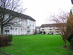
Older settlement on Poststrasse near the Constantin I mine
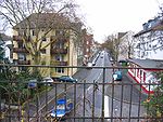
Poststrasse, western part

Retail stores on Hofsteder Strasse


Infrastructure
On the outskirts of Hofstede on the city limits of Eickel, a sewage treatment plant with sewage ponds was built, which is now being dismantled.
The WEDAG site is on Herner Strasse and extends to the street on Dahlacker. KHD Wedag was a Deutz AG company and was involved in the field of coking technology . The company no longer exists. The factory buildings are used by other companies (distribution warehouse) and the administration building on Herner Straße is being renovated. A BOGESTRA depot has been set up on the site ; this is where the U35 vehicles are serviced.
Churches

The Evangelical Lutheran (SELK) Epiphany Church (built 1929/30) at Dorstener Straße 263 is a reinforced concrete construction with red clinker in the Bauhaus style and has been a listed building since 2005. Since 2010, the Capital of Culture year, it has also been the RUHR motorway church . The construction of a Catholic church in Hofstede was planned as early as 1930 with the purchase of a piece of land on Dorstener Strasse and Poststrasse. The construction of the Church of St. Nikolaus von Flüe was not started until 1952 with the onset of further residential construction activities in the area and was completed in 1956. The church building is a brick building with a clear structure.
Population development
| Population development |
|
|---|---|
| year | Residents |
| 1818 | 242 |
| 1843 | 329 |
| 1858 | 524 |
| 1871 | 1982 |
| 1875 | 2950 |
| 1880 | 3142 |
| 1890 | 4925 |
| 1895 | 6158 |
| 1900 | 7447 |
| 1905 | 9275 |
| 1910 | 9675 |
The population development shows a strong increase at the end of the 19th century, which goes hand in hand with the expansion of the mines in Hofstede. The population density in Bochum (without incorporations in 1904) was 11891 inhabitants / km². After Hamme, Hofstede had the highest density in the Bochum district with 2945 inhabitants / km².
In the Second World War, in addition to the city center, the northern parts of the city were particularly affected by destruction and loss of residents; in Hofstede the population decreased by 15.3 percent. In the 50s and 60s the remaining agricultural land in Hofstede was abandoned and built on. The reason for the construction activities in the outer parts of the city was the need for housing due to the destruction in the inner city and the supply of housing for displaced people.
population
On December 31, 2019, 10,073 residents lived in Hofstede.
Structural data of the population in Hofstede:
- Minor quota: 15.1% [Bochum average: 14.6% (2019)]
- Old age quota (60 years and older): 26.6% [Bochum average 28.3% (2019)]
- Proportion of foreigners: 17.5% [Bochum average 14.4% (2019)]
- Unemployment rate: 11.1% [Bochum average 8.9% (2017)]
present
Up until the 1950s, Dorstener Strasse north of Bodelschwingplatz (out of town) was not built on. West of Dorstener Straße at the level of Breslauer Straße was a brick factory. Farms still existed in the Hofsted area until the mid-1960s. As a result, the remaining areas in the district that were not polluted by contaminated sites and heaps were largely built on.
The mines in Hofstede were shut down in the 1960s and early 1970s (Hanover / Hannibal: March 31, 1973). From the buildings of the Hannibal colliery, apart from the incorporation of some buildings into the shopping center, hardly anything has survived. Only one subway station of the same name on the U35 is evidence of the Constantin mine. The area has been filled up and a green area has been created. The sculpture of the "Bald Charles" commemorates the 475 fallen in World War I who were employed by the colliery. The position of shaft I can be traced using the degassing hood.
Shortly after its closure, a shopping center ( Hannibalzentrum ) was built on the site of the Hannibal mine . Here, too, the position of the shaft I can be identified on the degassing hood that is on the current parking lot. Buildings of the colliery (wages hall) are still preserved on the northern flank, but due to the cladding of the facades, they are only preserved in their original state on the rear. The shopping center at the gates of the city was first used by the allkauf department store, and it was expanded considerably in the 1980s and 1990s. To the south of the building that still exists is the mine dump, which was built between Dorstener Strasse and In der Provitze. There are some paths that are very steep and overgrown and not very attractive.
In addition to the Hannibal shopping center, an area with retail stores has developed on Hofsteder Straße north of the A 40 (Bauhaus, Media-Markt, Kaufland, Ratio-Großmarkt), with the good connection to the A 40 in particular favoring this development.
The large companies in Hofstede, the Hannibal and Constantin collieries and WEDAG as a major mining supplier have long ceased to exist. Many of Hofstede's residents work at the Opel plant in Langendreer and Thyssen Krupp, but the number of employees there is declining. In Hofstede and in the neighboring district of Hamme, car dealerships have established themselves on the former slag yard of the Bochum association. The retail trade in Hofstede is also of national importance. The GEA headquarters building is on the eastern side of Dorstener Straße on the city limits to Herne and is therefore still in Hofsted. The futuristic building with a sloping glass cover in the central area was erected in 1991. A biotope and landscape protection area was created towards the Dorneburg brook .
Rastenburger, Allensteiner, Ortelburger Straße settlement west of Dorstener Straße
Pump room on Ortelsburger Strasse


literature
- Jürgen Mittag, Ingrid Wölk: Bochum and the Ruhr area, urban development in the 20th century. Klartext, Essen 2005, ISBN 3-89861-459-X
Web links
Individual evidence
- ↑ Statistical yearbook of the city of Bochum 2017 ( [1] )
- ↑ The population figures are given according to statistical districts and not according to the districts, the figures for this are in the article population development of Bochum
- ^ Westfälische Rundschau, edition Bochum of January 22, 1968
- ^ Society for Geography and Geology Bochum e. V. (Ed.): Bochum and the middle Ruhr area. 1965, p. 97
- ↑ Westfälische Rundschau, edition Bochum of February 27, 1968
- ↑ Westfälische Rundschau, edition Bochum of February 29, 1968
- ↑ Stephanie Reekers: The regional development of the districts and communities of Westphalia 1817-1967 . Aschendorff, Münster Westfalen 1977, ISBN 3-402-05875-8 , p. 247 .
- ^ Karl Brinkmann: Bochum. From the history of a major city in the area. Schürmann & Klagges, Bochum 1968, p. 215
- ^ Karl Brinkmann: Bochum. From the history of a major city in the area. Schürmann & Klagges, Bochum 1968, p. 220
- ^ Karl Brinkmann: Bochum. From the history of a major city in the area. Schürmann & Klagges, Bochum 1968, p. 197

Altenbochum with Steinkuhl | Mountains | Dahlhausen with Oberdahlhausen | Eppendorf with Castel Sant'Angelo and Heath | Gerthe | Grumbles | Günnigfeld | Hamme with gold hammer (with Maar bridge ), Hundhamme and Stahlhausen | Harpen with Kirchharpen, Kornharpen , Rosenberg and Voede branch | Hiltrop | Hofstede with Marmelshagen | Höntrop | Hordel | Downtown | Laer | Langendreer with Kaltehardt , Langendreerholz and Ümmingen | Leithe | Linden | Munscheid | Querenburg with Hustadt and Steinkuhl | Riemke | Sevinghausen | Stiepel with Brockhausen , Haar and Schrick | Wattenscheid center with Südfeldmark | Weitmar with Bärendorf , Mark , Mitte and Sundern | Werne | Westenfeld | Wiemelhausen with Brenschede , Kirchviertel and Ehrenfeld