
Müncheberg
| coat of arms | Germany map | |
|---|---|---|

|
Coordinates: 52 ° 30 ' N , 14 ° 8' E |
|
| Basic data | ||
| State : | Brandenburg | |
| County : | Märkisch-Oderland | |
| Height : | 65 m above sea level NHN | |
| Area : | 152.29 km 2 | |
| Residents: | 6945 (Dec. 31, 2019) | |
| Population density : | 46 inhabitants per km 2 | |
| Postal code : | 15374 | |
| Primaries : | 033432 and 033477 | |
| License plate : | MOL, FRW, SEE, SRB | |
| Community key : | 12 0 64 317 | |
| LOCODE : | DE MCG | |
| City structure: | 8 districts | |
City administration address : |
Rathausstrasse 1 15374 Müncheberg |
|
| Website : | ||
| Mayoress : | Uta Barkusky ( The Left ) | |
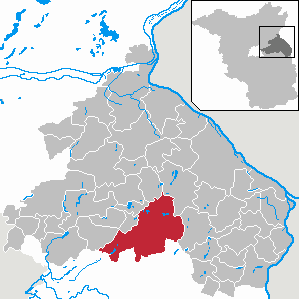
| Location of the city of Müncheberg in the Märkisch-Oderland district | ||
  |
||

Müncheberg is a small town east of Berlin in the Märkisch-Oderland district ( Brandenburg ) . The city, founded in the 13th century, is best known for its research institutions in the field of agriculture (in the GDR the AdL , today the ZALF ).
geography
Müncheberg is halfway between Berlin and the German-Polish border on the Oder on the edge of Märkische Schweiz . The proximity to Märkische Schweiz and the towns of Waldsieversdorf and Buckow makes the city with several bathing lakes (including in the districts of Obersdorf and Münchehofe) a popular destination for holidaymakers and day-trippers. To the northwest of Münchehofe and Hermersdorf, the Stobbertal nature reserve closes off the urban area.
City structure
According to the main statute, the city of Müncheberg is divided into the following districts:
- Eggersdorf (not to be confused with the Eggersdorf district of Petershagen / Eggersdorf further to the west , also in the Märkisch-Oderland district) with the inhabited district of Eggersdorf-Siedlung,
- Hermersdorf
- Hoppegarten (not to be confused with the municipality of Hoppegarten , also in the Märkisch-Oderland district)
- Jahnsfelde
- Müncheberg with the inhabited parts of the community Bienenwerder, Dahmsdorf, Heidekrug, Marienfeld, Philippinenhof and Schlagenthin
- Münchehofe (not to be confused with the Münchehofe district of the municipality of Hoppegarten , also in the Märkisch-Oderland district)
- Obersdorf
- Trebnitz
as well as the following residential areas: Alte Mühle, Augustenaue, Berghof, Brigittenhof, Eichendorfer Mühle, Elisenhof, Friedrichshof, Landhof, Maxseesiedlung, Müncheberger Loose, Müncheberger Siedlung, Neubodengrün and Waldschänke.
history
Until the 19th century


In the late summer of 1225, the Cistercian monks of the Leubus monastery near Breslau and the Cistercian women of the Trebnitz monastery received 200 hoofs of land from the Silesian Piast prince Heinrich the Bearded to found a market town. After the nuns waived their claims, the monks from Leubus built the settlement on a plateau surrounded by swamps and lakes, which they initially named Lubes based on its origins . The place was mentioned for the first time on June 29, 1232 in a document from Heinrich the Bearded, which granted the residents additional lands and privileges. In the confirmation of donation from Pope Gregorius on February 11, 1233, the place was given its current name Müncheberg (spelling at the time: Municheberg). In 1245 Duke Boleslav gave the place market rights. Beginning in 1319, a seven meter high city wall with two city gates, the Küstriner Tor (called Storchenturm) and the Berliner Tor (Powder Tower), was built to protect the city. In the course of the 14th and 15th centuries, the young city was able to expand its position as an important market town and expand its territory. In 1318 the city acquired the Cöpernitz forest, in 1352 the village of Hoppegarten came to Müncheberg, in 1410 the village of Maxsee and in 1493 the village of Schlagenthin. In 1355 the parish church and the hospitals were first mentioned. The relocation of the country roads via Quilitz and Seelow and Liebenberg to Müncheberg in 1348 and 1362 brought two customs offices to Müncheberg.
In April 1432, Trebnitz was completely destroyed by the Hussites , and on April 17, 1432, Müncheberg fell largely to rubble after the Hussites had destroyed the Küstriner Gate and plundered the church. From 1472 to 1639 Müncheberg was owned by the von Pfuel family, who lived in Jahnsfelde . The Thirty Years War and the plague left their mark in the 17th century . In addition, the city burned several times. The worst town fire in 1641 left only the church and a few surrounding houses. As a result, the number of inhabitants fell from around 1,300 in 1624 to less than 400 in 1655. In the late 17th century, however, conditions in the city improved again quickly. In 1689 the first post office was set up, which soon became an important station on the regular mail route from Berlin to Frankfurt (Oder) . In 1692 the rebuilt town hall was completed.
From 1699, French families who had left their homeland for reasons of faith were settled in Müncheberg. The French colony grew to 40 families, from 1701 French MPs were in the city's magistrate, in 1710 the French church was built on the site of the old Heilig-Geist-Hospital. The French colony lasted until the Napoleonic Wars of the early 19th century. The Französische Straße in the old town still bears witness to this time.
The expansion of the Kunststraßen in the first third of the 19th century ( Reichsstraße 1 ) made the city a center of goods traffic to the east. In 1818 the post station in Müncheberg was one of the largest post stations in Prussia.
Today's district of Dahmsdorf emerged from the "Villa Thomae" after Archbishop Rudolf von Magdeburg left it with 50 hooves to the Cistercians of the Silesian monastery Leubus (today Lubiąż). In the period that followed, up to the 15th century, the place had its name changed several times (Domestorp, Domasdorf, Tomasdorff, Tomestorf, Damesdorp, Damestorff and Domestorff). The Cistercians sold the village together with Buckow at the beginning of the 15th century. After that, it always had the same owners as this one. In 1560 Wolf von Kloster was enfeoffed with the village by Elector Joachim II. In the 17th century the village belonged to the von Pfuel family , and from around 1685 to the Counts of Flemming.
20th and 21st centuries
129 Münchebergers paid for the First World War with their lives. From the Second World War testify war cemeteries on the Müncheberger cemeteries and a Soviet war cemetery with the memorial on the B 168 (Karl-Marx-Straße). 239 Soviet soldiers are buried on the terraced complex built in the late 1970s. During the advance of the Red Army against Berlin, a large part of the city's historic building fabric was destroyed.
During the Nazi era , the New Synagogue at Hinterstrasse 155 , built in 1856, was desecrated and destroyed by SA men . A memorial plaque in Rathausstrasse 2 has been commemorating the Jewish community and its church since 1995. In the forest between the Hermersdorf and Wulkow district and between Wulkow and Neuhardenberg , two satellite camps of the Theresienstadt concentration camp were built during the Second World War . Since 1995 a memorial stone in the main street of Hermersdorf and a memorial plaque on the school camp next to the church have been commemorating the dead in these subcamps.
After the Second World War, the old town, which had been destroyed by the war, was largely rebuilt. After the reunification of Germany , the remaining monuments, in particular the town church of St. Mary, were restored and given a new use.
During the Cold War, Müncheberg had the joint command post of radio battalion 61 and Jagdgeschwader 8 of the NVA LSK / LV . From 1978 to 1981, a two-story monolithic protective structure of a higher protection class was built for around 28 million GDR marks , which was a special feature of this command post. The bunker was taken out of military use in 2004.
Müncheberg belonged to the district of Lebus in the province of Brandenburg since 1817 and from 1952 to the district of Strausberg (until 1990 in the GDR district of Frankfurt (Oder) , 1990–1993 in the state of Brandenburg ). Since the district reform in 1993 , the city has been in the Märkisch-Oderland district .
Research city Müncheberg
On September 29, 1928, the doctor and geneticist Erwin Baur founded the Kaiser Wilhelm Institute for Breeding Research , the predecessor of today's Max Planck Institute for Breeding Research in Cologne . Since then, Müncheberg has always remained a research location. After the Second World War there was the Institute for Arable and Crop Production, from 1970 the Research Center for Soil Fertility of the Academy of Agricultural Sciences of the GDR .
On January 2nd, 1992, the Center for Agricultural Landscape and Land Use Research (ZALF) e. V. founded, today's Leibniz Center for Agricultural Landscape Research (ZALF) e. V. This institution, financed jointly by the federal government and the state of Brandenburg, is the city's largest employer. The ZALF also houses the German Entomological Institute , which has one of the largest and most important insect collections (approx. 3,000,000 specimens) in Germany.
Müncheberg Office
On July 13, 1992, the Minister of the Interior of the State of Brandenburg approved the establishment of the Müncheberg Office. July 16, 1992 was set as the date on which the office was established. The office was based in the city of Müncheberg and consisted of six communities in the former Seelow and Strausberg districts :

- Trebnitz
- Jahnsfelde
- Hermersdorf / Obersdorf
- Eggersdorf b. Müncheberg
- Hoppegarten b. Müncheberg
- City of Müncheberg
The Müncheberg office was dissolved on March 31, 2002 and the city of Müncheberg was vacant. Since then Müncheberg has eight districts. The official director was Klaus Zehm, who later became mayor of the city of Müncheberg.
Incorporations
- July 1, 1950: Dahmsdorf is incorporated into Müncheberg
- January 1, 1957: Incorporation of Münchehofe in Obersdorf
- March 22, 1970: Merger of Hermersdorf and Obersdorf to Hermersdorf / Obersdorf
- March 31, 2002: Merger of Eggersdorf, Hermersdorf / Obersdorf, Hoppegarten, Jahnsfelde , Müncheberg and Trebnitz to form the city of Müncheberg
Population development
|
|
|
|
|
Territory of the respective year, number of inhabitants: as of December 31 (from 1991), from 2011 based on the 2011 census
politics
City Council
The city council of Müncheberg consists of 18 city councilors and the full-time mayor. After the local elections from 2003 to 2019, the following allocation of seats resulted:
| Party / list | 2003 | 2008 | 2014 | 2019 |
|---|---|---|---|---|
| AfD | - | - | - | 4th |
| The left | 4th | 6th | 4th | 3 |
| CDU | 6th | 6th | 5 | 3 |
| SPD | 5 | 4th | 5 | 2 |
| Voting group “Aktion Zukunft” (AZ) 1 | - | - | 2 | 2 |
| Obersdorf voter group (OD) | - | - | 2 | 2 |
| Voting group "Independent Free Voters Müncheberg" | - | - | - | 1 |
| Voting group "Free Voters Eggersdorf" | - | - | - | 1 |
| Voting group "Citizens for Müncheberg" (BfM) | 2 | 1 | - | - |
| DVU | 1 | 1 | - | - |
| total | 18th | 18th | 18th | 18th |
1 2019: List Association Action Future / Alliance 90 / The Greens
mayor
- 2003-2008: Klaus Zehm (SPD)
- since 2008: Uta Barkusky (Die Linke)
The city council of Müncheberg elected the former director Klaus Zehm on April 10, 2003 as full-time mayor. He was replaced by Uta Barkusky, who won the mayoral election on October 12, 2008 with 68.4% of the valid votes. Barkusky was confirmed in office on September 25, 2016 in the first ballot with 60.0% of the valid votes for a further eight years.
coat of arms

The newly founded city took over the coat of arms of the dissolved Müncheberg office on March 6, 2004.
Blazon : “Square of red (fields 1 and 4) and gold (fields 2 and 3); at the top in front a silver six-spoke wagon wheel; at the top in the back a green fir tree, in front at the bottom on a green three-mountain a growing monk with a silver robe and black scapular, who holds a silver shield with a red gold-armored eagle in his right hand and a silver star-studded staff in his left hand (city arms before 2002), silver-colored lower back jointed masonry. "
flag
The city of Müncheberg flies a flag. The flag is quartered in yellow and red with the city arms in the middle.
Partner communities
Sights and culture
In the list of monuments in Müncheberg are the monuments entered in the list of monuments of the state of Brandenburg.
Buildings


- Berlin Gate Tower (“Powder Tower”) : The older of the two defense towers is colloquially known as the “Powder Tower” because of its earlier use as a powder store and prison. It has a square floor plan and a pedestrian passage that was only created in the 20th century.
- Küstriner gate tower ("Storchenturm") : The Küstriner gate tower has a round floor plan and consists of field stones in the basement and bricks at the top. The top has a cone shape, and on top of it there is a stork's nest, which is why the tower is also called the “stork tower”. A massive oak club hangs on the tower and underneath it the saying: Whoever gives bread to his children and suffers hardship himself because one should beat with this club to death.
- Stadtpfarrkirche Sankt Marien : Gothic brick building from the Middle Ages with a tower based on plans by Karl Friedrich Schinkel . The church, which was destroyed in World War II, was rebuilt in the 1990s and has served both ecclesiastical and cultural purposes ever since.
- City wall : About 1800 meters of the seven meter high wall are still preserved. You can completely go around the old town on a path on the outside of the wall. The city wall only has gaps in some sections.
- Jahnsfelde Castle : ancestral castle of those von Pfuel , who lived in Jahnsfelde from 1449 to 1945. The core of the castle consists of a two-story solid plastered building. The building is partially basement with rooms with groin vaults from the 17th century (probably around 1680). The external appearance of this oldest surviving part of the building was probably redesigned in a classical style around 1831 and has a slightly protruding central projection on its southern façade, the crowning gable of which is adorned with the sandstone coat of arms of the von Pfuel family.
- Jahnsfelde Castle Church : Flat-roofed, rectangular field stone building with a slightly drawn-in west tower, medieval core. The walled-up pointed arch portal and the small round arched sound openings of the west tower have been preserved from the original building. Comprehensive renovation in the second half of the 19th century. Change of the windows, installation of a west portal and addition of the tower gable in neo-Gothic form. Inside, the coat of arms epitaph made of sandstone Christian von Pfuel † 1593, altar and pulpit in the 2nd half of the 19th century.
- Trebnitz Castle (in the district of the same name) : The place and Gut Trebnitz were first mentioned in 1124 as founded by the Silesian monastery Trebnitz , in whose possession it remained until 1498. In 1472 half of Trebnitz came into possession of the von Pfuel. In 1730 the 30 hectare park was created and later designed by Peter Joseph Lenné and Eduard Neide (a student of Lenné). In 1827 the estate came into the possession of the von Brünneck family. In 1900 the manor house was converted into a neo-baroque palace. In 1945 the owner Harald von Brünneck was expropriated. Subsequently the castle served u. a. as a military hospital and school and was renovated in 1992 and converted into an education and meeting center. A museum was opened on the grounds of the palace in September 2017, making the estate of the sculptor Gustav Seitz accessible to the public. The Sculpture Museum in Trebnitz Castle took over 150 sculptures, more than 4,000 drawings and graphics, an extensive library and furniture from the former Hamburg home and studio from the Gustav Seitz Foundation . The village church , a neo-Gothic hall church that was built in 1864 and 1865, stands in the former line of sight .
- Jewish cemetery : The cemetery was laid out in 1756 outside the city walls on the road to Eggersdorf and is surrounded by walls on three sides.
- The Eggersdorfer Church is a late medieval building made of field and brick. The nave is shortened on its west side. Experts therefore suspect that a larger facility was originally planned. Inside there is a pulpit altar , which JC Martin created in 1746.
- The Münchehofe village church was built in the second half of the 13th century. Originally the church facilities belonging altarpiece dating from around 1520 is located in St. Mary's Cathedral in Fürstenwalde / Spree . *
- The Obersdorf village church was also built in the second half of the 13th century. The structure was badly damaged in World War II; a large part of the church equipment was destroyed.
- The village church Hermersdorf was built at the end of the 13th century. The square west tower was added at the beginning of the 16th century. 1735 changed parish the tower top. Inside there is an altarpiece , which the artist Herrler created around 1953 and shows the birth of Jesus , his baptism and the crucifixion .
Parks
- city Park
- Schützenhauspark
- Jahnsfelde Castle Park , designed by Prince von Pückler in the 19th century. Numerous trees in the estate park, u. a. Hanging beech, Dutch linden, oak, black pine, cucumber magnolia, plane tree, black walnut, arborvitae, ginko.
traffic
The federal highway B1 / 5 leads from the west of Berlin coming through the districts Hoppegarten and Müncheberg. In a bypass built in the 1990s, it leads south around the core city of Müncheberg, north past Philippinenhof. It divides southeast of the city. The B 1 runs through the district Jahnsfelde to the district town of Seelow , the B 5 leads to Frankfurt (Oder) . The B 168 crosses the B1 / B 5 and, coming from Eberswalde , runs through the districts of Schlagenthin, Müncheberg and Eggersdorfer Siedlung in the direction of Fürstenwalde .
The Müncheberg , Obersdorf and Trebnitz stations on the Berlin – Küstrin-Kietz border line ( regional line RB 26 Berlin-Ostkreuz - Kostrzyn ) have been served by the Niederbarnimer Railway since 2006 . The Buckower Kleinbahn , operated as a museum railway, branches off from this route in Müncheberg .
Coming from Waldsieversdorf , part of the European cycle route R1 runs through the districts of Münchehofe, Obersdorf and Trebnitz towards Küstrin .
In the district of Eggersdorf is the same airfield in the grounds, a production of UL aircraft is located.
Personalities
sons and daughters of the town

- Bartholomäus Gesius (1562–1613), composer and cantor
- Carl Leberecht Messow (1759–1825), superintendent in Biederitz and school reformer, born in Obersdorf
- Ernst von Pfuel (1779–1866), Prussian general, Prime Minister and Minister of War
- Friedrich Heinrich Ludwig von Pfuel (1781–1846), Prussian lieutenant general, commandant of Saarlouis, Spandau and Stettin
- Alfred Adam (1888–1956), doctor and university professor, born in Dahmsdorf
- Werner Schleusener (1897–1977), crop scientist
- Klaus Mehle (1940–2020), politician (SPD)
- Jutta Stöck (* 1941), track and field athlete
- Markus Meckel (* 1952), politician (SPD)
- Stephan Hilsberg (* 1956), politician (SPD)
Personalities associated with Müncheberg
- Personalities at the Müncheberg research institutes
- Erwin Baur (1875–1933), doctor, botanist, geneticist and breeding researcher
- Reinhold von Sengbusch (1898–1985), botanist and plant breeder
- Joachim Hackbarth (1906–1977), plant breeder and geneticist
- Hans Breider (1908-2000), oenologist
- Gustaf de Lattin (1913-1968), zoologist
- Heinz Brücher (1915–1991), botanist and geneticist
- Kurt Rauhe (1922–1994), agricultural scientist
- Karl Steinbrenner (1927–1992), arable and crop scientist, died in Müncheberg
- Holger Heinrich Dathe (* 1945), zoologist
- Others
- Paul Zech (1881–1946), writer, spent his childhood in Müncheberg
- Gunter Fritsch (* 1942), politician (SPD), state minister and member of the state parliament, spent his youth in Müncheberg, later was Müncheberg city councilor and member of the district council of Märkisch-Oderland
- Anke Domscheit-Berg (* 1968), politician (formerly Bündnis 90 / Die Grünen and Pirate Party ) and author, spent her childhood and youth in Müncheberg
literature
- Heinrich Berghaus : Land book of the Mark Brandenburg and the Margraviate Nieder-Lausitz in the middle of the 19th century . Volume 3, 1st edition, Brandenburg 1856, pp. 200-207 ( online ).
- W. Riehl and J. Scheu (eds.): Berlin and the Mark Brandenburg with the Margraviate Nieder-Lausitz in their history and in their present existence . Berlin 1861, p. 378-380 ( online ).
- Müncheberger Bilderbogen, Horb 1998
Web links
Individual evidence
- ↑ Population in the State of Brandenburg according to municipalities, offices and municipalities not subject to official registration on December 31, 2019 (XLSX file; 223 KB) (updated official population figures) ( help on this ).
- ↑ Main statute of the city of Müncheberg of December 10, 2014 ( Memento of the original of September 2, 2016 in the Internet Archive ) Info: The archive link was automatically inserted and not yet checked. Please check the original and archive link according to the instructions and then remove this notice.
- ^ Service portal of the state administration of the state of Brandenburg - City of Müncheberg
- ^ Leopold von Ledebur: Adelslexikon der Prussischen Monarchy . Rauh, 1856, p. 196.
- ^ Siegmund Wilhelm Wohlbrück : History of the former Diocese of Lebus and the country of this taking. Third part. Berlin 1832, pp. 213/214; Land book of the Mark Brandenburg and the Markgrafthum Nieder-Lausitz in the middle of the 19th century. Third volume. Brandenburg. 1856. pp. 225/226, 206
- ^ Soviet cemetery of honor Müncheberg - Battle of the Seelow Heights . In: Berlin's Taiga . August 11, 2017 ( berlinstaiga.de [accessed September 3, 2017]).
- ↑ Untergrund-Brandenburg.de. Retrieved January 3, 2014
- ^ Formation of the Müncheberg office. Announcement of the Minister of the Interior of July 13, 1992. Official Journal for Brandenburg - Joint Ministerial Gazette for the State of Brandenburg, Volume 3, Number 54, July 31, 1992, p. 969.
- ↑ a b c Contribution to the statistics of the State Office for Data Processing and Statistics. Historical municipality register of the State of Brandenburg 1875 to 2005 7.15 pm Landkreis Märkisch-Oderland PDF
- ^ Formation of a new city Müncheberg Announcement of the Ministry of the Interior of February 19, 2002. Official Gazette for Brandenburg Common Ministerial Gazette for the State of Brandenburg, Volume 13, Number 10, March 6, 2002, p. 275 PDF ( Memento of December 2, 2013 in the Internet Archive )
- ^ Historical municipality register of the state of Brandenburg 1875 to 2005. Landkreis Märkisch-Oderland. Pp. 26-29
- ^ Population in the state of Brandenburg from 1991 to 2015 according to independent cities, districts and municipalities. Table 7
- ^ Office for Statistics Berlin-Brandenburg (Ed.): Statistical report AI 7, A II 3, A III 3. Population development and population status in the state of Brandenburg (respective editions of the month of December)
- ^ Result of the local elections on May 25, 2014
- ^ Result of the local election on May 26, 2019
- ↑ Brandenburg Local Election Act, Section 74
- ^ Result of the mayoral election on September 25, 2016
- ↑ Coat of arms information on the service portal of the state administration of Brandenburg
- ^ A b Reichelt: Research City - Gateway to Märkische Schweiz. City of Müncheberg, January 11, 2016, accessed April 7, 2017 .
- ^ Siegmund Wilhelm Wohlbrück: History of the former diocese of Lebus and the country of this taking . Ed., 1832, pp. 272-276.
- ↑ The estate of the sculptor Gustav Seitz. Neues Deutschland from September 5, 2017, p. 12
- ↑ Printed matter 14 / 5064. (PDF) In: Road construction report 2000. German Bundestag, May 1, 2001, p. 84 , accessed on December 23, 2017 .
Altlandsberg | Old cloth tape | Bad Freienwalde (Oder) | Beiersdorf-Freudenberg | Bleyen-Genschmar | Bliesdorf | Buckow (Märkische Schweiz) | Falkenberg | Falkenhagen (Mark) | Spruce height | Fredersdorf-Vogelsdorf | Garzau-Garzin | Golzow | Gusow-Platkow | Heckelberg-Brunow | Highlands | Hoppegarten | Küstriner Vorland | Lebus | Letschin | Lietzen | Lindendorf | Märkische Höhe | Müncheberg | Neuenhagen near Berlin | Neuhardenberg | New win | Neutrebbin | Oberbarnim | Oderaue | Petershagen / Eggersdorf | Podelzig | Prötzel | Rehfelde | Reichenow-Möglin | Riding wine | Rüdersdorf near Berlin | Seelow | Strausberg | Treplin | Vierlinden | Waldsieversdorf | Spices | Zechin | Zeschdorf