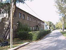
Berliner Chaussee
|
Berliner Chaussee district of Magdeburg |
|
|---|---|
| Basic data | |
| Surface: | 5.0198 km² |
| Residents : | 2311 |
| Population density : | 460 inhabitants per km² |
| (Information as of December 31, 2016) | |
| Coordinates : | 52 ° 8 ' N , 11 ° 42' E |
| Districts / Districts: |
Friedensweiler Neugrüneberg Puppendorf Steinwiese Stadium Neue Welt Berliner Chaussee |
| Postal code : | 39114 |
| Bus routes : | 51 701 720 ( NJL ) |
Berliner Chaussee is a district of Magdeburg , the state capital of Saxony-Anhalt .
Area and population
In the district east of the Elbe , 2,311 people live on an area of 5.0198 km² (as of December 31, 2016). The proportion of recipients of social benefits is well below the average for the city of Magdeburg. The average age is 41.1 years. The proportion of foreigners is 0.9% and thus also below the urban average. (As of 2001)
geography
The district combines several settlements east of the city, which are located north and south of the eponymous Berliner Chaussee and does not have a grown town center. It is subdivided into the statistical districts Berliner Chaussee , Friedensweiler , Neugrüneberg , Puppendorf , Stadion Neue Welt and Steinwiese .
A small part of the northern Biederitzer Busch around the two lakes Waldsee I and Waldsee II belongs to the district. The Schwarzkopf Kolk in Neugrüneberg is another stagnant body of water in the district. The Furtlake and various smaller ditches run through the district along flowing waters . The entire area of the district lies in the area of the former glacial valley of the Elbe.
In the north, Berliner Chaussee borders the Herrenkrug district . To the east lies the municipality of Gübs , to which the Elbe flood canal , which runs parallel to the city limits, belongs. Zipkeleben is located in the south and Cracau and Brückfeld are adjacent to the west .
history
Until the 20th century, the area was mainly used for agriculture. The Königsborn estate used the area in particular as pasture. Berliner Chaussee was only in use as the eastern arterial road for Magdeburg since the first half of the 19th century. Previously, traffic had been routed further south over the Klusdamm or Heerstraße Magdeburg-Brandenburg . Allotment garden colonies for the Magdeburg population emerged around 1900 . In 1929/30, the Reichsbanner Schwarz-Rot-Gold built the New World stadium including a swimming pool and lido. In 1930, the Magdeburg-Nord military airfield was established in the eastern part of the district . To the north of the Berliner Chaussee, barracks were built, which form today's Friedensweiler settlement. In 1932/1933 allotment parcels were sold to the previous allotment gardeners. Small houses were built on the garden plots and thus the small single-family house colonies that characterize the image of the district.
At the end of World War II , on April 13, 1945, the Neue Welt stadium was the scene of a massacre of prisoners who had to take part in a death march . Today the memorial stone erected there commemorates the dead. After the war, the military airfield was abandoned and the facilities converted for civil use. The Neue Welt stadium was operated until 1990, when it was closed for cost reasons.
The cultural monuments in the district are listed in the local monument register .
economy
According to the structure as a residential area, there are predominantly smaller companies. However, some medium-sized companies have also settled directly on Berliner Chaussee. In 2003 there were 90 member companies of the IHK and 21 craft businesses in the district.
literature
- 40 quarter in the big test , Magdeburg 2003, page 18 ff.
Web links
Individual evidence
- ↑ District catalog of the Office for Statistics
- ^ District catalog , 2001, page 336 ff.
- ↑ Helmut Asmus, 1200 Years Magdeburg, The Years 1945 to 2005 , Magdeburg 2009, page 18 f.


