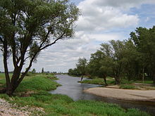
Elbe flood canal
The flood canal , together with the “ Pretziener Wehr ”, is a flood protection system for Magdeburg and the communities and agricultural areas east of the city. Schönebeck (Elbe) , south of Magdeburg, also benefits from the facility.
With the construction of roads and railroad embankments in the early to mid-19th century, the flood conditions in the east of Magdeburg deteriorated dramatically. Although the new routes had been provided with flood bridges as a precaution, dangerous floods occurred in 1845 and 1862. Since the old dikes of the villages in the east of Magdeburg had increasingly proven to be unsafe, the three dike associations mentioned were formed in accordance with the “Statute for the Magdeburg, Elbenau and Ehle dike associations” issued by the Prussian king on July 24, 1868 which the places in the polders participated as compulsory members. The execution of the buildings according to the established improvement plan was entrusted to a special building commission headed by a royal commissioner.
The starting point of the flood canal is the “Pretziener Wehr”, which was built between 1871 and 1875 in the bed of the Dornburg Old Elbe near the town of the same name . The 163 meter long sandstone dam is broken through by nine openings, which are closed by steel plates when the water level is normal. When the water level at the weir is 5.20 meters, the plates are raised so that a third of the Elbe water flows north into the flood canal. The canal itself is delimited by eight meter high dikes to a width of around 450 meters. The dykes were drawn up to the level of the village of Biederitz , after which the water flows off unencumbered to the mouth of the canal into the Elbe near Lostau. The entire system was completed in 1876.
With a total length of 25 kilometers, the canal runs up to 1.5 kilometers behind Plötzky in the old Elbarm. At Calenberge the Ehle Canal flows into the Umflutkanal, which then follows the river bed of the Ehle . The villages of Pretzien, Plötzky, Calenberge, Pechau , Gübs , Heyrothsberge , Biederitz and Lostau (from south to north) lie along its course . There are road crossings at Pretzien, Plötzky ( Bundesstrasse 246a ), Elbenau , Pechau, Heyrothsberge ( Bundesstrasse 1 ) and at Biederitz. The Berlin – Magdeburg railway line also crosses the flood canal here.
During the flood of the century in 2002 , a dyke broke near the village of Heyrothsberge , flooding Gübs , Biederitz , Königsborn , Menz and Wahlitz .
Web links
- Flood level entered in the topographic map TOP50 (April 7, 2006) for the area of the Elbe and the Elbe flood canal (ZKI of the DLR)
- Description of the flood canal and the Pretzien weir
Coordinates: 52 ° 5 ′ 3.6 " N , 11 ° 43 ′ 36.6" E

