
Western ring area (municipality)
| City district Western ring area |
|
|---|---|
 Location of the western ring area (red) |
|
| District Mayor : | Jürgen Dölz (SPD) |
| District : | No. 310 |
| Residents : | 35,088 (Dec. 31, 2017) |
| Area : | 858.5 ha |
| Population density : | 40 inhabitants per hectare |
| Postcodes: | 38114, 38118, 38122 |
 St. Jakobi |
|
The western ring area is a district of Braunschweig (official district number 310). The municipality has 34,088 inhabitants. This district includes the western ring area of the same name and the Gartenstadt district .
history
The western ring area was created at the end of the 19th century according to plans by Ludwig Winter as part of the Wilhelminian era belt around the historic city center of Braunschweig , today's city center district .
The district was largely shaped by industry. Well-known companies are u. a. the Braunschweigische Maschinenbauanstalt , which was built in 1853 on Bahnhofstrasse. As a result of industrialization, entire residential areas for the workers emerged in the quarter. The plans for the ring area were never fully implemented, some streets were never built, others only partially built on. Part of the southern half was partially built on in the 1920s and 1930s.
An important part of the planning was the Braunschweiger Ring , a ring-shaped road system around the historic city center. This was laid out relatively broad, as a promenade for pedestrians was to be created in the middle of the ring. The western ring area has remained almost unchanged since the 1940s, with only a few new houses built since then.
politics
- City District Council
The municipal district council of the western ring area has 19 members and has been composed as follows since 2011:
gallery
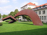
Sculpture in front of the employment agency

Reformed Church Cemetery


.JPG)
See also
Web links
- Map of the city district (PDF)
- City district council 310 Western ring area on the website of the city of Braunschweig
- Western ring area on the website of the city of Braunschweig
Individual evidence
- ↑ Stadtbezirksrat 310 Westliches Ringgebiet ( Memento of the original from April 18, 2010 in the Internet Archive ) Info: The archive link was inserted automatically and has not yet been checked. Please check the original and archive link according to the instructions and then remove this notice. on braunschweig.de
- ↑ a b Population statistics on braunschweig.de, accessed on July 29, 2018
- ↑ Braunschweig in Statistics 2010, page 20 (PDF file; 8.02 MB)
- ↑ http://www.braunschweig.de/leben/stadtportraet/stadtteile/westl_ringgebiet/
- ↑ Info-Line Braunschweig (PDF file; 139 kB) on braunschweig.de, 5, 2011.
Coordinates: 52 ° 15 ' N , 10 ° 30' E
Broitzem (223) | Heidberg-Melverode (212) | Hondelage (113) | Downtown (131) | Lehndorf-Watenbüttel (321) | Nordstadt (331) | Eastern ring area (120) | Rüningen (224) | Schunteraue (332) | Südstadt-Rautheim-Mascherode (213) | Stöckheim-Leiferde (211) | Timmerlah Geitelde Stiddien (222) | Veltenhof-Rühme (322) | Viewegsgarten-Bebelhof (132) | Folk maraud (114) | Wabe-Schunter-Beberbach (112) | Wenden-Thune-Harxbüttel (323) | Western ring area (310) | Weststadt (221)