Brunswick Ring

The multi-lane ring road around the historic city center is called Braunschweiger Ring or Ring . While the historic city center and today's city center district is bounded by the Okerum flood , the ring also includes areas beyond the Oker . It was created in the 19th century as part of the city's expansion. However, the ring is not completely closed in the south. Since its creation began in the Wilhelminian era , it is also known as the Wilhelminischer Ring .
However, it was expanded much later, and additions to the road ring followed until the post-war period. The development also took place during this period. A large part of its historic development is under monument protection. The ring is one of the most defining urban planning elements of the Braunschweig cityscape and is characterized by heavy main and through traffic.
The ring gave the city quarters the western ring area , the northern ring area and the eastern ring area . It is one of several traffic rings in Braunschweig that are roughly concentric. Inside the ring are the Cityring and Wallring , outside the ring track of the former ring railway and finally the unfinished motorway ring.
history

City planning officer Ludwig Winter (1843–1930) played a key role in the creation of the Braunschweiger Ring . He designed the ring in the local building plan of the city of Braunschweig, according to whose planning the construction of streets and buildings took place from the end of the 19th century. Winter designed a ring from Frankfurter Strasse to Leonhardplatz. Often existing streets and buildings in this young and emerging outer city were over-planned and had to give way.
While the eastern part was quickly built on and still implemented after Winter's ideas, the development of the western part in particular was a long time coming, so that it was only built in the 1920s and 1930s and houses were built from 1920 to 1960. There, however, the places planned by winter were foregone.
Since the ring road was also intended to be used for representative purposes and for strolling, it was laid out as a particularly wide avenue with a sidewalk in the middle. With the increasing number of traffic and the subsequent widening of multiple lanes, sidewalks and trees were removed. This explains the extraordinary width of the ring, which was recognizable back then and to this day.
The naming of the streets was originally based on the Braunschweiger Weichbilden Altstadt , Sack , Neustadt , Hagen and Altewiek , as well as the former St. Cyriakus Abbey , the Braunschweig district of Wenden and the entrepreneur Heinrich Büssing (1843-1929 ). The existing Rebenstrasse became the Rebenring. There, in September 1874, students from the Martino-Katharineum grammar school played the first soccer game on German soil on the so-called “small parade ground” , under the direction of the teacher and sports pioneer Konrad Koch (1846–1911).
In addition to the plans for winter, plans were made to continue the incomplete ring. At the end of the 1950s, the ring was extended across Leonhardplatz to the new train station and on to Wolfenbütteler Straße. The gap between Humboldtstrasse and Rebenring has also been closed.
A completion of the road ring was planned and prepared, especially in the 1960s and 1970s, but the realization was not implemented. For example, a route between Fabrikstrasse and Theodor-Heuss-Strasse had already been released for the continuation. Finally, a part of the area was dedicated to building a playground. Overall, it should run over Ekbertstrasse and through the Bürgerpark .
Subdivision
| Street / place | Buildings and plants | image |
|---|---|---|
|
Frankfurter Platz ( ⊙ ) |
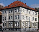
• Cultural monument residential building at Frankfurter Strasse 25 |

|
|
Cyriaksring ( ⊙ ) |
• Cyriaksring 42–45 residential block cultural monument |

|
|
Altstadtring ( ⊙ ) |
• Johannes-Selenka-Platz • University of Fine Arts |

|
|
Blind ring ( ⊙ ) |
• Hoffmann von Fallersleben School |

|
|
Rudolfplatz ( ⊙ ) |
• | |
|
Neustadtring ( ⊙ ) |
• Amalienplatz | |
|
Turning ring ( ⊙ ) |
• Wendenring Bridge • Andreasfriedhof |

|
|
Vine ring ( ⊙ ) |
• Katharinen- und Garrisonfriedhof (today canteen park) • Natural history museum • House of Science • Center for Systems Biology of the Technical University of Braunschweig |

|
|
Hagenring ( ⊙ ) |
• Chemical center of the Technical University of Braunschweig |

|
|
Altewiekring ( ⊙ ) |
• Mars-la-Tour barracks cultural monument • Altewiekring 70 |

|
|
Leonhardplatz ( ⊙ ) |
• Raabe House Literature Center • Braunschweig City Hall |

|
|
Willy-Brandt-Platz ( ⊙ ) |
• Vieweg's garden • Memorial site of the Schillstrasse subcamp • BraWoPark Business Center • Technical monument of the steam locomotive 01 1063 |

|
|
Berliner Platz ( ⊙ ) |
• Braunschweig main station • Braunschweig long-distance bus station |

|
|
Heinrich-Büssing-Ring ( ⊙ ) |
• Bürgerpark |

|
|
||
Innovations
Autonomous vehicles were tested several times on the Braunschweiger Ring. In 2010, a converted VW Passat named "Leonie" was allowed to drive in flowing traffic as part of the Stadtpilot project at the Technical University of Braunschweig .
With "Emil", the Braunschweiger Verkehrs-GmbH started inductively driving regular buses on the ring, which run on the twelve kilometer long ring line. These include vehicles from the Solaris Urbino 12 electric and Solaris Urbino 18 electric series . For operation, charging stations were built at several stops on the ring. Since the end of March 2014, a solo bus has been operating on the 419 ring route. Since December 22, 2014 inductive charging electric articulated buses have been running on the route.
literature
- Jürgen Hodemacher : Braunschweig's streets - their names and their stories. Volume 2: Between Okergraben and the city ring. Elm-Verlag, Cremlingen 1996, ISBN 3-927060-12-7 .
- Jürgen Hodemacher: Braunschweig's streets - their names and their stories. Volume 3: Outside the city ring. Meyer, Braunschweig 2001, ISBN 3-926701-48-X .
Web links
Individual evidence
- ^ Matthias Breitinger: Autonomous driving: When the computer steers. In: Zeit Online. Retrieved April 7, 2016 .
- ^ Driverless research vehicle: "Leonie" rolls through Braunschweig. In: Spiegel Online. Retrieved April 7, 2016 .
- ↑ Braunschweiger Verkehrs GmbH: Braunschweig now drives inductively!


