List of cultural monuments in the western ring area
The list of cultural monuments in the district Western Ring area includes part of the cultural monuments in Braunschweig District Western Ring area , based on the Braunschweiger guidance and information system REPUBLIC and publications of the conservation authority in Braunschweig.
Cultural monuments
Garden city
| image | designation | location | description | construction time | Registered since |
Monument number |
|---|---|---|---|---|---|---|

|
Coca-Cola filling station |
Alte Frankfurter Strasse 181 map |
Former filling station of the Coca Cola Company, built in two phases in the modern style of the 1950s according to plans by the architect H. Kratz. | 1954 and 1957 |
Western ring area
| image | designation | location | description | construction time | Registered since |
Monument number |
|---|---|---|---|---|---|---|
|
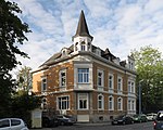
Broitzemer Strasse 1 |
Broitzemer Strasse 1 map |
||||
 more pictures |
Brothers Cemetery |
Broitzemer Strasse map |
Former cemetery that was used from 1769 to 1878 and has now been converted into a green area. | |||
 more pictures |
Former sugar refinery (ARTmax) |
Frankfurter Strasse 2 map |
Halls of a former sugar refinery, built in brick style by the architects Rasche & Kratzsch. | 1900-1902 | Sep 24 1986 | |
| Factory floor |
Kramerstrasse 9A map |
Former factory hall of the BMA company. Brick building from the late 19th century. | ||||
|
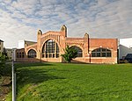
Facade foundry |
Ernst-Amme-Strasse 19 map |
Facade of a former brick-style foundry on the premises of Bühler AG . | |||
 more pictures |
Cemetery of the cross monastery |
Rennelbergstrasse map |
||||

|
former municipal poor house |
Goslarsche Strasse 93 map |
||||
| Industrial monument Kramerstraße |
Kramerstrasse 23 map |
The medium-sized machine factory "Elsner & Holdschmidt" was founded here in 1898. The factory has been preserved in its original state. | ||||

|
Industrial monument machine house |
Kramerstrasse (unnumbered) map |
The machine house of the BMA company in Kramerstrasse. | |||
 more pictures |
Jakobikirche |
Goslarsche Strasse 31A map |
Neo-Baroque church (reform architecture) | 1909-1911 | ||
 more pictures |
Jödebrunnen |
At the Jödebrunnen card |
Stone-enclosed water basin with spring water. | |||
 more pictures |
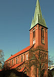
Joseph's Church |
Goslarsche Strasse 6 map |
Built in 1902 in neo-Gothic style and with brick masonry. Rear building also under monument protection. | 1902-1903 | ||
 more pictures |
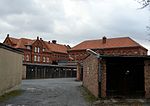
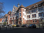
Correctional facility |
Rennelbergstrasse 10 map |
1884-1885 | |||
 more pictures |
Holwedestrasse Hospital (old building) |
Holwedestrasse 16 map |
||||
 more pictures |
KURZAG house |
Ekbertstrasse 14 map |
Company building. Steel frame construction from 1929. Architect Otto Haesler. 1995 Gutting and restoration of the original structure. | 1929 | ||

|
Madamenweg 174 |
Madamenweg 174 map |
Former police station. Neo-Renaissance style building with brick facade, built around 1900. | |||
 more pictures |
Martini Cemetery |
Goslarsche Strasse map |
Former cemetery, not used since 1909. | |||
 more pictures |
Machine factory (Wichmannhalle) |
Sophienstrasse 40 map |
Former machine factory of the Selwig & Lange company . Founded in 1877 and closed in 1989. Factory premises with a group of several buildings. After the factory was closed, the buildings were converted into offices and event rooms. Winner of the Prize for Monument Preservation of the Lower Saxony Sparkasse Foundation in 1999. | |||

|
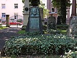
Munchenstrasse 11 |
Munchenstrasse 11 map |
||||
 more pictures |
Petri cemetery |
Goslarsche Strasse / Alerdsweg map |
The Petrifriedhof is one of the oldest still existing cemeteries in the city. The area has been designated as a cemetery since 1638. | 1638 | ||
 more pictures |
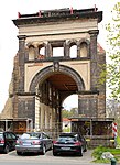
portal |
Spinner Street Map |
Entrance portal of the jute and flax spinning mill founded in 1874. | 1874 | ||
 more pictures |
Reformed cemetery |
Juliusstrasse / Sophienstrasse map |
Former cemetery of the Reformed Congregation in Braunschweig. | 1749 | ||

|
Rennelbergstrasse 11 |
Rennelbergstrasse 11 map |
||||
 more pictures |
Ring track |
At the Westbahnhof card |
Former rail ring around Braunschweig. Redesign to a walkway and bike path. | |||
 more pictures |
Rye mill |
Hildesheimer Strasse map |
Former rye mill from 1912. Additions in the following years. Use until the 1990s. In 2006, extensive restoration work began and the group of buildings was redesigned for use as an office and restaurant complex. Technical monument. | |||
 more pictures |
School building Bürgerstrasse |
Bürgerstrasse 2 map |
||||
 more pictures |
School building Diesterwegstrasse |
Diesterwegstrasse 7 map |
||||
 more pictures |
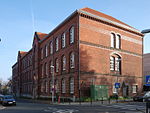
School building Hohestieg |
Hohestieg 2 card |
||||
 more pictures |
School building Sidonienstraße |
Sidonienstraße 3 map |
||||

|
School building Sophienstrasse |
Sophienstrasse 17 map |
||||
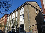
|
Sophienstrasse 33 |
Sophienstrasse 33 map |
||||

|
Administration building |
Hildesheimer Strasse 60 map |
||||
 more pictures |
Bülow's villa |
Celler Strasse 3 map |
Late classicist building, built in 1839 by Carl Theodor Ottmer (1800–1843). Outbuildings also listed. | 1839 | ||
 more pictures |
Wilmerdingstrasse |
Wilmerdingstrasse map |
||||

|
Apartment block Cyriaksring 42–45 / Luisenstrasse 18–25 |
Cyriaksring 42–45 / Luisenstrasse 18–25 map |
||||

|
Residential building Cammanstrasse 4 |
Cammanstrasse 4 map |
||||

|
Residential building at Frankfurter Strasse 25 |
Frankfurter Strasse 25 map |
||||

|
Residential building at Frankfurter Strasse 271 |
Frankfurter Strasse 271 map |
||||

|
Madamenweg 6 house |
Madamenweg 6 map |
||||

|
House Madamenweg 163 |
Madamenweg 163 map |
Half-timbered house built according to plans by the architect A. Bosch. | 1867 | ||

|
Sophienstrasse residential building |
Sophienstraße 31 / Wilmerdingstraße 1 map |
Semi-detached house (apartment buildings) from the Wilhelminian era, built in 1896 according to plans by the architects C. Rambow and Fr. Krohn. | 1896 | ||

|
Residential house Wilmerdingstrasse 7 |
Wilmerdingstrasse 7 map |
||||

|
Residential building Wilmerdingstrasse 8 |
Wilmerdingstrasse 8 map |
||||
| Residential building Wilmerdingstrasse 9 |
Wilmerdingstrasse 9 map |
|||||
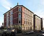
|
Wilmerdingstrasse residential building |
Wilmerdingstrasse 10 map |
Apartment building from the Wilhelminian era, built in 1896 according to plans by the architects C. Rambow and Fr. Krohn. | 1896 | ||

|
Residential houses Wilmerdingstrasse 2-6, 9A, 9B, 11-113, semi-detached houses Wilmerdingstrasse 14 / Sophienstrasse 32 | Wilmerdingstrasse |
literature
- Wolfgang Kimpflinger: Monument topography Federal Republic of Germany . Architectural monuments in Lower Saxony. Volume 1.1 .: City of Braunschweig. Part 1, Verlag CW Niemeyer Buchverlage , Hameln 1993, ISBN 3-87585-252-4 .
- Wolfgang Kimpflinger: Monument topography Federal Republic of Germany. Architectural monuments in Lower Saxony. Volume 1.2 .: City of Braunschweig. Part 2, Verlag CW Niemeyer, Hameln 1996, ISBN 3-8271-8256-5 .
