List of cultural monuments in the Lehndorf-Watenbüttel district
The list of cultural monuments in the Lehndorf-Watenbüttel district includes some of the cultural monuments in the Lehndorf-Watenbüttel district of Braunschweig , largely based on the Braunschweig guidance and information system BLIK and publications by the Braunschweig monument protection authority .
Cultural monuments
| image | designation | location | description | construction time | Registered since |
Monument number |
|---|---|---|---|---|---|---|
| Old village square |
Völkenrode Alter Dorfplatz map |
Völkenrode was originally a square village. One of the squares around which the houses clustered is the old village square. | ||||
 more pictures |
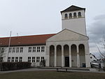
Construction house |
Lehndorf Saarplatz 2 map |
The construction house was built as the center of the Lehndorf community development. It housed an elementary school, party and government offices, a gym, a branch of the state bank and a maternity care center. There is a hall of honor in front of the tower. | 1935 | ||

|
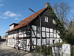
Former flax rotting |
Lamme Rodedamm card |
Former flax rotting . In the 18th century, flax cultivation and linen weaving played a very important role for lambs. | |||
|
Former school |
Lehndorf Grosse Strasse 26 map |
Former school from 1779. First school in Alt-Lehndorf. Today the building is used as an inn. | 1779 | ||

|
Former Ölper watermill |
Ölper Am Mühlengraben Card |
The Ölper Mühle, a former water mill, existed until 1859. It was first mentioned in 1388 and belonged to the Braunschweig council for centuries. Today only the fortifications and remains of the foundations are preserved. | |||
| Preserved farmhouses |
Map of Ölper Celler Heerstrasse |
Preserved farmhouses from the 18th century. They testify to the agricultural village of Ölper, which mainly grew hops and vegetables. | ||||
| Restaurant from Pavel's Wood | Bundesallee 149 map |
Former excursion restaurant with outbuildings. Light brown brick building on an Elm-lime base with a raised central section in which the main entrance with columns is located. Established in 1890 as a forest restaurant with a bar and dining room. It is part of a building complex of which the half-timbered mansion from 1873 and a cowshed from 1902 have been preserved. There was a café garden at the restaurant. | 1890 | |||
|
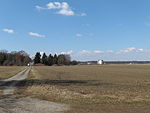
Site of the Federal Research Institute for Agriculture | Bundesallee map |
The area, which was incorporated in 1935, was used by the German Research Institute for Aviation from 1936. Later it was u. a. used by the former Federal Research Center for Agriculture and the Physikalisch-Technische Bundesanstalt. | 1936 | ||
 more pictures |
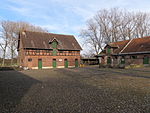
Gut Steinhof | Steinhof Celler Heerstrasse 336 map |
The Rieselgut Steinhof forms a group consisting of eight listed buildings: the manor house, the company building, the drive-through barn, the cattle barn, the warehouse, the day laborer's houses, a half-timbered building for stables and the workers' barracks. | from 1789 | ||
| Schrader farm |
Watenbüttel Celler Heerstraße 314 map |
The sculptor and inventor Hans Jürgen "Spinnrad" lived on this farm in the 16th century. | ||||
 more pictures |
Hofanlage Hannoversche Strasse 40 |
Lehndorf Hannoversche Strasse 40 map |
Rural courtyard from the years 1891 to 1892 with urban influence. Today the seat of a retirement home. Monument. | 1891-1892 | ||
| Courtyard complex Peiner Strasse 126 |
Völkenrode Peiner Strasse 126 map |
Courtyard with half-timbered building from the early 19th century. Monument. | ||||
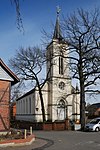
|
Church of St. Jürgen |
Map of Ölper Kirchbergstrasse |
Neo-Gothic church from 1842, built according to plans by Carl Theodor Ottmer . | 1842 | ||

|
St. Mary's Church |
Lamme Rodedamm card |
Classicist church from the years 1823 to 1824, built in place of a previous building under the direction of master builder Carl Liebau. | 1823-1824 | ||
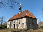
|
Völkenrode Church |
Völkenrode church attendance card |
Erected in 1744 after a village fire as a hall made of broken stone and house stone. A church already existed in Völkenrode in 1555. | 1744 | ||
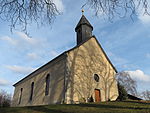
|
Watenbüttel Church |
Watenbüttel Am Okerdüker map |
In 1803 the church of Watenbüttel was demolished because it was in disrepair. From 1804 to 1805 today's classical church was built according to plans by the master builder Heinrich Ludwig Rothermundt. | 1804-1805 | ||

|
Klauenberg |
Lamme Klauenberg card |
The street is an example of new single-family houses from the post-war period. | |||
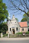
|
Kreuzkirche |
Lehndorf Große Strasse map |
First mentioned in 1245. Romanesque building with Art Nouveau additions. | 13th Century | ||
| Lehndorf settlement |
Lehndorf Saarstrasse map |
In order to relieve the medieval old town, plans for new, modern settlements in the countryside began in 1923. One of the implemented projects was the Lehndorf settlement, which was created from 1932 onwards with various settlement types for 6,000 residents. In the middle of the building was the construction house and adjacent the Wichernkirche. | From 1932 | |||
|
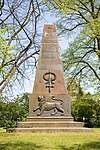
obelisk |
Map of Ölper Celler Heerstrasse |
Obelisk in memory of the battle near Ölper on August 1, 1809 . Erected in 1845. | 1845 | ||
 more pictures |
Ölper tower |
Ölper Celler Heerstrasse 46 map |
Half-timbered building built in 1642. Monument. | 1642 | ||
 more pictures |
Ölper weir (Ölper mill weir ) |
Ölper Am Mühlengraben Card |
A beam of the weir bridge bore the year 1859. From 2007 to 2008 the weir was renovated. Monument. | 2003 | ||
 more pictures |
Oker culvert | Watenbüttel Am Okerdüker 16 map |
Culvert completed in 1932. With this the Oker crosses under the Mittelland Canal . | 1932 | ||

|
Papengey |
Lamme Papengey Card |
The street is an example of new single-family houses from the post-war period. | |||

|
Rectory |
Lehndorf Grosse Strasse 13 map |
Classicist style rectory from 1840. | 1840 | ||
 more pictures |
Place |
Ölper Am Mühlengraben Card |
Former free flood barrier of the Ölper Mühle. Mentioned since 1727, the current condition with the side edging made of ashlar dates from around 1800 and is one of the best preserved cultural monuments in Braunschweig's city history. | 2013 | ||
 more pictures |
Physikalisch-Technische Bundesanstalt | Bundesallee map |
The headquarters of the Physikalisch-Technische Bundesanstalt is located on the site. | 1932 | ||
| Poettgerbrink |
Völkenrode Pöttgerbrink map |
Völkenrode was originally a square village. The Pöttgerbrink was one of the squares in the old town center. Most of the houses in Völkenrode gathered around him. | ||||
| Cross barn |
Lamme Frankenstrasse 27 / 27a map |
Half-timbered barn from the mid-19th century. The restoration of the barn was awarded the Prize for Monument Preservation of the Lower Saxony Sparkasse Foundation in 2012 and the special prize of the Federal Prize for Crafts in Monument Preservation 2012. | 19th century | |||

|
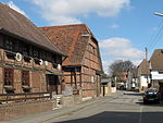
Gathering tower | Raffurm Rösturm 1 card |
The Raffurm was built as a guard tower for the Braunschweiger Landwehr. Today's half-timbered building was built around 1780 and served as an inn for a long time. | circa 1780 | ||
|
Settlement core |
Watenbüttel Am Okerdüker map |
The probable settlement center of Watenbüttel, which was first mentioned in a document in the 12th century, is located in the street “Am Okerdüker”. | |||
|
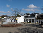
Supply center |
Kanzlerfeld David Mansfeld Weg map |
Together with the Wichernhaus, it forms the core of the Kanzlerfeld district, which was built in 1962 as a residential area in the countryside. Part of the Kanzlerfeld ensemble. | |||

|
Wichernhaus |
Kanzlerfeld David-Mansfeld-Weg 8 map |
The Wichernhaus, the church of the Wicherngemeinde for Chancellor Field and at the same time a meeting place, was built in 1976 according to plans by the architect Dieter Quiram. | 1976 | ||
 more pictures |
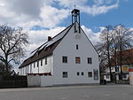
Wichernkirche |
Lehndorf Sulzbacher Strasse 41 map |
Modern church, built according to a design by the architect Gustav Gsaenger from Munich. In 1940 the consecration took place. Monument. | 1937-1940 | March 1999 |
literature
- Wolfgang Kimpflinger: Monument topography Federal Republic of Germany . Architectural monuments in Lower Saxony. Volume 1.1 .: City of Braunschweig. Part 1, CW Niemeyer Buchverlage, Hameln 1993, ISBN 3-87585-252-4 .
- Wolfgang Kimpflinger: Monument topography Federal Republic of Germany. Architectural monuments in Lower Saxony. Volume 1.2 .: City of Braunschweig. Part 2, Verlag CW Niemeyer, Hameln 1996, ISBN 3-8271-8256-5 .
