
Schleswig-Flensburg district
| coat of arms | Germany map |
|---|---|

|

Coordinates: 54 ° 37 ' N , 9 ° 31' E |
| Basic data | |
| Existing period: | 1973– |
| State : | Schleswig-Holstein |
| Administrative headquarters : | Schleswig |
| Area : | 2,071.14 km 2 |
| Residents: | 201,156 (Dec. 31, 2019) |
| Population density : | 97 inhabitants per km 2 |
| License plate : | SL |
| Circle key : | 01 0 59 |
| NUTS : | DEF0C |
| Circle structure: | 125 parishes |
| Address of the district administration: |
Flensburger Strasse 7 24837 Schleswig |
| Website : | |
| District Administrator : | Wolfgang Buschmann (independent) |
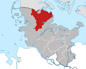
| Location of the Schleswig-Flensburg district in Schleswig-Holstein | |
  |
|
The Schleswig-Flensburg district ( Danish Slesvig-Flensborg amt ) is a district in the north-east of Schleswig-Holstein . In terms of its area, it is the third largest district in the country. Despite the name, the city of Flensburg does not belong to the district as it is not a district. The county seat is Schleswig .
geography
The Schleswig-Flensburg district borders in the north on the Danish municipality of Aabenraa and the Flensburg Fjord , in the east on the western Baltic Sea , in the south it borders on the district Rendsburg-Eckernförde , in the south-west on the district Dithmarschen and in the west on the district North Friesland . The district also encloses the independent city of Flensburg in the north .
In the eastern part of the district, the fishing region lies between the Flensburg Fjord and the Schlei . This is also where the Scheersberg is located , at 71 m the second highest point in the district. The highest point is the Höckeberg between Freienwill and Hürup at 82 m.
In the south-western corner of the district is the Stapelholm landscape in the Eider-Treene Sorge lowlands. There, moors and wetlands alternate with forests and ridges. This landscape, which is difficult to use for agriculture, was settled very late.
natural reserve
There are nature reserves throughout the district where biotopes typical of the region are preserved.
Coastal area

On the Geltinger Birk , the outer point of land that protrudes into the Flensburg Fjord in Gelting , with 773 hectares lies the largest nature reserve in the district, which has existed since 1934 and has been expanded again and again. Over 200 species of birds, including sea eagles and a large number of migratory birds, visit this swampy area with salt marshes, dunes and sea grass meadows.
In Schleimünde near Maasholm, there is also the Schleimünde nature reserve on a narrow and long headland . The area has around 122 hectares of land and 252 hectares of water, whereby new land is constantly being formed or land removed from the spit hooks . Since the spit continues to build up and the Schlei shipping route threatened to be cut off, the first Schleimünde was artificially created as early as 1796, which also resulted in the pilot island. Numerous species of migratory birds rest and hibernate here as well.
Bogs and wetlands

Although there were originally many moors in the district, most of the areas have been lost through peat removal and drainage. One of the few preserved moors is the Tetenhusener Moor , a raised bog in Tetenhusen that is under nature protection as part of the Natura 2000 network of protected areas .
The Frøslev-Jardelunder Moor is located on both sides of the border with Denmark near Ellund . As in all raised bogs, peat mosses also store the water here, so that the water level rises and very acidic bog water is created, in which only a few highly specialized plants such as sundew and cotton grass can live. But black grouse , snipe and numerous amphibians and reptiles also live in the moor.
The smallest natural experience area in Schleswig-Holstein is in Ekenis an der Schlei, the Moostoft Ekenis natural gardens, in which a dead ice hole has developed into a boggy wetland. The drained area, which was used for a long time as pasture, was renatured in the mid-1990s, so that various wetlands were created.
River landscapes

The white stork is particularly common in the Stapelholm landscape in the Eider-Treene-Sorge area, where the geest ridge and wetland alternate , so that a special protected area has been set up in Bergenhusen .
The area of the major nature conservation project Obere Treenelandschaft in the headwaters of the Treene also includes the Frörup mountains and some moors. The landscape was created at the end of the glacier advances in the Vistula glacial period . Here, the renaturation of wet meadows is intended to increase biodiversity. At the same time, there is extensive pasture use by sheep.
The Langballigau is a small river that flows through the municipality of Langballig in meanders through deciduous forests to the Baltic Sea. Here, too, there are valuable wetlands as well as forest and coastal biotopes.
Schäferhaus Foundation Land

An unusual nature reserve is the 280 hectare Foundation Land Schäferhaus , which was established near the Danish border near Harrislee , on Ochsenweg , on a former military training area. In order to enable the creation of a semi-open meadow landscape between the Knicks created in the 18th century , the area is extensively grazed by Galloway cattle and Koniks , wild horses descended from the Tarpan.
history
Neolithic and Bronze Age
The area of today's Schleswig-Flensburg district has been settled since the Mesolithic Age, especially on the Schlei there are many archaeological finds from this time. The megalithic tombs , which can be found in large numbers in fishing, date mainly from the Neolithic period. There are 22 burial mounds in Süderbrarup , the largest west of the Thorsberger Moors is surrounded by a stone circle. The Hermannshoi in Torsballig , whose place name can also be traced back to Thor , the Germanic god of thunder , is said to be a royal grave, according to legend.
Angles and Saxons become Anglo-Saxons
Especially in the 5th and 6th centuries, many Anglers emigrated together with the Saxons , who also came from Northern Germany, to what is now England, where they first settled in the eastern areas - for example East Anglia . Jutes moved into the now sparsely populated area, and their influence can still be seen today in the place names they have coined. The population density did not rise again until the 11th century.
Historic highways

The Ochsenweg between Hamburg and Viborg in Denmark, also known as the Heerweg, has been around since the Bronze Age . In the Schleswig-Flensburg district are the cities of Schleswig (originally Haithabu) and Flensburg on Ochsenweg.
The Angelbowege are five paths that fishing rods crossed in a west-east direction. The old path, which can be easily traced from the Treenefurt in Sollerup to the Ochsenweg in Sieverstedt, is best preserved. It is believed that it continued as the Freesenweg to North Friesland.
Viking age

The most important Viking town in the region was Haithabu near Schleswig , which flourished in the 9th and 10th centuries and was surrounded by a protective wall. Due to its location on the isthmus between Schlei and Treene and on Ochsenweg, it was predestined for trade. In 1050 the city was destroyed and abandoned, its residents moved to Schleswig. Schleswig itself is mentioned for the first time as Sliesthorp in 804, making it the oldest city in Schleswig-Holstein. Until Lübeck gained strength in the 12th century, Schleswig was the most important trading place in the Baltic Sea and the first place in Northern Europe to receive town charter, which it later had to give up.
Danewerk

The Danewerk , the remains of which can still be seen in the community of Dannewerk , was built in several construction phases between 730 and 1170 by the Danes as protection from their southern neighbors, the Saxons. It consists of earth walls and ditches and ran from Hollingstedt to Haithabu. The Ochsenweg passed through the only gate in the Danewerk.
Christianization
Christianization began here towards the end of the 9th century, when Archbishop Ansgar tried unsuccessfully in 828 to Christianize Haithabu. Ansgar, who later traveled to Scandinavia on the Ochsenweg, stopped in Hollingstedt in 849 on the way to Haithabu.
The diocese of Schleswig was established in 948, and small stone churches were built throughout the district in the 12th century .
The black griet
The Danish Queen Margaretha (1230–1282), who was married to Christopher I of Denmark, made a deep impression in the circle; there are many sagas in which it appears. After her death in the Flensburg harbor (see also the legend of the death of Queen Margarethe in the Flensburg harbor ), according to the legend, her ghost is said to have lived on Margarethenwall in Brodersby , which was named after her. have been seen many times.
Palaces, castles and goods

There were strong serfdom in Ostangeln, for example Gelting , Rundhof, Lindau (municipality of Boren ), where the oldest preserved manor house is, Priesholz (municipality of Rabenholz ) and Roest (city of Kappeln ). There were also some weaker manor areas, mostly scattered in central and western Angles. Many of the mansions preserved today were built in the 18th century.
Many of these goods were built around 1500, some, such as the Rundhof and the Gelting, already mentioned in King Waldemar's earth book of 1231 as a special royal property, on the remains of old fortifications and castles. Serfdom was not finally lifted until 1805.
The moated castle in Glücksburg , built in 1582, and Gottorf castle near Schleswig , built in 1697–1703, occupy a special position among the aristocratic seats in the district . The latter housed the Gottorf giant globe, a walk-in globe that stood in the palace garden in the middle of the 17th century until it was more or less voluntarily handed over to Tsar Peter the Great at the beginning of the 18th century , also one of the technical marvels of its time. In 2005, a replica was inaugurated in the presence of Federal Chancellor Gerhard Schröder and the Russian President Vladimir Vladimirovich Putin from Saint Petersburg .

Insofar as the country was not assigned to manor districts or ecclesiastical regional authorities such as the St. Johannis monastery in front of Schleswig , the areas were organized in Harden (hundreds), which were headed by a Hardesvogt. Several Harden were united to form a syssel , probably the oldest form of territorial division in Jutland. The then Idstedtsyssel roughly corresponded to today's territory of the Schleswig-Flensburg district and the two Goesharden around Bredstedt and Husum . In the Stapelholm countryside there was a farmer's bell in each village , with which the farmer's bailiff could call the residents or warn them in case of danger. One of these bells is still preserved in Erfde .
In many places there was a thing as a village court. In some communities the thing sites are still recognizable today. The church in Husby was built near the old Husbyharde Thingstätte , and the Gulde Thingplatz in Stoltebüll , which was used until the 19th century, was reconstructed.
Structural change in agriculture
The reclamation of the Geest with its moors and heathland in the southwest of the district began in 1761 in the offices of Gottorf and Flensburg. At that time, many people fled the areas devastated by the Seven Years' War and accepted King Friedrich V's offer to found colonies on the Geest. The Palatinate immigrants from southwest Germany were considered more suitable by the government in Copenhagen than the native, non-inheriting peasant sons. In order to make the land usable, geest humps were removed and drainage ditches were created in moors. The farms for the colonists were equipped with the bare necessities so that they could survive until the first harvest: work animals and their fodder, tools and seeds. However, the project had to be abandoned a few years later because the colonists did not accept the harsh living conditions and the inadequate preparation of the project. In addition, the yields that were achievable with the technology of the time were not enough to survive.
Place names such as Handewitt Colony, a district of Handewitt , and Neubörm are evidence of this colonization .
The coupling, in which the common land , which had been used jointly by all in the villages that were not managed by a property, was divided into willows, began in fishing very early, namely at the end of the 16th century. This not only changed the ownership structure and increased income, it also created a large part of the road network that still exists today and the hedgerow landscape .
The soil in the Geest could only be used for agriculture in the 19th century, when steam plows and mineral fertilizers were available. In the much more prosperous fishing, cattle breeding also played a major role, and the brown angler cattle and the Angeliter saddle pig , like the Schleswig draft horse , became well-known domestic animal breeds beyond the region.
Danish minority
The Schleswig-Flensburg district makes up a large part of the southern part of Schleswig-Holstein, which is home to the Danish minority . The region was settled by Jutes and Danes as early as 700 . Later, the Duchy of Schleswig established itself there as a Danish imperial fief. After the German-Danish War in 1864, South Schleswig became part of Prussia and remained with Germany after the referendum in 1920. As a result, the Danish minority organized itself into several associations and educational institutions. Similarly, a German minority organized itself north of the border. The former tensions between the two nationalities were increasingly reduced after the Second World War , also through the signing of the Bonn-Copenhagen Declarations in 1955. On this subject see also: History of Schleswig-Holstein , Danish Minority

Creation of the Schleswig-Flensburg district
The district of Schleswig-Flensburg emerged from the districts of Flensburg-Land and Schleswig on March 24, 1974 as part of the district reform . The district of Schleswig and the district of Flensburg-Land were two of 20 districts that were re-established by Prussia after the end of the German-Danish War in 1867 . The districts were made up of rural communities and manor districts , but the latter were dissolved in 1928.
Population statistics
The population figures up to 1970 refer to the territorial status of the two districts of Flensburg-Land and Schleswig on May 27, 1970.
|
|
Denomination statistics
According to the 2011 census , 63.6% of the population were Protestant , 4.5% Roman Catholic and 31.9% were non-denominational , belonged to another religious community or did not provide any information. The number of Protestants has fallen since then. As of April 30, 2018, 52.3% of the residents were Protestant.
politics
District council
The 56 seats of the district assembly are composed as follows based on the election results of May 6, 2018 shown opposite:
- Overview of the election results of past elections
| Party / list | Percent 1998 |
Percent 2003 |
Percent 2008 |
Mandates 2008 |
Percent 2013 |
Mandates 2013 |
Percent 2018 |
Mandates 2018 |
|---|---|---|---|---|---|---|---|---|
| CDU | 41.71% | 53.64% | 43.9% | 26th | 40.56% | 21st | 38.6% | 22nd |
| SPD | 37.97% | 26.65% | 22.5% | 13 | 25.51% | 13 | 20.1% | 11 |
| GREEN | 4.81% | 4.86% | 7.0% | 4th | 11.10% | 6th | 15.1% | 8th |
| SSW | 12.63% | 11.96% | 15.0% | 8th | 12.69% | 6th | 10.4% | 6th |
| FDP | 2.78% | 2.88% | 6.4% | 3 | 3.31% | 2 | 4.3% | 2 |
| FREE VOTERS | - | - | - | - | 3.38% | 2 | 3.8% | 2 |
| AfD | - | - | - | - | - | - | 3.7% | 2 |
| THE LEFT. | - | - | 5.1% | 3 | 1.88% | 1 | 2.7% | 2 |
| Alliance for Citizens (BfB) | - | - | - | - | 1.57% | 1 | 1.2% | 1 |
| total | 100% | 100% | 100% | 57 | 100% | 52 | 100% | 56 |
| voter turnout | 68.5% | 58.1% | 53.4% | 53.1% | 51.9% | |||
After the local elections in 2018, a district council member of the FREIEN VÄHLER and the district council member of the BfB merged to form a parliamentary group. After that, the group leader of the AfD switched to the FREE VOTERS / BfB; the AfD parliamentary group is thus dissolved. The second member of the district council, the former group leader of the FREE VOTERS, remains non-attached.
coat of arms
Blazon : "Above blue, with two silver wavy threads covered with a wave shield base of blue and gold, divided obliquely to the left with two striding, red-armored lions in confused colors."
flag
Blazon : "On a cloth divided lengthways into a blue and a yellow stripe - one above the other and shifted from the center towards the pole - the two lions of the circle coat of arms in mixed up colors."
Partner circles
The Schleswig-Flensburg district has partnerships with three districts:
- Powiat Piski ( Poland ), the area of the former Johannisburg district . The partnership, which had already existed with the Flensburg-Land district from 1954 , was renewed in 2000 following a regional reform in Poland.
- Borough of South Ribble ( United Kingdom ) since 1980
- Mecklenburg Lake District ( Mecklenburg-Western Pomerania ) since the district was founded in 2011. A partnership with the former Müritz district has existed since 1990. The administrative center of Neubrandenburg is also the twin town of the city of Flensburg.
architecture
Important buildings in the district are some churches and a large number of agricultural buildings.
Churches

The most important church building in the district is the Schleswig Cathedral . It was built in 1134–1200 as a three-aisled Romanesque basilica made of granite, tuff and brick. The high Gothic hall choir and the cloister were built before 1300. The neo-Gothic west tower and a large part of the exterior design date from the end of the 19th century. The Romanesque Petri portal, which was built around 1180, is particularly valuable.
Most of the churches in the district are field stone churches . One of the oldest of them is in Esgrus , the oldest in Brodersby . The churches in Sörup and Munkbrarup represent the type of the granite quard church and the church of Hollingstedt , the North Sea port of the Vikings on the Treene, was built from the most important imported goods of the place: from Eifel tuff . Other churches were built from brick, including Romanesque buildings such as St. Ursula zu Böel and more recent churches such as Neukirchen (municipality of Steinbergkirche) and Kappeln .
While the parishes on the sparsely populated Geest are relatively large, fishing has an unusually high density of medieval, mostly Romanesque churches.
Courtyards and cottages
Of the three house types in Schleswig-Holstein, the hall house , which is predominantly south of the Husum - Kappeln line , the Frisian Barghaus and the Jutish, divided Geesthardenhaus, the Geesthardenhaus predominates in the district. The entrance to the Geesthardenhaus is usually on the long side. The living area, threshing floor, stable and barns can be entered through their own doors and gates. The living area also includes the kitchen and the basement. The smoke from the fireplace was discharged through a chimney. In the living area, the roof structure rests on the load-bearing outer walls, and in the stable area on uprights that stand directly on the outer walls. From the end of the 19th century, a transverse wing was often added to accommodate the increased harvest yield.

The Angeliter Dreiseithof and the Angeliter Fachwerk are architectural styles that are typical of the district. In the Südangeliter Hallenhaus , the Danish nave (wall stand construction) in the living area merged with the Low German hall house (interior stand construction) for the stable area in the 18th century. Few of the houses are still largely preserved, such as the Marxenhaus in the fishing landscape museum in Unewatt , the Nanningsenhaus in Füsing and Haus Bartel in Wagersrott and a few small farmers. The wall stud construction is / was found in Nordangeln.
Thatched roofs on fishing rods are often secured with hanging wood on the heather ridge, for example at Gut Dänisch Lindau in Boren . In the west, for example in Tetenhusen and Norderstapel, the architectural style shows Frisian influences.
The colonist houses in the Geest at the end of the 18th century were hall houses that were initially very small with a size of 12.18 m long and 8.6 m wide. Only the later type II was a little larger. The hallway, which also served as a threshing floor, could be reached via an entrance on the gable side. The stables were on the sides of the hall. The cooking area was actually on the paved area behind the hall, but the colonialists insisted on a brick forge, as they knew it from their homeland, so that the colonialist houses were the only hall houses with chimneys at that time.
Since these were stud houses, where the roof structure is not supported by the walls, savings were made on the brick walls. Above all, the houses given to the colonialists were supposed to be cheap, so that many of them quickly collapsed due to a lack of stability. The prototype of the colonist houses stood on the outskirts of Schleswig .
Mills
Several Dutch windmills from the late 19th century have been preserved in the district. As an example, the “Fortuna” windmill, built as a Dutch gallery in 1878, should be mentioned as a functional technical monument in the Unewatt landscape museum , as well as the “Hope” mill as an earth Dutchman (1845 in Meierwik ), who was moved to Munkbrarup in 1868 .
Museums


The most important museums in the district are located in Schleswig. The State Museum for Art and Cultural History and the State Archaeological Museum are housed in Gottorf Castle, which is known for the Nydam ship and its bog bodies . More than five million finds are housed in Germany's largest prehistoric museum. This collection is supplemented by an exhibition on the regional history of the Middle Ages and ethnographic collections. The Haithabu Viking Museum in Busdorf near Schleswig is also part of the State Archaeological Museum and has been presenting finds from the Viking town since 1985. Near the castle island on the Hesterberger the folklore museum, which deals with the historical everyday culture of the state.
The fishing landscape museum in Langballig consists of four museum islands, on which typical agricultural buildings (dairy, windmill, Südangeliter hall house ) and equipment are presented in the historic town center, which is still inhabited.
The heart of the museum at Danewerk (Danevirkegården) in the municipality of Dannewerk is the Danewerk ramparts , the largest soil monument in Northern Europe, the remains of which can be found in the municipality and its history.
economy

Together with the independent city of Flensburg, the district forms a uniform economic area. Although agriculture is the main feature of the landscape in the district, the primary sector only accounts for a small part of economic output. The service sector, however, now not only has around 50% of the employees in the district, it is still growing. In the commercial sector, the food industry is particularly important, but refrigeration technology, communications electronics and mechanical engineering are also represented by large companies. The Schleswig vocational training center in Flensburg and Kappeln make a contribution to training . Besides Flensburg, Harrislee is an important business location.
In the Future Atlas 2016, the Schleswig-Flensburg district was ranked 293 out of 402 districts, municipal associations and independent cities in Germany, making it one of the regions with a “balanced risk-opportunity mix”.
food industry

There are 22 important companies in the food industry in the district, which produce around 70% of total sales in the manufacturing sector. Important meat processing companies are located in Böklund , Satrup and Steinbergkirche , important milk processing companies in Kappeln and Nordhackstedt . There is a company in Silberstedt that specializes in organic food.
Chamber of Commerce and Industry
The Chamber of Commerce and Industry responsible for companies in the district is the Chamber of Commerce and Industry in Flensburg .
WiREG
The WiREG (Wirtschaftsförderungs- und Regionalentwicklungsgesellschaft Flensburg / Schleswig mbH), based in Flensburg, was founded in 1996 as a municipal economic and regional development company for the region, which includes the city of Flensburg in addition to the district area. It wants to create jobs, promote the exchange of information and improve the region's infrastructure.
Regional program 2000
The EU set up the regional program in 2000 to promote the infrastructure in Schleswig-Holstein. This program also benefits the business park developments in the district.
tourism

The Schleiufer , Schleswig and the Baltic Sea coast are the most important tourist regions in the district. Including the city of Flensburg, there are 320 commercial accommodation providers in the district that offer over 11,000 beds, and there are also around 5,000 private beds. The tourism industry now generates more income than agriculture.
Culinary
One of the specialties of the region is the Angler Muck , an alcoholic mixed drink that can be drunk hot based on rum like grog or cold based on grain.
Infrastructure


The federal motorway 7 ( E 45 ), on which Schleswig and Flensburg are located, runs through the district in a north-south direction and also connects the region with Scandinavia. In parallel, the B 76 runs from Flensburg via Schleswig to Eckernförde and Kiel , south of Schleswig the B 77 to Rendsburg . The most important east-west connections are the B 199 (Niebüll-Flensburg-Kappeln), B 200 (Flensburg-Husum) and B 201 (Husum-Schleswig-Kappeln).
The north-south line of the railway also runs through the district; it currently offers connections to Hamburg and Flensburg every hour (operated by DB ); it stops in the district in Tarp , Jübek and Schleswig . Trains to Husum and Kiel Hbf (also operated by DB) stop in the district in Schleswig and Jübek. There is also the possibility of traveling once a day with the ICE train that stops in Flensburg and Schleswig via Hamburg to Berlin or with the return train to Aarhus . The routes of the Flensburger Kreisbahn and the Schleswiger Kreisbahn , which used to operate an extensive network, have long since disappeared , except for the Süderbrarup-Kappeln museum railway . The branch lines Flensburg-Husum and Husum-Rendsburg were also shut down for passenger traffic in 1959 and 1974 and have been dismantled with the exception of a few remains.
The region can be reached by plane via the airports in Flensburg-Schäferhaus, Sonderburg and Kiel-Holtenau . Ports that are important for the region are in Flensburg (see Flensburger Hafen ) and Kiel.
Communities

Today there are five unofficial cities and municipalities and 13 offices with a total of 120 official municipalities. Bad Arnis is one of them , the smallest town in Germany with just 281 inhabitants.
(Residents on December 31, 2019)
| Municipalities / cities that are not official | |
|---|---|
|
|
Offices with official municipalities / cities (* = seat of the official administration)
Municipality and office map

Former parishes
The following list contains the municipalities of the Schleswig-Flensburg district that were incorporated into other municipalities during its existence:
| local community | incorporated after |
date |
|---|---|---|
| Brarupholz | Scheggerott | January 1, 1978 |
| Brebel | Süderbrarup | 1st March 2018 |
| Brodersby | Brodersby-Goltoft | 1st March 2018 |
| Dollrottfeld | Süderbrarup | 1st March 2018 |
| Ekenis | Bores | 1st of March 2013 |
| Esperstoft | Silberstedt | November 1, 1976 |
| Friedrichsau | Jübek | January 1, 1978 |
| Gammellund | Bollingstedt | August 1, 1976 |
| Goltoft | Brodersby-Goltoft | 1st March 2018 |
| Havetoftloit | Medium fishing | 1st of March 2013 |
| Jarplund-Weding | Handewitt | March 1, 2008 |
| Kiesby | Bores | 1st of March 2013 |
| Norderstapel | stack | 1st March 2018 |
| Cross | Steinberg Church | 1st of March 2013 |
| Male | Medium fishing | 1st of March 2013 |
| Sankelmark | Oeversee | March 1, 2008 |
| Satrup | Medium fishing | 1st of March 2013 |
| South stack | stack | 1st March 2018 |
Protected areas
There are 21 designated nature reserves in the district (as of February 2017).
License Plate
On July 1, 1956, the Schleswig district was assigned the distinguishing sign SL when the vehicle registration number was introduced, which is still valid today . It is still issued in the Schleswig-Flensburg district to this day.
See also
Web links
- Official website of the Schleswig-Flensburg district
- Business promotion and regional development company Flensburg / Schleswig with limited liability (WiREG)
- Museums in Gottorf Castle
- Touristikverband Flensburger Außenförde / Ostsee e. V.
Individual evidence
- ↑ North Statistics Office - Population of the municipalities in Schleswig-Holstein 4th quarter 2019 (XLSX file) (update based on the 2011 census) ( help on this ).
- ↑ See The Black Greth
- ↑ Archived copy ( Memento from October 22, 2008 in the Internet Archive )
- ↑ State Statistical Office Schleswig-Holstein (Ed.): The population of the communities in Schleswig-Holstein 1867-1970 . State Statistical Office Schleswig-Holstein, Kiel 1972, p. 21 .
- ↑ Schleswig-Flensburg Religion District , 2011 census
- ↑ North Church Budget 2019, page 16 , accessed on April 5, 2020
- ↑ 146.425.1
- ↑ [1]
- ↑ [2]
- ↑ Lambert Gatzen and Hans-Werner Jarmer blow up the Schleswig district assembly - Source: https://www.shz.de/25968837 © 2019. Retrieved November 22, 2019 .
- ↑ a b Schleswig-Holstein's municipal coat of arms
- ↑ Partner in Germany and Europe - District and City of Pisz (Johannisburg) / Poland. Schleswig-Flensburg district, accessed on June 24, 2014 .
- ↑ Partner in Germany and Europe - Patenkreis Johannisburg. Schleswig-Flensburg district, accessed on June 24, 2014 .
- ↑ Partner in Germany and Europe - The Borough of South Ribble in Great Britain. Schleswig-Flensburg district, accessed on June 24, 2014 .
- ↑ Partners in Germany and Europe - Partnerkreis Landkreis Mecklenburgische Seenplatte. Schleswig-Flensburg district, accessed on June 24, 2014 .
- ↑ Future Atlas 2016. (No longer available online.) Archived from the original on October 2, 2017 ; accessed on March 23, 2018 .
- ↑ For the place name “Bad Arnis” an individual proof is required - place addition “Bad” is protected
- ↑ North Statistics Office - Population of the municipalities in Schleswig-Holstein 4th quarter 2019 (XLSX file) (update based on the 2011 census) ( help on this ).
Independent cities: Flensburg | Kiel | Lübeck | Neumunster
Districts: Dithmarschen | Duchy of Lauenburg | North Friesland | Ostholstein | Pinneberg | Plön | Rendsburg-Eckernförde | Schleswig-Flensburg | Segeberg | Stone castle | Stormarn