
Rugge
| coat of arms | Germany map | |
|---|---|---|

|
Coordinates: 54 ° 41 ′ N , 9 ° 46 ′ E |
|
| Basic data | ||
| State : | Schleswig-Holstein | |
| Circle : | Schleswig-Flensburg | |
| Office : | Süderbrarup | |
| Height : | 59 m above sea level NHN | |
| Area : | 6.01 km 2 | |
| Residents: | 249 (Dec. 31, 2019) | |
| Population density : | 41 inhabitants per km 2 | |
| Postal code : | 24405 | |
| Area code : | 04646 | |
| License plate : | SL | |
| Community key : | 01 0 59 070 | |
| Office administration address: | Königstrasse 5 24392 Süderbrarup |
|
| Website : | ||
| Mayor : | Walter Clausen (KWV) | |
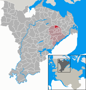
| Location of the municipality of Rügge in the Schleswig-Flensburg district | ||
  |
||

Rügge ( Danish : Rygge ) is a municipality in the Schleswig-Flensburg district in Schleswig-Holstein . Fraulund (Danish. Fruelund , Anglo-Danish. Frûlund , Fråwlund ), Blick ( Bleg ) and Hye belong to the municipality.
Geography and traffic
Rügge is about ten kilometers west of Kappeln in a rural area. The federal highway 199 runs north from Kappeln to Flensburg , south the federal highway 201 runs from Kappeln to Husum .
history
In the Danish period before 1864 the place belonged to the parish of Norderbrarup ( Nørre Brarup Sogn ) in the Struxdorfharde (Schleswig Office) in the Duchy of Schleswig . The place name is first documented in writing in 1460 and goes back to Danish. ryg or Old Norse hryggr for back, which here means an elongated hill. Blick probably stands for a bleaching place (cf. altnord. Blik for shine and bleikja for bleaching). Frauland, in a poetic sense, means women's grove in Danish. frue and lund .
In the municipality there was a fortified courtyard, which was mentioned in 1487 .
religion
69% of the population are Protestant. The Evangelical Lutheran Parish of Süderbrarup is responsible for them, the nearest church of which is St. Marien in Norderbrarup .
Catholics were not registered in the 2011 census in Rügge.
politics
The KWV voter community has had all nine seats in the municipal council since the 2013 local elections.
economy
The community is predominantly agricultural.
Web links
Individual evidence
- ↑ North Statistics Office - Population of the municipalities in Schleswig-Holstein 4th quarter 2019 (XLSX file) (update based on the 2011 census) ( help on this ).
- ↑ Schleswig-Holstein topography. Vol. 8: Pölitz - Schönbek . 1st edition Flying-Kiwi-Verl. Junge, Flensburg 2007, ISBN 978-3-926055-89-7 , pp. 213 ( dnb.de [accessed on July 23, 2020]).
- ↑ Wolfgang Laur: Historisches Ortsnamelexikon von Schleswig-Holstein , 2nd edition, Neumünster 1992, p. 556
- ↑ Johannes Kok: Det danske folkesprog i Sønderjylland , Volume 2, København 1867, p. 327
- ↑ Wolfgang Laur: Historisches Ortsnamelexikon von Schleswig-Holstein , 2nd edition, Neumünster 1992, p. 255
- ↑ a b census database
Ahneby | Alt Bennebek | Arnis | Ausacker | Bergenhusen | Böel | Böklund | Bollingstedt | Bores | Borgwedel | Börm | Böxlund | Brodersby-Goltoft | Busdorf | Dannewerk | Dollerup | Dbodstedt | Eggebek | Ellingstedt | Invent | Esgrus | Fahrdorf | Free will | Gelting | Geltorf | Glücksburg (Baltic Sea) | Grödersby | Great Rheide | Großewiehe | Large voltage | Grundhof | Handewitt | Harrislee | Hasselberg | Havetoft | Hollingstedt | Holt | Hörup | Hürup | Husby | Hüsby | Idstedt | Jagel | Janneby | Jardelund | Jerrishoe | Jörl | Jübek | Kappeln | Folded wood | Klein Bennebek | Klein Rheide | Kronsgaard | Kropp | Long-crowned | Langstedt | Lindewitt | Loit | Lottorf | Lürschau | Maasbüll | Maasholm | Medelby | Meggerdorf | Meyn | Middle fishing | Mohrkirch | Munkbrarup | Neuberend | Nieby | Sneeze gray | Norderbrarup | Nordhackstedt | Nottfeld | Nübel | Oersberg | Oeversee | Osterby | Pommerby | Rabel | Raven wood | Rabenkirchen-Faulück | Ringsberg | Rügge | Saustrup | Schaalby | Schafflund | Scheggerott | Schleswig | Schnarup-Thumby | Schuby | Selk | Sieverstedt | Silberstedt | Sollerup | Soerup | Hatchback | Stack | Steinberg | Steinberg Church | Steinfeld | Sterup | Proud | Stoltebüll | Struxdorf | Süderbrarup | Süderfahrenstedt | Süderhackstedt | Taarstedt | Tarp | Tastrup | Tetenhusen | Tielen | Tolk | Treia | Twedt | Uelsby | Ulsnis | Wagersrott | Wallsbull | Wanderup | Wees | Weesby | Westerholz | Wohlde