
Meggerdorf
| coat of arms | Germany map | |
|---|---|---|

|
Coordinates: 54 ° 21 ' N , 9 ° 24' E |
|
| Basic data | ||
| State : | Schleswig-Holstein | |
| Circle : | Schleswig-Flensburg | |
| Office : | Kropp stacking bar | |
| Height : | 3 m above sea level NHN | |
| Area : | 24.11 km 2 | |
| Residents: | 676 (Dec. 31, 2019) | |
| Population density : | 28 inhabitants per km 2 | |
| Postcodes : | 24799, 24861 | |
| Area code : | 04339 | |
| License plate : | SL | |
| Community key : | 01 0 59 058 | |
| Office administration address: | Am Markt 10 24848 Kropp |
|
| Website : | ||
| Mayor : | Ralf Lange (AMWG) | |
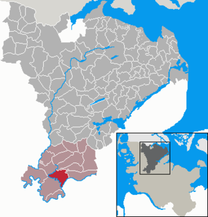
| Location of the municipality of Meggerdorf in the Schleswig-Flensburg district | ||
  |
||


Meggerdorf ( Danish : Meggertorp ) is a municipality on the Sorge in the Schleswig-Flensburg district in Schleswig-Holstein . Fünfmühlen, Hölken, Johannisberg, Königsberg, Meggerholm (originally part of Christiansholm ), Meggerkoog and diversion dike are located in the municipality.
history
Many of the wetlands, lakes and moors that used to shape the landscape are largely drained. However, the Stapelholm landscape around the Sorgeschleife is now a designated nature reserve.
The Gisela mill in Meggerkoog was built in 1922. She is a basement Dutchman who was used for drainage. Today it is privately owned and inhabited.
politics
Community representation
Of the nine seats in the municipal council, the community of voters AMWG has had six seats since the local elections in 2008 and the community of voters of ABB three.
coat of arms
Blazon : "In green a strongly agitated, front S-shaped, rear M-shaped oblique silver band, accompanied above by a naturally tinged lapwing, below by three silver cattails with black seed heads."
economy
The municipality is predominantly agricultural.
Attractions
The list of cultural monuments in Meggerdorf includes the cultural monuments entered in the list of monuments of Schleswig-Holstein.
To the northeast, 2 km away, is the 2.08 km² nature reserve Tetenhusener Moor . Parts of it were placed under protection as early as 1928.
Web links
Individual evidence
- ↑ North Statistics Office - Population of the municipalities in Schleswig-Holstein 4th quarter 2019 (XLSX file) (update based on the 2011 census) ( help on this ).
- ↑ Schleswig-Holstein topography. Vol. 6: Kronprinzenkoog - Mühlenrade . 1st edition Flying-Kiwi-Verl. Junge, Flensburg 2006, ISBN 978-3-926055-85-9 , pp. 283 ( dnb.de [accessed July 29, 2020]).
- ↑ Schleswig-Holstein's municipal coat of arms
Ahneby | Alt Bennebek | Arnis | Ausacker | Bergenhusen | Böel | Böklund | Bollingstedt | Bores | Borgwedel | Börm | Böxlund | Brodersby-Goltoft | Busdorf | Dannewerk | Dollerup | Dbodstedt | Eggebek | Ellingstedt | Invent | Esgrus | Fahrdorf | Free will | Gelting | Geltorf | Glücksburg (Baltic Sea) | Grödersby | Great Rheide | Großewiehe | Large voltage | Grundhof | Handewitt | Harrislee | Hasselberg | Havetoft | Hollingstedt | Holt | Hörup | Hürup | Husby | Hüsby | Idstedt | Jagel | Janneby | Jardelund | Jerrishoe | Jörl | Jübek | Kappeln | Folded wood | Klein Bennebek | Klein Rheide | Kronsgaard | Kropp | Long-crowned | Langstedt | Lindewitt | Loit | Lottorf | Lürschau | Maasbüll | Maasholm | Medelby | Meggerdorf | Meyn | Middle fishing | Mohrkirch | Munkbrarup | Neuberend | Nieby | Sneeze gray | Norderbrarup | Nordhackstedt | Nottfeld | Nübel | Oersberg | Oeversee | Osterby | Pommerby | Rabel | Raven wood | Rabenkirchen-Faulück | Ringsberg | Rügge | Saustrup | Schaalby | Schafflund | Scheggerott | Schleswig | Schnarup-Thumby | Schuby | Selk | Sieverstedt | Silberstedt | Sollerup | Soerup | Hatchback | Stack | Steinberg | Steinberg Church | Steinfeld | Sterup | Proud | Stoltebüll | Struxdorf | Süderbrarup | Süderfahrenstedt | Süderhackstedt | Taarstedt | Tarp | Tastrup | Tetenhusen | Tielen | Tolk | Treia | Twedt | Uelsby | Ulsnis | Wagersrott | Wallsbull | Wanderup | Wees | Weesby | Westerholz | Wohlde