
Ulsnis
| coat of arms | Germany map | |
|---|---|---|

|
Coordinates: 54 ° 34 ' N , 9 ° 45' E |
|
| Basic data | ||
| State : | Schleswig-Holstein | |
| Circle : | Schleswig-Flensburg | |
| Office : | Süderbrarup | |
| Height : | 5 m above sea level NHN | |
| Area : | 19.81 km 2 | |
| Residents: | 670 (Dec. 31, 2019) | |
| Population density : | 34 inhabitants per km 2 | |
| Postcodes : | 24897, 24888 | |
| Area code : | 04641 | |
| License plate : | SL | |
| Community key : | 01 0 59 094 | |
| Office administration address: | Königstrasse 5 24392 Süderbrarup |
|
| Website : | ||
| Mayor : | Jürgen Schmidt (FWU) | |
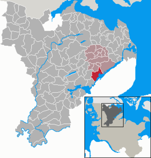
| Location of the municipality of Ulsnis in the Schleswig-Flensburg district | ||
  |
||


Ulsnis ( Danish : Ulsnæs ) is a municipality in the Schleswig-Flensburg district in Schleswig-Holstein .


geography

Geographical location
The wooded community is located in the fishing region on Gunnebyer Noor on the Schlei .
Community structure
The municipal area includes Affegünt (Dan. Affergynt ), brake Dieck ( Brend digestion or Brensdige ) Dallacker ( Dalager ) Düttnis ( Dytnæs ) Gunneby ( Gundeby ) Hestoft, Kius ( Kjus ) Knappersfeld, Ulsnis, Ulsniskirchenholz ( Ulsnæs Kirkeskov ) and Ulsnisland. The forest area Kiuser Gehege ( Kjus Skov ) is located 1.5 km west of Kius . The community has existed in its current form since 1974.
history
Ulsnis was first mentioned in 1349 as Vlfsnees (the ending -nees or -nis / -næs means a headland protruding into the sea ). The current districts of Ulsnis, Hestoft, Kius and two courtyards from Gunneby belonged to the bailiwick of Ulsnis after 1509, which in turn was subordinate to the cathedral chapter in Schleswig. The Schleswig bishop bought these lands with the farms on them in 1504 from the last non-church owner of the noble farm (or castle - see below) Hesselgaard . Until then, the inhabitants were subjects of the Lords of Hesselgaard. This differentiated Ulsnis from other parts of fishing, which was characterized by its free farmers on the bond estates . In 1770 the cathedral chapter was dissolved, and as a result some local Hufnern and Kätnern were allocated the land, including the share of forest areas. Ulsnis became part of the adjacent Harde .
After Schleswig-Holstein had become a Prussian province in 1866, the Harden were dissolved on October 1, 1889. In their place came the smaller administrative districts. The communities Steinfeld , Kius (with Gunneby) and Ulsnis (with Hestoft) formed the administrative district of Ulsnis.
During the Second World War , around 140 forced laborers for agricultural work were housed in Ulsnis.
It was not until 1969 that the Ulsnis office was dissolved as part of the reorganization of offices and assigned to the newly formed Süderbrarup office with effect from April 1, 1970 .
Incorporations
In 1973, the Kius community passed a resolution to merge with the Ulsnis community. On January 28, 1974, the last council meeting of the old parish of Kius took place. On February 1, 1974, the parishes of Kius and Ulsnis were formally united to form the parish of Ulsnis. The first joint mayor was Hans Hansen from Gunneby.
Ulsnis
The name Ulsnis is first mentioned in 1349 as "Vlfsnees". The word is derived from the Danish "Ulf", equal to "wolf" and the Danish "Näs", German "Nis", which means "nose", "land prominence" (or according to Jensen: fishing, (1922): "Ins Headland protruding from the sea ”).
The history of the eponymous district with its scattered Hufner places is still reflected today in the widely spread out village image. Between Ulsnis-Kirchenholz , the central part of the settlement around the former school building, over the Gallberg to Ulsnishöh (towards Hestoft), there is a meandering settlement pattern . Between the formerly completely separate parts of the settlement Ulsnis-Strand on the Schlei with the Ulsnisser Fährhaus , which was popular from the 1920s to the 1940s , individual houses of various types were built from the 1980s onwards.
Ulsnis still has a large number of forest areas in the municipality. The Hagab forest at Gunnebyer Noor has been a popular nesting place for countless crows since time immemorial. The southern wood above Ulsnis-Strand has a lighter character.
Hestoft
The name of the small town Hestoft is made up of "Hest" (Danish for horse) and "Toft" (Danish for fenced-in land). The oldest oak in Schleswig-Holstein is in Hestoft. Hestoft is the southernmost part of the municipality, with the loop island Kieholm in turn as the southernmost mainland point of the municipality.
The village of Hestoft is strongly influenced by agriculture.
Gunneby
Gunneby belonged to the Danish Lindau estate, which today belongs to Boren . On May 1, 1784, serfdom in Gunneby against the Lindau estate was lifted. The surveying and distribution of the property in the previous year created five full Hufner positions and twelve Kätner positions.
Kius
In the village chronicle of the municipality Ulsnis (2006 in a new version) it is pointed out that the place name is derived from Kyus, Kues, in Iceland "narrow valley".
politics
Of the ten seats in the municipal council, the community of voters of the communal voter community Ulsnis (KWU) had five seats since the local elections in 2008, the CDU had three and the community of voters FWU two. Of the nine seats in the municipal council, the KWU voting community had five seats since the 2013 local elections, while the CDU and the Free Voting Community Ulsnis (FWU) each had two seats.
Of the ten seats in the municipal council, the KWU voter community has had five seats since the 2018 local elections and the FWU voter community also has five seats. Jürgen Schmidt (FWU) became the new mayor of Mayor Heidrun Karaca (KWU), who died in office on June 21, 2018.
coat of arms
Blazon : "Above a raised blue corrugated shield base, inside a golden sailing boat, in gold a broken green crook, accompanied on the right and left by two green ears of wheat."
economy
Tourism is an important source of income for Ulsnis, which has been a recognized resort since 1995. In addition to holiday homes, there is a school camp run by the ADS-Grenzfriedensbund ( Arbeitsgemeinschaft Deutsches Schleswig ) and a family rest home in the municipality.
In the districts of Ulsnis-Strand and Kius there is a sport boat harbor each.
Attractions
The Ulsnisser Kirche is one of the largest Romanesque churches in the region. It was consecrated in 1338 to St. Wilhadus (originally Willehad ). However, the portal is dated to 1150. The Willhadikirche is probably the oldest church in fishing. The current shape of the hall church comes from a renovation in 1796. Together with the 100 seats on the gallery, the servant floor , the church can accommodate almost 400 people. As with other churches in fishing, the bell tower ( stack of bells ) is a wooden structure that is free from the actual church building. Below the bell tower there is a bench, from which you have a very good view over the Angeliter hills to Schwansen. The cemetery area is bordered by a wreath of old oaks. The Willhadikirche is built on a rock-stone foundation and has some remarkable evidence of medieval stone sculptures. There are legends about the large stones on the foundation of the church and the bell tower, according to which these originate from a quarrel between giants. The nose of the one slain giant is said to have formed the headland, "Nis", in the Schlei.
Only a few hundred meters from the church is the poor house built in the late 19th century by the Prussian community of Ulnis in the style of a stately farmhouse.
The local history museum, which is open on Sundays, is located in the Ulsnisstrand district .
Hesselgaard Castle, first mentioned in 1360 and destroyed in 1644, was located on a plateau in a lake and was located in the municipality. The lake was drained in 1862. Until 1970, the rectangular plateau with a circular elevation about 20 m in diameter could be seen.
Incidents
On the night of April 2nd to 3rd, 1922, a mother with her two children and a domestic help were murdered in Ulsnisland. Given the bloody circumstances and the atmosphere of mistrust during the criminal investigation, the murders remained in the minds of residents for decades. The act was the subject of several literary works.
Personalities
- Gustav Johannsen (1840–1901), teacher, journalist, founder of Flensborg Avis and member of the Reichstag for the Danish minority 1881–1901.
- Reinhold Tüxen (1899–1980), chemist, botanist and plant sociologist, one of the pioneers of plant sociology in Germany
- Andi Feldmann (* 1957), sculptor, actor, voice actor and author
literature
- Ulsnis parish (ed.): Chronicle of the Ulsnis parish, edited by Hans Tüxen, Ulsnis 1987.
- Ulsnis parish (ed.): Chronicle II of the Ulsnis parish, Ulsnis 2010.
Web links
Individual evidence
- ↑ North Statistics Office - Population of the municipalities in Schleswig-Holstein 4th quarter 2019 (XLSX file) (update based on the 2011 census) ( help on this ).
- ↑ Jens Peter Trap: Statistisk-topographisk beskrivelse af hertugdømmet Slesvig , Kjøbenhavn 1864, p. 527
- ↑ Quoted from M. Mørk Hansen and CL Nielsen: Kirkelig Statistics over Slesvig Stift med historiske og topografiske bemærkninger , Vol. 2, Kjøbenhavn 1864, p. 424
- ↑ a b c Schleswig-Holstein topography. Vol. 10: Timmaspe - Ziethen . 1st edition Flying-Kiwi-Verl. Junge, Flensburg 2008, ISBN 978-3-926055-92-7 , p. 83 ( dnb.de [accessed on August 9, 2020]).
- ↑ On forced labor in Ulsnis. In: ulsnis.de. Retrieved June 29, 2020 .
- ^ Federal Statistical Office (ed.): Historical municipality directory for the Federal Republic of Germany. Name, border and key number changes for municipalities, counties and administrative districts from May 27, 1970 to December 31, 1982 . W. Kohlhammer GmbH, Stuttgart / Mainz 1983, ISBN 3-17-003263-1 , p. 185 .
- ↑ Results of the 2018 local elections in the Ulsnis municipality. Ulsnis parish, accessed July 8, 2018 .
- ↑ Schleswig-Holstein's municipal coat of arms
- ↑ The church in Ulsnis. In: kirchenkreis-schleswig-flensburg.de. Retrieved July 8, 2018 .
- ↑ Bernd Langmaack: The Ulsnis murder of 1922. In: Yearbook of the Heimatverein der Landschaft fishing, 64th year 2000, pp. 112–116.
- ↑ Cornelia Schellhorn: The murder of 1922. In: Chronik II, Ulsnis 2010, p. 376 ff.
- ^ Jacob Kronika: Den sidste slesviger og Ulsnæs-mordene. Flensborg 1971.
- ↑ Hanna Dunkel: Ulsni's murderous matter. Leer 2010.
Ahneby | Alt Bennebek | Arnis | Ausacker | Bergenhusen | Böel | Böklund | Bollingstedt | Bores | Borgwedel | Börm | Böxlund | Brodersby-Goltoft | Busdorf | Dannewerk | Dollerup | Dbodstedt | Eggebek | Ellingstedt | Invent | Esgrus | Fahrdorf | Free will | Gelting | Geltorf | Glücksburg (Baltic Sea) | Grödersby | Great Rheide | Großewiehe | Large voltage | Grundhof | Handewitt | Harrislee | Hasselberg | Havetoft | Hollingstedt | Holt | Hörup | Hürup | Husby | Hüsby | Idstedt | Jagel | Janneby | Jardelund | Jerrishoe | Jörl | Jübek | Kappeln | Folded wood | Klein Bennebek | Klein Rheide | Kronsgaard | Kropp | Long-crowned | Langstedt | Lindewitt | Loit | Lottorf | Lürschau | Maasbüll | Maasholm | Medelby | Meggerdorf | Meyn | Middle fishing | Mohrkirch | Munkbrarup | Neuberend | Nieby | Sneeze gray | Norderbrarup | Nordhackstedt | Nottfeld | Nübel | Oersberg | Oeversee | Osterby | Pommerby | Rabel | Raven wood | Rabenkirchen-Faulück | Ringsberg | Rügge | Saustrup | Schaalby | Schafflund | Scheggerott | Schleswig | Schnarup-Thumby | Schuby | Selk | Sieverstedt | Silberstedt | Sollerup | Soerup | Hatchback | Stack | Steinberg | Steinberg Church | Steinfeld | Sterup | Proud | Stoltebüll | Struxdorf | Süderbrarup | Süderfahrenstedt | Süderhackstedt | Taarstedt | Tarp | Tastrup | Tetenhusen | Tielen | Tolk | Treia | Twedt | Uelsby | Ulsnis | Wagersrott | Wallsbull | Wanderup | Wees | Weesby | Westerholz | Wohlde