
Folding wood
| coat of arms | Germany map | |
|---|---|---|

|
Coordinates: 54 ° 37 ' N , 9 ° 32' E |
|
| Basic data | ||
| State : | Schleswig-Holstein | |
| Circle : | Schleswig-Flensburg | |
| Office : | South fishing | |
| Height : | 52 m above sea level NHN | |
| Area : | 8.22 km 2 | |
| Residents: | 455 (Dec. 31, 2019) | |
| Population density : | 55 inhabitants per km 2 | |
| Postal code : | 24860 | |
| Area code : | 04603 | |
| License plate : | SL | |
| Community key : | 01 0 59 049 | |
| Office administration address: | Toft 7 24860 Böklund |
|
| Website : | ||
| Mayoress : | Dörte Albrecht (AWK) | |
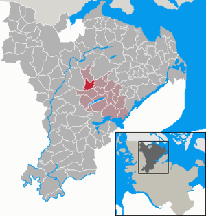
| Location of the municipality of Klappholz in the Schleswig-Flensburg district | ||
  |
||

Klappholz ( Danish : Klapholt ) is a municipality in the Schleswig-Flensburg district in Schleswig-Holstein . Dennholm, Elmholz ( Elmskov ), Fenn, Glasholz ( Glasholt ), Neubrück, Norderholz ( Nørreskov ) and Westscheide ( Vesterskel ) are located in the municipality.
Geography and traffic
Klappholz is located about 20 km north of Schleswig in the fishing region . West of the place runs the federal highway 7 to Flensburg .
history
The municipality has been inhabited since the Stone Age.
The place was first mentioned in 1352 as Klappholt ( wood in which leaves are collected as fodder by cutting off the branches ). The place name is composed of Danish. and nd. fetches for forest, wood and klappe for collecting, hitting (cf. altn. klappa - hitting, knocking). The place name Elmholz derives from the Danish elm for elm, meaning elm forest .
Westscheide was colonized from 1763. A colonist house from Westscheide is now in the Molfsee open-air museum .
politics
Community representation
In the municipal council, the constituency of the AWK has had all nine seats since the 2013 local elections.
coat of arms
Blazon : “From blue and green to the head of the shield, divided by an arch of facing golden ears. Above a golden frontal view of a colonist house, below a golden Lyngby ax. "
The coat of arms in the shield head shows the gable side of a colonist house from the time of settlement around 1763. It therefore stands for the Westscheide district. The row of ears symbolizes the rye mountain, the highest elevation of folding wood. The reindeer antler ax in the base of the shield represents the "Lyngby ax" from the Younger Paleolithic , which was found in 1991 in the municipality.
Parish
Klappholz belongs with Havetoftloit and Havetoft to the Havetoft parish, which has around 1,800 members.
Personalities
- Hermann Kühne (* 1929), agricultural engineer and politician born in Klappholz
Web links
Individual evidence
- ↑ North Statistics Office - Population of the municipalities in Schleswig-Holstein 4th quarter 2019 (XLSX file) (update based on the 2011 census) ( help on this ).
- ↑ a b c Schleswig-Holstein topography. Vol. 5: Holt - Krokau . 1st edition Flying-Kiwi-Verl. Junge, Flensburg 2005, ISBN 978-3-926055-79-8 , pp. 238 ( dnb.de [accessed on July 20, 2020]).
- ↑ Wolfgang Laur: Historisches Ortnamelexikon von Schleswig-Holstein , 2nd edition, Neumünster 1992, p. 386
- ↑ Wolfgang Laur: Historisches Ortsnamelexikon von Schleswig-Holstein , 2nd edition, Neumünster 1992, p. 235
- ↑ Schleswig-Holstein's municipal coat of arms
Ahneby | Alt Bennebek | Arnis | Ausacker | Bergenhusen | Böel | Böklund | Bollingstedt | Bores | Borgwedel | Börm | Böxlund | Brodersby-Goltoft | Busdorf | Dannewerk | Dollerup | Dbodstedt | Eggebek | Ellingstedt | Invent | Esgrus | Fahrdorf | Free will | Gelting | Geltorf | Glücksburg (Baltic Sea) | Grödersby | Great Rheide | Großewiehe | Large voltage | Grundhof | Handewitt | Harrislee | Hasselberg | Havetoft | Hollingstedt | Holt | Hörup | Hürup | Husby | Hüsby | Idstedt | Jagel | Janneby | Jardelund | Jerrishoe | Jörl | Jübek | Kappeln | Folded wood | Klein Bennebek | Klein Rheide | Kronsgaard | Kropp | Long-crowned | Langstedt | Lindewitt | Loit | Lottorf | Lürschau | Maasbüll | Maasholm | Medelby | Meggerdorf | Meyn | Middle fishing | Mohrkirch | Munkbrarup | Neuberend | Nieby | Sneeze gray | Norderbrarup | Nordhackstedt | Nottfeld | Nübel | Oersberg | Oeversee | Osterby | Pommerby | Rabel | Raven wood | Rabenkirchen-Faulück | Ringsberg | Rügge | Saustrup | Schaalby | Schafflund | Scheggerott | Schleswig | Schnarup-Thumby | Schuby | Selk | Sieverstedt | Silberstedt | Sollerup | Soerup | Hatchback | Stack | Steinberg | Steinberg Church | Steinfeld | Sterup | Proud | Stoltebüll | Struxdorf | Süderbrarup | Süderfahrenstedt | Süderhackstedt | Taarstedt | Tarp | Tastrup | Tetenhusen | Tielen | Tolk | Treia | Twedt | Uelsby | Ulsnis | Wagersrott | Wallsbull | Wanderup | Wees | Weesby | Westerholz | Wohlde