Havetoftloit
|
Havetoftloit
Mittelangeln municipality
|
||
|---|---|---|
| Coordinates: 54 ° 40 ′ 0 ″ N , 9 ° 34 ′ 0 ″ E | ||
| Height : | 43 m above sea level NN | |
| Area : | 14.89 km² | |
| Residents : | 943 (December 31, 2011) | |
| Population density : | 63 inhabitants / km² | |
| Incorporation : | 1st of March 2013 | |
| Postal code : | 24986 | |
| Area code : | 04603 | |
|
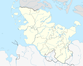
Location of Havetoftloit in Schleswig-Holstein |
||
Havetoftloit ( Danish : Havetoftløjt ) is a village in the Schleswig-Flensburg district in Schleswig-Holstein . Since March 1st, 2013 it has been part of the municipality of Mittelangeln . Torsballig ( Torsballe ), Dammholm ( Damholm ), Wester-Bunsbüll ( Vester Bondsbøl ), Oster-Bunsbüll ( Øster Bondsbøl ), Loitwesterfeld ( Løjt Vestermark ), Kollehav ( Kalleshave ), Loitmühle, Osterholz, Norderholz, Loitosterfeld ( Løjt Østolz ) ( Hyholt ), Waldhorn, Tordschell ( Torskjeld ) and Schwienholm ( Svinholm ) are located in the former municipality.
geography
Havetoftloit is located in the southern Schleswig region of fishing in a kinky landscape on the watershed between the North and Baltic Seas . In Havetoftloit is the pike moor, which has been used for peat extraction for centuries and has been a nature reserve since 1941.
history
There are few records about the history of Havetoftloit, but it is believed that the place was inhabited by free farmers around 1231. The place name probably comes from the Danish language, but the meaning is controversial. In 1407 the place was first mentioned as Loyth or Lüche .
In 1970 Dammholm (da: Damholm ) and Havetoftloit merged to form the new municipality Havetoftloit. On January 1, 1974, Torsballig ( Torsballe ) was added. There has been a municipal coat of arms since 2003.
On March 1st, 2013 Havetoftloit merged with the neighboring communities Satrup and Rüde to form the community Mittelangeln. The last mayor was Jürgen Matzen (AWG).
coat of arms
Blazon : "In gold, a blue flat rafter accompanied by a lying red sword at the top and two crossed red peat spades at the bottom."
economy
The place is predominantly agricultural.
Parish
Havetoftloit belongs Klappholz and Havetoft to parish Havetoft.
Web links
literature
- Johannes Thomsen: History of the village Havetoftloit. In: Yearbook of the Angler Heimatverein, Vol. 33 (1969) pp. 117–149.
Individual evidence
- ↑ Germany rediscovered: d. Federal Republic of Germany in color vertical aerial photo . 2., through Ed. By Hase and Koehler, Mainz 1976, ISBN 978-3-7758-0839-2 ( dnb.de [accessed April 12, 2020]).
- ↑ Schleswig-Holstein topography. Vol. 4: Groß Sarau - Holstenniendorf . 1st edition Flying-Kiwi-Verl. Junge, Flensburg 2004, ISBN 978-3-926055-75-0 , p. 174 ( dnb.de [accessed on May 3, 2020]).
- ↑ Germany rediscovered: d. Federal Republic of Germany in color vertical aerial photo . 2., through Ed. By Hase and Koehler, Mainz 1976, ISBN 978-3-7758-0839-2 ( dnb.de [accessed April 12, 2020]).
- ^ Federal Statistical Office (ed.): Historical municipality directory for the Federal Republic of Germany. Name, border and key number changes in municipalities, counties and administrative districts from May 27, 1970 to December 31, 1982 . W. Kohlhammer GmbH, Stuttgart / Mainz 1983, ISBN 3-17-003263-1 , p. 184 .
- ↑ Schleswig-Holstein's municipal coat of arms

