Obdrup
|
Obdrup
Mittelangeln municipality
Coordinates: 54 ° 41 ′ 44 " N , 9 ° 34 ′ 38" E
|
||
|---|---|---|
| Height : | 38 m above sea level NN | |
| Incorporation : | February 28, 1970 | |
| Incorporated into: | Satrup | |
| Postal code : | 24986 | |
| Area code : | 04633 | |
|
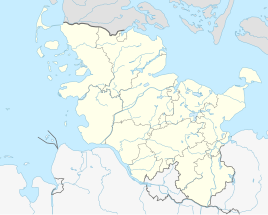
Location of Obdrup in Schleswig-Holstein |
||
Obdrup ( partly also Optrup in Danish ) is a district of Mittelangeln in the office of the same name in the Schleswig-Holstein district of Schleswig-Flensburg .
geography
Obdrup is 2 km west of Satrup, on the road to Bistoft, on the fishing peninsula , south of Flensburg and north of Schleswig at an altitude of 35 m.
history
The place name is first documented in 1470. He lets himself into the dan. Personal names Ubii or Obbe. In 1599 the former village consisted of three farms and three cottages , later these came to the Meierhof Obdrup of the Satrupholm estate. In 1771 the place came to the Satrupharde. After the German-Danish War, the place forms the municipality of Obdrup in 1871. East of Obdruphof on the Nackholzer Au (Danish: Nakholt Å ) is a former castle square on a small tower hill surrounded by a moat called Slotsholm. The place is said to have been inhabited until the 16th century. In 1893 the residential area Rabenkiel ( Ravnkilde ) was assigned to the former municipality of Satrup . Between 1901 and 1938 there was a stop of the small train Flensburg-Satrup on site. The municipality also included forests such as the 86 hectare Obdrupholz ( Obdrupskov ), Hißholz ( Hisskov ) forest and individual residential areas such as Hatteshuus ( Haddeshus ), Mingab ( Mindgab ), Nackholz ( Nakskov ), Obdruphof ( Obdrupgaard ), Obdrupstrasse ( Obdrupgade ), Sorgefrei and Tranholm. In 1970 the formerly independent municipality became part of the municipality of Satrup . In 1970 the community had 258 inhabitants and an area of 552 hectares. When it was dissolved on March 1, 2013, Obdrup became an independent district of the newly formed community of Mittelangeln.
Others
There is a barn at Obdruper Straße 2–4 that has been declared a cultural monument.
Individual evidence
- ^ Berthold Hamer: Topography of the landscape fishing , Vol. 2, Husum 1995, p. 124
